snow

Spring Foolery: March 2022 Recap
April 6, 2022 - 7:56pm -- Dave Robinson

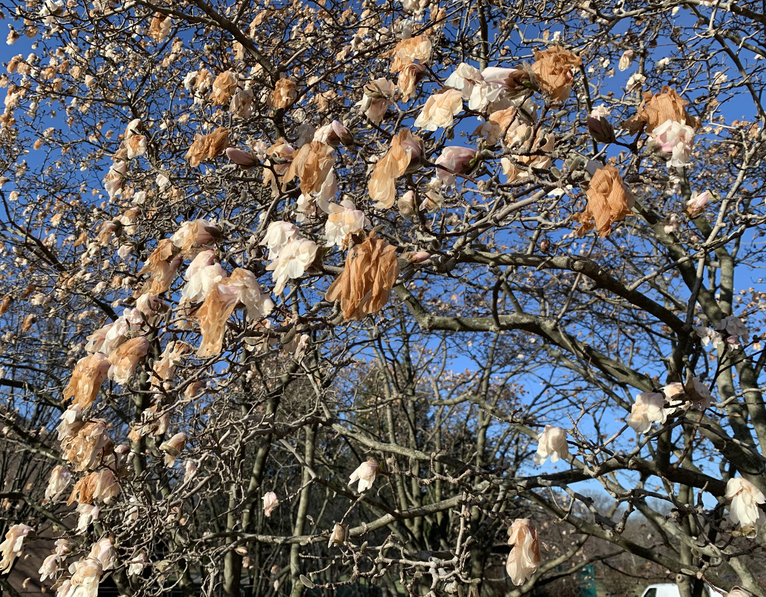
Damaged magnolia flowers on March 29th at Rutgers University Livingston Campus in Piscataway

When it comes to shedding the winter coat and thinking of warm weather to come, March is known to have its early spring teases. Then, along comes some late winter cold to remind us winter is not quite ready to disappear. This spring foolery was on exceptional display this month. High temperatures jumped into the 70°s on the 6th and 7th, then back to the cold until the 70° mark was again eclipsed during four of the five days from the 15th–19th. Next came some more seasonable temperatures before a polar blast brought mid-winter frigid conditions from the 28th–30th, only to be followed by another day of 70°s to end the month. Interspersed with these wild fluctuations were episodes of thunderstorms, snow and rain, and 13 days where winds gusted to greater than 40 mph at some locations.

When all was said and done, the statewide average temperature of 43.6° was 2.6° above the 1991–2020 normal. This ranked as the 16th mildest March since 1895, with the end-of-month cold spell keeping the month out of the top 10 for warmth. The average maximum of 54.0° was 3.1° above normal, ranking 17th mildest. The average minimum of 33.3° was 2.1° above normal, also ranking 17th. The north averaged 41.1° (+2.3°, 21st warmest), south 45.3° (+2.9°, 15th), and coast 44.9° (+2.7°, 13th).

Precipitation averaged 2.72” across NJ, which was 1.48” below normal and ranks as the 26th driest March since 1895. The north caught 2.54” (-1.47”, 26th driest), south 2.80” (-1.52”, 30th), and coast 3.06” (-1.36”, 34th). In particular, a zone from Hunterdon to Bergen counties was driest and the coast from Atlantic to Monmouth counties was wettest.

Up, Down, Round and Round: February 2022 and Winter 2021/2022 Recaps

March 8, 2022 - 12:53pm -- Dave Robinson

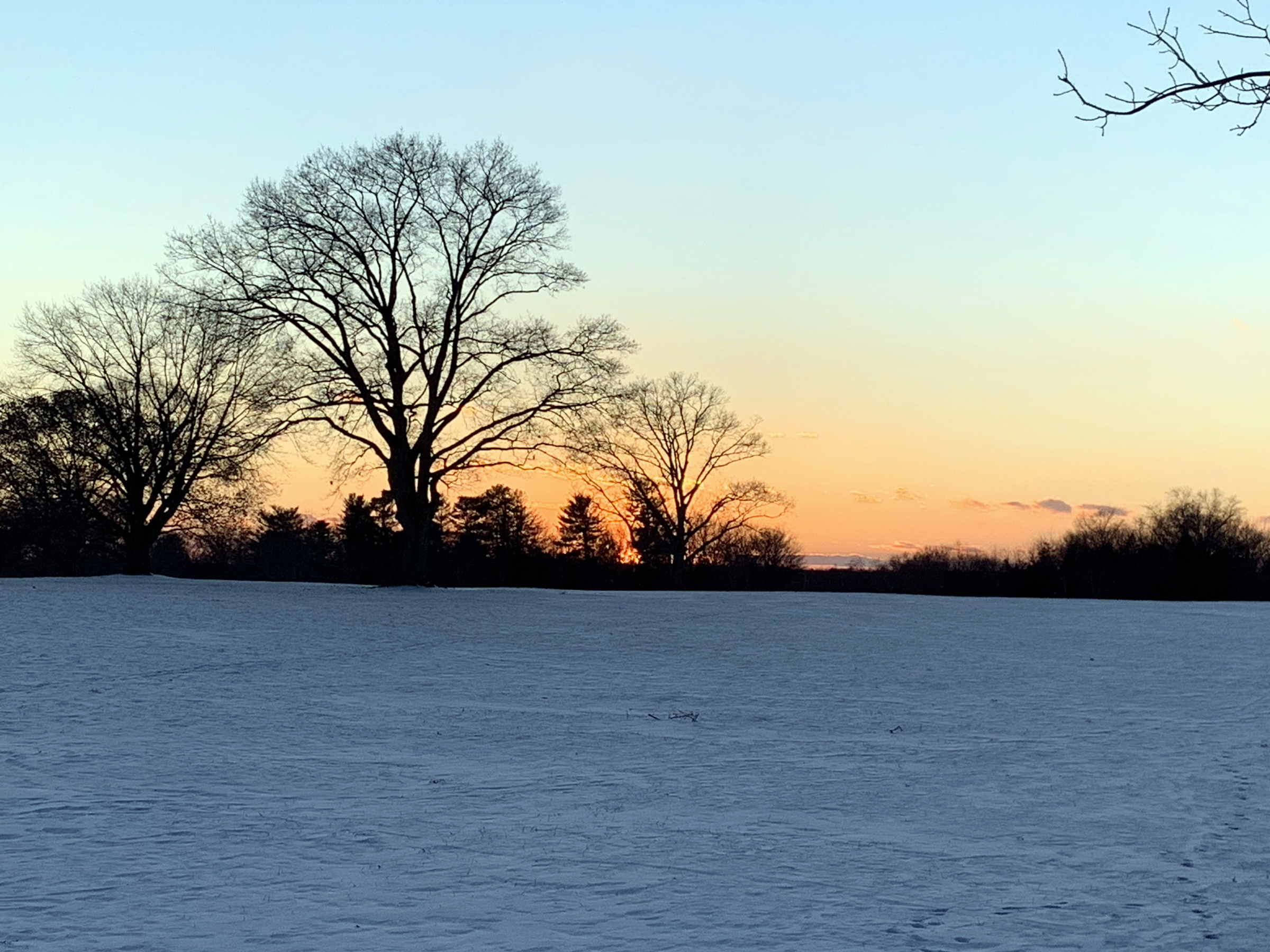
Sunset over a snow-covered field on February 14 at Colonial Park in Franklin Township (Somerset County).

The second month of 2022 and third month of winter continued a theme since December. Whether you call it a see saw, swing, or merry-go-round, it fits the theme of playground equipment as it never seemed any one particular variety of weather became established for all that long. More will be said about winter at the end of this report, but when it came to February, the end result was a somewhat warmer-than-normal month with about average precipitation and a dearth of snowfall. The statewide average temperature of 35.6° was 1.7° above the 1991–2020 normal, ranking as the 19th mildest since 1895. There was an above-average spread between the average high of 46.7° (+3.6°, 12th mildest) and low of 24.4° (-0.2°, 40th mildest), the 22.3-degree range being 3.8 degrees wider than normal. The north averaged 32.0° (+0.7°, 26th mildest), the south 37.7° (+2.2°, 16th mildest), and coast 37.9° (+1.9°, 18th mildest).

Rain and melted snow/sleet averaged 2.93”. This is 0.07” above normal and ranks as the 60th wettest/69th driest. The north averaged 3.45” (+0.66”, 44th wettest), south 2.62” (-0.27”, 49th driest), and coast 2.54” (-0.53”, 44th driest). More geographically specific, the far south was driest and the northwest wettest.

The South Coast Steals the Show: January 2022 Recap

February 8, 2022 - 10:40pm -- Dave Robinson

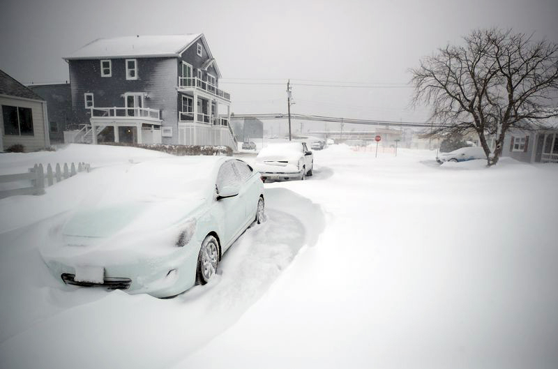
Severely drifted snow surrounds a car in Brigantine on January 29th.

When it comes to cold and snow, the second month of winter wasn’t anything like the first. New Jersey was right in the heart of winter to start off 2022, and nowhere was that more apparent than in southern coastal counties where far more than an average winter’s snow fell. At some locations, the total exceeded that of the most recent three winters combined. The prevailing storm track was such that the northwest corner of the state received the least snow, yet saw seven days with low temperatures dipping below zero. Toss in 15 days where one or more locations around the state recorded wind gusts of 40 mph or greater (five of these with gusts of at least 50 mph) and two atmospheric pressure waves moving across the state as a result of a volcanic eruption in the south Pacific, and it certainly was an eventful month.

Rain and melted snow averaged 3.45” across the state. This is 0.04” below the 1991–2020 normal and ranks as the 54th wettest (75th driest) January since 1895. The northern counties south to and including Hunterdon, Somerset, and Union averaged 2.90”, 0.60” below normal and 75th wettest (53rd driest). Southern counties, except close to the Atlantic Coast, averaged 3.72”, which is 0.25” above normal and ranks 46th wettest. The coastal region caught 4.34”, which is 0.83” above normal and ranks 31st wettest. Persistent dry conditions in recent months resulted in the southernmost NJ counties deemed “Abnormally Dry” for most of the month, according to the National Drought Monitor. As the month ended, northwestern counties were under consideration for being similarly designated.

ONJSC's Top 10 NJ Weather and Climate Events of 2021

January 3, 2022 - 7:18pm -- Dave Robinson

A flooded TD Bank Ballpark in Bridgewater (Somerset County) on September 2nd following the staggering rainfall caused by the remnants of Ida. Photo by Thomas P. Costello and Tariq Zehawi/USA Today Network.

For the 13th consecutive year, we in the state climate office have evaluated the myriad daily, monthly, and annual observations gathered across New Jersey during the course of the year to choose what we feel were the most significant and impactful 10 weather and climate events of 2021. More about each event can be found in the monthly narratives and the special Post-tropical Cyclone Ida report posted on our website. You might be tempted to rearrange the rankings, particularly as some of the events on the list may have affected you more than others ranked higher. Or perhaps you best recall one that didn't make the list. That's the enjoyment and frustration of lists! Unless stated otherwise, statewide values are based on an average of several dozen stations. The period of record for monthly, seasonal, and annual departures is 1991–2020; while for extremes and rankings it is from 1895–present. Observations are mainly drawn from National Weather Service Cooperative Observing Program stations, Rutgers NJ Weather Network stations, and NJ Community Collaborative Rain, Hail, and Snow Network locations.

Anything but Boring: February 2021 and Winter 2020/21 Recaps

March 8, 2021 - 3:51pm -- Dave Robinson

Wintry scene

Fate was clearly tempted when last month’s report was entitled: “Pretty Darn Boring.” Not that this wasn’t a truthful statement from both meteorological and climatological perspectives. So now this month’s title, being just as legitimate as January’s. The turnaround began in the waning hours of January 31st when what proved to be an impactful, long-lasting coastal storm began to invade the Garden State. This major event was followed by a series of storms that resulted in record or near record-setting monthly snowfall totals in northern and central regions and quite wet conditions in the south.

Statewide precipitation (rain and melted snowfall) averaged 4.89” in February. This was 2.03” above the 1991–2020 average and ranks as the 14th wettest February in 127 years of record keeping. The coastal south averaged 5.91” (+2.84”), ranking as 6th wettest. The remainder of the south came in with 5.09” (+2.20”, 11th) and the north 4.44” (+1.65”, 19th). More specifically, the southeast and central areas were wettest and the southwest and far north least wet.

While plenty of precipitation fell throughout the state, it was more often than not in the form of rain across the southern third of NJ, while central and northern areas were visited by one major snowstorm and a series of modest ones. All told, the statewide average snowfall was 23.5”. This is 15.3” above the 1991–2020 average and ranked as the 7th snowiest February.

Endless Spring: May and Spring 2020 Recaps

June 7, 2020 - 6:34pm -- Dave Robinson

In recent years, many a comment has been heard that New Jersey just does not have a spring season any more. We go right from winter to summer weather, people say. The same cannot be said for spring 2020. A seasonal summary follows at the end of this report and the individual March and April reports can be found on the state climate office website. To begin here, the talk will be of May, a month that produced both less rain and cooler temperatures than normal and included an unusual appearance of snow.

The statewide average temperature of 58.9° was 1.7° below the 1981–2010 normal. This ranked as the 40th coolest May since records commenced in 1895. April and May marked the first time since December 2017–January 2018 that consecutive months had below-average temperatures. Statewide, May precipitation averaged 2.50”. This was 1.49” below normal and ranked as the 29th driest on record.

A Dud: 2019/2020 Snow Season Recap

April 28, 2020 - 6:14pm -- Dave Robinson

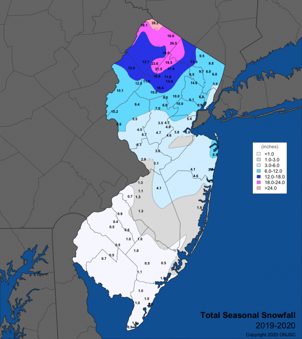
2019/20 season snowfall map

As we gradually transition into warmer spring temperatures, it’s a good time to recap what was a disappointing season for snow lovers, along with snowplow drivers, auto body repair people, and others who profit from snowy winters.

Seasonal snow totaled 4.7” averaged across the state. This is 19.2” below the 1981–2010 average and, looking back from the 1896/96 to 2018/19 snow seasons, is 21.4” below average. This ranks as the third least-snowy winter snow season, only behind the winters of 1972/73 and 1918/19.

Spring Ahead: March 2020 Recap

April 7, 2020 - 11:40am -- Dave Robinson

March 2020 was the 6th mildest in New Jersey dating back to 1895. Combined with mild rankings of 9th in January and 4th in February, 2020 has started off as the 2nd mildest on record at 5.8° above the 1981–2010 average. The 40.8° average only falls behind 2012’s 41.4°. Six of the ten mildest January–March intervals in the past 126 years have occurred since 2002.

March averaged 46.3° across NJ, which is 5.5° above average. The average maximum of 56.2° (+5.4°) ranked 7th mildest and the minimum of 36.4° (+5.6°) 2nd mildest. Anomalies were +5.8° in both the southern (47.9°) and coastal (47.7°) divisions, ranking 6th and 4th mildest, respectively, and +5.0° in the north (43.7°), ranking 9th mildest. As a result of the premature warmth, vegetation green up across the state was at least two weeks earlier than normal.

Where is Winter?: January 2020 Recap

February 4, 2020 - 2:01pm -- Dave Robinson

Boardwalk photo

The new decade got off on a rather unwintry note, with January temperatures well above average, snow rarely falling, and just one significant storm that brought only rain. The statewide average temperature of 37.3° was 6.6° above the 1981–2010 mean. This ranks as the 8th mildest January (tied with 1933) since records commenced in 1895. Anomalies and rankings were quite similar across the state. January 2020 was milder than December 2019 by 1.0°. The last time this climatological flip occurred was in December 2005/January 2006. Most notably, January 11th and 12th saw record daily temperatures in the upper 60°s to as high as 70°.

Precipitation fell mostly in the form of rain and mainly on the 25th. The monthly average across NJ was 2.38”. This is 1.02” below the mean and ranks as the 26th driest. The north was 1.27” below average, the south -0.84”, and the coast -1.12”, with all divisional totals between 2.14”–2.55”.

Lambs and Lions: March 2019 Summary

April 5, 2019 - 5:07pm -- Dave Robinson

Snow photo

Much like last month, March 2019 had a wide variety of weather conditions across the Garden State. The month came in like a lion, with a week of wintry weather, which was particularly snowy in northern and central regions. More snow fell than in any other month this season and the temperature fell below zero in one location and down to single digits at a number of others. The remainder of the month was often lamb-like, including four days with high temperatures exceeding 70° at many locations and six in the 60°s. Several inch-plus rain events occurred, along with the first lightning-filled squall line of the year, which, in some locations, included hail and strong winds.

The statewide monthly temperature averaged 39.7°. This is 1.1° below the 1981–2010 average and is the 58th mildest (66th coolest) since 1895. The statewide average rain and melted snow totaled 3.91”. This is 0.20” below the 1981–2010 average. It was the 61st wettest (65th driest) March since 1895.

Statewide snowfall averaged 6.3”. This was 1.9” above average. Northern counties averaged 13.0” (6.7” above average), the central region 8.6” (+3.5”), and south 1.6” (-1.5”). As a preview of the seasonal snow summary in next month’s report, statewide snowfall through March is 20.5”, 5.0” below average. Barring the unlikely case of April snowfall exceeding any other month of the season, this will mark the first time since records began in 1895 that March was NJ’s snowiest month of the season for three consecutive snow seasons (October–April).

Pages

Subscribe to RSS - snow