snow

Wooly and a Bit Wild: January 2015 Recap

February 6, 2015 - 4:37pm -- Dave Robinson

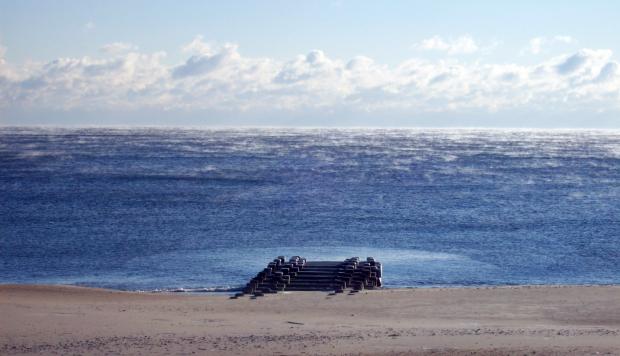
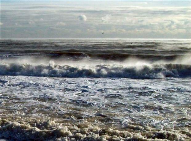
Sea smoke photo

The first month of 2015 was a cold one with above-average precipitation. The form of the precipitation varied quite a bit at any particular location as well as across the state over the course of individual events. The statewide average temperature of 27.7° was 3.5° below normal, making it the 32nd coldest January since records commenced in 1895. Precipitation (rain and melted snow) averaged 4.78", which is 1.30" above normal and ranks as the 20th wettest January. Statewide, snowfall averaged 8.6", which is 1.5" above normal and ranks as the 41st snowiest January of the past 121 years. Storms of various intensities arrived every three days throughout the month, and included an impactful freezing rain and flooding event and two moderate snowstorms during the final two weeks. Several bitter cold episodes were punctuated by strong winds and frigid wind chills.

A Cool Damp Month, and All Things Considered, a Rather Average Season: November and Fall 2014 Recap

December 7, 2014 - 7:32pm -- Dave Robinson

Wantage snow Nov 27

While cooler conditions took some time to arrive in New Jersey this fall, once here they locked in for the most part, as the November average temperature of 41.9° was 3.7° below the 1981-2010 average. This ranks as the 24th coolest November of the past 120 years. November precipitation (rain and melted snow) averaged 4.58" across the state. This is 0.94" above average and ranks as 31st wettest. On two occasions measurable snow was reported in northern and central areas, with these regions, respectively, picking up 4.6" and 1.9" on average for the month, with over a foot accumulating at higher elevations. Despite no snow accumulating in the south, the statewide average was 1.7", which is 1.3" above average. It is only the second November to average above an inch since 1995, the other in 2012. A Thanksgiving eve storm delivered a white Thanksgiving to central and northern counties.

Snow and more snow: 2013-2014 snow season recap

June 19, 2014 - 4:48pm -- Dave Robinson

Snow in Echo Lake Park

The record book on the winter of 2013-2014 officially closes on June 30. Given the recent streak of hot weather, and the summer solstice this Saturday, we're confident it's safe to run the calculations on seasonal snow totals a few days early. Indeed it will be hard for many New Jersey residents to forget this very active, cold, and snowy winter.

From first flake to last, this past season ranked 7th snowiest of the past 120 years. The statewide average snowfall was 54.3”, which is 28.4” (or 210%) above average. The most snow fell up north but ranked lowest of the three regions (14th) due to its normally higher seasonal average. The south had the least snow but ranked 9th highest. This was the third season on record that each of the three divisions recorded over 50"; the other two occurred in 1898-99 and 1957-58. All regions shared the snow load similarly through January. Snow was more plentiful in northern and central areas in February. The situation was reversed, exceedingly so, in March, when three accumulating events impacted the south but missed the other two regions.

Winter refuses to relinquish its grip on the Garden State: March 2014 Summary

April 5, 2014 - 12:00am -- Dave Robinson

March 2014 snow photo

One of the most disruptive winters in recent memory continued to deliver cold weather throughout New Jersey during March. Three snow events brought over 20" of snow to Cape May County, yet failed to bring more than flurries to northern counties. The statewide average monthly temperature of 35.3° was 5.8° below normal. Thus March ranked as the 11th coldest since statewide records commenced in 1895 (Table 1). Rain and melted snow for the month averaged 4.11". This is 0.12" below normal and ranks as the 55th wettest of the past 120 Marches. Aside from the southern snows, the bulk of the precipitation fell in a soaking storm at month's end.

Relentless Winter: February 2014 Summary and Winter 2013/14 Summary

March 4, 2014 - 12:00am -- Dave Robinson

Snow Cover Map

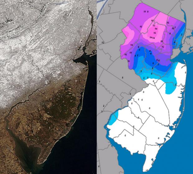
One of the more disruptive winters in recent decades continued during February, erasing the hopes of many for an early spring. Averaged across New Jersey, the monthly temperature of 29.5° was 4.3° below normal. This made for the 35th coldest February over the past 120 years and the coldest since 2007. Temperatures ranged from a low of -18° at Walpack in snow covered Sussex County valley on the 11th and 12th to a high of 67° at several southern locations on the 21st. The statewide average precipitation of 5.26" made for the 20th wettest February on record. This includes both rainfall and the liquid equivalent of frozen precipitation, and is 2.40" above normal. Snowfall averaged 21.9" across the state, which is 13.9" above normal and ranks as the 7th snowiest of the past 120 Februaries.

Cold and Snow: January 2014 Summary

February 1, 2014 - 12:00am -- Dave Robinson

Sea smoke photo

The year began where 2013 left off, with the jet stream in an amplified, progressive pattern that resulted in frequent, pronounced fluctuations in temperature and multiple precipitation events. By late month, the pattern slowed, but remained amplified, locking NJ into over a week of bitter cold conditions. The statewide average temperature for January was 26.1°, which is 5.1° below the 1981-2010 average and ranks as the 17th coldest since 1895 (120 years). It was the coldest January since 2004. Precipitation in the form of rain, freezing rain, and melted snowfall averaged 3.09". This is 0.39" below normal and ranks as the 57th driest. Snowfall averaged 17.7", which is 10.6" above normal and ranks at the 8th snowiest January on record.

Winter 2013/14: Round One

December 18, 2013 - 12:00am -- Dave Robinson

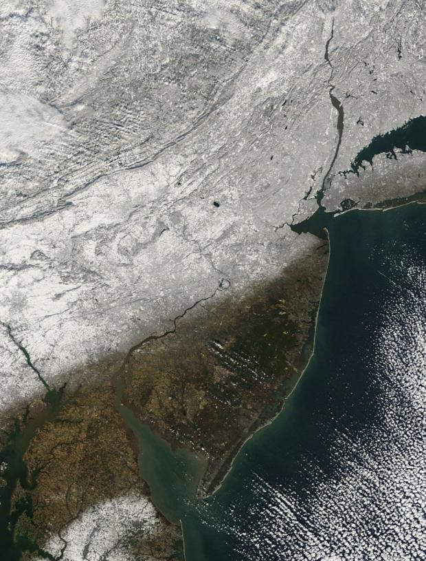
NASA MODIS satellite imagery

Following a mild six days of December, when a number of locations approached or exceeded the 50° mark for highs, the bottom fell out of the thermometer. From the 7th through the 18th most of the northern half of the state failed to reach 40°, while southern locations only saw milder highs on the 14th, early on the 15th, and on the 17th. This includes the first sub-zero observation of the winter, when -1° was reached at Walpack (Sussex County) on the 17th and again on the 18th.

Pages

Subscribe to RSS - snow