For the 13th consecutive year, we in the state climate office have evaluated the myriad daily, monthly, and annual observations gathered across New Jersey during the course of the year to choose what we feel were the most significant and impactful 10 weather and climate events of 2021. More about each event can be found in the monthly narratives and the special Post-tropical Cyclone Ida report posted on our website. You might be tempted to rearrange the rankings, particularly as some of the events on the list may have affected you more than others ranked higher. Or perhaps you best recall one that didn't make the list. That's the enjoyment and frustration of lists! Unless stated otherwise, statewide values are based on an average of several dozen stations. The period of record for monthly, seasonal, and annual departures is 1991–2020; while for extremes and rankings it is from 1895–present. Observations are mainly drawn from National Weather Service Cooperative Observing Program stations, Rutgers NJ Weather Network stations, and NJ Community Collaborative Rain, Hail, and Snow Network locations.
- Post-tropical Cyclone Ida pummels
- Rainfall on one-, two-, three-, and six-hour time scales at 100–2000-year recurrence intervals at multiple locations.
- Eight counties had at least one station with an 8.00” storm total.
- Hillsborough (Somerset County) received the most at 9.45”.
- Everywhere north of a line from Trenton to Perth Amboy received at least 4.00”.
- Every county saw at least one station with at least 1.98”.
- 30 drowning deaths in flash flooding. Second deadliest NJ weather event on record, only behind Sandy.
- Major river flooding in multiple central and northern basins.
- Three tornadoes, including an EF3 strength twister in Gloucester County that lasted for 20 minutes and had a 12.6-mile path length. Equals the strongest tornado on record in NJ, the first of that strength since October 1990.
- Peak straight-line wind gust of 53 mph in Hillsborough.
- Lowest pressure 29.45”.
- Warmth prevails yet again
- Annual:
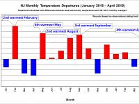
- Third warmest year of the past 127.
- Statewide average temperature of 55.2° was 1.6° above average.
- 17 of the 20 warmest years since 1895 have occurred since 1998. 7 of the 10 warmest on record have occurred since 2010.
- Seasonal:
- Summer (Jun–Aug) 6th
- Fall (Sep–Nov) 9th warmest.
- Monthly:
- 9 months above average.
- 4 months in the top 10 for warmth.
- Annual:
- Tornado country
- 13 tornadoes on six days.
- Second most in any year since 1950. 1989 remains at #1 with 17.
- Strongest (EF3) in NJ since 1990. Associated with Ida, with two other twisters.
- Two associated with Tropical Storm Elsa (July 9–10).
- One in a storm on July 17.
- Six on July 29. The second most in one day since at least 1950.
- One associated with Tropical Storm Fred (August 19).
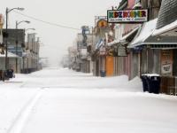
- Long-lived Snowstorm (January 31–February 3)
- Mine Hill (Morris) leading the way with 32.8”.
- 8 counties with a location receiving at least 20”.
- 15 counties with a location receiving at least 10”.
- Peak wind 56 mph as Seaside Heights (Ocean).
- Moderate coastal flooding for four tidal cycles.
- Heavy rain in the southeast.
- Contributed to northern NJ having its snowiest February (36.9”).
- Lowest pressure 29.35”.
- Tropical Storm Henri (August 21-23)
- A prolific rain maker, led by East Windsor (Mercer) with 9.02”.
- 11 counties with a location receiving at least 5.00”.
- Flash flooding, especially in southern Middlesex County and nearby.
- Moderate river flooding in central NJ.
- Lowest pressure not too low at 29.70”.
- Peak gust only 37 mph in Fortescue (Cumberland).
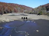
- Took a while to freeze
- Latest first fall freeze on record for NJ: November 2 at Pequest (Warren).
- Not since at least 1900 had NJ gone without an October (occasionally September) freeze at some location.
- Last location to freeze was West Cape May (Cape May) on November 28.
- Double storm week
- Act 1: A nor’easter impacted NJ from late on October 25 to early on the 27th.
- Rainfall was the key with 10 counties having at least one station receive 5.00”.
- Every county saw at least 1.49”.
- Minor flooding occurred along some central and northern waterways.
- Peak wind gust of 46 mph at Lower Alloways Creek Township (Salem).
- Act 2: A strong low-pressure system moved northward up the Appalachians from October 29-30.
- Powerful southerly winds impacted NJ with gusts to 69 mph in Tuckerton (Ocean), and 66 mph at Seaside Heights (Ocean). 22 NJWxNet stations gusted over 40 mph.
- Coastal flooding resulted on the Atlantic coast, on Delaware Bay, and up the Delaware River.
- Light to moderate rain fell. Up to 1.87” in Phillipsburg (Warren), with most locations catching from 0.50”–0.99”.
- Act 1: A nor’easter impacted NJ from late on October 25 to early on the 27th.
- Hail hail
- Reports of hail over 1” in diameter on six days.
- Largest 2.5” in diameter in Hillsdale (Bergen) on July 8.
- Other dates July 12, July 17, July 24, July 29, and November 13.
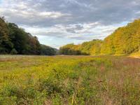
- A dry ending
- Statewide, November precipitation totaled 1.03” ranking 7th least on record.
- December’s total of 1.29” ranked 6th driest (-2.98”).
- Together, this was the driest last two months of the year on record, totaling just 2.32”.
- Smoky skies
- From western U.S. forest fires. Most pronounced milky skies on July 7, July 20–21, and July 27–28.
- Visibility and air quality in the lower atmosphere reduced at times.
Almost making the cut
- Two lightning deaths. One on June 9 in Burlington County, and another on August 30 in Ocean County. The first in NJ since 2012.
- Potent squall lines. Contained combinations of heavy rain, strong winds, hail, and/or rapid drops in temperature. Some notable ones include March 28, April 21, May 7, May 26, June 4, July 6, September 13, October 16, November 13, December 6, and December 11.
- Many a windy day. Includes 98 days with at least one NJWxNet station with straight-line winds gusting to at least 40 mph, 42 days with gusts to at least 50 mph, and 11 days with gusts from 60-69 mph. The MDL Base (Burlington) had a 70-mph gust on March 28, and Harvey Cedars (Ocean) and Sea Isle City (Cape May) gusts of 75 mph and 79 mph, respectively, on July 9.
- Persistent coastal flooding. Two episodes in October brought multiple consecutive minor to moderate flooding to a number of locations.
- From October 8–11 winds at Harvey Cedars on Long Beach Island (Ocean) gusted to at least 23 mph for 65 consecutive hours, with 48 hours gusting from 30–41 mph. This led to seven consecutive high tides with minor flooding at the Barnegat Bay (Ocean) gage.
- From October 27–31 winds associated with the Appalachian low (see entry #7 above) resulted in eight consecutive high tides with minor flooding at the Barnegat Bay gage and nine consecutive high tides with close to minor, minor, or moderate tidal flooding at the Burlington (Burlington) gage on the Delaware River.


