Following a mild six days of December, when a number of locations approached or exceeded the 50° mark for highs, the bottom fell out of the thermometer. From the 7th through the 18th most of the northern half of the state failed to reach 40°, while southern locations only saw milder highs on the 14th, early on the 15th, and on the 17th. This includes the first sub-zero observation of the winter, when -1° was reached at Walpack (Sussex County) on the 17th and again on the 18th.
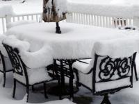
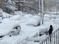
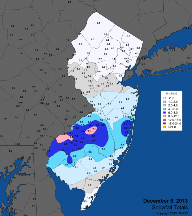
However, the main story of the first cold wintry round of the season wasn't the cold, rather it was four separate snow events in a 10-day period. The first occurred on Sunday the 8th, when portions of south Jersey were quickly smothered with about as much of the white stuff that fell all of last winter. If you tapped your barometer, you would have noted quite high pressures, certainly not indicative of a storm. However abundant moisture converged along a frontal boundary, was subsequently lifted and quickly fell to the ground as heavy snow in roughly a 20-mile wide band from the southwest to the central coast. Statewide, snow totals ranged from 9.5" in West Deptford Township (Gloucester) and 9.4" in Medford (Burlington) to a trace to a few tenths in the northern quarter of the state and the far south.
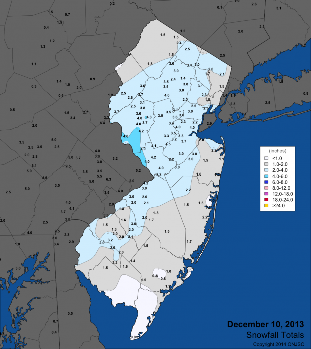
Next up was a weak area of low pressure that moved through NJ along an arctic front on Tuesday the 10th. This brought a light to moderate snowfall across most of the state, with totals ranging from 4.5" in South Brunswick (Middlesex) and 4.3" in both Long Hill (Morris) and White House Station (Hunterdon) to nothing or a trace in Cape May County.
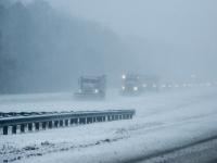
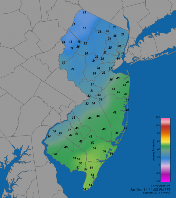
Cold conditions prevailed for the remainder of the week, setting the stage for a more powerful winter event on the weekend of the 14th-15th. Energy from a low-pressure system coming out of the central US was handed off to a developing low along the mid-Atlantic coast. The resulting system brought 2.34" (Eatontown in Monmouth County) to 0.41" (Hamilton in Mercer County) of moisture to locations across the state, most falling as rain in the south, with a mix of snow, sleet and freezing rain elsewhere. Snow totals ranged from 8.1" in Blairstown (Warren) and 7.0" in Oakland (Bergen), Wantage (Sussex), Asbury (Warren), and Belvidere (Warren) to nothing to at most a few tenths from Ocean, Atlantic, and Gloucester counties down to Cape May. Several tenths of an inch of ice accumulated on trees, wires, roads, and other surfaces from the southwest into central counties. A remarkable range of temperatures exceeding 40° developed across NJ during the afternoon and evening of the 14th as an arctic boundary was draped from the southwest to northeast. To the north, temperatures stayed below freezing and were as low as 8° at High Point Monument (Sussex). Meanwhile, it warmed to 56° in Dennis Township (Cape May). A map from late evening shows a range from 55° to 13°, typical of this event.
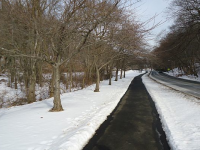
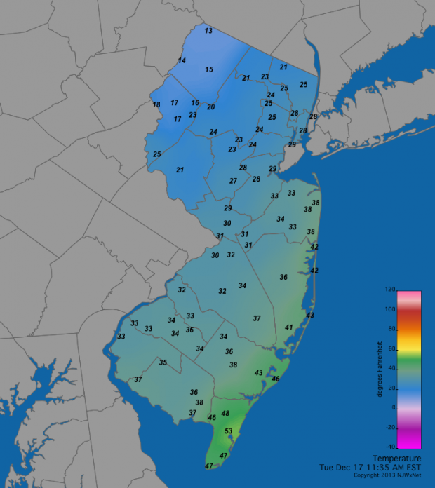
The fourth and final punch in this unusual early-season wintry bout occurred on the 17th. An Alberta Clipper system arrived from western Canada during the pre-dawn hours and deposited a nuisance inch or less of snow. A few additional shots of light precipitation (rain, freezing rain or snow) during the day resulted in event snow totals as much as 3.5" at Bethlehem Twp (Hunterdon) in central and 3.0" at Highland Lakes (Sussex) in northern locations, with none to a few tenths in the south. Meanwhile, much like the previous event, there was an enormous range of temperatures across NJ during the afternoon, as seen at mid day when temperatures ranged from 53° in Cape May Courthouse (Cape May) to 13° at High Point Monument.
This early start to the snow season has resulted in an average of 8.4" falling across the state thus far. The four recent events have led to average totals of 10.1" in northern, 9.2" in central, and 7.0" in southern counties. This compares to a long-term December statewide average of 4.1". However, at least at this point, a December snowfall record is far from being threatened. The five snowiest Decembers since statewide records commenced in 1894 include 21.9" in 1904, 17.4" in 1960, 16.7" in 1966, and identical 15.1" totals in 2009 and 2010.
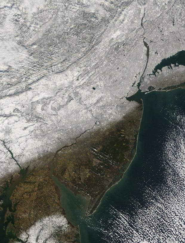
A major warm up is about to commence, likely eliminating most of central and northern NJ snow cover before Christmas. The NASA MODIS visible satellite image from the morning of the 18th clearly shows where the snowline sits across the mid Atlantic region. Still, it appears that on average December will be colder than normal. Thus this is likely to be the first December with above average snowfall and below average temperatures since 2009.
What does this early snowy round tell us about the remainder of this winter? Well...not too much. While the five snowiest Decembers on record contributed to full winter snow totals of from 20.5" to 33.8" above the long-term 23.9" average, Decembers with totals just above average provided no hint of what the remainder of winter might bring.


