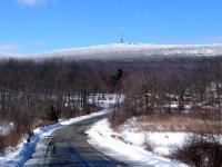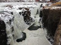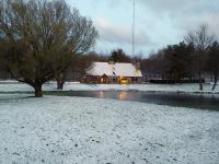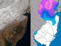
The year began where 2013 left off, with the jet stream in an amplified, progressive pattern that resulted in frequent, pronounced fluctuations in temperature and multiple precipitation events. By late month, the pattern slowed, but remained amplified, locking NJ into over a week of bitter cold conditions. The statewide average temperature for January was 26.1°, which is 5.1° below the 1981-2010 average and ranks as the 17th coldest since 1895 (120 years). It was the coldest January since 2004. Precipitation in the form of rain, freezing rain, and melted snowfall averaged 3.09". This is 0.39" below normal and ranks as the 57th driest. Snowfall averaged 17.7", which is 10.6" above normal and ranks at the 8th snowiest January on record.
Temperature
The variable swings of the thermometer in January are exemplified by the 11 days where maximum temperatures exceeded 50° at one or more locations in the state and the 12 days where minimum temperatures fell below 0°. There was even an unusual plunge of over 50° at many locations from the 6th to 7th. Five days saw locations with maximums of 55° or greater. On the 5th Dennis Township (Cape May County) reached 57° and both Woodbine (Cape May) and Piney Hollow (Gloucester) hit 56°. The 6th brought 62° to Cherry Hill (Camden) and 61° to four other south Jersey locations. The mildest day of the month occurred on the 11th, with 64° at Cherry Hill, Mansfield (Burlington), Sewell (Gloucester), and Red Lion (Burlington). The 60° mark was reached at 29 of the 52 NJ Weather and Climate Network stations on the 11th, with Bivalve the coolest in the network at 53°. Oceanport saw 55° on the 12th, and five stations reached 60° on the 13th.
The first frigid episode began on the 3rd, when late in the evening Walpack (Sussex) dropped to -12° and Pequest (Warren) reached -8°. By the morning of the 4th the temperature bottomed out at -13° in Walpack and -12° at Pequest. Kingwood (Hunterdon) was -10° and 28 other stations dropped below zero on the 4th. The “mildest" location in the state was Atlantic City Marina (Atlantic) at 13°. Walpack fell to -8° on the 5th and Pequest -5°.
Following the brief warm up on the 6th, minimums again fell below zero at some locations on the 7th, including -6° at High Point Monument (Sussex) and -5° at High Point (300 feet lower than the Monument station). Accompanying the cold on the 7th was strong wind that resulted in dangerous wind chills as low as -27° at the Monument at 11 AM, when the temperature was -4° with a wind speed of 20 mph. Wind chills of -10° to -20° (colder in gusts) were common across NJ during the daylight hours of the 7th, when thermometers across most of the state sat in the single digits. For instance at noon, temperatures ranged from -3° at High Point Monument to 12° in West Cape May (Cape May). These were the coldest daylight hours in NJ since January 19, 1994. The cold continued into the 8th, with lows of -4° at Walpack and -3° at the Monument, an interesting pair of minimums. The cold at Walpack is indicative of cold air pooling in valleys while High Point Monument is often the coldest location when cold air sweeps into the region, with winds at these times stirring up the lower atmosphere and minimizing cold air drainage into valleys.
Seven of the last ten days of January saw subzero cold at one or more location. High Point Monument and High Point dropped to -9° and -8°, respectively, on the 22nd. Pequest at -8° and Kingwood (Hunterdon) at -7° were the coldest locations on the 23rd. Minimum honors went to Berkeley Township (Ocean) and Basking Ridge (Somerset) on the 24th, when both fell to -10°. Walpack came in at -1° on the 26th and -2° on the 28th, and, along with Pequest, fell to -2° on the 29th. South Jersey experienced its coldest morning of the month on the 30th, with -9° at Oswego Lake (Burlington) and Berkeley Township (Ocean) and -6° at both Woodbine (Cape May) and Upper Deerfield (Cumberland). Some 24 stations around NJ fell below zero on the 30th, led by -10° at both Kingwood and Walpack. A fresh snowpack was of assistance in lowering southern temperatures, while the older snowpack in the north, despite the frigid cold readings, was not as effective in refrigerating the lower atmosphere.
Throughout January, West Cape May experienced single digit minimums on four days (minimum 5° on the 30th) and fell below freezing on 23 days. At the other end of the state, Walpack fell below zero on 12 days (minimum of -13° on the 4th) and had a below freezing minimum on all but one day (34° on the 14th). Rivers and bays were frozen over in many locations come month's end.
Precipitation and storms
Monthly precipitation totals at individual locations across NJ did not vary too widely in January. Rain, freezing rain, and melted snow amounted to as much as 4.44" in Washington Township (Gloucester), 4.32" in Lacey Township (Ocean), 4.31" in Bethlehem Township (Hunterdon), 4.20" at Long Branch (Monmouth), and 4.17" in Holland Township (Hunterdon). The driest locations included Bernards Township (Somerset) at 2.43", Cranford (Union) 2.68", Harrison (Hudson) 2.68", Franklin Township (Somerset) 2.70", and Princeton (Mercer) 2.75".
Snowfall averaged 15.4" (+5.9") in northern counties, 18.9" (+11.2") in central counties, and 18.3" (+12.7") in the south. Freehold (Monmouth) received the most with 28.6". Red Bank with 24.6" ranked second, followed by Washington Township (Gloucester) at 23.6" and Tenafly (Bergen), Mt. Laurel (Burlington), and Pitman (Gloucester) each with 23.5". The usually snowiest northwest and north central portion of the state shared low snowfall honors with the extreme southeast. Wantage (Sussex) received 10.6", Andover (Sussex) 11.1", Oakland (Bergen) 11.6" and 12.7" (two stations), Parsippany-Troy Hills (Morris) 11.9", Washington Township (Morris) 12.1", and Sea Isle City (Cape May) 12.2". There were six January events that brought snowfall of 2" or more to at least one location in NJ. The majority of the snow fell at temperatures well below freezing, something not always the case in NJ, even in mid winter.
Season-to-date snowfall is quite uniform statewide. The NJ average is 25.7", which is already only 0.2" below the full-season average (October-April). The north has totaled 25.9" (8.6" below the full season average), central counties 28.3" (0.4" below the seasonal average), and south 24.3" (4.5" greater than the full season average).
The first storm of the New Year arrived during the late afternoon of the 2nd and ended by mid morning on the 3rd. Moderate drifting in exposed locations followed for the remainder of the day. The Monmouth County communities of Freehold and Long Branch received 11.0", and Englishtown (Monmouth) and Brick Township (Ocean) both caught 10.7". Totals were in the 8-10" range throughout Monmouth, Ocean, and northern Burlington counties, tapering to 4-6" in the northern quarter of NJ and in the southeast. Melted down, the liquid equivalent of the snowfall was as high as 1.06" in Berkeley Township (Ocean), 0.98" at Wall Township (Monmouth), and 0.89" in Long Branch.
The next event began on the morning of the 5th as rain in the south and freezing rain in central counties. This resulted in numerous accidents on roadways. The heaviest of the rain arrived with temperatures above freezing throughout NJ and lasted until midday on the 6th. The entire state received at least several tenths of precipitation, with the most observed at Blairstown (Warren) with 1.31", Lacey Township (Ocean) 1.26", and Wantage (Sussex) 1.17". The rainfall and snowmelt resulted in minor flooding on a few rivers in central and southern NJ, including on the Millstone River at Griggstown (Somerset).
A mixed bag of snow, freezing rain and rain fell across NJ on the 10th, through the 11th, and ending early on the 12th. The first half of the event brought as much as 2.0" of snow to Flemington (Hunterdon), with lesser amounts in central and northern counties and none south of Interstate 195. Temperatures rose into the 11th, reluctantly so in some central and northern valley locations, but eventually the 50° mark was exceeded everywhere. Heavier rain fell at the warmer temperatures during the afternoon and evening of the 11th, with lightning and thunder accompanying the rain at some central and southern locations late in the afternoon. Precipitation for this complex event exceeded a half inch everywhere in NJ and was as high as 1.68" in Howell (Monmouth), 1.60" at Jackson Township (Ocean), 1.55" in Medford Lakes (Burlington), and 1.53" in Franklin Township (Gloucester).
Rain returned to NJ on the 14th, primarily during the daylight hours. At least several tenths fell throughout the state. It was heaviest in the far south, with the Cape May County communities of Upper Township, Woodbine, and Middle Township receiving 0.82", 0.80", and 0.79", respectively. Temperatures fell and dense freezing fog formed overnight into the morning of the 15th. This resulted in a rash of accidents on the roadways and dangerous conditions under foot.
The northern half of NJ received some light rain that quickly turned to snow squalls accompanied by some thunder during the morning of the 18th. The squalls brought out plows and sanders on one side of some communities with barely a dusting of snow on the other side. Wantage (Sussex) received 3.3" and Hope (Warren) 2.5". The most rain and melted snow fell in the northeast, with 0.35" in Glen Rock (Bergen) and nearby Hawthorne (Passaic). Little to no precipitation fell in the south.
The largest snowstorm of January began after sunrise on the 21st and tapered off during the late evening. Snowfall rates exceeded 2" per hour at some locations during the heart of the event, particularly in the central half of NJ where over 8" fell. There was some early mixed precipitation along the southeast coast, but elsewhere this was a cold storm with low-density snowfall. Totals tapered off to 2-3" in the northwest and southeast, where only 0.10-0.20" of rain and melted snow fell. Elsewhere, 0.50" to 0.75" melted totals were common and were as large as 1.11" in Lacey Township (Ocean) and 1.05" at Long Branch (Monmouth). Snowfall exceeded 10.0" at some locations in 14 of New Jersey's 21 counties. The maximum amount observed in each of these counties is listed below (Table 1).
|
Municipality |
County |
Snowfall |
|
E. Rutherford |
Bergen |
13.0" |
|
Cinnaminson |
Burlington |
13.5" |
|
Pennsauken |
Camden |
13.7" |
|
Cedar Grove |
Essex |
12.5" |
|
E. Greenwich |
Gloucester |
12.0" |
|
Secaucus |
Hudson |
12.5" |
|
Stockton |
Hunterdon |
12.0" |
|
Hamilton |
Mercer |
13.0" |
|
New Brunswick |
Middlesex |
10.5" |
|
Englishtown |
Monmouth |
15.1" |
|
Chatham |
Morris |
10.5" |
|
Point Pleasant |
Ocean |
12.1" |
|
Hillsborough |
Somerset |
11.7" |
|
Westfield |
Union |
12.3" |
Table 1. Maximum snowfall for the January 21st storm in counties where at least one location received 10".
The 25th brought snow to the entire state. Totals were generally in the 1-2" range, except under an inch along the southeast coast. West Milford (Passaic) received the most with 3.1". This was followed by Pennsauken (Camden) with 2.9" and Lawrence Township (Mercer) and Allamuchy (Warren), both with 2.8". Melted snowfall amounted to as much as 0.27" in Millstone (Monmouth), 0.25" at Denville (Morris), and 0.23" in Cedar Grove (Essex).
Some light freezing rain the morning of the 27th created scattered travel issues on northern roadways, as milder air moved into the area, eventually bringing temperatures above freezing for a portion of the day. Colder air soon followed and with it came a quick hitting storm to southern NJ from the evening of the 28th until just after sunrise on the 29th. Over 6" fell in Cape May and nearby locations, tapering to less than an inch north of Interstate 195. Reports of 7.7" and 7.0" were received from observers in Estell Manor (Atlantic). Surf City (Ocean) saw 7.5", Atlantic City Airport in Pomona (Atlantic) 7.3", Galloway Township (Atlantic) 7.0", Mamora (Cape May) 6.8", and 5.0" in both Millville (Cumberland) and Pittsgrove (Salem). This was a powdery snow, with the liquid equivalent only as high as 0.34" in Estell Manor, 0.30" at Lavallette (Ocean), and 0.28" at both Hamilton Township (Atlantic) and Wildwood Crest (Cape May).
January was a windy month, often bringing on very cold wind chill values. Gusts exceeded 40 mph at one or more locations on 11 days. Sea Girt (Monmouth) gusted to 40 mph on the 2nd, with High Point Monument (Sussex) to 51 mph and Wantage (Sussex) to 50 mph on the 3rd. Gusts reached 49 mph at Atlantic City Marina (Atlantic) and 47 mph at High Point Monument on the 6th. The brutally cold 7th was the windiest day of the month. High Point Monument gusted to 56 mph and Seaside Heights (Ocean) to 49 mph. 14 other stations gusted between 40-48 mph and 21 between 30-39 mph.
Woodbine peaked at 43 mph on the 11th and High Point Monument 51 mph on the 12th. The end-of-month cold included gusts to 42 mph in Harvey Cedars (Ocean) on the 21st, 47 mph at Wantage on the 22nd and 41 mph at that location on the 23rd, 44 mph in Harvey Cedars on the 25th, and 43 mph at the Monument on the 27th.
The highest barometric pressure for January occurred on the 9th with a peak of 30.65-30.70". The monthly minimum was just two days later on the 11th at between 29.30-29.35".


