News

Dry Conditions Persist: December 2021 Recap; Another Warm One: Annual 2021 Recap

January 8, 2022 - 1:28pm -- Dave Robinson

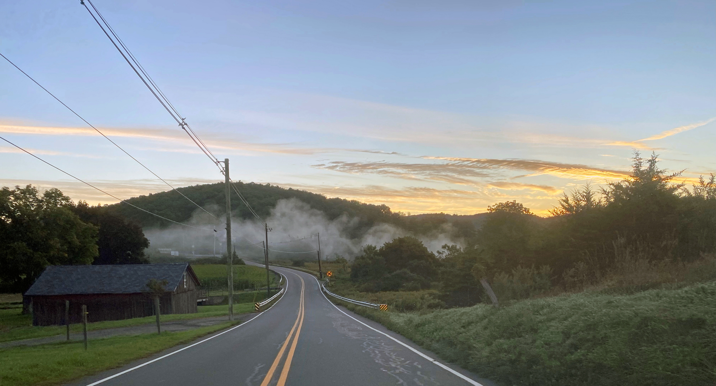
Fallstreak photo

Following a cooler-than-normal November, it was back to the mild side in December, the ninth such month in 2021. However, much like November, the last month of 2021 was a top 10 dry one. An annual recap follows the December report where more will be said regarding annual temperature and precipitation.

Statewide precipitation in December was 1.29”. This is 2.98” below the 1991–2020 normal and ranks as the 6th driest since records commenced in 1895. It was the driest December since 1989, which happened to be the coldest December on record. The west-central area received the most precipitation, exceeding 1.80” in some locations, but this was still well below normal. The far south was driest, most places receiving less than an inch. The northern division averaged 1.46”, which is 2.79” below normal and ranked 10th driest. The southern division came in with 1.20”, which is 3.08” below normal and ranks 5th driest. The coastal division with 1.09” was 3.27” below normal and ranked 4th driest.

ONJSC's Top 10 NJ Weather and Climate Events of 2021

January 3, 2022 - 7:18pm -- Dave Robinson

A flooded TD Bank Ballpark in Bridgewater (Somerset County) on September 2nd following the staggering rainfall caused by the remnants of Ida. Photo by Thomas P. Costello and Tariq Zehawi/USA Today Network.

For the 13th consecutive year, we in the state climate office have evaluated the myriad daily, monthly, and annual observations gathered across New Jersey during the course of the year to choose what we feel were the most significant and impactful 10 weather and climate events of 2021. More about each event can be found in the monthly narratives and the special Post-tropical Cyclone Ida report posted on our website. You might be tempted to rearrange the rankings, particularly as some of the events on the list may have affected you more than others ranked higher. Or perhaps you best recall one that didn't make the list. That's the enjoyment and frustration of lists! Unless stated otherwise, statewide values are based on an average of several dozen stations. The period of record for monthly, seasonal, and annual departures is 1991–2020; while for extremes and rankings it is from 1895–present. Observations are mainly drawn from National Weather Service Cooperative Observing Program stations, Rutgers NJ Weather Network stations, and NJ Community Collaborative Rain, Hail, and Snow Network locations.

It’s Been A While: November 2021; A Common Theme: Fall 2021 Recap

December 7, 2021 - 4:32pm -- Dave Robinson

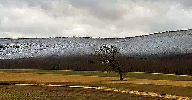
The season’s first measurable snow at High Point on November 15th. Photo courtesy of N. Stefano.

November was the first month since May 2020 with both averages of precipitation and temperature below 1991–2020 normals. The last drier-than-normal month was this past June while the last cooler-than-normal month was this past May. However, it’s been a while, 19 months, since the two anomalies teamed up. And dry it was, with the statewide average of 1.06” running 2.29” below normal. This ranks as the 7th driest November since records commenced in 1895. Only two other Novembers since 1936 fall in the top 10.

The statewide average November temperature of 43.9° was 1.2° below the 1991–2020 normal and ranked as the 73rd coolest of the past 127 years. This was 17.2° cooler than the mild average of this past October. The normal difference between the months is 10.2°. The average maximum was 54.5° (-0.2°, 84th coolest) and the average minimum was 33.2° (-2.3°, 47th coolest). The north averaged 41.9° (-1.2°, 74th coolest), the south 44.9° (-1.4°, 68th coolest), and the coast 46.0° (-1.3°, 70th coolest). The first Rutgers NJWxNet or NWS Cooperative station to reach the freezing point this season was Pequest (Warren County), late on the 2nd. This was the latest first freeze in NJ since at least 1900 (based on Coop records). The last location to reach freezing was West Cape May (Cape May) on the 28th, on the late side but not unusually so.

A Slow Crawl into Fall: October 2021 Recap

November 8, 2021 - 5:43pm -- Dave Robinson

Colorful foliage surrounding Lake Hopatcong (Sussex County) on October 31st, bringing a tranquil close to a turbulent end of October. Photo courtesy of Kelly Wallis.

October was the second mildest on record in the Garden State since records commenced in 1895. This follows on the heels of the 11th warmest September, leaving most residents wondering when cool weather would arrive and leaves would turn and fall. For the first time since at least 1900, not a single weather observing station in New Jersey recorded a freezing low temperature on any day in either September or, as is climatologically most common, October. All of this resulted in a leaf season that was delayed by one to two weeks.

The statewide average October temperature of 61.1° was 5.7° above the 1991–2020 normal, a mark only surpassed in 2007. The average daily maximum of 70.1° (+4.3°) ranked 5th mildest (tied with 1920), and the average minimum of 52.0° (+7.1°) tied with 2007 as the mildest. These temperatures are close to what Norfolk, Virginia, normally experiences in October. In fact, despite the mean temperature normally declining 11.5° from September to October, this year’s mean was warmer than four previous Septembers since 1895 and the minimum was milder than 14 earlier Septembers. The state’s three climate divisions all ranked second mildest, with the north at 59.0° (+5.7°), south 62.3° (+5.8°), and coastal 63.2° (+5.6°).

Unprecedented: September 2021 Recap

October 11, 2021 - 4:38pm -- Dave Robinson

A flooded TD Bank Ballpark in Bridgewater (Somerset County) on September 2nd following the staggering rainfall caused by the remnants of Ida. Photo by Thomas P. Costello and Tariq Zehawi/USA Today Network.

Post-tropical storm Ida. The title of this month’s report speaks to this momentous weather extreme that will forever be the defining event of this month and likely the entire year. The storm delivered the most powerful tornado to strike the Garden State since 1990, demolishing multiple homes in Gloucester County. Rainfall exceeding 3.00” per hour led to the most widespread flash flood event on record for the state, resulting in the tragic deaths of 30 individuals in central and northeastern locales. A separate report on Ida has been prepared and may be accessed in the "News" menu.

There were 29 other days of weather this month that fortunately were not as dramatic as Ida on the 1st. All told, monthly precipitation averaged 6.20” across NJ. This was 2.04” above the 1991–2020 normal and ranks as the 15th wettest September since 1895. The north, where the bulk of Ida’s rain fell, averaged 8.92”, which was 4.46” above normal and ranks 7th wettest. The south averaged 4.61”, which was 0.62” above normal and ties as the 31st wettest. Along the coast, only 3.81” fell, some 0.08” below normal and ranking 44th wettest.

Ida Remnants Strike New Jersey

October 6, 2021 - 2:59pm -- Dave Robinson

Photo of flood debris from business establishments on Main Street in Manville on September 7 (photo credit: M. Holzer).

Post tropical storm Ida moved across the Garden State during the afternoon of September 1st into the early hours of the 2nd. It brought with it torrential rainfall, leading to flash and river flooding that took the lives of approximately 30 individuals and the rescue of countless more from raging waters. Additionally, it brought three tornadoes to southwestern and central areas, including the first EF-3 twister to strike New Jersey in 31 years. There were only minor injuries and no deaths from the tornadoes.

Ida developed in the Caribbean, being named a tropical storm on August 26th. From there, it moved northwestward, attaining hurricane status on the 27th as it passed over extreme western Cuba and moved into the Gulf of Mexico. It maintained a steady course as it strengthened into a major category 4 hurricane, making landfall in Louisiana on the 29th with sustained one-minute wind speeds as high as 150 mph. Once inland, winds diminished rather quickly but rainfall associated with the tempest remained heavy as the storm began to curve toward the northeast. This track remained quite steady as the storm weakened to a tropical depression on the 30th and became an extratropical low-pressure system as it approached the central Appalachians. On September 1st, Ida’s remnants merged with an advancing cold front as the system entered the Mid-Atlantic and crossed New Jersey before moving into southeast New England on the 2nd.

Sticky: August 2021 and Summer 2021 Recaps

September 10, 2021 - 6:30pm -- Dave Robinson

Flash flooding and residential evacuations in Helmetta on August 22

Whether the thermometer was reading high or low this August or whether rain was falling or not, one factor that most always had to be considered was the high level of humidity. The “Dog Days” of summer indeed. Of course, there was much else to consider this month, including contributions of rain from two tropical storms, one of which brought the largest crests on some rivers since May 1, 2014, 11 days where one or more locations received at least 2.00” of rain, and 16 days where the high temperature reached 90° or higher somewhere in the state.

Adding up all the rainfall, the statewide monthly average was 6.87”. This is 2.30” above the 1991–2020 normal and ranks as the 15th wettest August since 1895. The northern climate division led the way with 7.89” (+3.33”, 11th wettest), followed by the coastal area with 6.65” (+2.05”, 21st wettest), and the southern division at 6.21” (+1.64”, 27th wettest).

The statewide average temperature of 75.9° is 2.3° degrees above normal and ranks 4th warmest. Seven of the top 10 and 13 of the warmest 20 have occurred this century. The warmth was most strongly a function of elevated nighttime temperatures, which, for NJ, averaged 66.9°. This is 3.6° above normal and ranks 2nd warmest. The maximum temperature averaged 84.9°, some 1.1° above normal and ranks 18th warmest.

Everything but the Kitchen Sink: July 2021 Recap

August 5, 2021 - 7:55pm -- Dave Robinson

Tornado damage

Wow, what a month. July 2021 provided a never-ending cascade of weather events, including a tropical storm, a record-tying number of tornadoes, large hail, flash floods, hot days, chilly nights, smoke-filled skies, and on the last day of the month, perhaps the nicest day of the summer. The statewide average precipitation of 7.59” was 2.88” above the 1991–2020 normal and ranked 8th wettest of all Julys back to 1895. It was the wettest July since 1975 and second wettest in almost 50 years. The northern portion of the state averaged 8.16” which was 3.44” above normal. The south averaged 7.36” which was 2.62” above normal.

The average temperature of 75.8° was 0.4° above the 1991–2020 normal, but 1.9° above the 1895–2021 average. This ranked as the 24th warmest July since 1895. 13 of the 25 warmest Julys in the past 127 years have occurred since 2002. The nine July tornadoes is the most in a month since official records began in 1950. Tropical Storm Elsa was the earliest fifth storm of any season on record in the Atlantic basin. Read on for details on this potpourri of weather happenings.

Hit or Miss: June 2021 Recap

July 8, 2021 - 7:32pm -- Dave Robinson

A weir immediately downstream of the confluence of the Raritan and Millstone rivers in Somerset County on June 16th, as taken from the towpath of the Delaware-Raritan Canal

June was a hit or miss month when it came to rainfall, even within counties. Of course, this is not all that uncommon during the warm season, where much of the rainfall arrives courtesy of localized showers and thunderstorms. There were also ups and downs of the thermometer during the month, including some chilly mornings. Overall, the balance was weighted towards the warm side of the ledger, resulting in a top 10 ranking for June temperature.

The statewide average temperature of 71.9° was 1.6° above the 1991–2020 normal (3.0° greater than the 1895–2021 average). This ties the month with 2011 as the 8th warmest since records commenced in 1895. Seven of the 16 warmest Junes of the past 127 years have occurred in just the past 17 years. The average high of 82.7° was 1.7° above normal and ties as the 11th warmest, while the average low of 61.0° was 1.4° above normal and ranks 8th warmest.

Decision-Making Dilemma: May & Spring 2021 Recaps

June 6, 2021 - 4:03pm -- Dave Robinson

A waterspout over Barnegat Bay on May 8th near Seaside Heights

Weather often varies from week-to-week and even day-to-day during the spring transition season. Such was certainly the case in spring 2021, as will be recapped later in this report. However, when it came to such “weather indecision,” May 2021 took the cake. Starting off somewhat damp with seasonable temperatures, a prolonged period of exceedingly dry weather ensued, first accompanied by cooler-than-normal temperatures and frosty mornings, and later by summer-like heat. As several wildfires broke out and soil moisture vanished, concerns of early-summer drought arose. Then along came one of the coolest Memorial Day weekends on record, accompanied by more than an average May’s worth of rain in some locations. This led to frequent decision making amongst farmers, gardeners, water resource managers, utility companies and customers, and day trippers. All were left wondering what might come next! Cicadas perhaps?

With the thermometer up and down throughout May, the statewide average temperature of 61.0° was just 0.2° below the new 1991–2020 normal. This ranked as the 47th mildest May since 1895. The average maximum of 73.0° was 0.7° above normal, while the 49.0° average minimum was 1.2° below normal. This is illustrative of a month that had many clear days and cool nights with low humidity. Despite dry conditions for most of the month, monthly precipitation came in close to normal, averaging 3.95” across NJ. This is 0.20” above normal, ranking 48th wettest of the past 127 years. Far south and west central areas were driest, while the central coast and northeast saw the most rain. Unlike last May, no snow was observed.

Pages

Subscribe to RSS - News