For the 16th consecutive year, we in the state climate office have evaluated the myriad daily, monthly, and annual observations gathered across New Jersey during the course of the year to choose what we feel were the most significant and impactful 10 weather and climate events of 2024. More about each event can be found in the monthly narratives posted on our website. You might be tempted to rearrange the rankings, particularly as some of the events on the list may have affected you more than others ranked higher. Or perhaps you best recall one that didn't make the list. That's the enjoyment and frustration of lists! Unless stated otherwise, statewide values are based on an average of several dozen stations. The period of record for monthly, seasonal, and annual departures is 1991–2020; while for extremes and rankings it is from 1895–present. Observations are mainly drawn from National Weather Service Cooperative Observing Program stations, Rutgers NJ Weather Network (NJWxNet) stations, and NJ Community Collaborative Rain, Hail, and Snow Network (CoCoRaHS) locations.
- Second half of 2024 drought
- July–December was 8.17” below normal (8th driest), while January–June was 3.13” above normal (22nd wettest).
- October: 0.02” statewide average; driest of any month on record.
- September–October driest of any two-month period.
- Five locations with records back to the second half of the 19th century set records for consecutive days without measurable precipitation. Ending on November 9, streaks ranged from 34 to 42 days and broke previous records by as many as 13 days.
- NJ Department of Environmental Protection issued a statewide Drought Watch on October 17th and a Drought Warning on November 13th. Despite some late November and December improvement, the warning remains in effect at year’s end.
- US Drought Monitor reported D3 (extreme drought) in NJ for the first time since 2002. At one point D3 covered most of south Jersey while the north reached D2 (severe).
- Dry conditions and warm temperatures that enhance evaporation resulted in over 500 wildfires in October–November.
- Second warmest of the past 130 years
- Annual: 55.8° (2.2° above normal). Only behind 2012.
- Seasonal: Every season ranked from 3rd–6th warmest.
- Monthly: Eleven months were above average. Four months ranked in the top 10 for warmth. March ranked 7th, June 2nd, July 7th, and November 5th.
- Nine of the ten warmest years have occurred since 2006. Four of the top six in the past five years.
- January 9th storm
- Mostly rain (1.3” of snow in Montague in Sussex County). West Milford (Passaic) received 4.39” of rain/melted snow, Randolph Township (Morris) 4.18”, and Vernon Township (Sussex) 4.12”.
- 253 of 278 NJ CoCoRaHS reports were from 2.00”–3.99”. Lowest total was 1.64” at Upper Deerfield (Cumberland).
- Major river flooding on the Passaic (9th highest crest) and Raritan (10th highest crest). Includes over 100 years of observations for each.
- One of the windiest storms since Sandy. Gusts at NJWxNet stations of 64 mph at Logan Township (Gloucester), Upper Deerfield 62 mph, Lower Alloways Creek Township (Salem) 60 mph, and 16 other stations from 50–59 mph.
- Persistent September easterly winds
- Very few hours with winds arriving from the “traditional” westerly direction from September 11th onwards.
- Resulted in persistent minor back-bay flooding during 20 of the 26 high tides from September 18th–30th. Also, frequent moderate to high rip currents in surf zones, and frequent foggy conditions as moist air moved ashore.
- General absence of severe weather
- No impacts from tropical systems or their remnants.
- Just one short-lived EF-0 tornado (June 14th in Lawrence Township in Mercer County).
- Despite this, there was one 2024 lightning fatality that occurred at Seaside Heights (Ocean) on June 23rd.
- Localized deluges
- Stalled storms fueled by warm, humid air impacted mostly isolated areas on several occasions.
- Lebanon Township (Hunterdon): June 22nd. Two CoCoRaHS stations in the south of town caught 5.59” and 5.52”, elsewhere two others at 1.92” and 1.44”, while a fifth in the north saw only 0.65”.
- Far south: June 30th–July 1st. Maurice River Township (Cumberland) 6.26”, Woodbine (Cape May) 5.09”.
- Far south again: July 13th. Woodbine 7.22” and 7.03”, Dennis Township (Cape May) 6.21”.
- Mercer County: August 6th. Pennington 7.76” and 6.79”, Hopewell Township 7.48” (another location in town 1.76”), Ewing Township 5.45” and 5.26”. Also, Cinnaminson (Burlington) 5.67”.
- Scattered: August 18th–19th. Warren Township (Somerset) 5.85”, Columbus (Burlington) 4.62”, Long Hill Township (Morris) 4.54”.
- High pressure
- On December 14th, the highest barometric pressure since February 13, 1981, was observed.
- Barometers topped out between 30.90” and 31.00”.
- Fluffy snow band
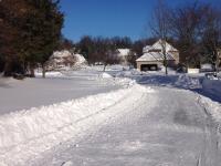
- Overnight of February 16th–17th frontogenesis (the creation and strengthening of a horizontal temperature gradient) resulted in a concentrated 20-mile-wide band of heavy snow across central counties, leaving the rest of the state with under 4.0”.
- Frenchtown (Hunterdon) received 13.5”, Riegelsville (Warren) 10.7”, Branchburg (Somerset) 11.5”, and New Brunswick (Middlesex) 11.3”.
- Notable was the low water content of the snow, with snow depth to liquid equivalent ratios of 20:1 to 25:1.
- Late end to the growing season in coastal and urban areas
- It was not until November 30th that nine NJWxNet stations and the National Weather Service station at Newark Airport fell to the freezing mark this fall. This is generally a few weeks later than normal.
- The first fall freeze at an NJWxNet station was in Walpack (Sussex) on October 10th. This site had the shortest freeze-free growing season of 165 days (April 28th–October 9th).
- The longest growing season was at the Atlantic City Marina (Atlantic) lasting 250 days from March 25th–November 29th. This is almost three months longer than at Walpack.
- Record November snowfall at High Point Monument
- 20.0” of snow accumulated at the Monument (Sussex, elevation 1,803’) overnight from the 21st–22nd. This is the largest NJ storm total ever observed in November. While not an official observation, given that the site is not a standard observing location, it exceeds the previous greatest official November storm total of 17.5” at Dover (Morris) in 1938.
- 16.0” was measured at the High Point Ranger Station (Sussex, 1,500’), Highland Lakes (Sussex, 1,363’) 15.7”, and Wantage (Sussex, 950’) 5.9”, while nearby valleys close to 400’ in elevation received a slushy inch or two.
While not exactly weather or climate, still science and newsworthy...
- An April 5th earthquake of magnitude 4.8 had its epicenter in Tewksbury Township (Hunterdon). It was felt throughout NJ and in neighboring states. Little damage occurred.
- A total solar eclipse several hundred miles to the northwest midafternoon on April 8th brought 90% totality to NJ. Partly cloudy skies obscured complete viewing across the state, while sensors at NJWxNet stations recorded notable decreases in solar radiation and some decrease in air temperature.
- A solar storm brought a magnificent aurora borealis that was viewed by many across NJ on the evening of October 10th. It was fortunate that skies were clear statewide for this rare showing.


