For the 14th consecutive year, we in the state climate office have evaluated the myriad daily, monthly, and annual observations gathered across New Jersey during the course of the year to choose what we feel were the most significant and impactful 10 weather and climate events of 2022. More about each event can be found in the monthly narratives posted on our website. You might be tempted to rearrange the rankings, particularly as some of the events on the list may have affected you more than others ranked higher. Or perhaps you best recall one that didn't make the list. That's the enjoyment and frustration of lists! Unless stated otherwise, statewide values are based on an average of several dozen stations. The period of record for monthly, seasonal, and annual departures is 1991–2020; while for extremes and rankings it is from 1895–present. Observations are mainly drawn from National Weather Service Cooperative Observing Program stations, Rutgers NJ Weather Network stations, and NJ Community Collaborative Rain, Hail, and Snow Network locations.
- Summer drought
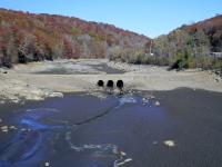
- June–August rainfall averaged 7.83” across NJ, 5.75” below normal.
- 4th driest summer on record. Driest since 1966.
- Key was persistence, as June ranked 59th driest, July 12th driest, and August 18th driest.
- Driest location: Wildwood Crest (Cape May County), 4.19”. Locally wettest: Mantua (Gloucester), 14.89”.
- Drought Watch commenced in NJ on August 9 (NJ Department of Environmental Protection). Continues through the end of 2022.
- US Drought Monitor had all of NJ in “Abnormally Dry”, “Moderate Drought”, or “Severe Drought” at one time or another during the summer.
- Summer heat
- June–August average temperature across NJ was 74.9°, 1.8° above normal.
- 3rd warmest summer on record. Warmest since 2020.
- The 9 warmest summers of the past 128 have occurred since 2005, and only 2 of the top 15 occurred before 1999.
- Key was July (7th warmest) and August (1st warmest). June 43rd warmest.
- 53 days from May–September had maximums of 90° or greater somewhere in NJ.
- Ian stalled remnant
- Remnant low pressure associated with former Hurricane Ian that pummeled Florida stalled close to or off the Mid-Atlantic coast from September 30–October 5.
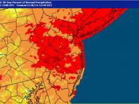
- Rainfall was as great as 9.60” in Lacey Township (Ocean) and 9.57” at Berkeley Township (Ocean). Least statewide was 2.27” in Westfield (Union). See map here.
- Rainfall was dispersed over multiple days, thus the NWS did not issue any flood warnings.
- Put a notable “dent” in drought conditions across the state.
- Winds gusted to 40 mph or greater from October 1–4 at multiple coastal locations. Maximum event gust of 59 mph at Atlantic City Marina (Atlantic) on the 2nd.
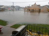
- Persistent onshore winds resulted in minor to moderate flooding of beaches and back bays. Substantial beach erosion, particularly along the southern coast.
- Southern snow rules
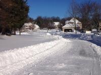
- 2021/2022 seasonal snowfall was highest in southern NJ (Burlington and Ocean counties southward) at 24.8” compared to 16.6” in central counties and 22.7” in the north. Statewide average was 22.1”. See seasonal snow map here.
- Only the third time the southern total exceeded the other two regions (also in 1978/1979 and 2009/2010).
- The 23.9” in the south in January was 18.3” above normal and ranked as 2nd greatest for the month after 24.1” in 1918.
- The two largest snow events of the season were on January 3 (highest total: 14.8” in Galloway Township (Atlantic) and January 28–29 (highest total: 18.4” in Manasquan (Monmouth).
- Highest NJ seasonal total was 36.0” in Galloway Township.
- Local but mean storms
- When storms arose during the dry warm season they often were quite localized but packed quite a punch. Examples follow.
- May 20: EF0 tornado Strathmere/Hazlet (Monmouth); 2.5” diameter hail Shamong (Burlington).
- June 1: rain 4.31” Mount Olive (Morris).
- June 9: EF1 tornado Gloucester Township (Camden).
- July 18: 3.02” Newton (Sussex).
- July 19: 4.25” Tenafly and Fairlawn (Bergen); 3.64” Blairstown (Warren).
- August 5: 4.30” Barnegat Township (Ocean); 3.82” Hopewell Township (Mercer).
- August 22: 5.39” Bedminster (Somerset); 4.43” Barnegat Township (Ocean).
- September 6–7: 5.57” Ocean City (Ocean).
- Another warm year
- Annual: 54.2° (0.6° above normal), 14th warmest on record.
- Seasonal:
- Summer (Jun–Aug) 4th warmest.
- Monthly:
- 7 months above average.
- 2 months in the top 10 for warmth. August ranked 1st, July 7th.
- Weather whiplash
- Major national storm impacted NJ beginning as rain (some freezing in the northwest) on December 22. Total precipitation by the afternoon of the 23rd was as much as 2.51” in West Milford (Passaic).
- Minor stream flooding in northeast NJ.
- Onshore winds gusted to 58 mph in Lyndhurst (Bergen) early on the 23rd.
- Moderate coastal flooding. Highest since Sandy at Sandy Hook and some other northern locations.
- Temperatures rose as high as 60° at Pennsauken (Camden) before a strong cold front brought hourly declines of several tens of degrees in a few hours and changes on the 23rd of much as 53° at Pennsauken (60° to 7°), Kingwood (Hunterdon; 57° to 4°), and Pittstown (Hunterdon) and Pequest (Warren; each 56° to 3°). 24-hour changes were a few degrees higher.
- Post-frontal winds exceeded 40 mph at 28 NJWxNet stations (maximum 60 mph in Fortescue [Cumberland]) resulting in sub-zero wind chills for many hours into the 24th.
- March and November unseasonably warm spells
- Hardly the only such 2022 spells, these two months had several exceptional ones.
- Seven March days had maximum temperatures of 70° or higher at one or more NJ weather station: 6th: 73°, 7th: 78°, 15th: 72°, 16th: 74°, 18th: 77°, 19th: 79°, 31st: 73°.
- Ten November days had maximum temperatures of 70° or higher: 1st: 74°, 2nd: 74°, 3rd: 72°, 4th: 78°, 5th: 80°, 6th: 80°, 7th: 81°, 10th: 74°, 11th: 72°, 12th: 75°.
- Record high minimum temperatures were set across NJ on November 7.
- Pinelands burning
- “Mullica River Fire” in Wharton State Forest (Burlington) scorched 13,500 acres between June 18–21.
- No significant injuries or deaths occurred, nor were any major structures destroyed.
- Largest NJ wildfire since 2007.
- 17th largest in NJ dating back to 1926.
- Pattern see-saw
- Weather patterns did not persist for intervals exceeding several days to about a week throughout the first four months of 2022.
- Thus, for instance, the titles of ONJSC monthly narratives included “Up, down, round, and round” (February), “Spring Foolery” (March), and “Consistently Inconsistent” (April).
Almost making the cut
- Blowing in the wind.
- 82 mph gust at High Point Monument (Sussex) on March 12.
- 82 mph gust at Lower Alloways Creek Township (Salem) on July 12.
- 95 days with gusts of 40 mph or greater at a NJWxNet station.
- 32 days with gusts of 50 mph or greater.
- 7 days with gusts of 60–69 mph.
- Smokey skies. From western wildfires. The smoke was high in the atmosphere, thus could not be smelled and was not a health hazard.
- Growing season disparity. While not record setting, the range in growing season length in New Jersey was impressive. In northwest valleys, there were 149 days of above freezing weather at Walpack (Sussex) and Sandyston (Sussex) between their last freezes of spring on May 11 and the first fall freezes on October 8. Along the coast, there were 234 days between the last spring freezes on March 30 and first fall freezes on November 20 at Atlantic City Marina (Atlantic) and Little Egg Harbor Township (Ocean).
- Volcanic pressure wave. Atmospheric pressure fluctuations occurred around the world following the explosive eruption of the undersea Hunga Tonga-Hunga Ha’apai volcano within the nation of Tonga on January 15 (Tonga time, which is 16 hours ahead of Eastern Standard Time). New Jersey was no exception, experiencing pressure fluctuations of several hundredths of an inch of mercury from an initial pressure wave at 10 AM EST, approximately 11 hours following the eruption. The pressure wave arrived in NJ a second time 14 hours later at midnight.


