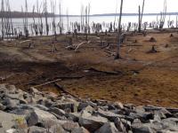
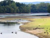
Whether it is a browning lawn, dry garden soil, or pollen that hasn’t washed off your car in weeks, many of us in New Jersey have recognized that the state is in the midst of an extended period of very meager rainfall. Along with the aforementioned impacts, the flow of water in streams and ground water levels as monitored in wells are below, and in some cases, well below seasonal levels. While it is fortunate that surface reservoirs in northern and central NJ are close to seasonal levels (quite full), there is less water than normal flowing into them and early season lawn watering is drawing water out of them at an unseasonable pace.
Advice provided by our office, by those within the National Weather Service and the NJ Department of Environmental Protection, and by others associated with the weekly US Drought Monitor has led to this week’s Monitor map depicting the northern third of NJ in D1 (defined as moderate drought) and the remainder of the state down to around the Atlantic City Expressway in D0 (abnormally dry). D1 can be expected to occur once every 5-10 years during a particular month, while D0 can be found every 3-5 years. While the type of conditions being experienced in parts of NJ right now are drought like, I am hesitant to call the north in “moderate” drought, and would prefer saying “minor” drought. However, this is the definition of the nomenclature decided upon by a national committee, thus within the Monitor map it is “moderate” in the north.
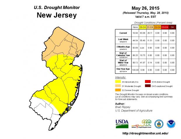
Figure 1. US Drought Monitor analysis for NJ, valid May 26, 2015.
The major indicator of dryness since the start of April is the low amount of precipitation that has fallen. While all areas have seen multiple inches of rain during this period, the last statewide soaker (and for some areas the bulk of the rainfall during this interval) was on April 20. What we've seen of late is just what can get us into trouble over multiple weeks, especially in the warm season when evaporation levels are high. There have been a number of cases where rain is forecast but the outcome is on the light and scattered side. We are frequently teased but ultimately are disappointed in terms of the quantity of rain we find in our gauges.
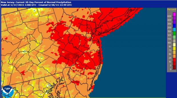
From April 22 through May 25 (35 days), no location in our NJWxNet or CoCoRaHS networks has received more than 1.73” of rain. Most locations have had 0.75”-1.25” accumulate, while a few scattered locations have only had 0.25”-0.50”. Average historical precipitation during this interval is a bit more than 4.00”.
Figure 2. 30-Day Percent of Normal Precipitation ending on May 27, 2015 (National Weather Service Advanced Hydrologic Prediction Service).
So will this continue to be a worrisome situation? Yes, I think so. Temperatures are projected to be above average through June, thus without average or, better yet, above-average precipitation, there will be increasing deficits in soil moisture, stream flow, ground water, and reservoir storage. Are there signs of a serious drought on the horizon? No, not at this time, but New Jersey just isn’t in a good position as we enter summer. Of course every summer has us keeping a close eye on hydrological conditions, but this is the first time in years that as much concern has arisen as we enter the season. In fact, should May 2015 end up more than 2.00” below the 4.00” 1981-2010 average, it will be the first time since 1965 that May was this dry and was preceded by an April that was more than an inch below average (April 2015 at 2.74” was 1.32” below average).


