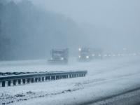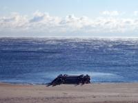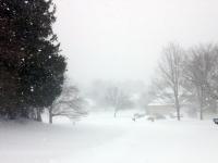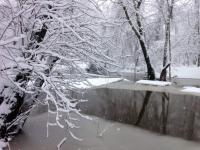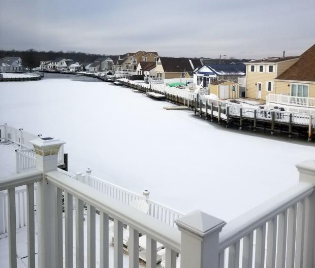
Early-season snow-covered ice on a lagoon in The Coves section of Beach Haven West in Stafford Township (Ocean County) on December 31. Photo by Erik Namendorf.
December Overview
The last month of 2017 was similar to many a month this past year. Whatever the season, weather conditions varied quite a bit from week to week. This was mainly due to an absence of atmospheric blocking in the middle and high latitudes with patterns that can lock a particular weather situation in place for multiple weeks. Thus in December we had a mild week, a snowy week, and a very cold week interspersed with transitional conditions. The one largely absent factor was precipitation, which resulted in the 11th driest December across NJ since records were established in 1895 (Table 1). The 1.57” of rain and melted snowfall was 2.28” below the 1981–2010 average. Snowfall averaged 8.7”, which is 3.9” above average and ranks as the 25th snowiest December on record. It was the snowiest since 2010. North Jersey averaged 8.7” (+2.1”), central areas 7.8” (+2.3”), and the south 9.1” (+4.9”). Temperatures seesawed from week to week, with the monthly statewide average of 33.6° being 1.6° below the 1981–2010 average. This ranked as the 61st coldest or 63rd mildest December on record.
| Rank | Year | Dec. Avg. Precip. |
|---|---|---|
| 1 | 1955 | 0.40" |
| 2 | 1980 | 0.81" |
| 2 | 1989 | 0.81" |
| 4 | 1988 | 0.95" |
| 5 | 1896 | 1.21" |
| 6 | 1998 | 1.34" |
| 7 | 1943 | 1.48" |
| 8 | 1939 | 1.50" |
| 9 | 1985 | 1.51" |
| 10 | 1958 | 1.56" |
| 11 | 2017 | 1.57" |
| 12 | 1937 | 1.60" |
| 13 | 1928 | 1.63" |
| 14 | 1965 | 1.70" |
| 15 | 1935 | 1.89" |
Table 1. The 15 driest Decembers across New Jersey since 1895.
Precipitation and Storms
The wettest locations across NJ were still well below average. They included locations in central NJ and were led by Robbinsville (Mercer) with 2.45”, East Brunswick (Middlesex) 2.39”, Hamilton (Mercer) 2.36”, Carteret (Middlesex) 2.31”, and Long Branch (Monmouth) 2.19” and 2.31”. The driest locations were in the south, with two Middle Township stations (Cape May) receiving only 1.10” and 1.15”, Woodstown (Salem) 1.27”, Woodbine (Cape May) and Lower Township (Cape May) each 1.31”, Buena Vista (Atlantic) and Pitman (Gloucester) each 1.32”, and Hammonton (Atlantic) 1.33.
Monthly snowfall was greatest in Bethlehem Township (Hunterdon) at 12.5”, followed by Ewing (Mercer) 11.3”, Rockaway Township (Morris) and Montague (Sussex) each with 11.1”, Hamilton (Mercer) and Wantage (Sussex) each with 10.8”, Howell Township (Monmouth) 10.7”, Point Pleasant Beach (Ocean) 10.4”, and Mt. Laurel Township (Burlington) 10.1”.
There were only six events during December where at least one location in the state received 0.25” or more of rain or melted snow. Only four of these topped 0.50”, while just one location on one day exceeded the 1.00” mark.
Late on the 5th a general statewide 0.25” of rain fell. South coastal counties had from 0.25”–0.50”, while Mercer and Middlesex received upwards of 0.75”. Robbinsville caught 0.94” and both South River (Middlesex) and East Brunswick saw 0.85”. From the pre-dawn of the 5th through the late evening, a snow event invaded the Garden State. Some rain mixed in far to the south but even there several inches of snow fell. Close to 3.0”–4.0” accumulated over the southern half of the state, with 4.0”–5.5” in the north (Figure 1). Snowfall exceeded 5.0” at one or more stations in 13 of the state’s 21 counties. Demonstrating the rather evenly-distributed nature of the storm, the top value of 5.5” was observed at nine locations over five counties, including Fort Lee and North Arlington in Bergen, four Middlesex County locations, Basking Ridge in Somerset, Wantage in Sussex, and Plainfield in Union. The rain and melted snowfall amounted to as much as 0.93” in Lower Township, 0.82” in Wildwood Crest (Cape May), 0.55”, 0.59”, and 0.62” at three Middle Township locations, and 0.61” at Jackson Township (Ocean).
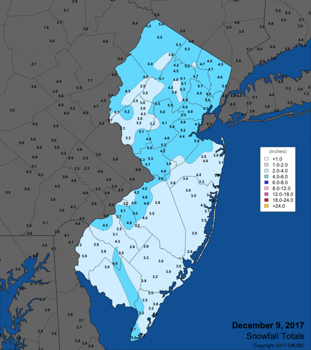
Figure 1. Snowfall totals from December 9th, 2017.
More snow arrived late on the 13th and continued into the morning of the 14th. Close to an inch fell in southern and central NJ, with 1.0”–2.0” in the northeast and 2.0”–3.0” in the northwest. The top totals in the seven counties where two or more inches fell included Ridgewood (Bergen) 2.2”, Bethlehem Township 3.2”, Rockaway Township 2.8”, Hawthorne (Passaic) 2.2”, Peapack-Gladstone (Somerset) 3.0”, Andover Township (Sussex) 2.5”, and Blairstown (Warren) 2.8”. The water equivalent of the snow was no greater than the 0.25” measured in Belmar (Monmouth), 0.23” in Union Township (Hunterdon), and 0.22” in Woodbridge Township (Middlesex).
The third modest snow event in a week arrived during the afternoon of the 15th and lasted into the evening. A 2.0”–3.0” swath of snow extended from southwestern counties into Burlington, Ocean, and Monmouth counties. Totals gradually fell off to only a few tenths in the far south and northwest. Top totals in counties receiving at least two inches included Hammonton (Atlantic) 2.5”, Florence and Burlington (Burlington) 3.0”, Berlin (Camden) 3.6”, six stations in Gloucester County 2.5”, Hoboken (Hudson) 2.0”, Hightstown (Mercer) 2.8”, Cheesequake and Old Bridge Township (Middlesex) 2.5”, Howell Township (Monmouth) 3.3”, and Toms River (Ocean) 3.5”. The liquid equivalent of the snow was as much as 0.27” at both Galloway Township (Atlantic) and Evesham Township (Burlington), and 0.24” in Jackson Township.
The 23rd was a rainy day across NJ from pre-dawn through the evening. The northern half of the state saw mainly 0.50”–0.75”, most of the southern half 0.25”–0.50”, and less than a tenth falling in most of Atlantic, Cumberland, and Cape May counties. Peapack-Gladstone received 1.18”, Holland Township (Hunterdon) 0.86”, Mount Arlington (Morris) 0.85”, and Rockaway Township 0.84”. Rain began again during the evening of the 24th and lasted into the pre-dawn hours of Christmas Day. Before ending, the precipitation transitioned to a period of accumulating snow in the north, with some flakes flying further south. About 1.0”–2.0” accumulated north of Interstate 80, with lesser amounts covering the ground south to about Interstate 78. Those areas with an inch or more on the ground that morning had their first White Christmas since 2012. Top county totals for the five that received at least an inch included 1.5” in Ramsey (Bergen), 2.0” at Green Pond (Morris), 2.0” in West Milford (Passaic), 2.7” in Wantage (Sussex), and 1.5” at Blairstown (Warren). Rain and melted snow amounted to several tenths of an inch across most of the state, with the exception of Monmouth County where 0.75” and 0.68” fell at two Long Branch stations, 0.59” at Eatontown, and 0.49” in Belmar.
On the 30th, snow began falling in the southwest just before dawn. It spread statewide and continued at a light to moderate pace throughout the morning into the early afternoon. An inch or more was measured along the Interstate 195 corridor from Hamilton (Mercer) with 2.6” to Jackson Township 2.5” to Upper Freehold Township (Monmouth) 2.6” to Howell Township 2.8”. The snow water equivalent was quite low, with at best 0.17” in Brielle (Monmouth), 0.16” in Flemington (Hunterdon), 0.15” in Galloway Township, and 0.13” at Bethlehem Township.
The highest barometric pressure of the month occurred on the 28th with readings of 30.55”–30.65”. The lowest came on the 12th with observations between 29.40”–29.50”. Winds gusted to 40 mph or higher at one or more NJWxNet stations on nine December days. The 6th saw a 60 mph gust at High Point Monument (Sussex), with 44 mph and 41 mph gusts, respectively, at Wantage and Columbus (Burlington). The Monument topped out at 51 mph on the 12th, with Fortescue (Cumberland) at 47 mph and six stations between 40 mph–44 mph. The 13th was one of the two windiest days of the month across NJ, with High Point Monument up to 53 mph, both Sea Girt (Monmouth) and Fortescue at 49 mph, and 11 stations between 40 mph–47 mph. The Monument station reached 40 mph on the 14th.
The 23rd saw gusts of 44 mph at Atlantic City Marina (Atlantic), 42 mph in Seaside Heights (Ocean), and 41 mph at the Monument. The latter site reached 44 mph on the 24th. The 25th was the second very windy day of the month, with the Monument up to 54 mph, Seaside Heights 50 mph, 19 stations from 40–49 mph, and 27 locations from 30 mph–39 mph. High Point Monument gusted to 42 mph on the 28th and 43 mph on the 31st.
Temperature
Maximum temperatures equaled or exceeded 55° at the 63 NJWxNet stations on 11 December days. This included the first six days of the month, which started off with Cape May Courthouse (Cape May), Mansfield (Burlington), and Woodbine reaching 56° on the 1st, and 53 other locations between 50°–55°. Oswego Lake (Burlington) and Woodbine were 57° and 56°, respectively, on the 2nd. Woodbine reached 56° on the 3rd, with Cape May Courthouse and Oswego Lake at 55°. Oswego Lake got to 58° on the 4th, when Vineland (Cumberland), Hammonton, and Woodbine were 56°. The 5th was the warmest day of the month, with Oswego Lake again leading the way at 68°, followed by Cream Ridge (Monmouth), Hammonton, and Red Lion (Burlington) all at 67° and 42 stations between 60°–66°. High Point Monument was coolest at 50°. Oswego Lake reached 61° and seven stations 60° on the 6th.
Oswego Lake managed a 55° maximum on the 12th, when High Point Monument only made it to 35°. Milder weather returned on the 18th, with Atlantic City Marina and West Creek (Ocean) up to 55° and 33 stations between 50°–54°. Oswego Lake, Vineland, and West Creek each reached 60° on the 19th, with 11 sites at 59° and 22 stations up to 58°. A large range of maximum temperatures occurred on the 22nd, with Cape May Courthouse and Dennis (Cape May) up to 56° and 55°, respectively, while Wantage only got to 32°. In the south, warmth accompanied the rain on the 23rd, when Cape May Courthouse reached 64°, 11 locations topped out at 62°, and 13 others hit 60°–61°. In the northwest, Walpack (Sussex) only made it to 40°.
On the cold side of the ledger, ten days during the month had a minimum temperature of 10° or lower at one or more NJWxNet locations. First came a four-day stint from the 13th–16th. This began with High Point Monument falling to 10° on the 13th. Walpack was 2° and Pequest (Warren) at 9° on the 14th, while Atlantic City Marina only fell to 29°. Walpack was 1°, Pequest 4°, Basking Ridge 5°, and Kingwood (Hunterdon) 6° on the 15th. Walpack and Pequest were 5° and Kingwood 6° on the 16th.
The month ended on a very cold note, with quite a few stations recording 10° or lower minimums on a number of occasions from the 26th–31st. Walpack was 2°, High Point (Sussex) 6°, and High Point Monument 8° on the 26th, with West Cape May (Cape May) only down to 29°. The first sub-zero observation of the season occurred at Walpack on the 27th, with a minimum of -1°. High Point and High Point Monument fell to 3° and Pequest 4°, with West Cape May “mildest” at 20°. Walpack was -2° on the 28th, the Monument 0°, and High Point 2°, while 30 NJWxNet locations were 4°–10°. Walpack and the Monument repeated their -2° and 0° performances on the 29th, with 33 stations between 2°–10° and the mildest four stations in the network dropping to 14°. The 30th found Walpack down to -1° and both Berkeley Township (Ocean) and High Point 3°. The year ended with the coldest temperatures of the month just before midnight, with Walpack a frigid -8°, High Point Monument -3°, High Point -1°, Pequest 0°, and 48 stations between 1°–10°. West Cape May was “only” 14°.
Annual overview, including the ONJSC’s Top 10 NJ Weather and Climate Events of 2017
The majority of this annual review focuses on our 9th annual top 10 list. Before getting to that, a brief recap of annual temperature and precipitation is in order. The statewide annual temperature of 54.7° was 1.8° above average (3.0° above the 1895–present average). This ranks as the 6th warmest year on record (Table 3). Notice that all of the top 10 years have been since 1990 and 15 of the top 21 warmest years over a 123-year period of record have occurred since 1998. Additional 2017 thermal rankings are found under #1 on the top 10 list below.
| Rank | Year | Annual Avg. Temp. |
|---|---|---|
| 1 | 2012 | 55.9° |
| 2 | 1998 | 55.2° |
| 3 | 2016 | 55.0° |
| 3 | 2006 | 55.0° |
| 5 | 2011 | 54.9° |
| 6 | 2017 | 54.7° |
| 6 | 2010 | 54.7° |
| 8 | 1990 | 54.5° |
| 9 | 1991 | 54.4° |
| 10 | 2002 | 54.3° |
| 11 | 1999 | 54.1° |
| 12 | 1949 | 53.9° |
| 12 | 2015 | 53.9° |
| 14 | 2001 | 53.6° |
| 14 | 2007 | 53.6° |
| 14 | 2008 | 53.6° |
| 17 | 1953 | 53.5° |
| 18 | 2005 | 53.5° |
| 19 | 1973 | 53.4° |
| 20 | 1931 | 53.2° |
| 20 | 2013 | 53.2° |
Table 3. The 21 warmest years across New Jersey since 1895.
Annual precipitation (rain and melted frozen precipitation) averaged 44.95”. This was 1.41” below the 30-year average, ranking 61st driest or 62nd wettest. It is just 0.36” below the 1895–present average and exactly equals the 123-year median.
There was only about a 12” difference between the wettest and driest location in New Jersey in 2017. Coastal areas were on the high end, led by Stafford Township (Ocean) with 53.71”, followed by Berkeley Township (Ocean) 53.38”, Lacey Township (Ocean) 52.94”, Howell Township (Monmouth) 52.76”, and Woodbridge (Middlesex) 52.58”. Scattered areas in the western half of the state saw the least precipitation, with Upper Deerfield (Cumberland) at 41.41”, East Windsor Township (Mercer) 42.74”, Plainsboro Township (Middlesex) 42.81”, Florham Park (Morris) 43.73”, and Hackettstown (Warren) 44.43”.
Now for the top 10 list. More about each event can be found in the monthly narratives posted on njclimate.org. You might be tempted to rearrange the rankings, particularly as some of the events down the list may have affected you more than others ranked higher. Or perhaps you best recall one that didn't make the list. That's the enjoyment and frustration of lists! Unless stated otherwise, statewide values are based on an average of several dozen stations. The period of record for monthly and annual departures is 1981–2010; while for extremes and rankings it is from 1895–present.
- Top 10 warmth
- Annual: Yet again, this makes the annual top 10 list, coming in as the 6th warmest on record, with a mean of 54.7°.
- Seasonal: winter (December 2016–February 2017) 6th warmest, fall 6th warmest.
- Monthly: February warmest, April warmest, September 10th warmest, October 2nd warmest.
- February warmer than March
- The statewide monthly average temperature of 40.4° in February exceeded the March average of 39.1°.
- This was only the third time on record when March was colder than the previous February. This also occurred in 1984 and 1960, mainly due to cold Marches, while this year it was due to a record warm February.
- The 24th was one of the three warmest February days on record in NJ (others being the 25th in 1930 and 24th in 1985). Hamilton (Mercer County) reached 78° and stations in Burlington, Middlesex, and Sussex counties got to 77°.
- New Brunswick (Middlesex) exceeded 70° on three consecutive days for the first time on record in February.
- October 29th–30th deluge
- Largest statewide rainstorm since April 30, 2014.
- Due to previous dry conditions, there were no flooding issues aside from scattered roadway flooding and some streams and small rivers approaching bank-full status.
- Randolph Township (Morris) caught the most rain with 5.42”. Of the 232 CoCoRaHS reports, four sites received over 5.00”, 45 locations had 4.00”–4.99”, 109 from 3.00”–3.99”, and 74 from 2.08”–2.99”.
- Atmospheric pressure fell to 28.85”–29.95”.
- Wind gusts reached 53 mph at High Point Monument (Sussex) and 52 mph at Harvey Cedars (Ocean).
- A storm surge approached 5 feet along the north Jersey coast, however, the peak of this occurred at low tide, thus flooding was minimal.
- January 23rd–24th nor’easter
- 3.16” of rain in Lacey Township (Ocean) and 4.1” of snow in Highland Lakes (Sussex).
- 13 NJWxNet stations gusted above 50 mph and 20 between 40–49 mph. Maximum was 59 mph in Seaside Heights (Ocean) and Sea Girt (Monmouth).
- There was a 3–4 foot storm surge along coast, with extensive beach erosion.
- Green summer
- June–August precipitation averaged 14.78” across NJ. While only 2.10” above average and ranking 39th wettest, rains were timely enough that fields and non-irrigated lawns remained green.
- July was particularly wet in portions of the south, with monthly totals as high as 11.46” in Fairfield (Cumberland). Franklin Township (Gloucester) caught 6.15” from the 23rd–24th and the Atlantic City Airport in Pomona (Atlantic) received 5.41” on the 28th.
- The summer green was preceded with an assist from the 9th wettest May on record.
- Brushes by remnants of tropical systems.
- Remnants of Tropical Storm Cindy (June 24): 3.22” in Hopewell Township (Mercer), two EF0 tornadoes in Howell (Monmouth), microburst in Browns Mills (Burlington).
- Remnants of Hurricane Harvey (September 5th–7th): 2.64” in Jefferson Township (Morris).
- The westernmost bands of precipitation from Hurricane Jose brushed the state on the 19th, with Colts Neck (Monmouth) and Point Pleasant Beach (Ocean) each receiving 0.64”.
- Along with Jose, Hurricane Irma, which remained well offshore, resulted in dangerous rip currents from September 18th–21st. This led to several drowning deaths and numerous water rescues. Minor to scattered moderate back-bay flooding and beach erosion accompanied the tumultuous surf.
- Hurricane Nate remained well offshore but managed to throw some rain back into NJ from October 8th–9th. Montague (Sussex) received the most, with 1.51”.
- The strong hybrid storm on October 29th–30th was partly fueled by the remnants of short-lived Tropical Storm Philippe. See entry 3 for more event information.
- Windy days
- Gusts of 50 mph or higher somewhere in NJ every month of the year except September.
- 6 days with winds gusting above 60 mph at one or more NJWxNet or National Weather Service airport stations. Maximum 66 mph at High Point Monument on February 9th.
- Maximum gust 66 mph at High Point Monument on February 9th.
- 89 days with winds gusting to 40 mph or higher. Of these, 34 had gusts of at least 50 mph.
- Statewide, several especially windy days, including January 23rd–24th, February 9th, 13th, 25th, March 2nd, March 13th–14th, April 6th, May 14th, June 19th, October 24th, October 29th–30th, November 19th, December 13th, and 25th.
- Three 10” plus snowstorms
- 10.7” at Barnegat Light (Ocean) on January 7th, the only station over 10”.
- 13.5” at Highland Lakes (Sussex) on February 9th. Passaic and Sussex counties had some stations report 10” or more.
- 19.8” in Wantage (Sussex; click here to view a video from the height of the storm) on March 13th–14th. Eight counties had at least one station report 10” or more.
- These three events were among 17 during the 2016–2017 snow season where 2.0” or more fell at one or more locations across NJ.
- Quirky cold
- A -8° minimum at Berkeley Township in the south Jersey Pinelands on January 9th proved to be the coldest in NJ in 2017. This observation stood alone until 11:50 PM on December 31, when Walpack fell to -8° for five minutes (it rose to -7° at 11:55 and midnight). Typically, the honor of the state’s lowest annual temperature is held by a northwest location; either Walpack on calm clear nights with a pronounced atmospheric inversion or at High Point Monument when northerly winds advect cold air into NJ, which is coldest at high elevations. However, the Berkeley station sits in a subtle low spot in the Pinelands and had a fresh snow cover on January 9th (the northwest did not), which helped to further chill the air during an inversion episode.
- Fall cold weather finally arrived on November 11th. The minimum of 20° in New Brunswick was the first freeze of the season at this location, and was 22 days later than average. It not only tied the record low for the date, but also was the coldest on record for so early in the season. The first recorded sub-freezing temperature of the season at this location had never been colder than 25°.
- Eclipse weather
- While the solar eclipse during the mid afternoon of August 21st was only 70%–75% complete in New Jersey, there was still a noticeable impact on NJ weather conditions.
- Solar radiation values around the 2:45 PM eclipse maximum fell to levels received at about 7:30 AM earlier during that clear to partly cloudy day.
- At the time of maximum solar obscuration, the air temperature fell about 4° at many stations around the state.
In close contention:
- Dry conditions dominate fall and early winter.
- September, November, and December (10th driest) all had negative statewide average precipitation departures exceeding 1.50”.
- If not for the heavy rains of late October (24th and 29th; see #3 above) this entry would have made the top 10.
- End of year cold snap.
- The vast majority of the state failed to see the temperature rise above freezing during the last five days of 2017. Lows dipped into the single digits in a number of locations each day.
- This outbreak is continuing into early 2018, thus might make the top 10 list for 2018!


