News

No escaping a sultry, sweaty heat wave

July 22, 2013 - 8:09pm -- Dan Manzo

Garden State residents suffered through another heat wave last week, and at times it seemed like the unrelenting heat would never subside. A heat wave is unofficially defined as three or more consecutive days with the maximum temperature at or over 90°. This heat wave lasted seven days for many areas and furthermore, very high dew points (a measure of moisture in the air) made the heat index soar above 105°.

The heat wave began for many on Sunday, July 14, with stations in central and northeast Jersey, such as Haworth, Jersey City, New Brunswick, Howell, and Toms River all recording high temperatures in the low 90°s. Hawthorne was the hottest spot with a high temperature of 94°. Other stations recorded high temperatures in the upper 80°s. This combined with widespread dew points above 70° resulted in heat indices at or near 100°.

Union County towns see rare tornado

July 3, 2013 - 1:24pm -- Tom Karmel

Tornado Damage in Berkeley Heights

Mary Borsos walked toward her backdoor the morning of July 1 in Berkeley Heights (Union County) and noticed the rain falling in heavy sheets. “It didn't seem like anything unusual due to all the rain and thunderstorms we’ve had these past couple weeks.”

However, she quickly noticed the wind pick up, and took her three grandchildren a couple steps into the dining room away from windows. Within those couple steps, she heard trees begin to snap and branches pound the house. In what she described as “no more than two minutes”, Borsos’ yard was littered with downed trees, snapped power lines, and scattered outdoor furniture. Little did Borsos and many know, three towns encountered their first ever documented tornado.

Record Wet June and Mid-Year Recap

July 1, 2013 - 12:00am -- Dave Robinson

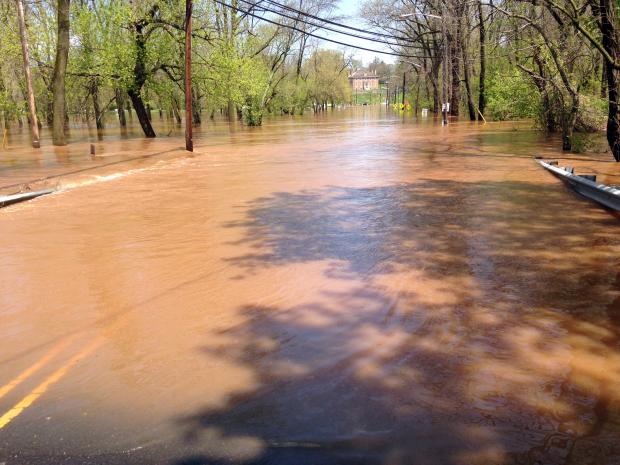
Raritan River flooding

Rain, rain and, more rain was the theme for New Jersey weather in June 2013. When all was said and done, statewide average precipitation totaled 9.57", a record for any June back to 1895 (Table 1). Temperatures were above average too. The average of 71.3° was 1.2° above the 1981-2010 mean and ranked as the 19th warmest June. These averages are derived from an evaluation of several dozen long-term National Weather Service Cooperative Observing (Coop) stations situated throughout the state.

More on thermal conditions later in this report, but first back to the precipitation. The 9.57" total was 5.55" above the 4.02" average. Tropical Storm Andrea brought the most abundant rain of the month, but there were 13 days during the month when an inch or more accumulated at one or more locations. A point of information is warranted here. While over an inch fell in some locations on the afternoon of the 30th, most Coop observers had already reported for the day, as had Community Collaborative Rain, Hail and Snow Network (CoCoRaHS) observers. Most take measurements close to 7 AM, with the historic rule being that the morning observation "ends" that particular calendar day. Thus any rain after that time on the last day of a month is reported on the 1st of the following month. While this practice can be debated, one can only compare June 2013 with previous Junes by following suit.

Flooding rains persist

June 19, 2013 - 12:00am -- Dan Manzo

Tropical Storm Andrea rain totals

"It's been a wet one." That's what many New Jersey residents would say so far about the first part of June. There has been little time to dry out in between back to back to back rainstorms.

Earlier this month, only a few days after the official start of the Hurricane Season, Tropical Storm Andrea formed in the Gulf of Mexico and headed northeast bringing heavy rain and gusty winds to parts of Florida and the coasts of North Carolina and Virginia. The remnants of Andrea eventually tracked off our shores and brought a period of very heavy rain to much of the state. Andrea's downpours gave much of the northern Jersey shore around 4.50" to just over 5.00" of rain. Most of the Turnpike corridor saw precipitation range from 3.50" to a little over 4.00". There was less precipitation to the southeast and the northwest with those areas averaging around 2.00"-3.00".

A manageable heat wave to end May

June 4, 2013 - 12:00am -- Dan Manzo

Boardwalk photo

A week after the unofficial start of summer many areas saw temperatures soar, giving the Garden State its first heat wave of the season (a heat wave is defined as a hot period having at least three consecutive days of 90°+ temperatures). Temperatures steadily rose throughout the period from May 29 to May 31, with most areas away from the shoreline getting into the low to mid 90’s.

Just prior to the beginning of the heat wave on May 29, temperatures along the state’s Turnpike corridor rose into the upper 80’s. Our NJWxNet Woodstown station in Salem County recorded a high temperature of 88°, Cream Ridge in western Monmouth County recorded a maximum of 87°, and Haworth in Bergen County recorded a high of 86°. The story was not the same away from the urban corridor. Wantage (Sussex County) only made it to 80°, and Atlantic City Marina topped off at 71°.

May 2013 Summary and Spring Recap

June 2, 2013 - 12:00am -- Dave Robinson

Seaside Heights boardwalk rebuild

If there is one thing that was consistent with New Jersey's weather in May, and for that matter throughout this past spring (March-May), it was the inconsistency. Of course this is rather typical of many a spring month, as our region sits in the battle zone between reluctantly retreating winter conditions and sporadically advancing summer weather. When all was said and done, May 2013 came in with a near average statewide temperature of 60.7°. This was 0.1° below the 1981-2010 average and ranks as the 53rd mildest May of the past 119 years (1895-present). Precipitation averaged 4.01", a minute 0.01" above average and was the 42nd wettest on record. It was not only day-to-day conditions that varied in May, there were also notable differences in temperature and precipitation from one location to another.

April 2013 Summary and 2012-2013 Snow Season Recap

May 4, 2013 - 12:00am -- Dave Robinson

April sea breeze map

While many wondered if spring would ever arrive across the Garden State, the average April temperature was actually close to the long-term mean. At 51.5°, the month was 0.3° above average, ranking as the 35th mildest April since statewide records were established in 1895. Using the central NJ city of New Brunswick as an example, 16 days were above average, 12 below, and two spot on average.

A Chilly Start to Spring: March 2013

April 7, 2013 - 12:00am -- Dave Robinson

While the core of the winter season (December-February) averaged quite a bit milder than usual across New Jersey (see winter summary in the February narrative), the broader cool season began with a November that was cooler than average with above-average snowfall and ended with a cooler and snowier than average March, making for what seemed to be a long winter. Looking more closely at March 2013, the statewide average of 38.3° was 2.8° below the 1981-2010 average and ranked as the 37th coolest since 1895. What a difference a year makes, as March 2012 was 11.5° warmer than this year! Precipitation (rain and melted snowfall) averaged 3.05", which is 1.18" below average and the 36th driest on record. Snowfall averaged 5.2", which is 1.0" above average.

Chilly conditions were rather consistent during March, with only six days where one or more observing stations in NJ reached a maximum of 60° or higher. There was an absence of excessive cold, with lows falling into the teens in some locations on 12 mornings, yet most of the state dropping no lower than the 20°s at any point. Beginning with the cold lows, the 3rd and 4th both dawned with the NJWxNet High Point and High Point Monument stations (Sussex County) at 18° and 19°, respectively. Walpack (Sussex) was coldest at 19° on the 9th. The 10th was one of the three coldest mornings statewide in March. Pequest (Warren), Berkeley Township (Ocean), and Walpack fell to 19°, with a total of 23 of the 55 stations in the NJWxNet at 25° or colder.

A Rather Average Month, A Mild Winter 2012/2013

March 15, 2013 - 3:59pm -- Dave Robinson

Snow cover photo

An amalgamation of cold and mild spells, a few moderate rain events, one significant snowstorm, and several local or minor snowfalls brought a rather average February in the weather department to New Jersey. Preliminary numbers indicate an average temperature of 32.5°. This is 1.3° below normal and 53rd warmest of the 119 Februaries since 1895. Precipitation averaged 3.28" (rain and melted snow/sleet), which is 0.42" above normal and 44th wettest. Snowfall averaged 6.8", which is 1.2" below normal and 53rd most snowy.

A Mild Start to the Year, Despite One Frigid Week: January 2013 Report

February 13, 2013 - 4:16pm -- Dave Robinson

Highway sign knocked over by the wind

By mid-winter standards, January 2013 was not an exceedingly memorable one in the New Jersey weather and climate annals. But like every month, there were certainly events worthy of mention. This included the state's coldest week since 2007 and a surge of warmth late in the month that was broken by a squall line with strong winds and heavy rain.

Statewide, the January temperature averaged 33.7°, which is 2.5° above average. This ranks as the 27th mildest January since 1895 (119 years). Of the past 24 months, only one (November 2012) has averaged below normal. Going back a bit further, since March 2010, 30 of the past 35 months have been above average, one month was exactly average, and four months were below average.

The first three weeks of the month were mostly on the mild side. On five of the first 20 days, one or more station topped out at 55° or higher.

Pages

Subscribe to RSS - News