News

The Wet Bandits Strike/Warmth with Precipitation Indecision: December/Annual 2023 Report

January 5, 2024 - 11:31am -- Dave Robinson

Flooding from the nearby Pompton River in Wayne (Passaic County) on December 19th, 2023. Photo by Julian Leshay/NJ Advance Media.

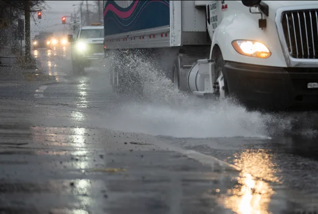
It was a wet December, of this there is no doubt. In fact, it was New Jersey’s wettest 12th month on record, dating back to 1895. On multiple occasions, rainfall arrived in multiple-inch increments, leading to episodes of minor to major stream and river flooding. Though hardly maliciously, Mother Nature certainly left the tap flowing far too long and often!

Monthly rainfall (with a little melted snowfall added to the mix in some locations) averaged 8.20” across the state (Figure 1). This was 3.93” above the 1991–2020 normal and was 0.33” above the previous wettest December in 1996 (Table 1). Precipitation averaged 8.51” (+4.26”, 3rd wettest) in the northern climate division (Hunterdon-Somerset-Union northward), 8.02” (+3.74”, 2nd wettest) over the southern division (Mercer-Middlesex-Monmouth mostly southward), and 7.88” (+3.52”, 2nd wettest) in the coastal division (generally east of the Garden State Parkway from Monmouth to Cape May).

ONJSC's Top 10 NJ Weather and Climate Events of 2023

January 2, 2024 - 3:06pm -- Dave Robinson

Wildfire smoke blankets downtown Paterson (Passaic County) on June 7th. Photo by Steve Hockstein/NJ Advance Media.

For the 15th consecutive year, we in the state climate office have evaluated the myriad daily, monthly, and annual observations gathered across New Jersey during the course of the year to choose what we feel were the most significant and impactful 10 weather and climate events of 2023. More about each event can be found in the monthly narratives posted on our website. You might be tempted to rearrange the rankings, particularly as some of the events on the list may have affected you more than others ranked higher. Or perhaps you best recall one that didn't make the list. That's the enjoyment and frustration of lists! Unless stated otherwise, statewide values are based on an average of several dozen stations. The period of record for monthly, seasonal, and annual departures is 1991–2020; while for extremes and rankings it is from 1895–present. Observations are mainly drawn from National Weather Service Cooperative Observing Program stations, Rutgers NJ Weather Network stations, and NJ Community Collaborative Rain, Hail, and Snow Network locations.

Waiting and Wondering/On Average: November/Fall 2023 Recaps

December 6, 2023 - 7:10pm -- Dave Robinson

Steam rising from the cooling tower at the Hope Creek Nuclear Generating Station in Lower Alloways Creek Township (Salem County) on the afternoon of November 11th.

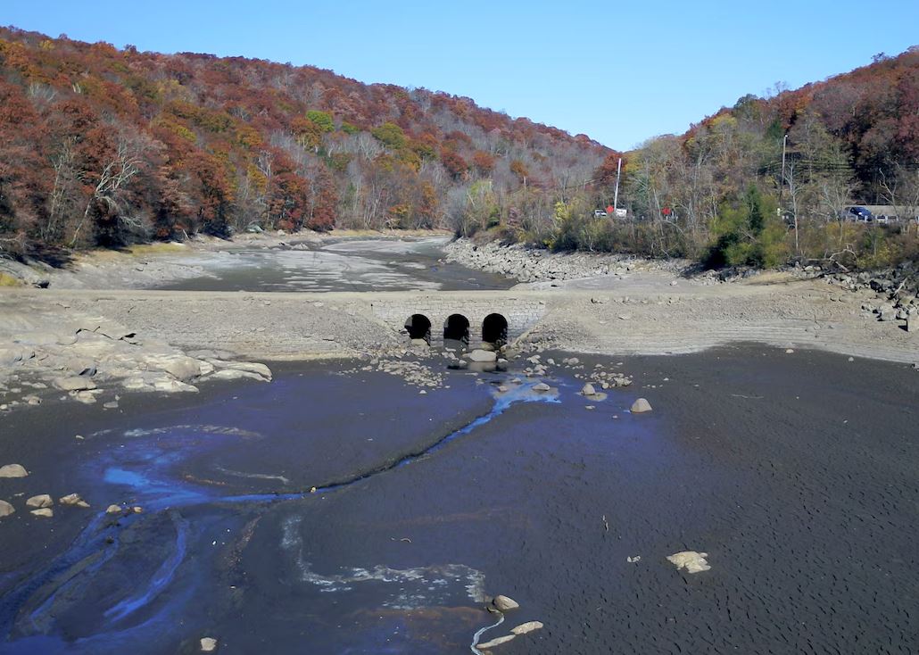
The dry first three weeks of November kept everyone waiting and wondering if a record dry month might be at hand along with increasing drought concerns. To the rescue came two rain events on the 21st–22nd and 26th to bring the monthly average precipitation to a rather respectable total. The statewide average of 2.68” was 0.68” below normal, ranking 52nd driest of the past 129 Novembers. Unlike recent months, it was the coastal northern counties that were driest, while the central north was wettest. The northern division (Hunterdon-Somerset-Union counties northward) averaged 2.92” (-0.55”, 50th driest), the southern division (Mercer-Middlesex-Monmouth counties southward, except along the coast) 2.56” (-0.73”, 53rd driest), and the coastal division (roughly the Garden State Parkway to the coast) 2.24” (-1.10”, 42nd driest).

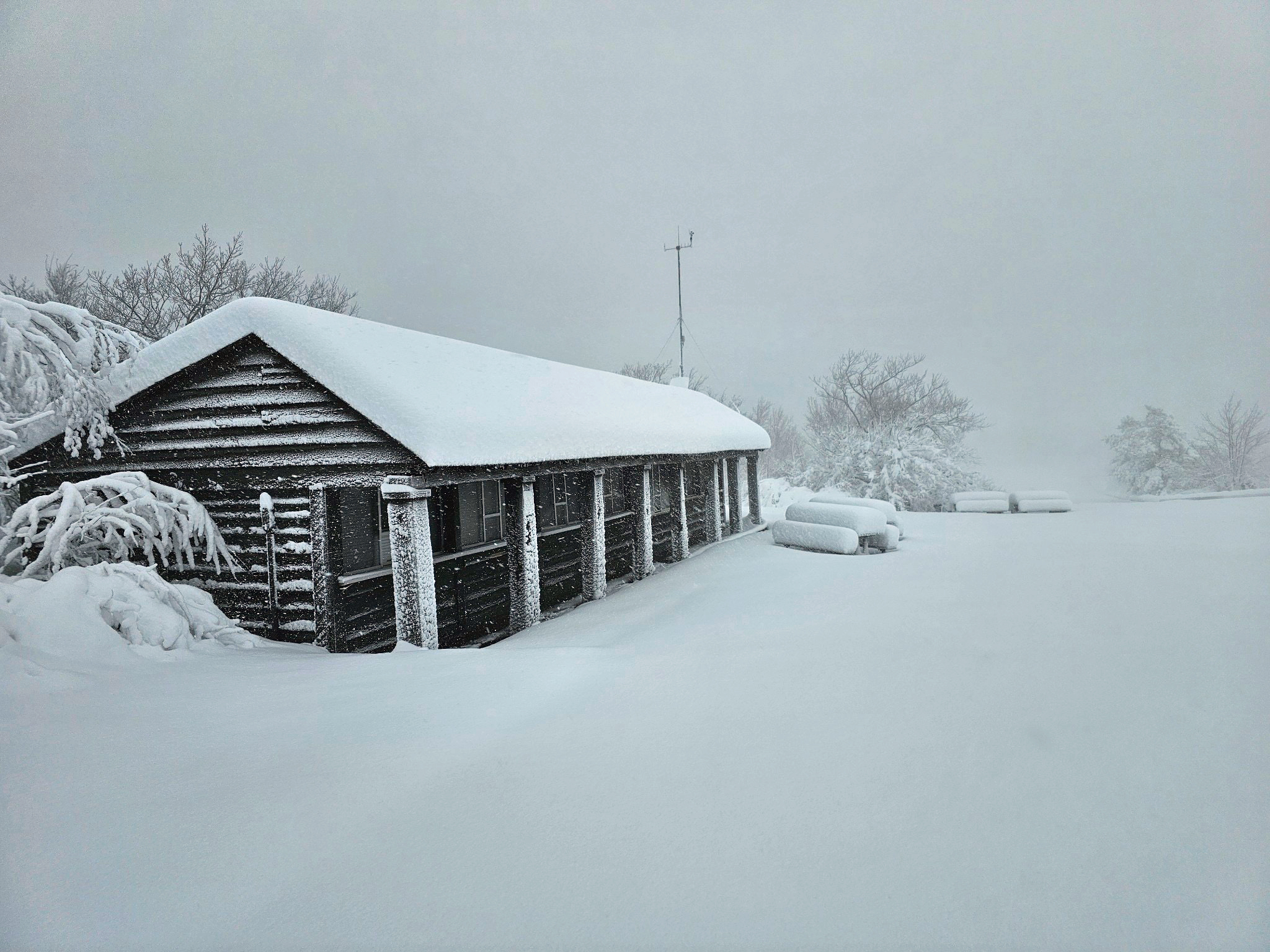
Snowflakes were seen in a few northern locations on the 1st, a dusting occurred at higher elevations at the start of the 21st–22nd rain event, and flurries and a few measurable dustings from squalls occurred on the 28th. Despite the scattered dustings, regionally and statewide records show an absence of accumulation. This is 0.5” below normal but has been seen in 52 of the previous 128 Novembers.

Tranquility: October 2023 Recap

November 6, 2023 - 9:14pm -- Dave Robinson

Fall colors surrounding Lake Wapalanne at the NJ School of Conservation on October 25th. The Sandyston (Sussex County) NJWxNet station sits nearby on school grounds. (Photo courtesy of Nick Stefano).

Foggy mornings, clear days, four modest rain events, and most locations yet registering a fall freeze. This all speaks to a rather quiet weather October, thus the title of this report. The rather dry conditions resulted in statewide monthly precipitation averaging just 2.16”. This was 2.03” below normal and ranked as the 32nd driest October since records commenced in 1895. Under an inch fell in the southwest, while only the northeast and northern coast saw totals close to or above normal. The northern climate division averaged 3.06” (-1.39”, 56th driest), southern division 1.57” (-2.46”, 17th driest), and coastal division 2.00” (-2.09”, 30th driest).

As a result of above-normal temperatures to begin and end the month, the statewide average temperature of 58.2° was 2.8° above normal, ranking 9th warmest (tied with 2019). Every other October since 2017 sits in the top 10. The northern division averaged 56.4° (+3.1°, 9th warmest), southern 59.2° (+2.7°, 12th warmest), and coastal 60.2° (+2.6°, 11th warmest).

Turn! Turn! Turn!: September 2023 Recap

October 9, 2023 - 2:32pm -- Dave Robinson

Flooding of Wesley Lake on the border of Asbury Park and Ocean Grove (Monmouth County) on September 29th. Submerged cars are located on aptly named Lake Avenue. (Photo courtesy of S. Isk).

Fall and spring months are considered to be seasonal transition ones. At times, the change of season takes place rather slowly. Then there are months like this past September when the turn is quite abrupt. September 2023 began with the hottest day and week of 2023. Several rainy periods, some with severe storms, ensued as temperatures began to decline and Hurricane Lee, while remaining far offshore, brought rough surf and some clouds to NJ. Soon after came chilly conditions with the remnants of Tropical Storm Ophelia twice bringing heavy rain into portions of the state and over a week of minor to occasional moderate coastal flooding at times of high tide.

Statewide, the average temperature of 68.1° was 1.2° above the 1991–2020 normal. This ranked as the 16th warmest September since records commenced in 1895. The average high temperature was 77.4°, which 0.2° above normal and ranks 35th warmest. The average low temperature of 58.8° was 2.2° above normal, ranking 8th warmest. The northern climate division averaged 65.8° above (+0.9°, 21st warmest), southern +69.5° (+1.4°, 14th warmest), and coastal 69.9° above (+1.2°, 14th warmest).

September rainfall was excessive, with the southwest and northwest the driest regions of the state yet averaging above the statewide 30-year normal. The wettest area was along the northern coast with rainfall as much as 3 to 4 times above the climatological mean. Statewide, September precipitation averaged 7.55”, which is 3.39” above normal and ranks as the 9th wettest. The northern division averaged 7.73” (+3.27”, 11th wettest), southern 7.38” (+3.39”, 11th wettest), and coastal 8.01” (+4.12”, 3rd wettest).

Is That All There Is?/Dodging Extremes, With a Few Exceptions: August/Summer 2023 Recaps

September 7, 2023 - 6:45pm -- Dave Robinson

The confluence of the Raritan and Millstone Rivers as seen from the Delaware-Raritan Canal Towpath in Franklin Township (Somerset County) on August 20th. Photo by Dave Robinson.

It is not as if August 2023 was devoid of strong thunderstorms that produced locally heavy rain and three minor tornadoes. There were also some hot and humid days and even a few days with smoke high aloft, a rather persistent feature of this summer’s weather (more on this in earlier June and July recaps and the summer summary later in this report). However, with temperatures a bit below normal and statewide rainfall leaning that way too, it just was not a particularly notable August in the weather/climate department. Mind you, most folks hardly complained of 90° maximum temperatures being rather scarce, there being no soaking tropical system, and, for the most part, fine weather for outdoor activities.

Statewide, the average temperature of 72.9° was 0.7° below the 1991–2020 normal. This ranked as the 48th warmest August of the past 129, but the coolest since 2017. Three of the past four months have been below normal, something not accomplished since January, March, and April 2018. The average high of 82.4° was 1.4° below normal, ranking 60th warmest. The low of 63.4° was 0.1° above normal, raking 31st warmest. The northern climate division averaged 70.7° (-1.2°, 53rd warmest), the southern division 74.2° (-0.4°, 46th warmest), and coastal division 74.5° (-0.2°, 38th warmest).

Precipitation averaged 4.03” across NJ, which is 0.54” below normal and ranks as 61st driest (68th wettest) since 1895. There was a north/south difference in rainfall, with the north averaging 5.02” (+0.46”, 41st wettest/89th driest), the south 3.45” (-1.12”, 49th driest/81st wettest), and coastal NJ 3.14” (-1.46”, 42nd driest/88th wettest).

Sultry: July 2023 Recap

August 7, 2023 - 5:22pm -- Dave Robinson

The aftermath of flash flooding in Warren County on July 16th as seen along Brass Castle Creek on Harmony Brass Castle Road by Hartsman Corner Road, Washington Township.

Yet another warmer-than-normal July is in the books. Nine of New Jersey’s 11 hottest Julys dating back to 1895 have occurred since 2010. Unlike last year where the heat was accompanied by the 12th driest July, this year was a wet and humid one, the 22nd wettest on record. The statewide average temperature of 77.2° was 1.8° above the 1991–2020 normal and 3.3° above the 1895–2021 period-of-record mean, ranking 10th warmest on record (tied with 2016). The average high was 87.0°, 1.3° above normal and ranking 18th warmest. The average low was 67.4°, 2.3° above normal and ranking 4th warmest. The northern climate division averaged 75.2° (+1.5°, 12th warmest), the southern division 78.5° (+2.0°, 10th), and the coast 78.3° (+2.1, 8th).

The 6.27” statewide average precipitation was 1.56” above normal to earn the 22nd wettest ranking. The northern division averaged 7.37” (+2.65”, 16th wettest), southern division 5.64” (+0.90”, 30th), and the coast 5.09” (+0.71”, 36th). The largest totals were found in Warren County and adjacent northwest counties, with some totals over a foot. The Pinelands region received the least, with totals of 2.50” to 3.50”.

Strange, Just Plain Strange: June 2023 Recap, Plus First Half of 2023 Review

July 11, 2023 - 9:38pm -- Dave Robinson

Wildfire smoke blankets downtown Paterson (Passaic County) on June 7th. Photo by Steve Hockstein/NJ Advance Media.

There is rarely a month in New Jersey where something interesting, exciting, and different than normal doesn’t occur in the weather and climate department. However, not often do you find a month like this past June where one is left with their head spinning as smoke from near and distant wildfires darkened the sky, creating exceptionally unhealthy air quality, where growing drought concerns were quieted in most locations by late-month downpours, where two tornadoes touched down, and with temperatures averaging cooler than normal for the second consecutive month. Strange, indeed.

June temperatures across the state averaged 67.8°. This was 2.5° below the 1991–2020 mean and tied as the 36th coolest June since 1895. The average daily maximum temperature of 79.0° was 2.0° below normal and ranks 40th coolest. The daily minimum averaged 56.6°, 3.0° below normal and was 35th coolest. The northern NJ climate division averaged 66.1° (-2.5°, 33rd coolest), the southern division averaged 68.9° (-2.5°, 36th coolest), and the coastal division averaged 68.2° (-2.3°, 45th coolest). Both May and June averaged below normal, the first such back-to-back occurrence in NJ since April and May 2020.

NJ June precipitation averaged 3.87”. This was 0.43” below normal, however, it ranks as the 53rd wettest of the past 129 years (or 77th driest) due to the skewed nature of the distribution of monthly precipitation over this period. The north averaged 5.13” (+0.52”, 29th wettest [101st driest]), the south 3.19” (-0.95”, 51st driest [79th wettest]), and the coast 2.20” (-1.65”, 28th driest [102nd wettest]).

Smoke Gets In Your Skies, and Another Mild One: May and Spring 2023 Recaps

June 7, 2023 - 6:43pm -- Dave Robinson

Wildfire smoke from western Canada contributed to a scenic sunrise on May 11 in Brigantine (Atlantic County). Photo courtesy of Connie Pyatt Photography.

When the headline for this monthly report alludes to hazy May skies that were frequently overhead, you know it was a quiet period weather-wise across the Garden State. Such was the case during the middle two weeks of May and at month’s end, with smoke from wildfires in western Canada frequently passing well overhead, followed by smoke from fires in Nova Scotia and a few in NJ. Otherwise, May temperatures were cooler than normal, and rainfall sparse.

The statewide average temperature of 59.3° was 1.9° below the 1991–2020 normal. This ranked as the 52nd coolest May since 1895. It was the coolest month compared to normal since January 2022. Following the third mildest April on record, May was only 4.0° milder than the previous month. This is the third smallest temperature difference on record between these two months. The average high temperature of 71.7° was 0.6° below normal, ranking 60th warmest and 68th coolest. The average low temperature of 46.9° was 3.3° below normal, ranking 26th coolest. The northern division averaged 57.8° (-2.1°, 50th coolest), the southern division 60.3° (-1.9°, 50th coolest), and the coastal division 59.6° (-1.4°, 63rd coolest).

An Odd One: April 2023 Recap

May 8, 2023 - 5:15pm -- Dave Robinson

A vivid rain shaft accompanies a thunderstorm as seen from Hardyston Twp. (Sussex County) on April 15th, 2023. Photo courtesy of Yulia Karpova.

What can you say about a month that began with a swarm of tornadoes, finished with flooding rain, and in between, featured record heat, wildfires, and increasing drought concerns? Best to say that it was an odd one! Fitting this theme, the statewide average temperature of 55.4° was 3.9° above the 1991–2020 normal. This ranks as the third warmest April on record (since 1895) only behind 2017 and 2010 for top honors. April was the fifth month of the past ten ranking in the top 10, joining July (#7), August (#1), January (#1), and February (#5). The first four months of 2023 come in as the warmest start of the year on record with an average of 44.4°. This exceeds the previous record of 44.2° in 2012, with seven of the 10 warmest January–April periods (1895–present) occurring since 2002. The average April maximum temperature across NJ was 67.4° (+4.7°, 3rd warmest) and the average minimum was 43.4° (+3.1°, 5th warmest). Northern counties averaged 53.5° in April (+3.6°, 5th warmest), southern counties 56.6° (+4.0, 2nd warmest), and the coastal zone 55.8° (+4.1°, 2nd warmest).

April precipitation averaged 5.84” across New Jersey. This was 2.14” above normal, ranking as the 10th wettest on record. It was the wettest April since 2007 and second wettest since 1983. All but scattered areas in the northwest received above-normal precipitation, the greatest amounts falling near the Atlantic and Delaware Bay coasts. Northern counties averaged 5.55” (+1.65”, 26th wettest), southern counties 6.04” (+2.49”, 7th wettest), and the coastal zone 5.94” (+2.39”, 10th wettest). It is important to note that these totals and those for individual stations in the next section, do not include heavy rain that fell after standard early morning observation times at CoCoRaHS and National Weather Service Cooperative stations on April 30th. These rains were reported in morning observations on May 1st, thus will be included in May totals.

Pages

Subscribe to RSS - News