Monthly Summaries

Consistently Warm and a Mixed Distribution of Precipitation: August & Summer 2015 Recaps

September 2, 2015 - 9:58pm -- Dave Robinson

Dry Reservior

This month had quite a variety of weather conditions around the state. This resulted in some areas experiencing flash flooding and others encroaching drought conditions. Damage resulted from the flooding and one storm even produced a nocturnal “heat burst.” Some minor brush fires and declining river, ground water, and reservoir levels accompanied subnormal rain totals. The dry conditions helped produce some wide daily swings from cool nighttime temperatures to consistently warm daytime maximums. Preliminary values show August 2015 to have a statewide average rainfall of 2.18”. This is 2.03” below normal and ranks as the 13th driest since statewide records commenced in 1895 (Table 1). The 74.5° average temperature was 1.1° above the 1981–2010 mean and ranks 21st warmest.

A Cool August and a Warm and Wet Summer of 2013

September 2, 2013 - 12:00am -- Dave Robinson

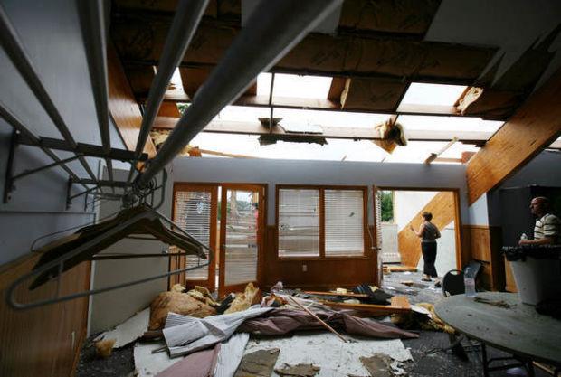
Tornado Damage

After two warm and wet months to start off the summer of 2013, August provided an about face in the temperature department. The 71.6° statewide mean is 1.8° below the 1981-2010 average and ranks as the 41st coolest August since statewide records commenced in 1895. It was only 0.1° warmer than this past June. Precipitation averaged 4.50", which is 0.29" above normal and makes this the 51st wettest of the past 119 Augusts.

What a change from July. There were only four afternoons when the temperature was 90° or higher somewhere in the state, compared with 18 in July. The warmest it got was 93° at Harrison (Hudson County) on the 21st and only nine stations reached 90° at some point during the month, compared to most of the 50 NJWxNet stations reaching that mark in July.

Record Wet June and Mid-Year Recap

July 1, 2013 - 12:00am -- Dave Robinson

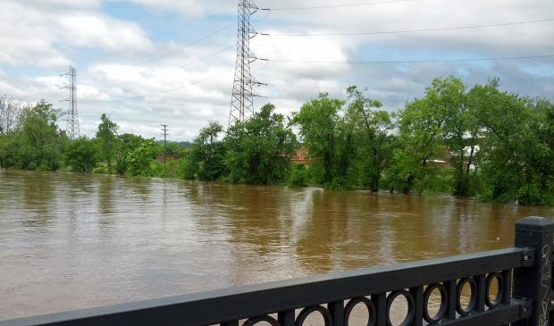
Raritan River flooding

Rain, rain and, more rain was the theme for New Jersey weather in June 2013. When all was said and done, statewide average precipitation totaled 9.57", a record for any June back to 1895 (Table 1). Temperatures were above average too. The average of 71.3° was 1.2° above the 1981-2010 mean and ranked as the 19th warmest June. These averages are derived from an evaluation of several dozen long-term National Weather Service Cooperative Observing (Coop) stations situated throughout the state.

More on thermal conditions later in this report, but first back to the precipitation. The 9.57" total was 5.55" above the 4.02" average. Tropical Storm Andrea brought the most abundant rain of the month, but there were 13 days during the month when an inch or more accumulated at one or more locations. A point of information is warranted here. While over an inch fell in some locations on the afternoon of the 30th, most Coop observers had already reported for the day, as had Community Collaborative Rain, Hail and Snow Network (CoCoRaHS) observers. Most take measurements close to 7 AM, with the historic rule being that the morning observation "ends" that particular calendar day. Thus any rain after that time on the last day of a month is reported on the 1st of the following month. While this practice can be debated, one can only compare June 2013 with previous Junes by following suit.

Pages

Subscribe to RSS - Monthly Summaries