Record Warmth

Once Again, Summer is Slow to Depart: September 2018 Recap
October 7, 2018 - 8:18pm -- Dave Robinson

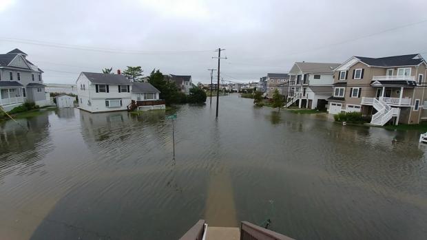
Coastal flood photo

For the fourth consecutive year, summer weather stubbornly hung on well into September across the Garden State. The statewide average temperature of 70.4° was 4.6° above the 1981–2010 mean, and ranks as the third warmest since records commenced in 1895. September 2017, now ranking 11th, sat in the top 10 for just one year before being bumped out by 2018. This September was the fifth consecutive month of above-average temperatures. The past 12 months have seen the 2nd warmest October, 4th warmest May, 1st warmest August (tied with 2016 based on updated figures), and now the 3rd warmest September. The June through September period this year averaged 73.3° (+2.5°), making it the 4th warmest on record. The top 10 such intervals have all occurred since 2005. The August–September average of 73.7° (+4.3°) was the warmest on record, followed by 2005, 2016, 2015, and 2010.

Perhaps what was most interesting about temperatures this past month was the disparity between average maximum and minimum temperature anomalies. The average maximum of 77.7° was 1.4° above average and ranked 27th warmest. However, the average minimum of 63.2° was 7.9° above average and is a whopping 2.2° milder than the previous highest September average minimum. This came about due to the excessive cloud cover and humidity throughout most of the month, which kept the days from getting too warm and, come nighttime, “trapped” much of the heat gained during the day within the lower atmosphere. Thus, unlike the past three warm Septembers (as well as 2013 and 2014), each of which had below-average precipitation, this year was anything but dry. There were frequent rainy episodes, which at times produced localized deluges and resultant flash flooding. The statewide average rainfall of 7.60” is 3.55” above the 1981–2010 average, and is tied with 1960 as the sixth wettest September since 1895. The wettest September on record remains 1999, which averaged 9.50 inches, in no small part due to Tropical Storm Floyd’s rains. Aside from 1999, you have to go back to 1975 to find a September with more rain than this year.

Green Warmth: August and Summer 2018 Recaps

September 5, 2018 - 8:18pm -- Dave Robinson

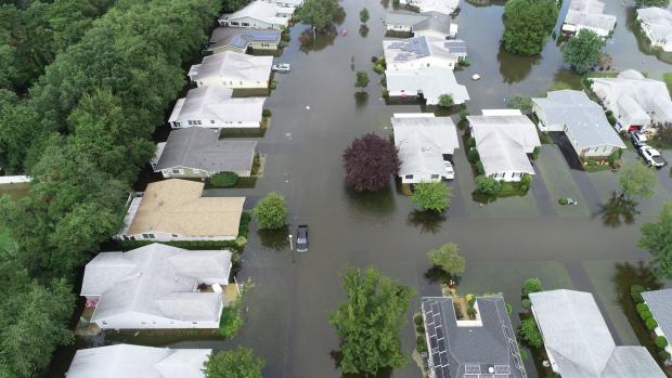
Flash flood photo

The summer of 2018 concluded on a warm, wet note across the majority of what was a persistently green Garden State throughout the season. The warmth dated back to late June, with frequent humid conditions and abundant showers from mid-July onward. There will be more on the entire summer at the end of this report. First a look at August, with a statewide average temperature of 76.8° coming in 3.8° above the 1981–2010 average. This was the second warmest August since 1895, falling just behind 2016 by 0.1°. Nine of the 13 warmest Augusts during that 124-year interval have occurred since 2001.

Statewide, August precipitation averaged 5.63”. This was 1.53” above the 1981–2010 average and ranked as the 32nd wettest since 1895. It was the wettest August since the record wettest month in 2011. As is often seen in the summer, the majority of the precipitation fell in scattered showers and thunderstorms. This resulted in a wide range of monthly totals around the state, with some serious flash flooding occurring in several locations when moisture-ladened storms parked themselves over an area for multiple hours. Where storms missed time and time again, rainfall totals were below average. The northern NJ climate division (Hunterdon, Somerset, and Union counties northward) saw their 10th wettest August on record, with an average of 8.28” falling. This is 4.17” above average. Since 1990, only August 2011 was wetter in this division.

A December Warm Spell for the Record Books

December 24, 2013 - 12:00am -- Dave Robinson

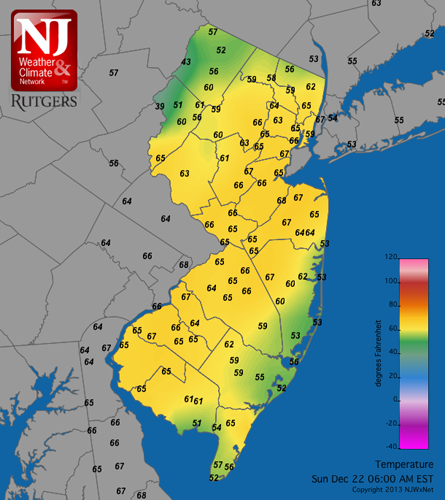
Temperature map

It wasn't just chestnuts that were roasting in New Jersey several days before Christmas this year. In fact it may be that coal noses on rapidly shrinking snowmen were igniting as a snowy spell from the 8th to 18th quickly transitioned to some unusually warm conditions.

Woodbine (Cape May County), Toms River (Ocean), and Berkeley Township (Ocean) shared top honors on Sunday the 22nd when the thermometer topped out at 73°. Maximum temperatures reached from 70° to 72° at 22 of the 55 NJ Weather and Climate Network stations. Only High Point Monument (Sussex), Hope (Warren), and Harvey Cedars (Ocean) managed to stay out of at least the 60s on the 22nd, with all three locations reaching 59°. Daily records were established at a number of long-term observing stations. For instance highs at Newark (Essex) on the 21st and 22nd of 64° and 71° beat former daily records by 3° and 6°, respectively.

October begins with record warmth, a tornado, and strong winds

October 9, 2013 - 12:00am -- Dan Manzo

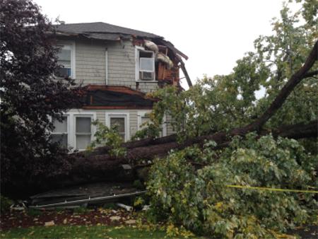
Damage from tornado in Paramus

The first week of October was nothing but bizarre, or at least to most New Jerseyeans it seemed that way. The period included unseasonably warm weather, heavy rain, strong winds and even a tornado. It was all credited to a stationary front that held in position in Southern New York, which allowed warm air to enter the Garden State. The warm air was later pushed out, when a sharp and potent cold front from the Midwest set off severe storms and heavy rain in parts of the area.

Pages

Subscribe to RSS - Record Warmth