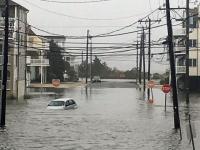
Waves crash into a sheet pile wall in Brick (Ocean County) on October 5. (Photo by Sharkey-Images).
Overview
There were many sides to New Jersey’s October 2015 weather, however, when temperature and rainfall observations were averaged, conditions were quite close to long-term (1981–2010) means. The statewide average temperature of 54.4° was 0.4° below normal. This ranked as the 53rd coolest since 1895 (121 years). Precipitation averaged 4.17", which is 0.24" above normal and ranks as 44th wettest. October was bookended by events that dumped the vast majority of the month’s precipitation, with an extended period of very dry weather in between. This led to a continuation of moderate drought in the northeast, with nearby areas remaining abnormally dry. The late-month rain, which for the first time in many months was heaviest over the driest areas, staved off the need for any further drought deterioration, at least for the time being. The major weather event of the month extended over the first five days, when incessant onshore winds generated the worst beach erosion and back bay flooding since Sandy three years ago, though not nearly in the same ballpark of what Sandy wrought.
Precipitation and storms
The central coast had the heaviest October rainfall totals. In Ocean County, Lacey Township saw 7.98", Lavallette 6.97", Stafford Township 6.37", Berkeley Township 6.00", and Toms River 5.99". To the west in Mercer County, two Lawrence Township stations caught 5.71" and 5.61". The northwest was on the low end of the register, where Wantage (Sussex County) received 2.37" for the month, Mt. Olive (Morris) 2.82", Liberty Township (Warren) 2.89", Andover (Sussex) 3.00", and Allamuchy Township (Warren) 3.03". In the far south, Ocean City (Cape May) saw just 2.91".
From the 1st to 3rd several waves of energy moved northward through the state along a stalled cold front that first brought welcome rain on September 30th. The heaviest fell on the 2nd, with totals for the full period as large as 6.77" in Lacey Township, Lavallette 5.98", Stafford Township 5.05", and Berkeley Township 4.80". Of the 220 CoCoRaHS reports received, 19 were between 3.00–3.99", 56 from 2.00–2.99" and 100 from 1.00–1.99". This statewide soaking saw the northwest come in with the lowest totals, including 0.25" at Mt. Olive and 0.59" at both Wantage and Bloomingdale (Passaic).
The synoptic pattern associated with the stalled front was strongly linked with a ridge of high pressure over eastern Canada and low pressure over the southeastern US. The latter ultimately led to the atmospheric river of moisture (peripherally associated with Hurricane Joaquin over the Bahamas) that inundated portions of South Carolina with over a foot of rain. It also contributed to steering Joaquin out to sea and away from the East Coast, which had for a time been threatened by the hurricane. Not that this left the New Jersey coast out of harm’s way, as the combination of the clockwise winds around the high and counter clockwise winds around the low brought an extended period of onshore winds to the Mid Atlantic…a classic atmospheric "squeeze play." As an example of the strength and persistence of this event, the NJWxNet station at Harvey Cedars on Long Beach Island (Ocean) registered wind gusts exceeding 20 mph for 122 consecutive hours (4PM September 30th–5PM October 5th). Remarkably, gusts exceeded 30 mph for 99 consecutive hours (2AM October 1st–5AM October 5th) and 40 mph or greater for 61 consecutive hours (9PM October 1st–9AM October 4th). As mentioned in the Overview, the winds pushed water up to the dunes, pulling a considerable amount of sand off the beaches and led to moderate back bay flooding during several high tides. This leaves coastal areas quite vulnerable when winter storms visit the region over the coming months.
A squall line raced through the state during the late afternoon and early evening of the 9th. Many areas heard thunder and brief heavy rain deposited as much 1.23" and 1.04" at two Hopewell Township (Mercer) stations, 1.10", 1.07" and 1.01" at three Lawrence Township stations, and 1.04" at both Palisades Park (Bergen) and Lambertville (Hunterdon). Mercer County saw the most rain with the rest of the state mostly within several tenths of an inch of 0.50". Exceptions were Pine Beach (Ocean) with only 0.11", two Wantage sites each with 0.15", and 0.15" in Pittsgrove (Salem).
The period from the 10th to 27th was almost precipitation-free. The 16th saw traces to a few hundredths of an inch of rain at scattered locations. The 18th brought the first snow flurries of the season. No accumulations were reported from these morning and afternoon flurries, which fell at unseasonably cool daytime temperatures that only got up to 39° at High Point Monument (Sussex). A few tenths of an inch of rain fell in the far northwest on the 25th, with less than a tenth of an inch to no measureable rain elsewhere.
A storm from dawn on the 28th through dawn on the 29th brought a welcome soaking rain to most of the state. Despite lacking the isolated 4.00" plus totals of the rainy period that began the month, most of the state saw accumulations similar to that event. West Milford (Passaic) topped the charts with 3.45", followed by Charlotteburg Reservoir (Passaic) with 3.33", Rockaway Township (Morris) with 3.31", Mine Hill Township (Morris) with 3.30" and 3.23" (two sites), and 3.27" in Randolph Township (Morris). Ten of the 220 CoCoRaHS reporting stations received 3.00–3.99", 69 between 2.00–2.99", and 100 from 1.00–1.99". Cape May County saw the least, with Lower Township at 0.27", Wildwood Crest 0.35", and two Middle Township stations at 0.41". From Route 1 northward 2.00–3.00"+ fell, except in Sussex, Warren, and western Hunterdon where only 1.30–2.00" fell. Totals gradually tapered off toward the southeast corner of the state.
The highest atmospheric pressure occurred on the 27th at between 30.55–30.60". The 19th and 26th were close behind. The lowest pressure was achieved on the 13th at about 29.50–29.55". Despite the strong winds early in the month, atmospheric pressure was not too low across NJ. Rather, as mentioned previously, NJ was wedged between a strong high to the north and deep low to the south. On the 1st winds gusted to 46 mph at Harvey Cedars and Sea Girt (Monmouth) and 43 mph at Seaside Heights (Ocean). The 2nd was the windiest day of the month. Harvey Cedars topped out at 53 mph, Seaside Heights at 50 mph, and Sea Girt at 49 mph. Five other NJWxNet stations gusted to 41–43 mph and 19 between 30–39 mph. Harvey Cedars got to 47 mph on the 3rd, followed by Sea Girt 46 mph, Seaside Heights (Ocean) 45 mph, and four stations between 40–43 mph. Sea Girt and Harvey Cedars reached 47 mph on the 4th, with Seaside Heights to 43 mph and Woodbine (Cape May) at 40 mph.
Storms on the 9th saw winds peak at 51 mph in Cream Ridge (Monmouth) and 45 at Berkeley Township. Later in the month Wantage gusted to 45 mph on the 25th, Lyndhurst (Bergen) to 40 mph on the 28th, and Stewartsville (Warren) to 41 mph on the 29th.
Temperature
Maximum temperatures topped out at 75° or higher at one or more of the 55 NJWxNet stations on ten October afternoons on a number of dates throughout the month. The 6th saw Hamilton (Mercer) and New Brunswick (Middlesex) up to 76°, with four stations at 75°. Four stations also made it to 75° on the 7th, with nine at 75° or 76° on the 8th. The 9th was the warmest day of the month, with Greenwich (Cumberland) reaching a lofty 83°, Woodbine 82°, and 80° or 81° at 22 stations. Sixteen reached 75° to 79°, with High Point Monument the coolest at 67°.
The 12th saw Hawthorne (Passaic) up to 79° and 14 stations at 77° or 78°. The next day, Cape May Courthouse (Cape May) and West Cape May (Cape May) reached 77°. Another run of warm days occurred a week later, with Walpack (Sussex) the warmest in NJ at 75° on the 20th. This after a morning low of 35° that was just 2° from the state minimum of the day at Hopewell Township. Basking Ridge (Somerset) reached 79° on the 21st, with ten stations at 78° and 25 between 75°–77°, while Atlantic City Marina (Atlantic) only made it to 65°. Five sites reached 78° on the 22nd, with 33 between 75°–77°. Sea Girt, West Creek (Ocean), and Woodbine topped out at 76° on the 29th.
Without any freezing temperatures being observed in the Garden State in September, it was up to several October nights to end the growing season everywhere except right along the coast. The first freezing temperatures of the season were found at Basking Ridge and Berkeley Township when they reached 32° on the morning of the 11th. That same morning, Harvey Cedars only got down to 51°. At some point during the morning or late evening of the 17th, the temperature dropped to freezing at 12 locations, including Walpack at 24°, and 26° at both Basking Ridge and High Point (Sussex). West Cape May dropped to 49°. The morning of the 18th brought freezing conditions to 40 of the 55 NJWxNet stations, including 18° to Walpack and 23° at Basking Ridge. Harvey Cedars got to 39°. The 19th was the coldest morning of the month, with 51 stations at or below freezing, including Walpack and Basking Ridge each at 19°. The only stations remaining above freezing that morning (and not reaching freezing by month's end) were Seaside Heights (33°), West Cape May (35°), Atlantic City Marina (36°), and Harvey Cedars (37°). The month finished on a chilly note in Walpack, the archetypal cold air drainage location within NJ. Minimum temperatures there were 29° on 23rd, 24° on the 24th, 26° on the 26th, 24° on the 27th, 28° on the 20th, and 22° on the 31st. The next coldest location on those mornings was either Basking Ridge or Pequest, where temperatures were 1° to 3° warmer.


