News

Comparing the 1981–2010 and 1991–2020 Normals

October 21, 2022 - 4:44pm -- Erica Langer

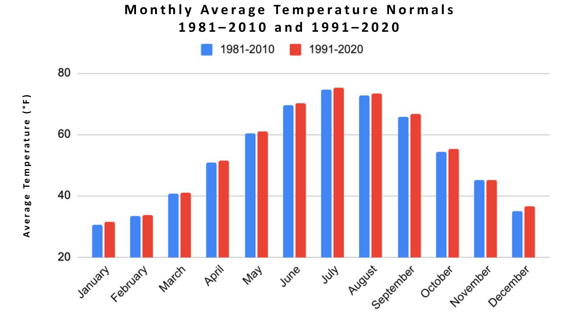
NJ monthly average temperature normals for the 1981–2010 and 1991–2020 periods.

Human-induced climate change is no longer an abstract concept or a threat to be faced in the future. It is currently changing the workings of Earth’s atmosphere and causing extremes in weather events (Arguez et al. 2012). It is the warming of the environment from human activity that is indicated through variables such as temperature, precipitation, and sea level. This global phenomenon influences regional climates. In particular, New Jersey has been one of the fastest warming states throughout the country (New Jersey Department of Environmental Protection 2020) and observing how is fundamental in understanding how climate change is affecting the natural state of the environment.

When one looks to observe how the climate of New Jersey has changed, one way to explore any adjustment in the climate system is by examining climate normals. These normals reflect 30-year averages of weather observations. They are the basis for judging how daily, monthly, and annual weather conditions compare to what is “normal” for a specific location in today’s climate. Normals provide a baseline that allows an individual to compare a location's current weather to average conditions one would expect to see. Normals are updated every ten years at (e.g., 1991–2020), similar to how a Census provides an updated snapshot of the populace and economy of the United States. They replace the previous 30-year normals (e.g., 1981–2010), and are calculated within the United States and elsewhere around the world. Gaining new information from them every ten years is useful in the work of public and private stakeholders, including the energy and agricultural sectors of the U.S. economy, building design, infrastructure, construction, and many governmental organizations such as the United States Department of Agriculture and Department of Health and Human Services.

Flipping the Seasonal Switch: September 2022 Recap

October 6, 2022 - 11:47am -- Dave Robinson

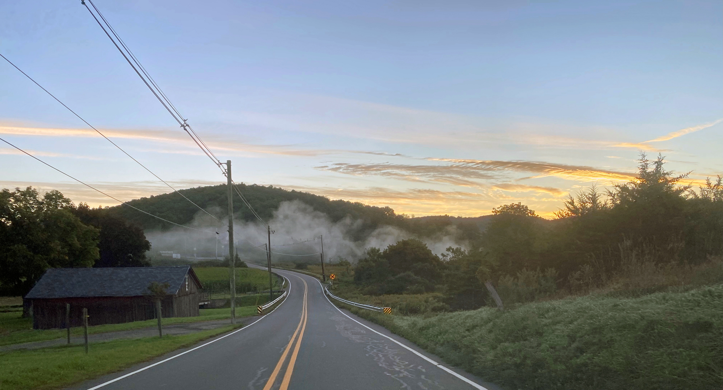
Low-lying radiation fog crossing the road in Sparta on the morning of September 24th.

Following a hot and dry summer, the questions of the day in September were when the temperature would begin to cool and would more abundant rainfall arrive. Signs of a rainfall resurgence were mixed, with drought conditions diminishing in spots but worsening in others. The temperature answer came in almost a flash on the 22nd (the first day of astronomical fall!) when a powerful cold front sent the thermometer quickly downward with an early-fall-like pattern arriving and remaining through month’s end.

September temperatures averaged 67.8° across NJ. This is 0.9° above the 1991–2020 normal and ties as the 22nd mildest September since statewide records commenced in 1895. The average high temperature was 78.2°, which is 1.0° above normal and tied for 23rd warmest. The average low was 57.3°, 0.7° above normal and ranking 23rd warmest. North Jersey came in at 65.7° (+0.8°, tied for 23rd warmest), the south 69.0° (+0.9°, tied for 21st warmest), and the coast 69.7° (+1.0°, 15th warmest).

NJ precipitation averaged 3.16” for September, which is 1.00” below normal and ranks as the 57th driest of the last 128 years. The north was wettest at 3.64”. This is 0.82” below normal, though ranks as just the 67th driest. The south came in with 2.86” (-1.13”, 51st driest) and the coast 2.98” (-0.91”, 57th driest).

Roasting: August 2022 Recap and Summer Overview

September 7, 2022 - 8:17pm -- Dave Robinson

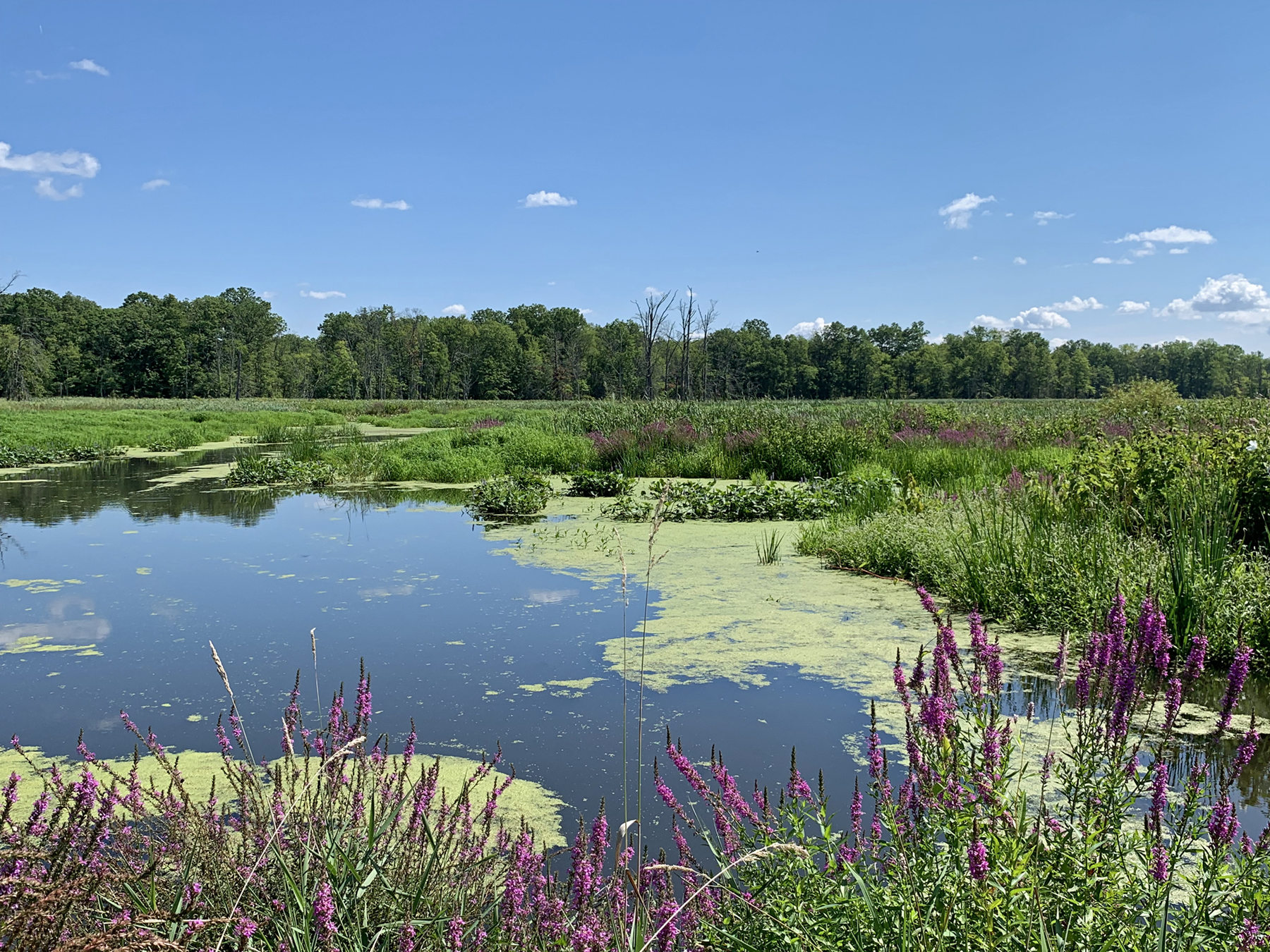
The Great Swamp National Wildlife Refuge (Morris County) on August 24th. While August 22nd rain proved beneficial, the water level is normally higher. Photo taken by D. Robinson.

Much like this past July, August was a hotter and drier month than normal. Despite a June with rather close-to-normal numbers, the two most recent months brought the summer temperature and precipitation to top-10 levels for hot and dry conditions. More on summer ’22 later in this report, but first to discuss is a record hot and quite dry August.

The August average temperature of 77.4° was 3.8° above the 1991–2020 normal, ranking as the hottest on record. Eight of the ten warmest Augusts since 1895 have occurred since 2001. The average maximum of 88.5° was 4.7° above normal, the hottest on record, while the average minimum of 66.2° was 2.9° above normal, tied for 5th warmest. North Jersey averaged 75.7° (+3.8°, warmest on record), the south 78.4° (+3.8°, warmest on record), and the coast 77.9° (+3.2°, 3rd warmest).

Statewide, August precipitation averaged 2.61”, which is 1.96” below normal, ranking as the 22nd driest. The north came in at 2.31” (-2.25”, 18th driest), south 2.82” (-1.75”, 29th driest), and coast 2.54” (-2.06”, 25th driest). As the map shows, virtually the entire state had a monthly total below the statewide 4.57” normal. Exceptions were found in isolated west central and central coastal areas where several storms quickly deposited hefty totals. Less than half the normal monthly rainfall fell in a good portion of the north and in scattered areas of the south and north coast.

Once Again Hot, and This Time Around, Dry: July 2022 Recap

August 6, 2022 - 11:14am -- Dave Robinson

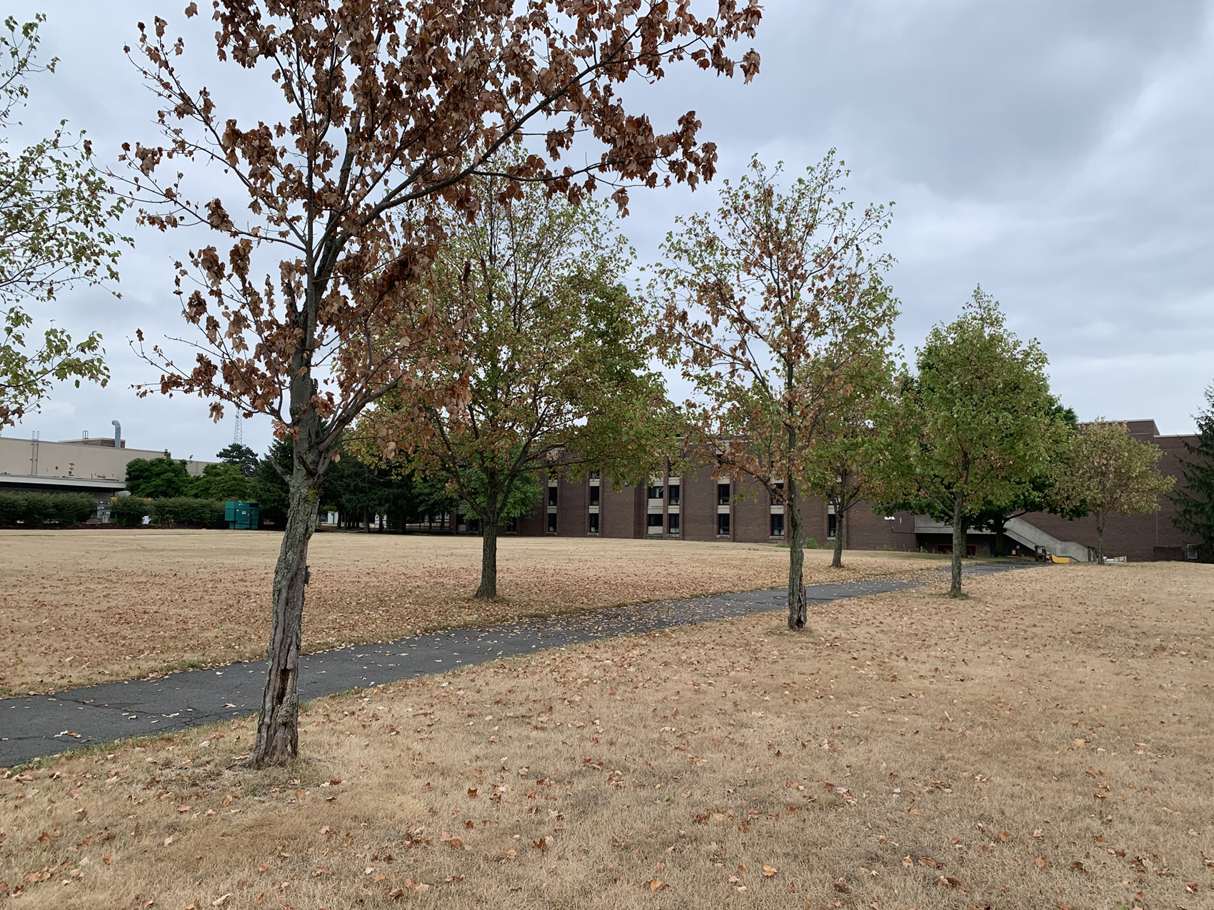
Trees and grass impacted by excessively dry conditions on Livingston Campus at Rutgers University in Piscataway (Middlesex County). Photo taken by D. Robinson on August 1st.

When it comes to recent hot Julys in New Jersey, the beat goes on. This year the heat was joined by quite limited precipitation, something not often seen in recent years. The statewide average temperature of 78.1° was 2.7° above the 1991–2020 normal, ranking 6th warmest since records commenced in 1895. Eight of the ten warmest Julys have occurred since 2010, leaving only 1955 and 1999 as top-ten outliers. The statewide average maximum was 88.6° (+2.9°, 6th warmest) and the minimum 67.5° (+2.4°, 4th warmest). Northern counties averaged 75.9° (+2.2°, 9th warmest), southern counties 79.5° (+3.0°, 3rd warmest), and coastal areas 78.8° (+2.6°, tied as 4th warmest).

Statewide July precipitation averaged 2.19”, which is 2.52” below normal, ranking as the 13th driest on record. Of the top 15, only two have occurred this century. The north averaged 2.03” (-2.69”, 14th driest), south 2.30” (-2.44”, 14th driest), and coast 2.16” (-2.22”, 17th driest). The central portion of the state was driest, with less than 2.00” accumulating, and under an inch in the driest areas. Closer-to-normal totals were found in the northwest, northeast, and southwest. At month’s end, portions of central NJ were classified as being in moderate drought (D1) on the weekly U.S. Drought Monitor map. This denotes conditions not seen more than once every five to ten years. Surrounding central and northern areas were considered abnormally dry (D0), as was the southeast corner of the state. This all coincides quite well with the most pronounced precipitation deficits of the past month.

Nondescript: June 2022 Recap

July 7, 2022 - 3:24pm -- Dave Robinson

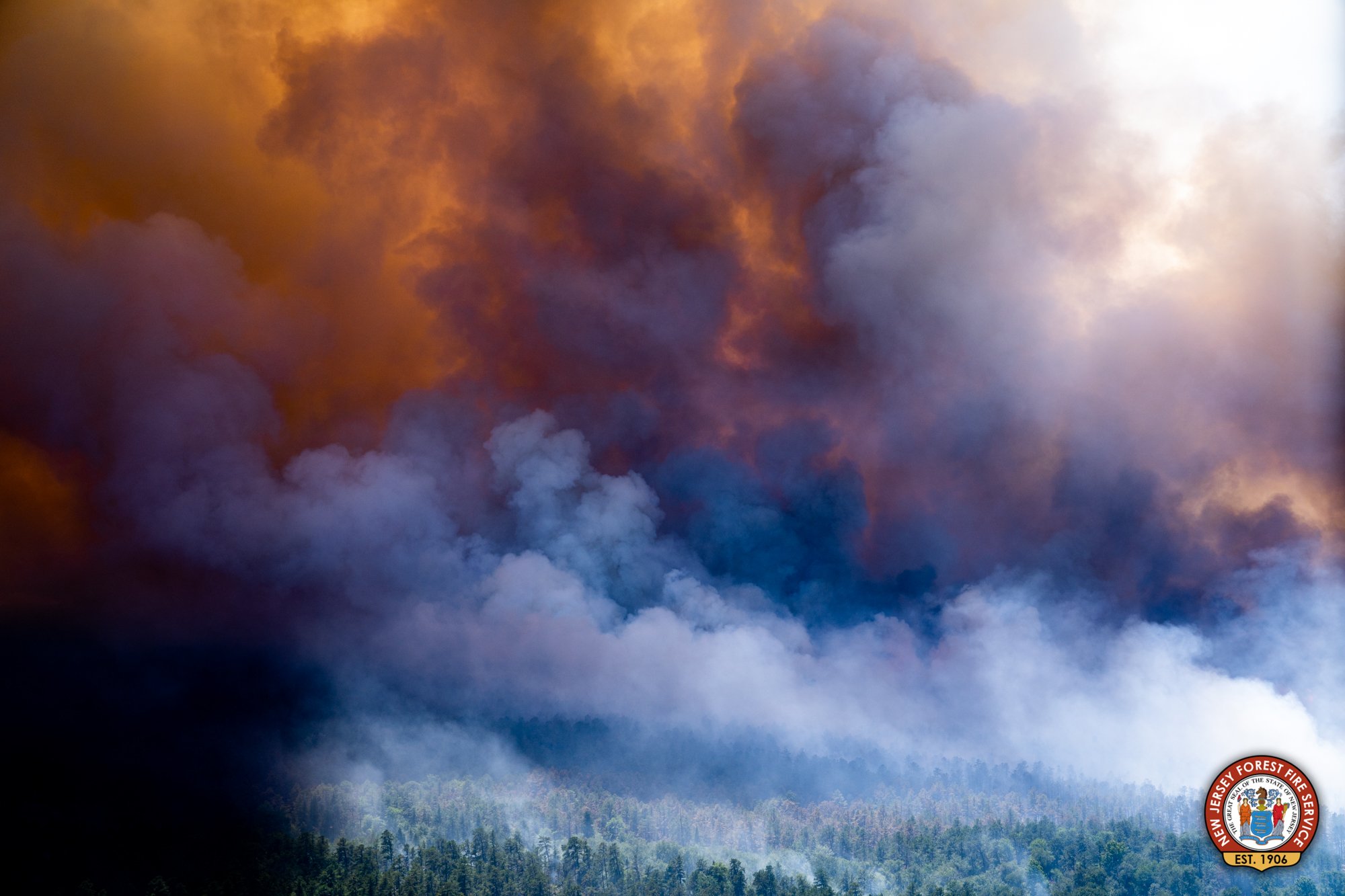
Smoke billows from a large wildfire in the Wharton State Forest around June 20th. Photo from the New Jersey Forest Fire Service.

As reported multiple times during the first half of 2022, the day-to-day weather and overall climate of the Garden State have varied frequently, exhibiting lots of variability and never “locking” into a given pattern for an extended period of several weeks or longer. Such was the case this June, making it difficult to define any conditions that dominated. June was somewhat drier than average, but eight events brought over an inch of rain somewhere within the state. It was also dry enough at one point for a wildfire to scorch over 13,000 acres of the Pine Barrens. Low temperatures fell into the upper 30°s and low 40°s at multiple locations on the 20th, yet three days earlier, the majority of the state saw highs in the low to middle 90°s. “Non-descript” seems the best way to sum things up.

Statewide, rainfall averaged 3.44”. This is 0.86” below the 1991–2020 normal and ranks as the 61st driest of the 128 Junes since 1895. The north received 3.59” (-1.02”, 61st driest), the south 3.39” (-0.75”, 61st driest), and coast 2.90” (-0.95”, 54th driest). As the map shows, the far south was driest, continuing a pattern seen in recent months. The June 30th U.S. Drought Monitor map has the bulk of the southern area seen on the Figure 1 map receiving less than 4.00” for the month classified as “Abnormally Dry” (D0). This rating is also a function of both low streamflow and ground water levels. Further north, pockets of above-average rainfall surrounded a below-average central region that has yet to have prolonged enough water deficits to qualify for D0 status.

Transition Complete: May and Spring 2022 Recaps

June 7, 2022 - 1:31pm -- Dave Robinson

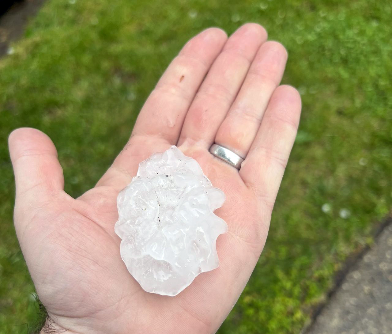
Large hailstone from severe thunderstorm in Cherry Hill on May 20.

Many across NJ wondered if the incessant back and forth of weather conditions from early spring into May would ever cease and the more consistent warmth of late spring would arrive and persist. It took time this year, with a cool, damp start to May that included a nine-day interval of almost continuous onshore easterly flow. Come mid-month the seasonal transition was finally complete, and daytime highs mostly remained above 70° away from the coast and higher elevations. This included two episodes where temperatures exceeded 90°. Whether it was cool or warm, rainfall was rather plentiful through most of the month. Seven events produced an inch or more at multiple locations, two of which found some spots exceeding 3.00”.

The statewide average temperature was 63.3°. This is 2.1° over the 1991–2020 normal and ties as the 14th mildest May since 1895. The average maximum of 73.6° was 1.3° above normal and ranked 35th mildest while the average minimum of 53.0° was 2.8° above normal, ranking 7th mildest. Regionally, the north division came in at 62.0° (+2.1°, 15th mildest), the south 64.3° (+2.1°, tied with two others at 13th), and coast 62.4° (+1.4°, tied with one other at 20th).

Rainfall averaged 5.37” across NJ. This is 1.62” above normal and ranks as the 23rd wettest May of the past 128 years. Even with the Highlands being somewhat dry, the north was wettest at 5.98” (+1.96”, 18th wettest). The south averaged 5.03” (+1.43”, 25th), despite the far south being on the dry side. The coast came in with 4.77” (+1.26”, 26th).

Consistently Inconsistent: April 2022 Recap

May 7, 2022 - 11:00am -- Dave Robinson

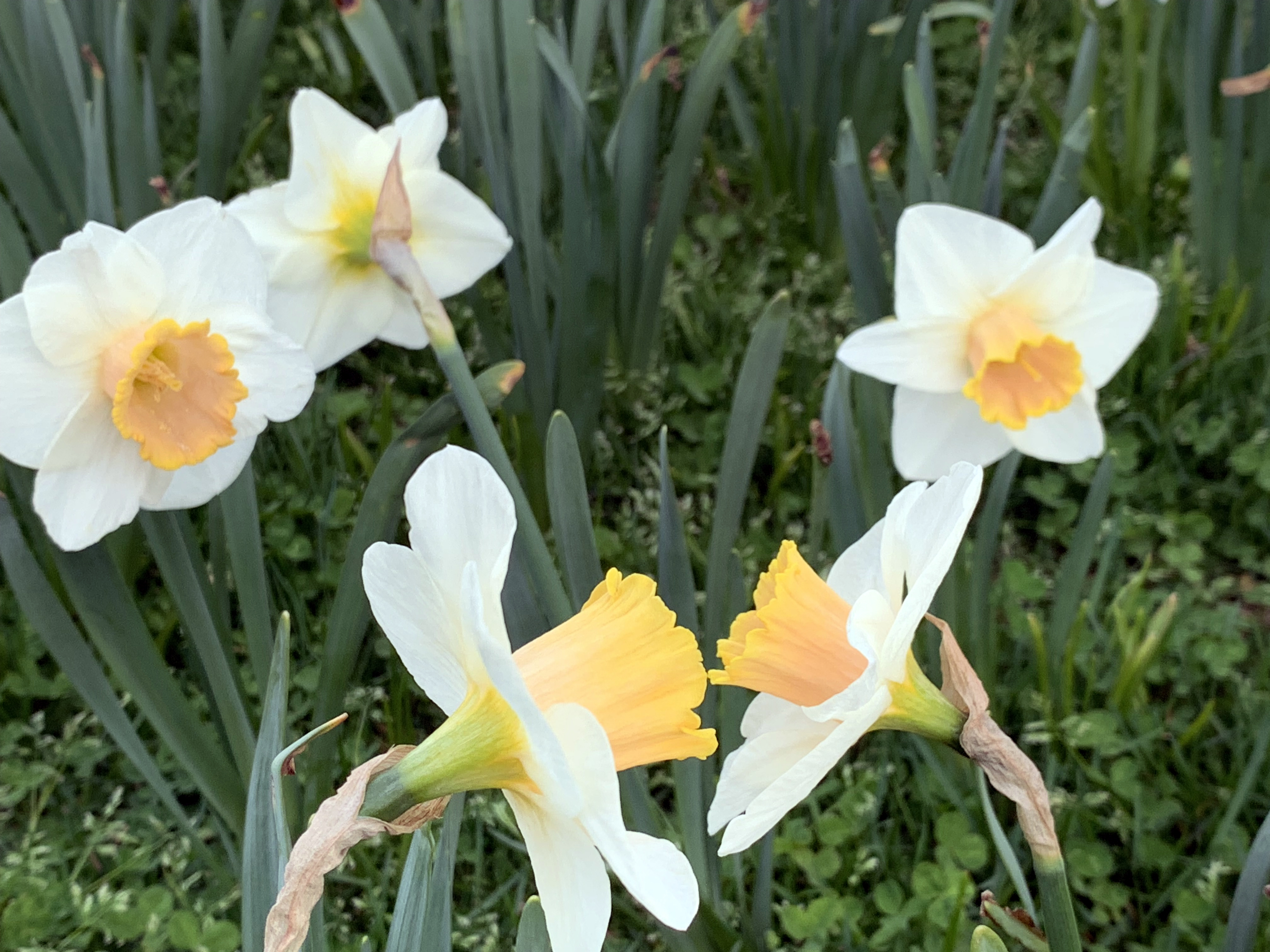
Daffodils chat with each other in the foreground on April 16th in Franklin Twp. (Somerset County), as two others eavesdrop in the background along with one that couldn't care less.

As has been the case for the past several months, weather patterns have been reluctant to persist for more than several days to about a week. While climatologically rather common as winter transitions to summer, this season has seemingly been consistently inconsistent beyond the norm. April saw temperatures reach well into the 80°s on several days, followed a short time later by a hard freeze in most inland locations. Rainfall was above normal, more than twice so in the northwest, which is a reversal of the general pattern since late fall. Precipitation fell every few days, including multiple squally episodes that briefly delivered small hail, graupel, and bursts of snow at some locations. There was one event that brought some flash flooding and minor river flooding. Many residents are impatiently waiting for some mild conditions to lock in, getting summer underway. Patience….summer will arrive!

The good news is the rainfall that arrived quite often. Increasing concerns for drought encroaching on NJ were washed away by multiple storms that “performed” up to or exceeded expectations, something that was often not the case for multiple underperforming events in past months. Statewide rainfall averaged 5.10”. This is 1.40” above the 1991–2020 normal and ranks as the 24th wettest April since records commenced in 1895. As the monthly map shows, the northwest was wettest and south driest, yet still above normal. The north average 6.34” (+2.44”, 11th wettest), south 4.37” (+0.79”, 32nd wettest), and coast 4.09” (+0.54”, 42nd wettest).

Spring Foolery: March 2022 Recap

April 6, 2022 - 7:56pm -- Dave Robinson

Damaged magnolia flowers on March 29th at Rutgers University Livingston Campus in Piscataway

When it comes to shedding the winter coat and thinking of warm weather to come, March is known to have its early spring teases. Then, along comes some late winter cold to remind us winter is not quite ready to disappear. This spring foolery was on exceptional display this month. High temperatures jumped into the 70°s on the 6th and 7th, then back to the cold until the 70° mark was again eclipsed during four of the five days from the 15th–19th. Next came some more seasonable temperatures before a polar blast brought mid-winter frigid conditions from the 28th–30th, only to be followed by another day of 70°s to end the month. Interspersed with these wild fluctuations were episodes of thunderstorms, snow and rain, and 13 days where winds gusted to greater than 40 mph at some locations.

When all was said and done, the statewide average temperature of 43.6° was 2.6° above the 1991–2020 normal. This ranked as the 16th mildest March since 1895, with the end-of-month cold spell keeping the month out of the top 10 for warmth. The average maximum of 54.0° was 3.1° above normal, ranking 17th mildest. The average minimum of 33.3° was 2.1° above normal, also ranking 17th. The north averaged 41.1° (+2.3°, 21st warmest), south 45.3° (+2.9°, 15th), and coast 44.9° (+2.7°, 13th).

Precipitation averaged 2.72” across NJ, which was 1.48” below normal and ranks as the 26th driest March since 1895. The north caught 2.54” (-1.47”, 26th driest), south 2.80” (-1.52”, 30th), and coast 3.06” (-1.36”, 34th). In particular, a zone from Hunterdon to Bergen counties was driest and the coast from Atlantic to Monmouth counties was wettest.

Up, Down, Round and Round: February 2022 and Winter 2021/2022 Recaps

March 8, 2022 - 12:53pm -- Dave Robinson

Sunset over a snow-covered field on February 14 at Colonial Park in Franklin Township (Somerset County).

The second month of 2022 and third month of winter continued a theme since December. Whether you call it a see saw, swing, or merry-go-round, it fits the theme of playground equipment as it never seemed any one particular variety of weather became established for all that long. More will be said about winter at the end of this report, but when it came to February, the end result was a somewhat warmer-than-normal month with about average precipitation and a dearth of snowfall. The statewide average temperature of 35.6° was 1.7° above the 1991–2020 normal, ranking as the 19th mildest since 1895. There was an above-average spread between the average high of 46.7° (+3.6°, 12th mildest) and low of 24.4° (-0.2°, 40th mildest), the 22.3-degree range being 3.8 degrees wider than normal. The north averaged 32.0° (+0.7°, 26th mildest), the south 37.7° (+2.2°, 16th mildest), and coast 37.9° (+1.9°, 18th mildest).

Rain and melted snow/sleet averaged 2.93”. This is 0.07” above normal and ranks as the 60th wettest/69th driest. The north averaged 3.45” (+0.66”, 44th wettest), south 2.62” (-0.27”, 49th driest), and coast 2.54” (-0.53”, 44th driest). More geographically specific, the far south was driest and the northwest wettest.

The South Coast Steals the Show: January 2022 Recap

February 8, 2022 - 10:40pm -- Dave Robinson

Severely drifted snow surrounds a car in Brigantine on January 29th.

When it comes to cold and snow, the second month of winter wasn’t anything like the first. New Jersey was right in the heart of winter to start off 2022, and nowhere was that more apparent than in southern coastal counties where far more than an average winter’s snow fell. At some locations, the total exceeded that of the most recent three winters combined. The prevailing storm track was such that the northwest corner of the state received the least snow, yet saw seven days with low temperatures dipping below zero. Toss in 15 days where one or more locations around the state recorded wind gusts of 40 mph or greater (five of these with gusts of at least 50 mph) and two atmospheric pressure waves moving across the state as a result of a volcanic eruption in the south Pacific, and it certainly was an eventful month.

Rain and melted snow averaged 3.45” across the state. This is 0.04” below the 1991–2020 normal and ranks as the 54th wettest (75th driest) January since 1895. The northern counties south to and including Hunterdon, Somerset, and Union averaged 2.90”, 0.60” below normal and 75th wettest (53rd driest). Southern counties, except close to the Atlantic Coast, averaged 3.72”, which is 0.25” above normal and ranks 46th wettest. The coastal region caught 4.34”, which is 0.83” above normal and ranks 31st wettest. Persistent dry conditions in recent months resulted in the southernmost NJ counties deemed “Abnormally Dry” for most of the month, according to the National Drought Monitor. As the month ended, northwestern counties were under consideration for being similarly designated.

Pages

Subscribe to RSS - News