News

Strange, Just Plain Strange: June 2023 Recap, Plus First Half of 2023 Review

July 11, 2023 - 9:38pm -- Dave Robinson

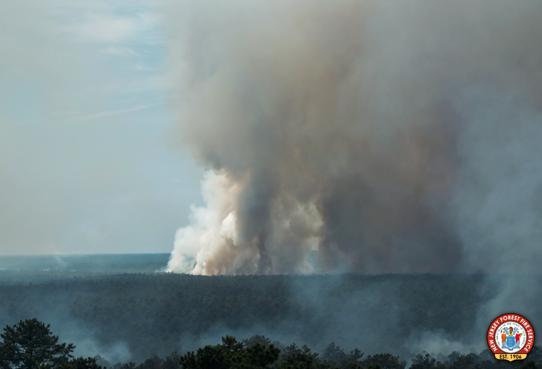
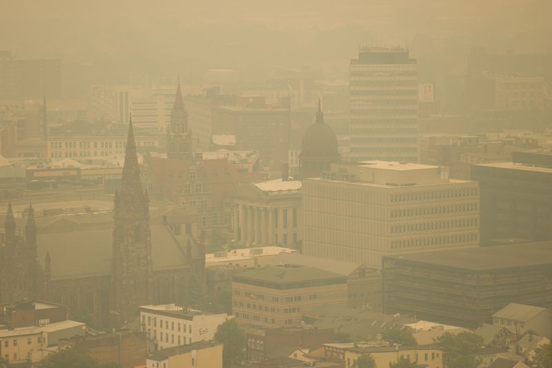
Wildfire smoke blankets downtown Paterson (Passaic County) on June 7th. Photo by Steve Hockstein/NJ Advance Media.

There is rarely a month in New Jersey where something interesting, exciting, and different than normal doesn’t occur in the weather and climate department. However, not often do you find a month like this past June where one is left with their head spinning as smoke from near and distant wildfires darkened the sky, creating exceptionally unhealthy air quality, where growing drought concerns were quieted in most locations by late-month downpours, where two tornadoes touched down, and with temperatures averaging cooler than normal for the second consecutive month. Strange, indeed.

June temperatures across the state averaged 67.8°. This was 2.5° below the 1991–2020 mean and tied as the 36th coolest June since 1895. The average daily maximum temperature of 79.0° was 2.0° below normal and ranks 40th coolest. The daily minimum averaged 56.6°, 3.0° below normal and was 35th coolest. The northern NJ climate division averaged 66.1° (-2.5°, 33rd coolest), the southern division averaged 68.9° (-2.5°, 36th coolest), and the coastal division averaged 68.2° (-2.3°, 45th coolest). Both May and June averaged below normal, the first such back-to-back occurrence in NJ since April and May 2020.

NJ June precipitation averaged 3.87”. This was 0.43” below normal, however, it ranks as the 53rd wettest of the past 129 years (or 77th driest) due to the skewed nature of the distribution of monthly precipitation over this period. The north averaged 5.13” (+0.52”, 29th wettest [101st driest]), the south 3.19” (-0.95”, 51st driest [79th wettest]), and the coast 2.20” (-1.65”, 28th driest [102nd wettest]).

Smoke Gets In Your Skies, and Another Mild One: May and Spring 2023 Recaps

June 7, 2023 - 6:43pm -- Dave Robinson

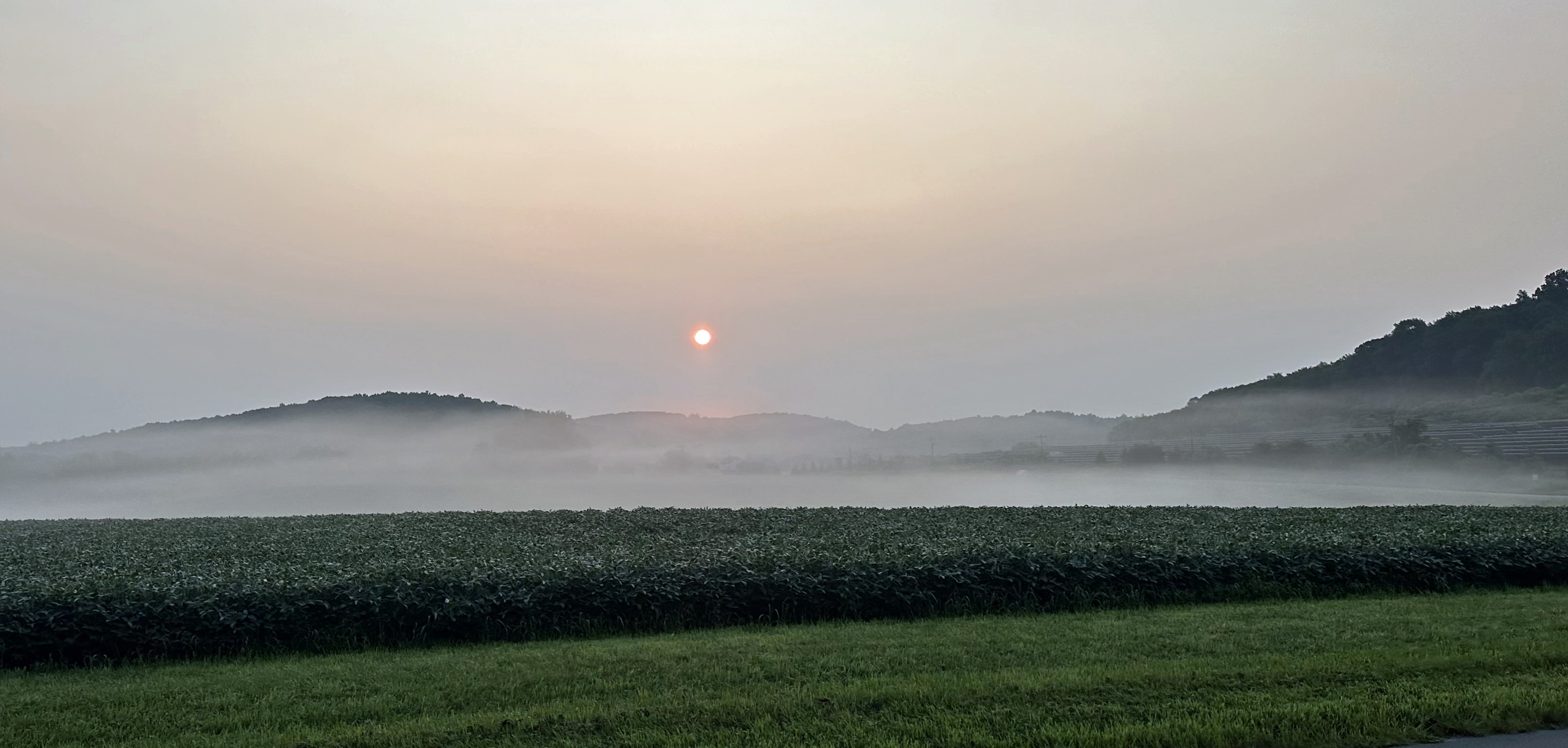
Wildfire smoke from western Canada contributed to a scenic sunrise on May 11 in Brigantine (Atlantic County). Photo courtesy of Connie Pyatt Photography.

When the headline for this monthly report alludes to hazy May skies that were frequently overhead, you know it was a quiet period weather-wise across the Garden State. Such was the case during the middle two weeks of May and at month’s end, with smoke from wildfires in western Canada frequently passing well overhead, followed by smoke from fires in Nova Scotia and a few in NJ. Otherwise, May temperatures were cooler than normal, and rainfall sparse.

The statewide average temperature of 59.3° was 1.9° below the 1991–2020 normal. This ranked as the 52nd coolest May since 1895. It was the coolest month compared to normal since January 2022. Following the third mildest April on record, May was only 4.0° milder than the previous month. This is the third smallest temperature difference on record between these two months. The average high temperature of 71.7° was 0.6° below normal, ranking 60th warmest and 68th coolest. The average low temperature of 46.9° was 3.3° below normal, ranking 26th coolest. The northern division averaged 57.8° (-2.1°, 50th coolest), the southern division 60.3° (-1.9°, 50th coolest), and the coastal division 59.6° (-1.4°, 63rd coolest).

An Odd One: April 2023 Recap

May 8, 2023 - 5:15pm -- Dave Robinson

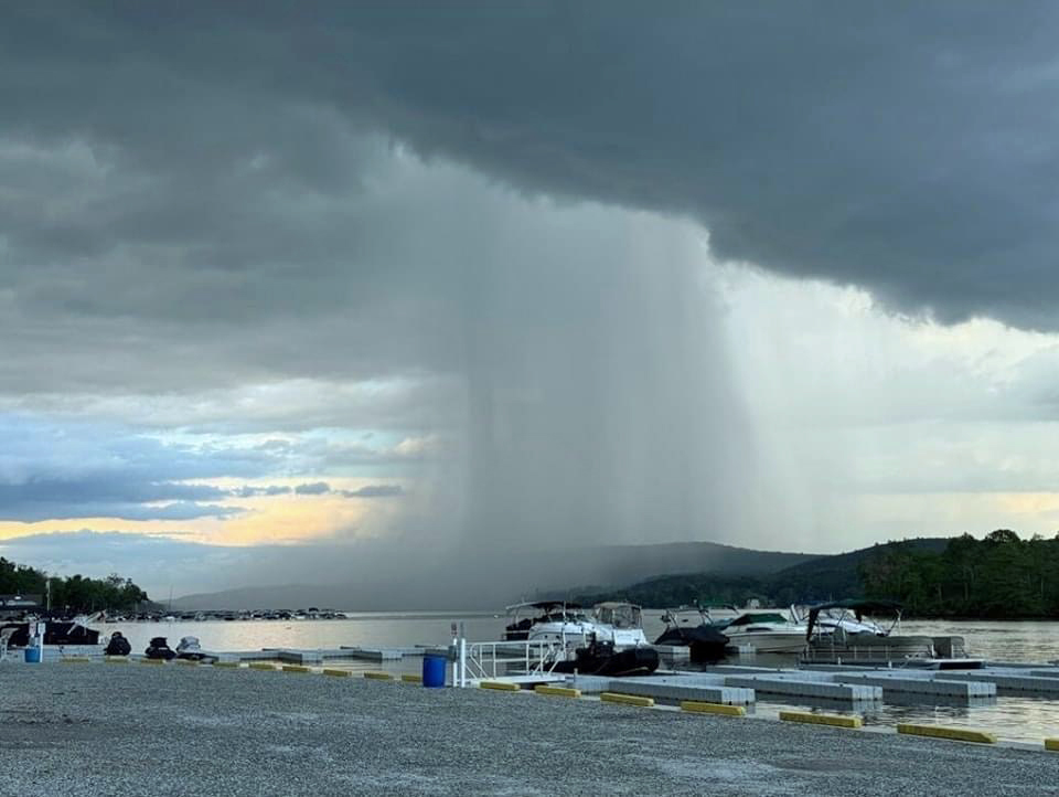
A vivid rain shaft accompanies a thunderstorm as seen from Hardyston Twp. (Sussex County) on April 15th, 2023. Photo courtesy of Yulia Karpova.

What can you say about a month that began with a swarm of tornadoes, finished with flooding rain, and in between, featured record heat, wildfires, and increasing drought concerns? Best to say that it was an odd one! Fitting this theme, the statewide average temperature of 55.4° was 3.9° above the 1991–2020 normal. This ranks as the third warmest April on record (since 1895) only behind 2017 and 2010 for top honors. April was the fifth month of the past ten ranking in the top 10, joining July (#7), August (#1), January (#1), and February (#5). The first four months of 2023 come in as the warmest start of the year on record with an average of 44.4°. This exceeds the previous record of 44.2° in 2012, with seven of the 10 warmest January–April periods (1895–present) occurring since 2002. The average April maximum temperature across NJ was 67.4° (+4.7°, 3rd warmest) and the average minimum was 43.4° (+3.1°, 5th warmest). Northern counties averaged 53.5° in April (+3.6°, 5th warmest), southern counties 56.6° (+4.0, 2nd warmest), and the coastal zone 55.8° (+4.1°, 2nd warmest).

April precipitation averaged 5.84” across New Jersey. This was 2.14” above normal, ranking as the 10th wettest on record. It was the wettest April since 2007 and second wettest since 1983. All but scattered areas in the northwest received above-normal precipitation, the greatest amounts falling near the Atlantic and Delaware Bay coasts. Northern counties averaged 5.55” (+1.65”, 26th wettest), southern counties 6.04” (+2.49”, 7th wettest), and the coastal zone 5.94” (+2.39”, 10th wettest). It is important to note that these totals and those for individual stations in the next section, do not include heavy rain that fell after standard early morning observation times at CoCoRaHS and National Weather Service Cooperative stations on April 30th. These rains were reported in morning observations on May 1st, thus will be included in May totals.

Tempered Spring Advance: March 2023 Recap

April 8, 2023 - 3:52pm -- Dave Robinson

Controlled burn conducted near the Basking Ridge (Lord Sterling Park, Somerset County) Rutgers NJ Weather Network station by NJ Fire Service personnel on March 27th. Photo courtesy of Stephen Federico/Somerset County Park Commission.

While March temperatures came in above normal, they were not nearly as anomalously mild as those seen in January and February. This quelled concerns that an early blooming season might arise, one that could result in damaged vegetation had an early bloom been followed by an unseasonable cold spell. The average March temperature across NJ was 42.1°. This was 1.2° above the 1991–2020 normal and ranks as the 30th mildest March since 1895. The average maximum temperature of 52.2° was 1.3° above normal, ranking 37th mildest. The average minimum of 32.1° was 0.9° on the mild side, ranking 29th mildest. The National Centers for Environmental Information northern division averaged 39.8° (+1.0°, 31st mildest), the southern division 43.5° (+1.1°, 31st mildest), and the coastal division 43.7° (+1.5°, 23rd mildest).

Statewide, precipitation averaged 2.75”, which is 1.45” below normal and ranks 29th driest of the past 129 years. The northern coast and northeast were wettest and the southwest and far south driest. This was reflected in the northern division averaging 3.07” (-0.94”, 44th driest), southern 2.52” (-1.80”, 24th driest), and coast 2.84” (-1.58”, 30th driest).

March statewide average snowfall was 1.8”. This was 2.8” below normal and ranks as 49th least snowy. Northern counties averaged 5.4” (-1.8”, 56th least snowy), central counties 1.5” (-3.9”, 46th least snowy), and southern counties 0.0” (-2.7”, tied with 37 other years as least snowy).

Normally Abnormal: February 2023 & Winter 2022/2023 Recaps

March 7, 2023 - 4:28pm -- Dave Robinson

Tornado damage in the Lawrence Square Village housing complex in Lawrence Twp. (Mercer County) after an EF2 tornado tore through the area on the afternoon of February 21st. Photo by Michael Mancuso/NJ Advance Media.

Abnormal conditions were seemingly the norm cross the Garden State during the second month of 2023 and, for that matter, during much of the winter (December–February). More on winter later in this report. First, focusing on February, milder-than-normal temperatures and limited snowfall were the rule, a short-lived frigid blast was followed by 70° warmth, and the most notable February tornado of at least the past 74 years touched down.

The statewide average temperature of 38.9° was 5.0° above the 1991–2020 normal and ranked as the 5th mildest February since 1895 (tied with 2012). Five of the six mildest Februarys have occurred in the last 11 years. Exemplifying the warmth, the New Brunswick (Middlesex County) Cooperative station experienced 23 days with above-average temperatures and just five below average. The same was true at both Sussex (Sussex) and Newark Airport (Union). Atlantic City Airport in Pomona (Atlantic) had 18 above and ten below normal, and Cape May (Cape May) reported 21 above and seven below.

The average February maximum was 49.3°, which is 6.2° above normal and ranks 3rd mildest, while the average minimum of 28.5° was 3.9° above normal, ranking 7th mildest. Temperatures in the northern climate division averaged 36.0° (+4.7°, 7th mildest), southern 40.6° (+5.1°, 4th mildest), and coastal 41.1° (+5.1°, 3rd mildest).

Does Anybody Really Know What Month It Is?: January 2023 Recap

February 7, 2023 - 5:47pm -- Dave Robinson

The pronounced snowline (at about 1000 feet elevation) near the base of Sunrise Mountain as seen from Rt 519 in the Beemerville section of Wantage (Sussex County) at 4:25 PM on January 23rd. Photo courtesy of Karen Walsh.

January 2023 was unlike most any first month of the year a New Jersey resident has experienced. Temperatures were similar to those normally seen in March and accumulating snowfall was meager in the north and non-existent further south. NJ weather was more like that of the piedmont of North and South Carolina at this time of year. The statewide average temperature of 41.0° was 9.3° above the 1991–2020 normal and ties with 1932 as the mildest January since records commenced in 1895. The average high of 48.9° was 8.6° above normal, ranking 2nd mildest. The average low of 33.1° was 9.9° above normal, also ranking 2nd mildest. It is indeed impressive to see the January 2023 monthly mean 0.7° warmer than the normal monthly high temperature and the average low was 1.4° above the normal monthly mean. The NCEI northern division averaged 38.8° (+9.9°, rank #1), the southern division 42.3° (+8.9°, #2), and the coastal division 43.0° (+8.6°, #2).

January precipitation averaged 3.65” across NJ, which is 0.16” above normal and ranks as the 45th wettest on record. This includes rain that fell during the PM hours of December 31st, as the clock starts on the new month (and in this case, also the new year) once observations are gathered at most NWS Cooperative stations around 7–8 AM each morning (much as what occurred on November 30, 2022, contributing to December totals). The northern division was wettest, averaging 4.19” of rain and melted snowfall (+0.69”, 31st wettest), the southern division 3.36” (-0.11”, 56th wettest), and the coastal division 3.01” (-0.50”, 78th wettest/52nd driest).

Seeking Identities:December 2022 and Annual 2022 Recaps

January 6, 2023 - 9:53pm -- Dave Robinson

Strong winds push waves and spray onshore after a cold frontal passage on December 23rd in Seaside Heights (photo credit: Daniel Nee/Lavallette-Seaside Shorebeat).

As has so often been the situation in 2022, December’s weather never settled into any persistent pattern. Unless, of course, a pattern of frequent variations constitutes persistence! In any case, it seems appropriate to co-label this combined monthly and annual report as intervals in search of identities!

Looking first at December, the statewide average temperature of 35.5° is 1.1° below the 1991–2020 normal. This ranks as the 44th mildest December dating back to 1895. The statewide average maximum temperature of 44.9° is 0.1° below normal and ranked 31st mildest. The average minimum was 26.1°, which is 2.1° below normal and ranks 54th mildest. North Jersey averaged 33.3° (-0.8°, 36th mildest), south Jersey 36.8° (-1.3°, 49th mildest), and the Jersey coast 37.7° (-1.4°, 50th mildest).

Statewide precipitation averaged 4.76”, which is 0.49” above normal and ranks 35th wettest. North Jersey averaged 4.93” (+0.68”, 32nd wettest), south Jersey 4.68” (+0.40”, 37th wettest), and the Jersey coast 4.49” (+0.13”, 43rd wettest). The wettest locations were in the northeast and along the northern coast, while the northwest and much of the south were on the drier side.

ONJSC's Top 10 NJ Weather and Climate Events of 2022

January 3, 2023 - 7:14pm -- Dave Robinson

Trees and grass impacted by excessively dry conditions on Livingston Campus at Rutgers University in Piscataway (Middlesex County), as the summer drought ranked as the #1 most impactful weather/climate events of 2022 . Photo taken by D. Robinson on August 1st, 2022.

For the 14th consecutive year, we in the state climate office have evaluated the myriad daily, monthly, and annual observations gathered across New Jersey during the course of the year to choose what we feel were the most significant and impactful 10 weather and climate events of 2022. More about each event can be found in the monthly narratives posted on our website. You might be tempted to rearrange the rankings, particularly as some of the events on the list may have affected you more than others ranked higher. Or perhaps you best recall one that didn't make the list. That's the enjoyment and frustration of lists! Unless stated otherwise, statewide values are based on an average of several dozen stations. The period of record for monthly, seasonal, and annual departures is 1991–2020; while for extremes and rankings it is from 1895–present. Observations are mainly drawn from National Weather Service Cooperative Observing Program stations, Rutgers NJ Weather Network stations, and NJ Community Collaborative Rain, Hail, and Snow Network locations.

A Tale of Two Novembers, and Leaning Warmer and Wetter Than Normal: November and Fall 2022 Recap

December 12, 2022 - 4:31pm -- Dave Robinson

An autumnal view along the Lamington River in Hacklebarney State Park on the border of Chester Twp. and Washington Twp. (Morris County). Photo by Dave Robinson.

Last month’s report spoke of how “classic” the weather was during October. November’s weather could be classified as being anything but such. The month began with perhaps the warmest first ten days of November on record in the Garden State, an interval that ranked up there with early November 2020. Then came winter-like temperatures for about ten days leading up to Thanksgiving before the month ended on a closer-to-normal note. There were only two mid-month events that brought more than an inch of rain to parts of the state, one associated with the remnants of a late-season hurricane that struck Florida. Portions of central and northern NJ saw the first snowflakes of the season during the cold spell, though aside from some minor accumulations at higher elevations, mostly traces were observed.

With the ups and downs of temperature, November came out averaging 47.5° for the state as a whole. This is 2.4° above the 1991–2020 normal and ties as the 15th mildest eleventh month on record. Ten of the twenty mildest Novembers since 1895 have occurred since 2001. The statewide average high temperature of 58.1° was 3.4° above normal, ranking 10th mildest. The average low of 36.9° was 1.4° above normal, ranking 20th mildest. North Jersey averaged 45.2° (+2.1, 15th mildest), south Jersey 48.7° (+2.4°, 17th mildest), and the Jersey coast 50.0° (+2.7°, 13th mildest).

Statewide precipitation averaged 3.08”, which is 0.28” below normal and ranks as the 63rd driest (66th wettest) on record. The north averaged 2.98” (-0.28”, 63rd driest), south 3.14” (-0.15”, 71st driest), and coast 3.14” (-0.20”, 68th driest). As the monthly map shows, central and northern coastal areas were wettest, while the driest areas were scattered in the far south, central, and north. It must be noted that the rain falling during the second half of the 30th is not included in the monthly totals for the state, regions, or individual stations presented later in the report. By convention, the reporting day for most National Weather Service (NWS) Cooperative and Community Collaborative Rain, Hail, and Snow Network (CoCoRaHS) stations used in this report ends at morning observation time on the last day of the month. Totals from the afternoon of the 30th, to be included in December totals, ranged as high as about an inch, though mainly 0.25”–1.00”.

True Fall Colors: October 2022 Recap

November 7, 2022 - 6:00pm -- Dave Robinson

Brilliant fall foliage looking up towards High Point Monument (Sussex County) on October 22nd. Photo courtesy of Chris Stachelski.

There are years when many say that New Jersey didn’t experience “classic” fall weather. This October is not one of those years, as the month included rain, wind, and coastal flooding from the persistent remnants of a hurricane, many locations received their first frost and freezing temperatures to end the growing season, and there were days with a cloud-free deep-blue sky. October certainly showed its true fall colors.

October temperatures averaged 54.1° across NJ. This is 1.3° below the 1991–2020 normal and was the coolest October since 2009. It was the 57th coolest (tied with 4 other years) of the 128 since 1895. The average high was 64.5° which is 1.3° below normal and is the 48th coolest (tied with 3 years). The average low of 43.6° is 1.3° below normal and ranks 65th coolest (tied with 4 years). Northern NJ averaged 52.1° (-1.2°, 59th coolest [tied with 2 years]), southern 55.1° (-1.4°, 56th coolest [tied with 3 years]), and coastal 56.6° (-1.0°, 70th coolest [tied with 1 year]).

Rainfall was abundant, averaging 6.45” statewide. This is 2.26” above normal and ranks 10th wettest on record. It was the wettest since the record October 2005. Ten different decades are found in the top 15 years. The north averaged 5.88” (+1.43”, 21st wettest), south 6.75” (+2.72”, 6th wettest), and coast 7.53” (+3.44”, 3rd wettest). Coastal Monmouth, Ocean, and Atlantic counties were wettest, coming in at two to three times normal totals. While coming in close to normal, the driest areas were in the north central, far southern, and southwest regions.

Pages

Subscribe to RSS - News