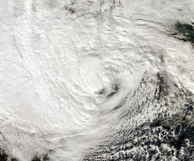
Sandy Strikes: October 2012 Report

Sandy, a category 1 hurricane as it approached the New Jersey coast during the daytime hours of the 29th and a post-tropical cyclone as it came ashore near Atlantic City (Atlantic County) that evening, dealt the state a punishing blow. It brought hurricane-force wind gusts to coastal and inland sections, close to a foot of rain in the far south, a state record low barometric pressure, and a record storm surge along the coast and in adjacent water bodies. Additional
information on Sandy can be found later in this report, and a more complete analysis will be provided on an upcoming website from the state climate office.
Statewide, the month averaged 57.1°, which is 2.3° above average. This ranks as the 20th warmest October since statewide records commenced in 1895. It marks the 21st consecutive month with temperatures equal to (June 2012) or warmer than (all other months since February 2011) average. The first ten months of this year have averaged 58.9°, or 3.1° above the 1981-2010 average. This keeps 2012 on pace to be the Garden State's warmest year on record (Table 1).

