Heat Wave

Warm Evenings in New Jersey
March 30, 2015 - 7:55pm -- Jack McCarty

Heat wave photo

Daily temperatures naturally fluctuate from week-to week and year-to-year (factoring out the seasonal “march” of temperature). Thus when temperature trends emerge over decades, it sparks a special interest here in the Office of the New Jersey State Climatologist. We are in the midst of a project to examine prolonged heat episodes throughout the state and have found some evidence for recent increases in such events. As impressive winter cold slowly comes to an end in NJ is there a better time to present some of our heat results? Of course not!

Our study involves examining daily maximum and minimum temperatures for seven stations distributed across the state, each with 100-plus years of records. This study began last summer with an evaluation of New Brunswick heat events. We showed that New Brunswick has had an increase of daytime heat events in recent decades and nighttime heat events are becoming more commonplace. In the course of expanding our analysis to seven stations, we have found larger changes in warm nighttime temperatures than in hot daytime temperatures. Excessively warm nighttime temperatures typically get overlooked when discussing potentially dangerous heat episodes, yet they can bring about dangerous health concerns for those unable to escape persistent warmth.

Heat Events in New Brunswick: A Climatological Analysis

September 16, 2014 - 1:27pm -- Jack McCarty

Heat wave photo

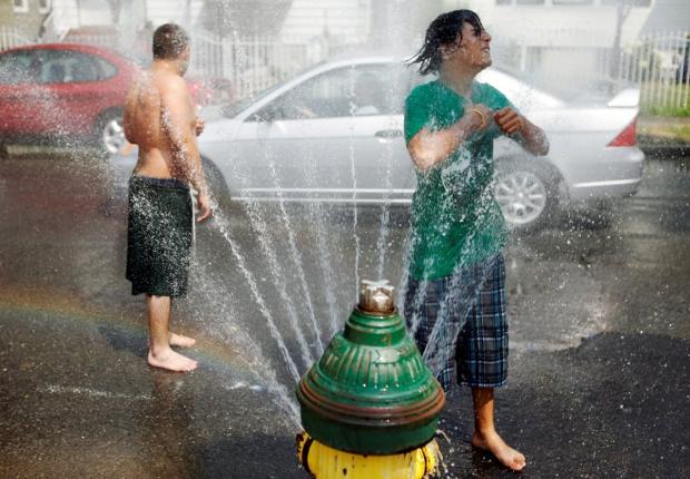
The summertime in New Jersey is characterized by warm temperatures that give some relief from cold and dreary wintertime conditions. However, amongst pleasant summer days, the atmosphere can align in a way that makes the heat on other days rather unbearable — something that we commonly refer to as a heat wave. Heat waves have a large impact on public health, utilities, infrastructure and more, which is why we often hear the media discussing heat waves across the nation. While heat waves may call for a day at the beach, they're also a cause for public concern.

No escaping a sultry, sweaty heat wave

July 22, 2013 - 8:09pm -- Dan Manzo

Garden State residents suffered through another heat wave last week, and at times it seemed like the unrelenting heat would never subside. A heat wave is unofficially defined as three or more consecutive days with the maximum temperature at or over 90°. This heat wave lasted seven days for many areas and furthermore, very high dew points (a measure of moisture in the air) made the heat index soar above 105°.

The heat wave began for many on Sunday, July 14, with stations in central and northeast Jersey, such as Haworth, Jersey City, New Brunswick, Howell, and Toms River all recording high temperatures in the low 90°s. Hawthorne was the hottest spot with a high temperature of 94°. Other stations recorded high temperatures in the upper 80°s. This combined with widespread dew points above 70° resulted in heat indices at or near 100°.

A manageable heat wave to end May

June 4, 2013 - 12:00am -- Dan Manzo

Boardwalk photo

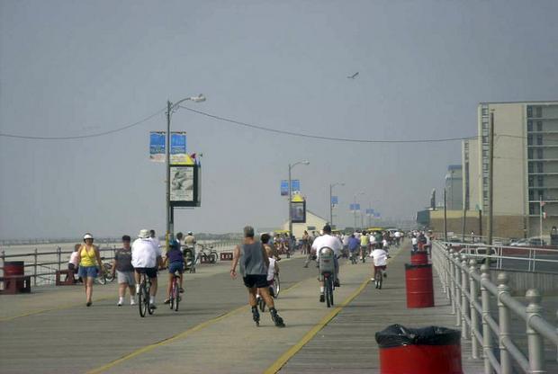
A week after the unofficial start of summer many areas saw temperatures soar, giving the Garden State its first heat wave of the season (a heat wave is defined as a hot period having at least three consecutive days of 90°+ temperatures). Temperatures steadily rose throughout the period from May 29 to May 31, with most areas away from the shoreline getting into the low to mid 90’s.

Just prior to the beginning of the heat wave on May 29, temperatures along the state’s Turnpike corridor rose into the upper 80’s. Our NJWxNet Woodstown station in Salem County recorded a high temperature of 88°, Cream Ridge in western Monmouth County recorded a maximum of 87°, and Haworth in Bergen County recorded a high of 86°. The story was not the same away from the urban corridor. Wantage (Sussex County) only made it to 80°, and Atlantic City Marina topped off at 71°.

Subscribe to RSS - Heat Wave