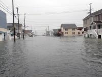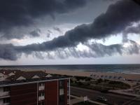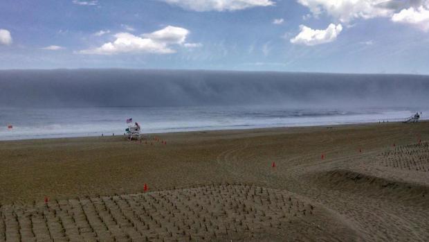
A fog bank sits just offshore of Sea Girt (Monmouth County) during the afternoon of May 31st. Photo by Captain Jim Freda, Beach Manager for Borough of Sea Girt (@SGLifeguards).
May Overview
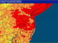
May 2015 was a warm and dry month across New Jersey. As the month ended, drought concerns were looming large, though rainfall in the north during the afternoon and evening of the 31st and continuing into the first days of June resulted in at least a temporary braking of the downward slide. Based on data gathered at long-term National Weather Service Cooperative Observing (COOP) stations, May rainfall averaged 1.08" across NJ. This is 2.92" below the 1981-2010 mean and ranks as the 3rd driest May since records commenced in 1895 (Table 1).
| Rank | Year | May Avg. Precip. |
|---|---|---|
| 1 | 1903 | 0.53" |
| 2 | 1964 | 0.94" |
| 3 | 2015 | 1.08" |
| 4 | 1986 | 1.21" |
| 5 | 1911 | 1.23" |
| 6 | 1993 | 1.34" |
| 7 | 1939 | 1.37" |
| 8 | 1977 | 1.37" |
| 9 | 1955 | 1.43" |
| 10 | 1923 | 1.49" |
Table 1. Top 10 driest NJ Mays since 1895.
As those who have been reading these monthly narratives for some time now know, precipitation that falls at COOP stations after observation time on the last day of the month gets recorded as falling on the first day of the next month. Most COOP stations observe in the morning, thus the heavy showers that fell across north Jersey on the 31st were not factored into this May average, except for a few stations such as Newark Airport (which registered 3.83" on the 31st alone) that observe at midnight. The last time this situation had a notable impact on monthly rainfall was a daytime heavy rain event on April 30, 2014.
Temperatures were quite warm throughout May. The statewide average temperature of 66.0° was 5.2° above average. This ranked as the 3rd warmest may since 1895 (Table 2). It was the persistence of above-average temperatures (especially daily maximums) rather than a scorching heat wave that led to the high ranking. Four of the eight warmest Mays have occurred since 2004.
| Rank | Year | May Avg. Temp. |
|---|---|---|
| 1 | 2004 | 66.2° |
| 2 | 1991 | 66.1° |
| 3 | 2015 | 66.0° |
| 4 | 1944 | 65.1° |
| 5 | 2012 | 65.1° |
| 6 | 1896 | 64.9° |
| 7 | 1965 | 64.4° |
| 8 | 2010 | 64.2° |
| 9 | 1911 | 64.1° |
| 10 | 1918 | 64.1° |
Table 2. Top 10 warmest NJ Mays since 1895.
Temperature
Episodes of well above-normal temperatures occurred every week. The dry conditions often resulted in rather wide diurnal temperature ranges, with the cooler nights somewhat balancing the warm daytime maximum temperatures, but still the overall picture was one of warmth. An exception to this was observed along the immediate coast, where persistent sea breezes coming onshore off of a still chilly Atlantic almost without exception kept daily temperatures much cooler than inland. Meanwhile, the modifying influence of the water kept temperatures from getting too low at night. On twelve May afternoons when high temperatures exceeded 85° at an inland location, the high at Harvey Cedars (Ocean County) on Long Beach Island was at least 20° cooler than the inland site. This coastal station had highs in the 50°s or 60°s on 21 days and only exceeded 80° once (85° on the 12th when strong northwest winds kept winds blowing offshore). Conversely, inland Hamilton (Mercer) equaled or exceeded 85° on 21 days and had highs in the 50°s or 60°s just three times.
On 17 days somewhere in the state reached 85° or higher. Seven of these days had highs of 89°–92°. The first occurrence was on the 12th, when West Creek (Ocean) got to 90° and Egg Harbor Township (Atlantic) 89°. Six of the last seven days of May fell in this category, starting with 89° at Hawthorne (Passaic) and Hillsborough (Somerset) on the 19th. The 26th was the warmest day of the month, with six stations reaching 90° and 34 of the 55 NJ Weather and Climate Network (NJWxNet) stations between 85°–89°. The 27th almost equaled the previous day for warmth. In fact, Hamilton achieved the state maximum for the month with 92°. Three other stations reached 90° and 30 were between 85°–89°. Berkeley Township topped out at 91° on the 28th, Hamilton and Hillsborough were 89° on the 30th, and seven stations peaked at 91° on the 31st.
May was not without some cool mornings, as clear skies and a dry atmosphere permitted daytime heat to escape the atmosphere. As usual, northwest valley locations experienced the coolest conditions as the denser air drained off nearby hills. On 11 mornings temperatures fell into the 30°s. Pequest (Warren) was 34° and Kingwood (Hunterdon) 37° on the 1st. The 2nd was the coldest day of the month, with 20 stations bottoming out between 36°–39°. This included Basking Ridge (Somerset), Cream Ridge (Monmouth), and Hillsborough all at 36°. Walpack (Sussex), Pequest, and Berkeley Township fell to 35° on the 3rd. Walpack was 38° and Pequest 39° on the 4th. Three cold mornings beginning on the 13th first saw 39° at Walpack, then 31° at Pequest and Walpack on the 14th, and 35° in Walpack on the 15th. The middle day saw a 42 degree diurnal temperature range at Pequest and 41 degree range at Walpack. A four day cold run from the 21st–24th may have been the last of the season with temperatures in the 30°s. Walpack and Pequest were 38° and 39°, respectively, on the 21st and Pequest 39° on the 22nd. Walpack fell to freezing on the 23rd, with High Point Monument and High Point at 34°. Walpack was again down to 32° on the 24th, with Pequest at 33°, and eight other stations between 34°–39°. Bivalve (Cumberland) only dropped to 57° that morning.
With the last freezing temperatures of the cold season likely achieved, a look back at the freeze season of 2014–2015 is in order. Walpack saw the first fall freeze on September 23rd and the last one on May 24th, making for a 244-day season. Pequest's season went 221 days, from October 6th – May 14th. Many inland NJ stations saw their first freeze on October 20th and last one on April 25th, giving a 188-day season. Three coastal stations experienced just a 135-day season. Bivalve, Atlantic City Marina (Atlantic), and West Cape May (Cape May) first froze on November 15 and last reached that mark on March 29th. Harvey Cedars' season was only a day longer.
Precipitation and storms
Among the driest locations in the state this month were ten that received less than a half inch of rain. They were mostly concentrated in west central NJ and Monmouth County, and included Greenwich Township (Warren) 0.15", Bethlehem Township (Hunterdon) 0.22", Holland Township (Hunterdon) 0.32", Lambertville (Hunterdon) 0.33", Franklin (Sussex) 0.39", Eatontown (Monmouth) 0.43", Clinton (Hunterdon) 0.44", White Township (Warren) 0.45", Long Branch (Monmouth) 0.46", and Somerdale (Gloucester) 0.48". On the wet end was a small area of coastal Ocean County that received the bulk of its May rain in a deluge on the 28th. This included two Toms River stations at 5.46" and 4.91" for the month, Pine Beach 3.05", Berkeley Township 2.87", Lavallette 2.81", and Seaside Heights 2.78". Elsewhere, Roxbury Township (Morris) saw 2.16", with no other station in the state over 1.99" besides those mentioned above.
Despite being one of the driest Mays on record, there were six occasions where rainfall exceeded 0.50" at one or more of the over 250 CoCoRaHS and NJWxNet stations around NJ. However, there was not a single day that would qualify as delivering a statewide soaking, that last being experienced on April 20th. On May 6th, morning showers, primarily in Cumberland and Atlantic counties, brought as much as 0.65" to Egg Harbor City (Atlantic) and 0.42" in Upper Deerfield (Cumberland). Nothing fell in the northern half of NJ. Late afternoon thunderstorms on the 11th brought the heaviest rain to the central Jersey counties of Hunterdon, Somerset, and Middlesex, with little to none elsewhere. New Brunswick (Middlesex) received 0.68", Flemington (Hunterdon) 0.60", and East Brunswick (Middlesex) 0.55". Some of this moisture appeared to be loosely associated with Tropical Storm Ana that earlier in the day made landfall in South Carolina.
Thunderstorms during the evening of the 16th involved the National Weather Service issuing a tornado warning in southern Morris County (fortunately none was observed). A swath from the Sussex-Warren border southeastward to Union County generally saw 0.75"–1.00", with as much as 1.55" in Roxbury Township, Randolph 1.29", Mt. Olive 1.25", and Long Hill 1.24", all in Morris County. Most of the remainder of northern and central NJ received from 0.25"–0.50", with under 0.10" in the southern third of the state. Winds downed wires in Sussex County. The second half of the 21st saw moderate rain in Cape May County, with Woodbine receiving 0.87", Middle Township 0.84", and Sea Isle City 0.82". Mostly 0.25"–0.50" fell in the remainder of south Jersey with a trace to no rain in the northern half of the state.
Amidst the discussion of stormy May weather it may seem out of place, however it would be remiss to fail to mention the nearly ideal weather on all three days of the Memorial Day weekend from the 23rd–25th. Starting on the cool side, by the afternoon of the 25th temperatures approached summer-like mid to upper 80°s, except along the immediate coast where highs were in the upper 60°s to upper 70°s, and in the low 80°s at higher elevations.
Rain returned during the late afternoon and evening of the 27th with thunderstorm winds felling trees and power lines in Morris and Gloucester counties and Mercer County receiving the most rain. Four CoCoRaHS observers in Lawrence Township (Mercer) reported 1.51", 1.16", 1.10", and 1.06". Princeton (Mercer) received 1.14". Up the Rt. 1 corridor to New Brunswick 0.25"–0.50" fell, with nothing observed along the coast.
Thunderstorms returned during the afternoon and early evening of the 28th in an isolated but extremely potent manner. A small, very slow moving complex along a sea breeze front over central coastal Ocean County resulted in two nearby Toms River stations receiving 5.24" and 4.60". Nearby, Pine Beach caught 2.76", eastern Berkeley Township 2.54" (a western station in the township received only 0.09"), Seaside Heights 2.37", Lavallette 2.30", and Lacey Township 1.08". Outside of Ocean County, a storm near the Ocean-Burlington border brought 0.77" to Jackson (Ocean) and 0.73" to Medford Lakes (Burlington). An isolated storm gave New Brunswick (Middlesex) 0.50". Hail accompanied the coastal ocean storms, while strong winds felled trees in Burlington County. Outside of these local action zones, 124 of the 174 statewide observations from CoCoRaHS stations reported no rainfall and 26 others between 0.01"–0.10".
As previously mentioned, the north Jersey afternoon and evening storms of the 31st into early on June 1st will be a part of June monthly totals. However, it seems illogical to wait a month to discuss them. These moisture rich showers and thunderstorms brought hail to a few locations but were mainly known for their rapid deluges. By sunrise on the 1st, a good portion of previously moisture-starved west central NJ (note that “official" May totals were lowest in this region) received 1.50"–3.00". Rains of this magnitude stretched eastward through southern Morris and northern Somerset counties to northern Middlesex and northward into Bergen County. River Vale (Bergen) was swamped with 6.30" and nearby Haworth saw 4.25". Other impressive totals included Old Bridge (Middlesex) 3.65", Kenilworth (Union) 3.60", Lebanon (Hunterdon) 3.56", Harrison (Essex) 3.51", New Providence (Union) 3.24", and Randolph (Morris) 3.13". Some 44 stations (of 207 total reports) received from 2.00"–2.99" and 59 between 1.00"–1.99". Much less rain fell in the southern half of NJ, most of it in the early hours of June 1st. This area had to wait until the second half of the 1st to be impacted by heavy rains. More on those rains in the June report.
As would be expected, the multi-inch downpours resulted in localized flash flooding of roadways and streams. However, the heavy coverage was not extensive enough and the rivers low enough such that large-scale flooding did not occur. In many respects this rain was a blessing, as by month's end the northern third of NJ had been classified by the US Drought Monitor as being in moderate drought. Such conditions are typically seen no more often than once every 10 years. From about Interstate 78 to the Atlantic City Expressway, abnormal dryness, or what might be called minor drought, was underway. Rivers were flowing at near-record levels, ground water, especially in the northwest, was very low, crops were growing slowly or not germinating, and reservoirs, while still at average levels, were beginning to fall at a pace not usually seen this early in the season most likely due to considerable early season lawn watering. Whether the rains of late May and early June will signify the end of dry conditions or only provide a brief and welcome respite from an increasingly worrisome situation remains to be seen.
May was not particularly windy. Only two NJWxNet stations recorded gusts of 40 mph or higher, and just on five days. High Point Monument reached 45 mph and 40 mph, respectively, on the 12th and 13th. The 12th was the windiest day of the month in NJ with 11 other stations gusting from 30–35 mph. The Monument gusted to 40 mph on the 19th, Wantage 42 mph on the 20th, and the Monument 41 mph on the 27th. No doubt there were localized gusts of this magnitude or greater associated that felled trees and downed wires during thunderstorms, but no observing station sat in their midst.
The 14th and 23rd saw the highest barometer readings of the month at about 30.45". The 12th and 19th had the lowest pressures from 20.70"–20.75".
Despite the warm and dry conditions it was fortunate that forest and brush fires were generally small and infrequent. One exception was a forest fire in Wharton State Park (Burlington) on the 7th that burned over 700 acres. It resulted in some temporary home evacuations and, for a short time, the closure of a section of Route 206, however there were no injuries and no structures were damaged.
Spring Overview
Beginning when snow may still cover the ground and ending when warm may inspire early trips to the beach, any New Jersey spring is certainly a season of major climate transition. Perhaps never was this more apparent than in Spring 2015. However, in the future should one simply look at the average temperature for the March–May 2015 period they would find that the mean temperature of 51.0° was spot on average. This ranks as the 38th warmest spring since 1895. What this average “hides" is the fact that March temperatures were a bone chilling 5.5° below average, April very close to average, and May an almost summerlike 5.2° above average. This truly matches the scenario in the opening sentence of this section!
The Spring 2015 precipitation regime was one that began with March rain and melted snow averaging 4.86", which is 0.63" above normal. April (2.70") and May (1.08") combined could not come close to the March total, averaging 1.36" and 2.92" below normal, respectively. This led to a total of 8.64" for the season, which is 3.65" below normal and ranks as the 21st driest on record. The last time April precipitation was more than an inch below normal followed by a May with a negative departure of greater than two inches was 50 years ago in 1965. This helps explain why drought conditions were encroaching upon the Garden State toward the end of May.


