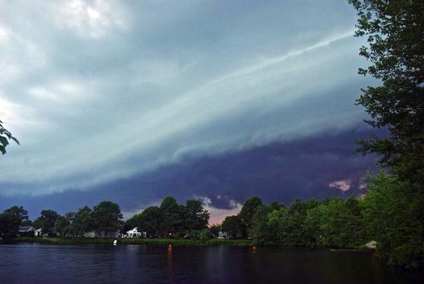
A shelf cloud warns of an approaching thunderstorm in Southampton (Burlington County) on July 2, 2014. Photo courtesy of Anthony Adams (@Aadams90).
July Overview
Despite a general feeling amongst NJ residents that July 2014 was a cold summer month, in actuality, compared to long-term records, it was rather average. The statewide average temperature of 74.5° was 0.5° below the 1981-2010 mean. However, it was 0.3° above the 1895-present mean and ranked as the 45th warmest July of the past 119 years. Even the number of afternoons with temperatures of 90° or higher was close to normal. So why the common misperception? Some armchair psychology brings me to four possibilities:
1) The first half of the month was above average, while the more recent weeks were on the cool side. Our perceptions are biased toward the most recent.
2) People have yet to “recover" from the cold start of 2014. The dubious media ramblings of the “polar vortex" returning to the eastern US in mid-July fueled these thoughts.
3) The most recent four NJ Julys all rank in the top six for warmth over the past 119 years. This was an amazing run of hot Julys.
4) Those sticking their toes in the Jersey surf in early July were shocked by water temperatures in the 50°s and may have equated this to the cool July atmosphere. The cold surf was actually indicative of persistent southerly winds that brought atmospheric warmth. This wind flow led to coastal upwelling that pushed warmer surface waters offshore and introduced cool deeper waters to the surf zone.
Yes, I know, I should stick to my day job!
Turning to precipitation, given that NJ often sat with in the battle zone between the cool and warm air masses, storms frequently erupted, particularly in the first half of July. With this, the statewide average precipitation of 5.22" was 0.70" above average (1981-2010 average), or 0.73" above the 1895-present average. July 2014 ranks as the 40th wettest back to 1895.
Temperature
Maximum temperatures equaled or exceeded 90° at one or more of the 54 NJWxNet stations on 12 July afternoons. All but two occurred by the 15th. The month started on a hot note, with 26 stations reaching the 90° mark on the 1st. This included Hamilton (Mercer County), Hawthorne (Passaic), and Hillsborough (Somerset) tops at 93°. The 2nd was the hottest day of the month across NJ. 37 stations got to 90° and Hillsborough at 97° experienced the peak statewide temperature of the month. 12 stations were at least 95°, while Sea Girt (Monmouth) only reached 78° and Atlantic City Marina (Atlantic) 79°. The 3rd saw a maximum of 95° at Piney Hollow (Gloucester) and 94° in Berkeley Township (Ocean).
90° heat resumed on the 7th with Berkeley Township at 94° and four other locations at 93°. The 8th was just about as hot as the 2nd, with 37 stations up to 90° or higher. This included eight at 95° and seven at 94°. Harvey Cedars (Ocean) was the cool spot at 82°. Hillsborough was the only location to reach 90° on the 9th. Cherry Hill (Camden) and Hamilton topped out at 90° on the 12th, while nine stations, led by 93° at Sewell (Gloucester), met the mark on the 13th. Nine also got to 90° on the 14th, including Piney Hollow (Gloucester) at 92°. The 15th found Berkeley Township up to 92° and six other stations reaching 90° or 91°.
Two late month hot days completed the 90° tally for July. Five stations came in at 92° on the 23rd, with 16 others 90° or 91°. Hamilton reached 91° on the 27th, when three other stations got to 90°.
On the flip side of the ledger, there were thirteen July mornings when the low temperature at one or more NJWxNet location fell below 55°. This began on the 4th when enough cool air drained into the northwest valley location of Walpack (Sussex) to drop the temperature to 53°. Walpack led the way on the 5th at 47°, followed by Pequest (Warren) at 50° and five other stations between 51° and 55°. Some 15 stations were at or below 55° on the 6th, including Walpack’s 47° and Pequest’s 49°.
Cool mornings reappeared on the 17th, with Walpack at 53° and both Pequest and Basking Ridge (Somerset) at 54°. The 18th was the chilliest July morning in terms of the number of stations at or below 55°. 18 stations were between 48° (Pequest) and 55° (6 stations including Woodbine (Cape May)). Walpack reached 54° on the 19th and 53° on the 21st and 24th. The 25th saw Walpack fall to 45°, the coldest minimum temperature of July. Eleven other stations were at or below 55°. Walpack got to 52° and Pequest 54° on the 26th.
The month finished with three chilly mornings. Walpack at 50° and Pequest 51° started this off on the 29th. The 30th found fourteen locations at or below 55°, led by Pequest’s 46° and 48° in Basking Ridge, Hope (Warren), and Walpack. Basking Ridge, Oswego Lake (Ocean), and Walpack fell to 50° on the 31st.
There were two uncomfortably warm nights over much of NJ during July, a far cry from 2013, when the monthly average minimum temperature was a record high. On the 2nd, forty stations failed to fall below 70°, including 76° for a low at Bivalve (Cumberland). The 15th found 35 stations in the same situation, led by 73° at Bivalve and Hawthorne (Passaic).
Precipitation and storms
Monmouth took top honors as the wettest NJ county in July. The three wettest locations in the state were found there, including 10.23" at Howell, 9.33" in Millstone Township, and 9.23" in Belmar. The next five wettest locations included Somerville (Somerset) with 9.10", Wall Township (Monmouth) 9.00", Brick (Ocean) 8.43", Robbinsville (Mercer) 8.28", and Palisades Park (Bergen) 8.16". The Cumberland-Salem county region was the driest area in July, with well below-average totals of 1.28" and 2.08" at two Upper Deerfield (Cumberland) locations and 2.44" in Pittsgrove (Salem). Scattered dry locations included Collingsworth (Camden) 3.11", Berkeley Township (Ocean) 3.25", Pitman (Gloucester) 3.25", and Hopewell (Hunterdon) 3.44".
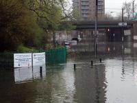
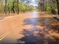
There were eight episodes where more than an inch of rain fell at one or more locations, with three of these having totals exceeding 4.00". Most resulted from a slow moving thunderstorm or series of thunderstorms drenching a location. Some storms were accompanied by strong winds that toppled trees and power lines, hail, dangerous lightning, and localized flash flooding, rather typical of summer storms.
Storms on the afternoon and evening of the 2nd brought scattered inch-plus rains around the state, with only parts of the far south and northern coast escaping at least 0.25". Palisades Park received 2.81", Kingwood (Hunterdon) 2.64", Montague (Sussex) 2.47", Kenilworth (Union) 2.26", and Kearny (Hudson) 2.19", demonstrating the widespread coverage of these storms. Pea-size hail fell in Frenchtown (Hunterdon) and numerous trees and power lines toppled in what may have been a microburst near Flemington (Hunterdon). Street flooding was also reported.
Storms during the second half of the 3rd, primarily in the northern half of the state, transitioned into scattered rain in the north and heavier rain in the southeast on the 4th. The southern rain was a direct result of Hurricane Arthur that moved from eastern North Carolina to east of Cape Cod and Nantucket (Massachusetts) from late on the 3rd into the evening of the 4th. The storms on the 3rd contributed the most rainfall, with 4.25" and 3.64" reported at two Wantage (Sussex) locations, 2.90" in Chatham (Morris), 2.70" in Summit (Union), 2.14" and 2.35" at two Montgomery (Somerset) locations, and 2.30" in Wood Ridge (Bergen). The storms pummeled Oak Ridge (Morris) with ping-pong ball size hail, quarter sized hail in Mt. Arlington (Morris), and pea to dime size hail in Wantage. Trees and power lines were downed by strong winds in at least six counties stretching from Camden to Bergen. None of the wind damage was associated with Arthur. In addition to depositing from 0.50" to 1.25" along the southeast coast, rough surf with dangerous rip currents and a 40 mph maximum wind gust at Harvey Cedars (Ocean) were the major impacts from the hurricane.
Storms were scattered around NJ from the 8th into the 9th, concentrated more in the north on the 8th and in the south on the 9th. Hackettstown (Warren) caught 1.61", Montague (Sussex) 1.57", and Pequest (Warren) 1.33". There was some tree damage and power outages scattered around mainly central and northeast counties. The 10th brought some heavy rain to Morris County and surrounding areas, totaling as much as 2.32" in Morris Township. However, the main action was in the southeast where a line of training storms (one after the other over the same general locations) dumped copious amounts of rain. This included Cape May County totals of 4.74" in Upper Township, 3.65" and 2.63" at two Woodbine locations, and 2.32" in Dennis Township. Linwood, in southern Atlantic County, got in on the act with 2.53".
The 13th-14th saw storms bring 2.83" to Wall Township (Monmouth), 2.52" and 1.41" in Kingwood (Hunterdon), and 1.76" in Franklin Township (Somerset). Most of northern NJ saw several tenths of an inch, while little or none fell in the southern half.
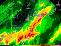
Storms plagued the state from the 14th into early on the 15th. An average month's worth of rain fell in just hours at a few locations, pea-size hail fell in Howell (Monmouth), and trees went down and power out in portions of central NJ. In Monmouth, Howell received 5.91", Millstone Township 4.35", and Belmar 4.24". Among 220 CoCoRaHS reports, six locations caught between 3.00"-3.99" and 26 had 2.00"-2.99". Totals tailed off to, at best, just a few tenths of an inch in the northwest and far south.
Storms resumed later on the 15th, and extended into the morning of the 16th. Rain was more widespread than the previous event, with scattered 2.00" plus totals in southern and central regions. There were scattered areas with less than 0.50" in the northwest, northeast and parts of the south. The area near the Monmouth-Ocean county border again took a beating. Two Brick (Ocean) stations received 3.76" and 3.73", while Howell saw 2.57". That brought the three-day total at Howell to 8.48". Two other impressive totals from the latest storm were 3.36" in Woodland Township (Burlington) and 2.80" at Woodstown (Salem). Flash flooding again accompanied the downpours and grape-size hail fell in Ewing Township (Mercer) and marble-size hail in Tabernacle Township (Burlington).
Rainfall was not nearly as plentiful in the last two weeks of July, with the exception of storms focusing on the southwestern corner of NJ on the 27th into the 28th. Berlin Township (Camden) caught 2.30", East Greenwich (Salem) 2.17", and Lindenwold (Camden) 2.05". Several homes were damaged by falling trees in Medford (Burlington).
The minimum barometric pressure across the state in July was approximately 29.50" on the 28th. The maximum was about 30.30" on the 19th.
Winds gusted to 40 mph or higher on nine July days. Wantage (Sussex) gusted to 44 mph and High Point Monument (Sussex) to 42 mph on the 2nd. The 3rd saw gusts to 60 mph at the Trenton-Mercer County Airport in Ewing, 46 mph at Stewartsville (Warren), 45 mph at Greenwich (Cumberland), and 43 mph in New Brunswick (Middlesex). There was the aforementioned 40 mph Arthur gust at Harvey Cedars on the 4th. High Point Monument reached 42 mph on the 7th.
The 8th was the windiest day of July with 14 stations gusting to 40 mph or higher. This included Oceanport (Monmouth) 50 mph, Cream Ridge (Monmouth) 48 mph, Sea Girt (Monmouth) 47 mph, Greenwich (Cumberland) and Silas Little (Burlington) 45 mph, Chatham Township (Morris) and Woodstown (Salem) 44 mph, Wantage 43 mph, Seaside Heights (Ocean) and Red Lion (Burlington) 42 mph, Berkeley Township (Ocean) and Kingwood (Hunterdon) 41 mph, and High Point Monument and Stewartsville 40 mph.
Berkeley Township gusted to 47 mph and Woodstown to 44 mph on the 14th, and Red Lion to 41 mph on the 15th. Wantage got to 41 mph and High Point Monument to 40 mph on the 28th.


