wildfires

Tempered Spring Advance: March 2023 Recap

April 8, 2023 - 3:52pm -- Dave Robinson

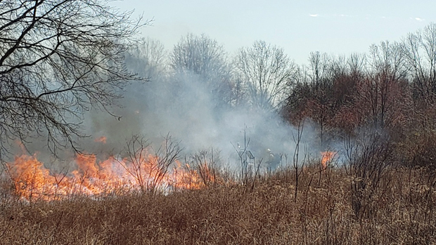
Controlled burn conducted near the Basking Ridge (Lord Sterling Park, Somerset County) Rutgers NJ Weather Network station by NJ Fire Service personnel on March 27th. Photo courtesy of Stephen Federico/Somerset County Park Commission.

While March temperatures came in above normal, they were not nearly as anomalously mild as those seen in January and February. This quelled concerns that an early blooming season might arise, one that could result in damaged vegetation had an early bloom been followed by an unseasonable cold spell. The average March temperature across NJ was 42.1°. This was 1.2° above the 1991–2020 normal and ranks as the 30th mildest March since 1895. The average maximum temperature of 52.2° was 1.3° above normal, ranking 37th mildest. The average minimum of 32.1° was 0.9° on the mild side, ranking 29th mildest. The National Centers for Environmental Information northern division averaged 39.8° (+1.0°, 31st mildest), the southern division 43.5° (+1.1°, 31st mildest), and the coastal division 43.7° (+1.5°, 23rd mildest).

Statewide, precipitation averaged 2.75”, which is 1.45” below normal and ranks 29th driest of the past 129 years. The northern coast and northeast were wettest and the southwest and far south driest. This was reflected in the northern division averaging 3.07” (-0.94”, 44th driest), southern 2.52” (-1.80”, 24th driest), and coast 2.84” (-1.58”, 30th driest).

March statewide average snowfall was 1.8”. This was 2.8” below normal and ranks as 49th least snowy. Northern counties averaged 5.4” (-1.8”, 56th least snowy), central counties 1.5” (-3.9”, 46th least snowy), and southern counties 0.0” (-2.7”, tied with 37 other years as least snowy).

Nondescript: June 2022 Recap

July 7, 2022 - 3:24pm -- Dave Robinson

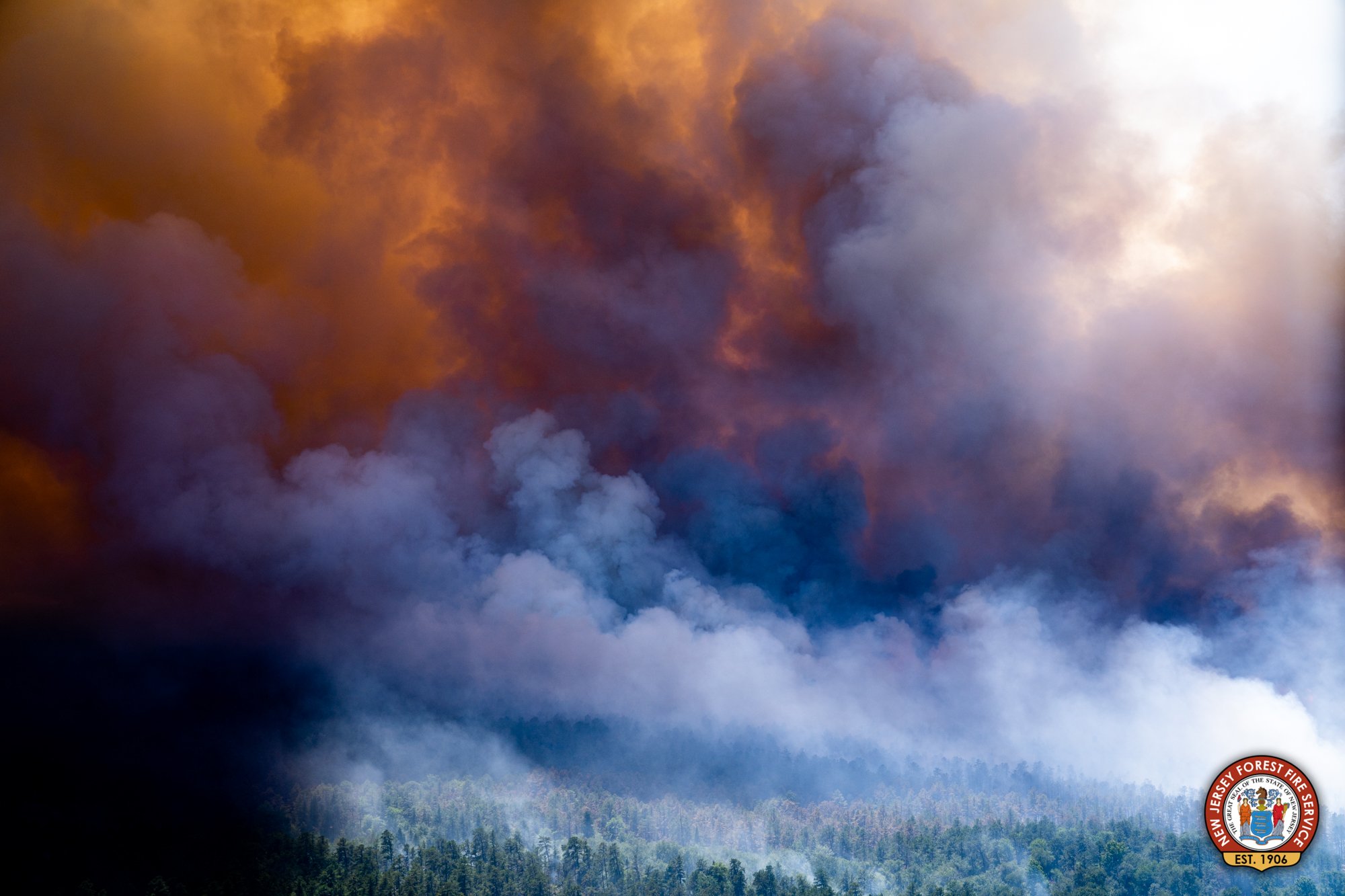
Smoke billows from a large wildfire in the Wharton State Forest around June 20th. Photo from the New Jersey Forest Fire Service.

As reported multiple times during the first half of 2022, the day-to-day weather and overall climate of the Garden State have varied frequently, exhibiting lots of variability and never “locking” into a given pattern for an extended period of several weeks or longer. Such was the case this June, making it difficult to define any conditions that dominated. June was somewhat drier than average, but eight events brought over an inch of rain somewhere within the state. It was also dry enough at one point for a wildfire to scorch over 13,000 acres of the Pine Barrens. Low temperatures fell into the upper 30°s and low 40°s at multiple locations on the 20th, yet three days earlier, the majority of the state saw highs in the low to middle 90°s. “Non-descript” seems the best way to sum things up.

Statewide, rainfall averaged 3.44”. This is 0.86” below the 1991–2020 normal and ranks as the 61st driest of the 128 Junes since 1895. The north received 3.59” (-1.02”, 61st driest), the south 3.39” (-0.75”, 61st driest), and coast 2.90” (-0.95”, 54th driest). As the map shows, the far south was driest, continuing a pattern seen in recent months. The June 30th U.S. Drought Monitor map has the bulk of the southern area seen on the Figure 1 map receiving less than 4.00” for the month classified as “Abnormally Dry” (D0). This rating is also a function of both low streamflow and ground water levels. Further north, pockets of above-average rainfall surrounded a below-average central region that has yet to have prolonged enough water deficits to qualify for D0 status.

Another End-of-Month Soaker…but First Some Flames: April 2014 Summary

May 10, 2014 - 4:44pm -- Dave Robinson

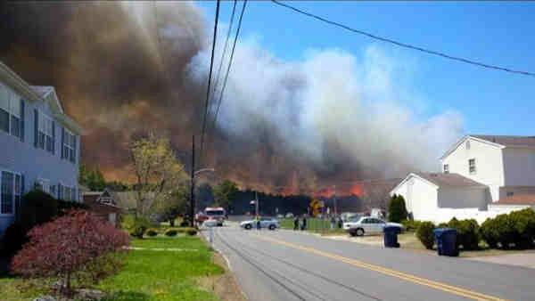
Wildfire photo

Was it a drier-than-average April? Was it a wetter-than-average April? If only it hadn't rained heavily on the last day of the month! Certainly this is a strange beginning to this monthly weather narrative. Let me explain before we get to the numbers. Most National Weather Service Cooperative observers, of which there are several dozen in New Jersey, take their daily observations in the 7-8 AM time range. So does nearly every NJ CoCoRaHS observer. These observations are recorded for the calendar day at hand, thus a day's weather records are complete as of the observation time. This means that any precipitation that occurs after the daily observation gets recorded the next morning (day). This is something that must be understood when evaluating daily precipitation reports, however, it does not make any difference in monthly totals except on the first and last day of the month. One of these exceptions occurred, in a big way, in April…or was it May?! Torrential rain fell during the daylight hours into the evening of April 30, part of an event that began lightly during the daylight hours of the 29th and ended just after observation time on the morning of May 1st (yes, meaning May 2 observations also were involved in storm totals). What up until then had been a somewhat dry April suddenly became a wet month…if you waited until midnight to take your observations. And believe it or not, some COOP stations do have observations taken at midnight. Confused? Can't blame you…

Amid dry and windy conditions, wildfires rip through portions of South Jersey

April 24, 2014 - 2:07pm -- Adam Rainear

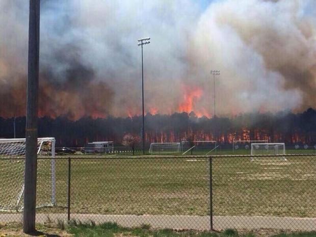
Wildfire photo

April showers typically bring May flowers, but when they fail to arrive in abundance and bundled with low humidity and gusty winds, wildfires become a major risk.

Just such a scenario unfolded across New Jersey experienced on Thursday April 24. Low dew points, combined with winds gusting over 30 mph, prompted the National Weather Service to issue Red Flag warnings across nearly all of the state both Wednesday and Thursday. Such warnings indicate a high risk for wildfires in wooded areas and grasslands. Unfortunately, fires did erupt in scattered locations around the state, with several large wildfires in Ocean and Cumberland counties.

Subscribe to RSS - wildfires