February Overview
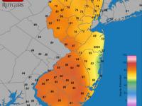
An amalgamation of cold and mild spells, a few moderate rain events, one significant snowstorm, and several local or minor snowfalls brought a rather average February in the weather department to New Jersey. Preliminary numbers indicate an average temperature of 32.5°. This is 1.3° below normal and 53rd warmest of the 119 Februaries since 1895. Precipitation averaged 3.28" (rain and melted snow/sleet), which is 0.42" above normal and 44th wettest. Snowfall averaged 6.8", which is 1.2" below normal and 53rd most snowy.
Examining precipitation further, coastal areas were wettest, while the northwest was driest. Lacey Township (Ocean County) topped the list with 5.68", followed by Linwood (Atlantic) with 5.22", Egg Harbor Township (Atlantic) 5.06", Upper Township (Cape May) 4.87", and Estell Manor (Atlantic) 4.81". The lowest total was 1.35" in Allamuchy Township (Warren), then Liberty Township (Warren) 1.56", Wantage Township (Sussex) 1.57", and Mt. Olive Township (Morris) 1.60". Snow was observed across the state on a number of occasions, of which five events resulted in 2.0" or more accumulating at one or more locations. Bethlehem Township (Hunterdon) saw 18.5" pile up, followed by 17.7" in Mine Hill Township (Morris). A number of other northern locations topped 10.0". Totals ranged from several inches to 10.0" over the remainder of the state.
A surprise storm struck the far southern reaches of NJ during the morning of the 1st. Seaville and Dennisville in Cape May County both picked up 7.5". Top totals in nearby counties included 3.5" at Linwood (Atlantic) and 3.0" in Newport (Cumberland). Areas farther north had little or no precipitation, although eight southern NJ counties reported at least a tenth of an inch of snow. At most, several tenths of melted equivalent precipitation were observed where the snow fell. A widespread light snowfall event dusted the entire state during the overnight hours of the 2nd-3rd. Reports of at least 0.1" came from all 21 counties, the top amount being 2.0" in Middle Township (Cape May), Newport (Cumberland), and Franklin Township (Gloucester). Again, nowhere did melted snow amounts exceed 0.20".
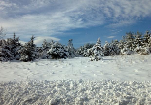
The major storm of the month, and for snow, the top event of the season (thus far), occurred during the pre-dawn hours of the 8th through daybreak on the 9th. While NJ escaped the multiple-foot totals of eastern Long Island and southern and eastern New England, the northeast corner of the state received more than 10.0". Top totals included the Bergen County communities of River Vale (16.8"), Woodcliff Lake (16.0"), and Franklin Lakes (15.0"). The largest totals in other counties with at least 10.0" included Roselle (Union; 14.2"), Vernon Township (Sussex; 14.1"), Chatham (Morris; 14.0"), West Caldwell (Essex; 14.0"), West Milford (Passaic; 13.7"), North Bergen (Hudson; 12.5"), and Allenhurst (Monmouth; 11.5"). At least 5.0" fell in other locations north of Interstate 195, 2.0"-5.0" fell from I-195 south to the Atlantic City Expressway, and less than 2.0" accumulated south of there. For much of the event, it rained in the southern third of NJ, while central locations saw a mix of snow, sleet and a little rain, and snow with a little sleet fell to the north. Rain and melted snow/sleet totaled 2.87" in Lacey Township (Ocean) and 2.30" at Berkeley Township (Ocean). Most coastal areas saw 1.50"-2.50", with totals gradually decreasing westward to 0.30"-0.50" in the Delaware Valley. Light to moderate drifting accompanied and followed the snow, as winds gusted in the 30 mph to 50 mph range in many locations on the 8th and 9th.
Centered on the morning hours of the 11th, light to moderate rain fell throughout NJ, some of it light freezing rain for a time in central and northern locations. Linwood (Atlantic) picked up 0.62", while 0.60" fell in Estell Manor (Atlantic), Pitman (Gloucester), and Washington Township (Gloucester). Other locations received 0.20" to 0.60". Next up was a modest event that brought a mix of rain and snow to the south and light snow north. Snow totaled as much as 3.3" in Bethlehem Township (Hunterdon), 3.0" in both Rockaway Township (Morris) and Ft. Dix (Burlington), and 2.5" in Stafford Township (Ocean). All counties saw some snow, while rain and melted snow amounted to 0.53" at Lacey Township (Ocean), 0.51" at Linwood (Atlantic), and 0.50" in both Estell Manor (Atlantic) and Wildwood Crest (Cape May).
Scattered higher elevations in the north received a measurable snow late on the 15th into the morning of the 16th. This included 5.1" at Highland Lakes (Sussex) and 3.3" in both Bethlehem and Holland Townships (Hunterdon). Melted precipitation in these areas and a localized area of rain in Cape May County amounted to several tenths of an inch. Elsewhere less fell. Most of NJ was dampened by 0.20"-0.40" of rain during the afternoon and evening of the 20th, with coastal areas only picking up a tenth of an inch. Flemington (Hunterdon) and Randolph (Morris) observed 0.47", while Washington Township (Morris) saw 0.46".
Rain fell statewide from the evening of the 22nd through the morning of the 23rd. Highest totals were in north coastal Monmouth County, including 0.83" at Belmar, 0.78" in Asbury Park, and 0.75" in Ocean Township. The coast had the most rain, with totals tapering to no more than 0.10" in the Delaware Valley. The 9th and final February event of note occurred on the late evening of the 26th through midday on the 27th. Once again, the north coastal area had the most rainfall with 1.57" in Holmdel (Monmouth) and 1.55" at Woodbridge (Middlesex). Coastal areas generally had from 1.00"-1.50", the southwest 0.50"-0.75", and the northwest 0.25"-0.50". About a quarter of an inch of icing occurred in freezing rain at the highest northwest locations.
The first ten days of February were on the cold side, accounting for five of the seven days of the month with daily low temperatures falling to 10° or lower at one or more of the 54 NJ Weather and Climate Network stations. The High Point and High Point Monument (Sussex) stations dropped to 8° on the 2nd. The 3rd found Walpack (Sussex) down to 8° and High Point at 9°. Walpack reached 9° on the 7th and High Point Monument 10° on the 9th. The fresh snow cover over the northern half of NJ on the 10th contributed to the coldest morning of the month. Walpack fell to -1°, Pequest (Warren) 0°, and 13 other stations were between 1° and 10°. West Cape May (Cape May) was the "mildest" location at 22°. A week later, the two High Point stations dropped to 8° on the 17th and 7° and 8° on the 18th.
In between the two coldest intervals, considerable mild air infiltrated NJ, promoting snow melt. The 11th-15th all saw one or more location reach at least 50° for a daily high. Five other days later in the month would see the same. Woodbine (Cape May) reached 56° on the 11th, with seven stations at 55°. Toms River (Ocean) topped out at 53° on the 12th, Greenwich (Salem) 51° on the 13th, and Cherry Hill (Camden) 50° on the 14th. The 15th was the mildest day of February, with 59° reached at Clayton (Gloucester), Sicklerville (Camden), Red Lion (Burlington), and Mansfield (Burlington). 45 other stations were between 50° and 58° and Atlantic City Marina (Atlantic) was coolest at 46°. The 19th saw seven stations reach 52°, with West Cape May (Cape May) to 50° on the 23rd and Egg Harbor (Atlantic) 52° on the 24th. The month ended with ten stations reaching 56° on the 27th, and Hawthorne 52° on the 28th.
The highest barometric pressures of February were achieved on the 7th and 10th when readings were close to 30.50". The lowest pressures of between 29.40" and 29.45" were experienced on the 27th.
Wind gusts equaled or exceeded 40 mph at one or more locations on nine days scattered throughout the month. The 1st brought gusts of 47 mph to Woodbine (Cape May), High Point Monument (41 mph), and Mullica (Atlantic; 40 mph). The storm on the 8th-9th saw a 46 mph gust at both Harvey Cedars (Ocean) and Sea Girt (Monmouth) and 43 mph in Point Pleasant (Ocean) on the 8th, with 53 mph at Wantage (Sussex) and 51 mph at High Point Monument on the 9th. 29 other stations gusted to between 30 mph - 43 mph on the 9th. The 17th was the windiest day of the month, with High Point Monument gusts reaching 59 mph and Wantage (Sussex) 52 mph. Nine stations gusted from 41 mph - 47 mph and 27 others from 30 mph - 39 mph. High Point Monument gusts reached 51 mph on the 18th, 54 mph on the 20th, and 50 mph on the 21st. On those three dates, Wantage gusts were up to 46 mph, 47 mph, and 45 mph, respectively. The 26th brought a 46 mph gust to Sea Girt, 42 mph at Pittstown (Hunterdon), and 41 mph at Harvey Cedars. Sea Girt gusted to 41 mph on the 27th.
Slippery roads associated with snowfalls posed the major weather hazard during February. There were no reports of wind damage, and coastal flooding was at most quite minor, with the exception of high tide on the morning of the 9th when minor to moderate flooding occurred along the north Jersey coast.
Winter Overview
Mild conditions in December (+5.2°) and January (+2.7°) more than outweighed a slightly below average February, leading to a winter averaging 35.7°. This is 2.2° above normal, and ranks as NJ's 13th warmest winter since 1895 (Table 1).
| Rank | Winter | Avg. Temp. |
|---|---|---|
| 1 | 2001-2002 | 39.2° |
| 2 | 1931-1932 | 38.9° |
| 3 | 1997-1998 | 38.5° |
| 4 | 2011-2012 | 38.3° |
| 5 | 1948-1949 | 37.3° |
| 6 | 1936-1937 | 36.8° |
| 7 | 1990-1991 | 36.6° |
| 7 | 1998-1999 | 36.6° |
| 9 | 1952-1953 | 36.5° |
| 10 | 1949-1950 | 36.4° |
| 11 | 1996-1997 | 36.2° |
| 12 | 1974-1975 | 35.8° |
| 13 | 2012-2013 | 35.7° |
| 13 | 1932-1933 | 35.7° |
| 15 | 2006-2007 | 35.5° |
| 15 | 2005-2006 | 35.5° |
Table 1. Warmest 16 winters in New Jersey since statewide records commenced in 1895.
Winter precipitation totaled 11.93", which is 1.68" above normal and ranks as the 28th wettest. This included anomalies of +1.88" in December, -0.61" in January, and +0.41" in February. No wide-scale flooding occurred at any time during the season.
Snowfall between December and February amounted to 11.3", which is 8.7" below average. When the 4.0" that fell early in November is added to this total, the 15.3" through the end of February results in the 44th least fall-winter snowfall since 1895. Perhaps spring events will add to this total.


