By mid-winter standards, January 2013 was not an exceedingly memorable one in the New Jersey weather and climate annals. But like every month, there were certainly events worthy of mention. This included the state's coldest week since 2007 and a surge of warmth late in the month that was broken by a squall line with strong winds and heavy rain.
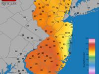
Statewide, the January temperature averaged 33.7°, which is 2.5° above average. This ranks as the 27th mildest January since 1895 (119 years). Of the past 24 months, only one (November 2012) has averaged below normal. Going back a bit further, since March 2010, 30 of the past 35 months have been above average, one month was exactly average, and four months were below average.
The first three weeks of the month were mostly on the mild side. On five of the first 20 days, one or more station topped out at 55° or higher. Cape May Courthouse (Cape May County) got to 59° on the 9th, when Woodbine (Cape May) and Egg Harbor Township (Atlantic) reached 57°. Greenwich (Cumberland) was 55° on the 12th and Berkeley Township (Ocean) 56° on the 13th. The 14th saw Egg Harbor Township at 60°, eight other stations in the 54 station NJ Weather and Climate Network reach 59° and nine at 58°. Five stations reached 58° and seven got to 57° on the 20th.
The last three days of January saw mild conditions return, with 59° highs at Cape May Courthouse, Woodbine, and Piney Hollow (Gloucester) on the 29th. The 30th brought unusual warmth, with South Harrison (Gloucester) up to 69°, eight stations at 68°, and eight at 67°. Only the far northeast and coastal stations failed to get into the warmth. Ramsey (Bergen) at 51° and Hawthorne (Passaic) 53° represent the former, while the coast stayed in the low to mid 50s. Mild conditions persisted into the early morning of the 31st, prior to a cold front barreling through the state by dawn. Before the front arrived, daily highs of 65° were recorded at Greenwich and Mansfield (Burlington), with 33 other stations between 60° and 64°. Even Hawthorne warmed to 62° and Ramsey to 59° in the overnight hours.
Cold air was to be found on occasion during January, with one or more stations falling under 10° on eight days. On only three days (12th, 13th, and 30th) did temperatures continually remain above freezing at every station in the state. On the opposite end of the spectrum, for five consecutive days (22nd-26th) the thermometer failed to top 31° at any location. This was the longest cold spell since early February 2007. It was made all the more impressive by the fact that cold-enhancing snow cover was mostly absent from all but the northwest portion of the state during this week.
Walpack (Sussex) fell to 6° on the 2nd, with High Point (Sussex) at 12° the next coldest location. Walpack and Wantage (Sussex) reached 6° on the 3rd, with High Point down to 7° (the High Point Monument station was out of service on both of these days). Sub-10° cold did not return until the 22nd, when High Point Monument bottomed out at 2°, High Point 3°, and eight other stations between 4°-9°. The next two mornings were the coldest of the month and the season thus far. Berkeley Township (Ocean) in the Pinelands dropped to -3° on the 23rd, followed by -1° at the two High Point stations and at Walpack. 31 other stations were between 0° and 9°, with West Cape May (Cape May) the "warmest" location at 17°. West Cape May had the same minimum on the 24th, when Walpack fell to -4°, Berkeley Township and High Point Monument -2°, and High Point -1°. 30 stations were between 0° and 9°. Kingwood (Hunterdon) bottomed out at 1° on the 25th, with 3° at Walpack and High Point Monument. Walpack was -1° on the 26th, Cream Ridge (Monmouth) and Pequest (Warren) 1°, with 30 other stations between 2° and 9°. Walpack fell to 0° on the 27th, with Berkeley Township and Pequest at 1°.
January 2013 precipitation (rain and melted snow/sleet) averaged 2.79" across NJ. This is 0.69" below average and ties with 1934 as the 42nd driest January on record. The most precipitation was observed in the Gloucester-Atlantic counties area of the south and in Warren and Passaic counties in the north. Washington Township (Gloucester) led the way with 4.44", followed by Linwood (Atlantic) at 4.27", Franklin Township (Gloucester) 4.18", White Township (Warren) 3.97", Blairstown (Warren) 3.89", and Ringwood (Passaic) 3.87". The south coast and the southern Morris/Union area came in on the low side. Long Hill Township (Morris) received 2.07", New Providence (Union) 2.18", Sea Isle City (Cape May) 2.19", Egg Harbor Township (Atlantic) 2.30", and both Little Egg Harbor Township (Ocean) and Middle Township (Cape May) 2.31".
Snowfall was relative meager in January, particularly in central areas. On average, 2.2" fell statewide. This is 4.9" below normal and ranks as the 22nd least snowy on record and the least snowy January since 2008 and second least since 1998. The north averaged 2.7", central NJ 1.1", and the south 2.5".
There were four events during January that brought an inch or more of precipitation to one or more locations and three depositing 2.0 or more inches of snow at multiple locations. During the PM hours of the 11th as much as 1.06" of rain fell in Belmar (Monmouth), 0.86" in Medford (Burlington), and 0.85" at Tabernacle (Burlington). The most rain fell in a northeast trajectory from the southwest to the northern coast, with only a few tenths of an inch in the far south and northwest. A few days later, rain from late on the 14th to early on the 15th fell most heavily on a northeast trajectory from Cumberland County to the central coast. Berkeley Township received the most with 1.34", Lavallette (Ocean) 1.25", and Hammonton (Atlantic) 1.05". Little or no rain fell in the northwest.
Late on the 15th through the first half of the 16th saw the southwest receive the most precipitation, with 1.47" in Washington Township (Gloucester) and 1.44" at Woodland Township (Burlington). Central and southern locations generally saw more than 0.75". Meanwhile, snow, sleet, and freezing rain fell in the north and snow, sleet, and mostly rain in central areas. The Piedmont reaches saw several tenths of an inch of snow and sleet, while more than an inch accumulated in northern portions of Warren, Morris, Passaic, and Bergen counties and throughout Sussex County. Top totals within these counties included Lafayette (Sussex) 4.8", Blairstown (Warren) 4.5", Wanaque (Passaic) and Oakland (Bergen) 3.8", and Butler (Morris) 3.5".
Scattered snow squalls crossed the state on the evening of the 21st, ushering in the coldest air of the season. Mostly under an inch of snow fell, and it was accompanied by lightning and thunder in Woodbine and Upper Township (Cape May). Most 1.0" totals were confined to Monmouth and Ocean counties, where Toms River (Ocean) caught 2.5" and Cheesequake (Monmouth) 2.0". The evening of the 25th saw scattered reports of 1.0"-2.0" of snow in the southern half of the state, with a few tenths elsewhere. A maximum of 2.5" was measured at Delran and Moorestown in Burlington County, as well as at Pennsauken (Camden) and Newport (Cumberland).
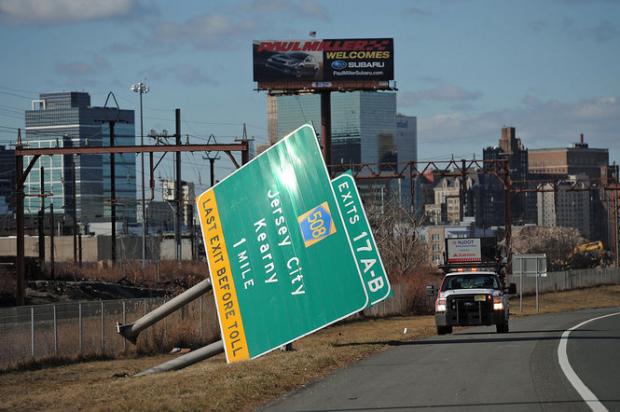
The last rain event of the month was the largest. A frontal system swept into the state late on the 30th and was through by dawn on the 31st. Of approximately 200 CoCoRaHS observers who reported event totals, 15 measured more than 2.00". This included totals of 2.69", 2.60" and 2.31" by three Blairstown (Warren) observers, 2.44" in White Township (Warren), and 2.35" at Liberty Township (Warren). The far northwest generally received from 1.50"-2.50", while 0.80" to 1.50" fell southeast of there to about the NJ Turnpike (including extreme southwest NJ), with totals gradually decreasing from there down to about 0.20" along the south coast. This event included an intense squall line of heavy rain and strong wind (without reports of lightning) that raced across NJ from west to east between 3 and 4 AM. This storm brought down trees and branches that contributed to as many as 50,000 customers temporarily losing power (see last paragraph below for observed gusts), and caused some localized flash flooding, in part due to the mostly frozen ground.
Barometric pressure was quite high during the bulk of January. Readings exceeding 30.50" were observed on six days, with the pressure highest on the 27th when 30.55"-30.58" readings were common. The storm on the 31st dropped pressures to impressively low values of between 29.00" and 29.05".
Fog was particularly widespread on the 13th and the morning of the 30th, resulting in airline delays and dangerous conditions on the roads.
It was not a particularly windy month, though many might feel otherwise given that the most persistent windy conditions were on the coldest days. On seven days at least one location gusted to 40 mph or greater. This included a 40 mph gust on the14th at perennially windy High Point Monument. On the 20th, Charlotteburg (Passaic) reached 45 mph, High Point Monument 44 mph, Pittstown (Hunterdon) 42 mph, and Sea Girt (Monmouth) 41 mph. The 22nd saw a gust to 41 mph at High Point Monument. The Monument station gusted to 51 mph on the 24th, when the high temperature was a bone chilling 13° and the low -2°. The next windiest station that day was Wantage (Sussex) at 37 mph. The Monument gusted to 43 mph on the 25th. The 30th brought gusts to 53 mph at Berkeley Township (Ocean) and Woodbine (Cape May). The windiest day of January was the 31st when the squall line and, later in the day, post frontal winds gusted to 63 mph at Sandy Hook (Monmouth), 59 mph in Tuckerton (Ocean), 57 mph at Woodbine and Berkeley Township and 55 mph at Oswego Lake (Burlington). Eight other NJWxNet stations saw gusts between 50-54 mph, 21 from 40-48 mph, 18 from 30-39 mph and the sheltered site in Cherry Hill (Camden) reaching 28 mph.


