Overview
Season transitional months are often known for the wide swings in daily and weekly weather conditions. October 2016 did not disappoint when it came to exhibiting such variability. Moisture associated with a weakening hurricane to the south contributed to south Jersey’s heaviest rain event. A modest late-month storm brought the first frozen precipitation of the season to northern counties. Record warmth for so late in the season was part of a dry mid-month week. Halloween eve seeing the temperature touch 80° in some locations before a thunder-strewn frontal passage dropped temperatures to more seasonal temperatures for trick or treating.
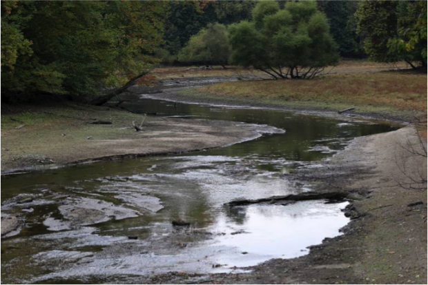
The overall weather pattern continued to produce below-normal precipitation over most of NJ. Since March, precipitation has been about two thirds of average across the northern half of the state. Most of the south has had three quarters of average, the exception being the far south, which averaged a bit above normal during the growing season. Following a drought hearing held by the NJ Department of Environmental Protection, the 20th saw a Drought Warning issued for NJ’s 14 northernmost counties (south to and including Ocean an Mercer counties). A drought watch is in place for Burlington, Camden, Salem, and Gloucester counties. Only Atlantic, Cumberland, and Cape May are immune from a watch or warning. At month’s end, the US Drought Monitor showed northern NJ in “severe drought”, tapering to “moderate drought” to “abnormally dry” to no designation moving southward and toward the coast. “Severe drought” is related with precipitation and associated hydrological conditions only found at a given time of year once every 10–20 years, thus in my opinion is worded somewhat too strongly.
October 2016 statewide average precipitation was 2.79”. This is 1.10” below the 1981–2010 normal and ranks as the 58th driest October of the past 122 years. The seesaw pattern of temperatures over the course of the month led to a mean of 56.7°. This is 2.2° above average and ranks as the 21st mildest October since 1895. The warm temperatures of September and October resulted in a one- to two-week delay in the fall foliage display, reminiscent of years such as 2011 and the exceptionally late season in 2007. The relatively dry growing season did not appear to have a major impact on the timing or color of fall foliage.
Temperature
By month's end, most NJ locations had observed frost and the first freezing temperature of the season. Only coastal and urban locations escaped having the growing season come to an end. Most places saw what was likely their last 80° afternoon, though some coastal locations and the highest elevations didn’t get above the 70°s in October.
There were nine October afternoons when the temperature reached 75° or higher at one or more of the 65 NJ Weather and Climate Network stations. Six locations saw 80° plus highs. Sicklerville (Camden County) hit 84° on the 17th, with 15 other NJWxNet stations at 83°. Hawthorne (Passaic) at 86° achieved the top mark on the 18th, with 10 stations at 85° and 15 at 84°. West Cape May (Cape May) was coolest with a 69° high. The 19th was one of the warmest late season-days on record across NJ. In fact the 88° maximum at New Brunswick (NJWxNet and NWS Cooperative Station; Middlesex) was the latest that mark or higher had been reached at this location in the past 124 years. It was close to the warmest for any NJ location so late in October, only surpassed by 89° in Hammonton (Atlantic) on October 21, 1947. Hamilton (Mercer) also made it to 88° on the 19th, with 19 stations either 86° or 87°, and 37 others between 80°–85°. High Point Monument (Sussex) only got to 73°. The 20th found Logan Township (Gloucester), Mannington Township (Salem), and Woodstown (Salem) up to 81°. This was also the maximum at Cherry Hill (Camden), Moorestown (Burlington), and West Deptford (Gloucester) on the 21st, when 13 other stations made it to 80°.
The 30th saw a brief surge of warmth bring the thermometer up to 81° at Hopewell Township (Mercer). Ten stations reached 80° and 46 stations were between 75°–79°.
On the cold side of the ledger, 11 days saw the temperature slip to or below freezing at one or more NJ locations. The 31° minimum at Walpack (Sussex) on the 10th marked the first freezing morning of the month and the second of the season, following Walpack’s 32° low on September 26th. Walpack reached 26° on the 11th, with Basking Ridge (Somerset) at 27° and Pequest (Warren) 28°. Cold air pooled in the valley at Walpack on the 14th, leading to a 28° minimum when no other NJ location reached the freezing mark. Basking Ridge topped Walpack’s 27° on the 15th with a low of 26°.
Walpack was alone at 32° on the 23rd, while Berkeley Township (Ocean) and Hopewell Township were 28° on the 25th. The most widespread freeze of the month occurred on the 26th when Pequest bottomed out at 22° and Basking Ridge 23°. 26 stations had minimums for 25°–29° and 18 others fell to 30°–32°. The mildest location was Atlantic City Marina (Atlantic) at 42°. High Point Monument and High Point (Sussex) fell to 27° and 29°, respectively, on the 27th. As a side note, the Monument station only made it to a high of 35° on the 27th, while Cape May Courthouse (Cape May) reached 65°.
Pequest was 29° on the 28th, with Hopewell Township and High Point Monument 31°. Basking Ridge, Kingwood (Hunterdon), and Pequest fell to 26° on the 29th, and Walpack 26°, Pequest 28°, and Basking Ridge 29° on the 31st, with the warm 30th sandwiched inbetween.
Precipitation and Storms
Coastal northern NJ was the wettest part of the state in October. Topping the list was 6.79” in Brick (Ocean), with another Brick station reporting 6.04”. Other totals exceeding 5.50” include Ocean Township (Monmouth) with 6.79”, Eatontown (Monmouth) 5.58”, Rumson (Monmouth) 5.55”, and Long Branch (Monmouth) 5.51”. West-central NJ had the least amount of October rain. Lebanon (Hunterdon) had two stations reporting 1.30” and 1.58”. Flemington (Hunterdon) saw just 1.31”, Far Hills (Somerset) 1.54”, Mendham (Morris) 1.55”, and Bernards Township (Somerset) 1.56”.
The first rain event of the month was mostly a carry over from a late September storm. As mentioned in the September report, most rainfall occurring after about 7AM on the 30th was counted in October totals (except for those stations with evening or midnight observation times). Rain ended before dawn on the 1st and amounted to 2.60”, 2.15”, and 1.76” at three stations in Brick, 1.89” in Brielle (Monmouth), and 1.84” at Ocean Township (Monmouth). The heavy rain was confined to the northern coast, though a few tenths were observed at scattered locations around NJ.
Late day and evening showers on the 3rd brought 0.96” to Eatontown (Monmouth) and 0.74” to Rumson. Little rain fell outside of a path from central Middlesex to northeast Monmouth counties. Rain returned from south to north on the afternoon of the 8th into the 9th, ending at midday. What likely would have been light rain from a cold front passage was greatly enhanced in south Jersey from moisture associated with Hurricane Matthew, which deluged the eastern Carolinas and resulted in disastrous flooding. Wildwood Crest (Cape May) received 3.10”. Other impressive Cape May County totals included 3.09” in Lower Township, 3.00”, 2.81”, and 2.50” at three Middle Township stations and 2.95” in North Wildwood. Of approximately 200 CoCoRaHS reports for the event, 20 were between 2.00”–3.10” and 67 from 1.00”–1.99”. There was a sharp cutoff to the 1.00” plus rains at the northern end of Burlington and Monmouth counties. Totals tailed off to under 0.10” north of the Route 1 corridor.
An almost completely dry ten days from the 11th–20th ended with morning rain in eastern areas on the morning of the 21st. Rain became more widespread later in the day and continued into the evening of the 22nd. Belmar (Monmouth) took top honors with 1.48”, followed by 1.30” and 1.24” at two Brick locations, Lavallette (Ocean) 1.30”, and Ocean Township (Monmouth) 1.24”. Close to an inch fell in northeast NJ, 0.50”–0.75” in northwest and north central areas and 0.25”–0.50” in southwest and west central locations.
To kick off the winter season, a few snowflakes were observed in the High Point vicinity on the morning of the 25th. This was followed by multiple reports of sleet with a few snowflakes mixed in on the morning of the 27th in Sussex, Warren, Morris, Passaic, and Bergen county locations. A light accumulation occurred at higher elevations, which was followed by a bout of freezing rain at the highest elevations during the daytime hours. About a quarter inch of ice accumulated on cold surfaces at High Point, with icicles extending about 10” off of benches and rooftops in the state park. Rain and melted frozen precipitation totaled as much as 1.21” in River Vale (Bergen), 1.12” at Palisades Park (Bergen) and Kearny (Hudson), 1.09”, 0.99”, and 0.97” at three Oakland (Bergen) locations, 1.08” and 1.05” at two Hawthorne sites, and 1.00” in Glen Rock (Bergen). Overall, the northern quarter of NJ caught over 0.50”, the middle half 0.25”–0.50”, and the southern quarter under 0.25”.
The last rain of October came with a cold front that traversed NJ from northwest to southeast in the late afternoon and evening of the 30th. Squalls brought locally strong winds, lightning, and rapid 20° drops in temperature. Given the fast movement of the front, totals were not too heavy, but locally amounted to 1.14” in Hardyston (Sussex), 1.03” in Red Bank (Monmouth), 0.98” at Colts Neck (Monmouth), and 0.94” in Flemington. Most central and northern locations caught 0.25”–0.50”, with under 0.10” falling in the far southeast.
The barometer rose to close to 30.50” on the 11th and close to that on the 26th–27th. By far the lowest readings of the month were found on the 21st–22nd at between 29.40”–20.45”.
Winds gusted to 40 mph or higher at one or more NJWxNet locations on an impressive nine October days. Stewartsville (Warren) reached 40 mph on the 1st. Northern fringe winds of Matthew and a frontal passage led to winds gusting to 46 mph at Harvey Cedars (Ocean), 44 mph at Fortescue (Cumberland), and 42 mph at High Point Monument on the 9th, with 16 other stations gusting between 30–39 mph.
Wantage (Sussex) achieved the top monthly gust of 55 mph on the 22nd, with High Point Monument at 49 mph, Fortescue 45 mph, Sea Girt (Monmouth), Harvey Cedars, and Pennsauken (Camden) all at 41 mph, and Point Pleasant (Ocean) 40 mph. The Monument reached 47 mph and Hillsborough (Somerset) 40 mph on the 24th. The Monument was up to 40 mph on the 24th. The 28th brought a gust of 49 mph at the Monument, with Wantage up to 44 mph and 24 NJWxNet stations gusting between 30–39 mph. Squalls on the 30th brought a 54 mph gust to Pennsauken, along with gusts to 51 mph at Moorestown, 49 mph at Columbus (Burlington), 47 mph in Oswego Lake (Burlington), 45 mph at High Point Monument, and 41 mph in Berkeley Township. The Monument reached 40 mph on the 31st.


