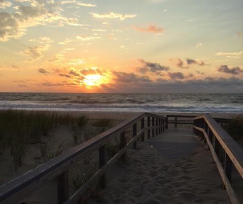
September 4th sunrise at Sea Girt (Monmouth County) as Tropical Storm Hermine lurked offshore (photo couretesy of Kathleen Melli).
Overview
Summer warmth continued into September, only beginning to relinquish its grip on the Garden State during the last week of the month. The average statewide monthly temperature of 70.1° was 4.3° above the 1981–2010 mean. This ranks as the 4th warmest September going back to 1895, with five of the eight warmest Septembers occurring since 2005. Seven of the most recent 13 months have ranked in the top 10 for warmth in their respective months.
| Rank | Year | Sept. Avg. Temp. |
|---|---|---|
| 1 | 1961 | 70.8° |
| 2 | 2015 | 70.6° |
| 3 | 2005 | 70.2° |
| 4 | 2016 | 70.1° |
| 5 | 1931 | 69.5° |
| 6 | 2010 | 69.2° |
| 7 | 1921 | 69.1° |
| 8 | 2011 | 68.9° |
| 9 | 1930 | 68.6° |
| 10 | 1998 | 68.3° |
Table 1. The 10 warmest Septembers across New Jersey since 1895.
Monthly rainfall averaged 3.36” across the state, which is 0.69” below average and ranks as the 61st driest of the past 122 Septembers. However, as discussed below, the average this month does not show the wide disparity of rainfall between the northern and southern parts of the state. While concerns for persistent dry conditions continued increasing across most of NJ through mid September, two soakings in the south alleviated worries in this region. Meanwhile, only one event of note produced totals exceeding an inch in much of the north, thus this region remains much too dry. As of the 27th, a good deal of north and central NJ was considered in moderate drought, with the remainder deemed abnormally dry according to the US Drought Monitor. North Jersey remained under a NJ Department of Environmental Protection “drought watch."
Precipitation and storms
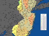
Cape May County was the focal point for heavy September rainfall. Cape May received 11.06” for the month, followed by Wildwood Crest with 9.82” and three stations in Middle Township with 9.38”, 8.97”, and 7.76”. Elsewhere in the county, Dennis Township caught 7.56”, Sea Isle City 7.01”, and Woodbine 6.94”. The next highest total was 6.24” in Estell Manor (Atlantic County). Far to the north, conditions were much drier, with two stations in Oakland (Bergen) catching the least for the month with 1.08” and 1.14”. In adjacent Passaic County, Ringwood received 1.12” and Bloomingdale 1.25”. In Sussex County, Hardyston only saw 1.34”, while Manville and Far Hills in Somerset County had monthly totals of 1.32” and 1.34”, respectively.
In many a month, this series of reports only chronicles precipitation events that resulted in at least one NJ station receiving an inch or more. However, given that only three such events occurred this past September, mention will also be made of five other events where at least a half-inch fell in one or more localities. The month began with occasional rain falling throughout the 1st. Most of the state saw at least several tenths of an inch, with central areas seeing the most. This included 1.38” and 1.37” at two Howell (Monmouth) observing stations, 1.10” at Jackson (Ocean), 1.07” in Robbinsville (Mercer), and 1.02” in both Matawan (Middlesex) and Montgomery Township (Somerset).
Showers associated with the remains of Tropical Storm Hermine grazed coastal sections late on the 6th into the 7th. Lavallette (Ocean) saw 0.60” and Berkeley Township (Ocean) 0.37”, while little to no precipitation fell elsewhere. As Hermine approached the Mid Atlantic on the 3rd, winds gusted to 37 mph at Harvey Cedars (Ocean) and Woodbine. As the storm lurked farther off shore than expected through the 6th, winds along the coast continued gusting close to 30 mph but never higher. Fortunately, only minor coastal flooding occurred, however beach erosion was deemed moderate in some locations due to the multiple days of pounding surf.
A few tenths of an inch of rain fell in the northwest and northeast corners of the state on the evening of the 9th. Top totals were 0.63” in Palisades Park and 0.57” in Wantage (Sussex). Nothing fell south of Interstate 78. A strong thunderstorm traveled east along the Interstate 80 corridor during the evening rush hour of the 14th. Some trees were felled by strong winds and a quick burst of rain deposited 0.62” in Fredon Township (Sussex), 0.69” in Sparta (Sussex), 0.81” in Rockaway (Morris), 0.85” at North Arlington (Bergen), and 0.67” in Kearny (Hudson). Less fell to the north and little to none further south.
Heavy rain soaked most of NJ on the 19th, generally moving through the state from the northwest through the southeast. The latter area took the biggest pounding, with 4.79” in Wildwood Crest, 3.73” and 3.82” at two Middle Township stations, West Cape May (Cape May) 3.79”, Atlantic City Marina (Atlantic) 3.73”, Harvey Cedars 3.35”, Egg Harbor City (Atlantic) 3.08”, and Ocean City (Cape May) 3.00”. Of the 220 CoCoRaHS stations reporting, 33 received between 2.00”–4.79” and 74 between 1.00”–1.99”. Two stations in Oakland were on the short end with 0.25” and 0.26”, while Bloomingdale saw only 0.28”.
North central and northeast locales saw thunderstorms on the 24th. Lyndhurst (Bergen) took top honors with 0.74”, followed by 0.65” in Boonton (Morris) and 0.62” at Little Falls (Passaic). Little to no rain fell elsewhere. Light to moderate rain again invaded northern sections during the predawn hours of the 27th. River Edge (Bergen) and Wayne (Passaic) each received 0.56”, with 0.25”–0.50” amounts in the northern third of NJ and less to the south.
The final event of September again dumped prodigious amounts of rain on the southernmost portion of the state. Rain began during the evening of the 28th and became moderate to heavy at times on the 29th. During the latter portion of the day, some heavier rain extended northward up the Delaware Valley. Rain continued throughout the 30th, but was only heavy for a time in middle and northern coastal areas (due to morning observation times for CoCoRaHS and most NWS Cooperative stations, rain falling during the daylight and evening hours of the 30th will count toward October totals). Elsewhere, mostly drizzle was accompanied by blustery easterly winds that commenced on the 29th. Gusts reached 46 mph at Harvey Cedars and Sea Girt (Monmouth) and 43 mph at Fortescue (Cumberland) on the 29th, and 47 mph in Sea Girt, 43 mph at Harvey Cedars, and 40 mph in Point Pleasant (Monmouth) on the 30th. Rainfall through the morning of the 30th totaled as much as 4.96” and 4.60” at two Middle Township stations, 4.30” at Wildwood Crest, 3.90” in Dennis Township, and 3.86” in Pennsville (Salem). Overall, an inch or more fell from southern Burlington and Ocean counties south, tapering off to 0.10” at best in the far northwest and most of the northeast.
Maximum barometric pressure for the month occurred on the 16th, with values close to 30.35”. Some northern areas approached this level on the 29th–30th, while southern areas remained at least 0.10” lower. Minimum pressure was in the 29.80”–29.85” range on the 1st and 8th. Aside from the aforementioned 40 mph wind gusts, the only NJWxNet location that could meet that mark in September was High Point Monument (Sussex) with a 44 mph gust on the 11th.
Temperature
Exemplifying the unusual warmth of the month, the thermometer topped 90° at one or more of the 64 NJWxNet stations on nine afternoons. A run of five such days began on the 7th with Logan (Gloucester) up to 91° and five stations at 90°. The 8th found Hamilton (Mercer) and Moorestown (Burlington) at 96°, with 39 stations between 90°–95°. Harvey Cedars and Point Pleasant were coolest that afternoon at 80°. The 9th was the warmest day of September with Sicklerville (Camden) at 98°, Berkeley Township and Oswego Lake (Burlington) each 97°, and 46 stations between 90°–96°. High Point Monument was coolest that afternoon at 81°, and daily minimum temperatures ranged from 69° at Pequest (Warren) and High Point Monument to 79° in Fortescue (Cumberland) and Point Pleasant. The 10th was almost as hot as the previous day, with Hamilton (Mercer) and Moorestown up to 98° and 39 stations between 90°–97°. Cape May Courthouse (Cape May) made it to 90° on the 11th.
Heat returned on the 14th, with Hamilton (Mercer) and Moorestown reaching 94° and 39 stations between 90°–93°. Oswego Lake, Hammonton (Atlantic), and Piney Hollow (Gloucester) got to 90° on the 18th. Hawthorne (Passaic) reached 90° on the 22nd and 91° on the 23rd, when Hamilton (Mercer), Haworth (Bergen), and Moorestown got to 90°.
With longer nights arriving and dry air frequently ensconced, minimum temperatures fell into the 30°s and 40°s at one or more NJWxNet stations on 16 September days. The coolest of stations were often northern valley locations such as Basking Ridge (Somerset) and Pequest. The often chilly Walpack (Sussex) station was out of service until the 26th, returning just in time to record the state’s first freezing temperature of the season. On eight days the low fell below 45°, beginning with 43° readings at Pequest and Basking Ridge on the 12th. The 16th saw Pequest down to 41° and Basking Ridge 42°. Basking Ridge was 43° on the 17th and Pequest and Berkeley Township each at 44°. Both Pequest and Basking Ridge fell to 44° on the 23rd, with the former at 43° on the 24th.
The first minimums of the season in the 30°s occurred on the 25th, with Pequest at 36°, Basking Ridge 37°, and Kingwood (Hunterdon) 38°. The 26th was the coldest morning of the month, with Walpack at 32° and both Basking Ridge and Pequest at 35°. Four other stations were in the upper 30°s and 45 were between 40°–49° on the 26th, while nearby still warm ocean and bay waters kept Atlantic City Marina and Harvey Cedars from dropping below 62°. The 28th saw a low of 39° at Pequest and 40° in Basking Ridge.
It is likely that New Jersey has seen its last 90° afternoon of 2016. Thus it is time to look back at counts of such hot afternoons this past season. New Brunswick (Middlesex) reached the 90° or higher mark on 39 days. This was 18 days above average and tied for the 3rd most days since 1912. The 40 days at Newark (Essex) were 13 above average. High Point Monument reached no higher than 89° this season. Annual 90° totals at these and other stations are listed in Table 2. Compared to last summer, these range from 0 (High Point Monument), 2 (Harvey Cedars), and 3 (New Brunswick) days greater on the low end and 24 (Upper Deerfield, Cumberland), 18 (Sicklerville), and 12 (Hawthorne) greater on the high end than last summer. The hottest temperature observed in New Jersey in 2016 was 100° at the Harrison (Hudson) NWS Cooperative station on August 14th.
| Station | County | Days |
|---|---|---|
| Hamilton | Mercer | 47 |
| Sicklerville | Camden | 44 |
| Newark | Essex | 40 |
| Hillsborough | Somerset | 40 |
| New Brunswick | Middlesex | 39 |
| Upper Deerfield | Cumberland | 39 |
| Hawthorne | Passaic | 38 |
| Haworth | Bergen | 32 |
| Woodbine | Cape May | 31 |
| Sea Girt | Monmouth | 17 |
| West Cape May | Cape May | 9 |
| Wantage | Sussex | 6 |
| Harvey Cedars | Ocean | 4 |
| High Point Monument | Sussex | 0 |
Table 2. Number of days in 2016 with a maximum temperature of 90° or higher at selected New Jersey locations.


