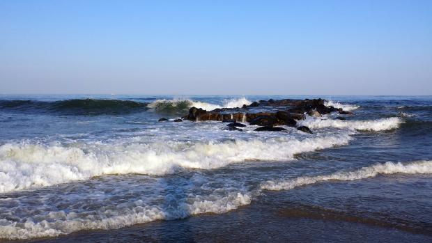
Hazardous surf along the beach in Belmar (Monmouth County) on August 25. (Photo credit: Doug Robinson)
August Overview
A month ago, many NJ residents felt July was quite cool, while in fact it was just 0.4° below the 1981-2010 mean. Such was not the case in August, which truly was on the cool side. The statewide average temperature of 71.0° was 2.4° below average. It ranks as the 32nd coolest since 1895. Even when compared to the 1895-present mean, the month was 1.5° below average. Days with a maximum temperature of 90° or greater were hard to find, certainly a characteristic of the summer of 2014, which will be discussed later in this narrative.
Precipitation varied widely across the Garden State in August, rather typical of a summer month in these parts. Individual station totals ranged from 12.33” in Lacey Township (Ocean County) to 1.01” in Hillsborough (Somerset). When monthly totals from several dozen long-term stations were averaged together, the statewide precipitation was 4.39”. This is 0.18” above the 1981-2010 mean (0.26” below the 1895-present mean) and ranks as the 53rd wettest of the past 120 Augusts. It must be noted that the heavy rain that fell after 8 AM on the 31st is not accounted for in most August station totals. For the monthly state average, only several stations that observe at midnight have their full August 31st totals included, while monthly totals at most other National Weather Service Cooperative stations only run through the morning of the 31st. For more on this observing practice, see the April 2014 report.
Precipitation and storms
The coastal counties of Ocean and Atlantic were wettest in August. In addition to the previously mentioned Lacey Township foot plus total, impressive accumulations were seen at a Stafford Township (Ocean) station with 10.39”, Lavallette (Ocean) 10.20”, Buena Vista (Atlantic) 9.70”, and Little Egg Harbor (Ocean) 9.57”. Two other Stafford stations came in with 9.19” and 8.58”. Scattered locations in northern and central sections often missed the passing downpours. In addition to the Hillsborough total (another station in that community caught 2.05”), other stations with under 1.50” to show for the month included Roxbury Township (Morris) 1.04”, Ringwood (Passaic) 1.16”, Mine Hill Township (Morris) 1.35”, Wantage (Sussex) 1.43”, and Flemington (Hunterdon) 1.47”.
There were only three August episodes that resulted in heavy rainfall in parts of NJ. For each, several stations received more than 3.00”, while little to none fell in other locations. Each event resulted in local flooding of small streams and roadways. The first included periods of showers from the afternoon of the 1st until mid morning on the 2nd, with the rain resuming later that day and continuing into the morning of the 3rd. Wildwood Crest (Cape May) took top honors with 3.79”, followed by Upper Township (Cape May) 3.65”, Egg Harbor Township (Atlantic) 3.46”, and Middle Township (Cape May) 3.45”. Six of the approximately 200 CoCoRaHS stations caught more than 3.00”, 20 between 2.00”-2.99”, and 50 from 1.00”-1.99”. The heaviest rain was in the southeast, with somewhat lesser amounts in the remainder of the southern half of the state, and tapering to no rain in portions of the northwest.
The next event brought excessive rain along a narrow path that extended from eastern Cumberland County northward to the southern coast of Monmouth County. An earlier report covered this overnight 12th into 13th event in some detail. The 8.94” that inundated Millville (Cumberland) is likely to only be seen at a given location in south Jersey once every 100 years. Other impressive totals were Lacey Township (Ocean) 8.35”, Stafford Township (Ocean) 7.24”, Buena Vista (Atlantic) 6.79”, Lavallette (Ocean) 6.55”, and Vineland 6.51”. Three other locations caught between 7.00-7.99”, five from 6.00”-6.99”, nine from 5.00”-5.99”, 12 between 3.00”-4.99”, and 49 from 1.00”-2.99”. In the northwest, Wantage only saw 0.05” and Branchburg (Somerset) 0.08”. Over an inch fell from Monmouth and Burlington counties southward. Flooding damaged roadways and the foundations of some homes.
Beginning with scattered showers in the north during the morning of the 21st and transitioning into drenching storms during that evening and early morning on the 22nd, heavy totals were observed in the Interstate 78 corridor. Greenwich Township (Warren) received 3.37”, Holland Township (Hunterdon) 3.21”, and one location in Bridgewater (Somerset) 3.00”. Four other Bridgewater locations caught 1.69”, 1.62”, 1.47” and 1.20”. Ten stations saw 2.00-2.99”, and 70 between 1.00-1.99”. At least an inch fell from Sussex County southeastward into Ocean County. The northeast corner and most of the southern third of the state saw several tenths, with less than 0.10” in the far southwest.
The aforementioned event on the 31st began with storms in the northern half during the afternoon and ended in south Jersey during the pre-dawn hours of September 1st. Rainfall exceeded 3.00” at several locations in Gloucester and Camden counties. This will be covered in more detail in the September narrative.
The highest pressures of the month were close to 30.30” on the 30th, while the lowest were in the upper 29.60”s on the 13th. Winds gusted to 40 mph or greater at NJWxNet stations on just three August days. Stewartsville (Warren) received a 44 mph gust on the 1st and Seaside Heights (Ocean) saw a 40 mph gust on the 12th. The windiest day of the month was the 13th, with coastal stations gusting to 50 mph at Harvey Cedars (Ocean), 46 mph in Sea Girt (Monmouth), and 40 mph at Seaside Heights. On the 13th, seven stations had peak gusts between 30-39 mph.
Temperature
Maximum temperatures equaled or exceeded 90° at one or more of the 56 NJWxNet stations on just four August afternoons. Hawthorne (Passaic) made it to 92° on the 5th, when six other stations reached 90°. It wasn’t until the last week of the month that 90° conditions reappeared. On the 26th, Hawthorne was 92° and Cherry Hill (Camden) 90°. The 27th saw Hawthorne up to 93°, Haworth (Bergen) at 92°, and six locations either 90° or 91°. The 31st was the warmest August day across NJ. Hillsborough (Somerset) and Greenwich (Cumberland) made it to 93°, seven stations were 92°, and 18 were either 90° or 91°.
There were a number of cool nights during the month. On 12 mornings, Walpack (Sussex), the often chilly northwest valley location, dropped into the 40°s. This was followed closely by Pequest (Warren) with 10 such days. On several occasions other locations reached the upper 40°s. Walpack dropped to 45° on the 7th, with Pequest at 48°. The 8th found Walpack at 43°, Pequest 46°, and Kingwood (Hunterdon) 49°. The 9th saw Pequest at 48° and Walpack 49°. The next day, Walpack was 47° and Pequest 49°. Walpack stood alone in the 40°s at 47° on the 14th. The two coolest mornings of the month statewide occurred on the 15th and 16th. The first day found Pequest at 44°, Walpack 45°, Kingwood 46°, and six stations between 47°-49°. On the 16th, Pequest made it down to 44°, Walpack 46°, and seven stations between 47°-49°. On the 18th-19th, Walpack was 42° and 43°, respectively, and Pequest 47° both days. Walpack was 48° on the 28th, and 42° on the 29th, when Pequest dipped to 44°. The 30th saw Walpack at 46° and Pequest 47°. Coastal stations failed to dip below 60° throughout the month, only reaching 60° or 61° on several occasions at locations including Seaside Heights (Ocean), Harvey Cedars (Ocean), Atlantic City Marina (Atlantic), and West Cape May (Cape May).
Summer Overview
Perhaps the best word to describe the 2014 summer (June-August) is “comfortable.” Statistically, the primary word is “average.” The average temperature of 72.1° was 0.7° below the 1981-2010 mean. However, it ranks as the 54th warmest of the past 120 summers, and compared to the 1895-present mean it was 0.1° above average. The first half of the summer was on the warm side, while conditions from mid July through August were cooler than average. There were frequent transitions from warm to cool temperatures and back again. This resulted in the absence of extended periods of heat and humidity. In fact, there were only two occasions when some, but certainly not all, locations around NJ experienced three consecutive days with maximum temperatures equal or exceeding 90°. These were July 1-3 and July 7-9. The total number of 90° days were below average throughout NJ (recognizing that September days will add to totals). This followed four consecutive summers with temperatures averaging in the top 15, an unprecedented run of abnormal warmth.
Summer precipitation averaged 13.00”. This is 0.25” above the 1981-2010 mean, and just 0.07” above the 1895-present mean. This ranks as the 56th wettest on record. Leading the way was Lacey Township (Ocean) with 19.24”, followed by Belmar (Monmouth) with 18.26”, Howell (Monmouth) 17.88”, Buena Vista (Atlantic) 17.45”, and Wall Township (Monmouth) 17.24”. Pockets of drier-than-average conditions were found around the state. In the southwest corner, Upper Deerfield (Cumberland) caught only 9.41”, while elsewhere in the south Collingswood (Camden) came in with 10.24” and Wildwood Crest (Cape May) with 10.89”. In the north, Boonton (Morris) received just 10.10” and Blairstown (Warren) 10.64”.
Another characteristic of the summer of 2014 was the abundance of stellar weekend and holiday weather days. Going back to Memorial Day weekend (May 24th-26th) and extending through Labor Day (September 1), we evaluated the 33 weekend/holiday days. This included looking at maximum temperatures, daily precipitation, and average solar radiation at a handful of stations up and down the coast (though results generally hold throughout the state). A combination of these observations and some subjective judgment had us awarding each day a double thumbs up, thumbs up, neutral, thumbs down, or a double thumbs down. For the season, 11 days earned a double thumbs up, 10 a single thumbs up, 6 were neutral, 5 a thumbs down and 1 a double thumbs down. Memorial Day and Labor Day each received double thumbs up and were both considerably warmer than July 4th, which earned the single double thumbs down. A dreary 4th was due to the western edge of Hurricane Arthur impacting coastal areas and a stalled front providing light rain and clouds in the north. While ratings aren’t available for previous summers, we are confident that not too many recent ones have been any nicer than 2014.


