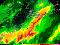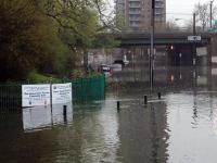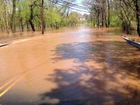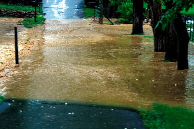
Flash flooding in Stewartsville (Warren County) on June 13. Photo courtesy of Dave Dabour
June Overview
The statewide average temperature in June was 70.6°. This is 0.5° above normal and ranks as the 29th warmest since 1895. More than a few people may be inclined to think the month was cooler than average. This might be due to the absence of an extended hot spell, the thermometer remaining below 90° over most of the northern third of the state, or a continued reaction to the earlier cold start of 2014 (more on this later).
June precipitation averaged 3.15", which is 0.87" below normal and ranks as the 47th driest. As expected during a warm-season month, rainfall was quite variable around NJ, ranging from 6.49" in Denville (Morris County) to 0.38" in Sea Isle City (Cape May).
Precipitation and storms
In addition to the Denville total, other locations in north Jersey had abundant June rain. This includes Mansfield (Warren) with 6.42", Rockaway (Morris) 6.24", Greenwich Township (Warren) 6.15", and 27 other CoCoRaHS stations with 5.00"-5.99" (out of almost 200 statewide stations with monthly totals). Joining Sea Isle City on the dry side were other south Jersey locales including Woodbine (Cape May) with 0.66" and 0.80" (two CoCoRaHS stations), Middle Township (Cape May) 1.06", Tabernacle (Burlington) 1.63", and Estell Manor (Atlantic) 1.97".
There were seven June events of one to several days duration where an inch of rain or more was observed at multiple locations. The first was during the afternoon and evening of the 3rd when thunderstorms dropped 1.44" in Princeton (Mercer), 1.20" at Montague (Sussex), and 0.98" in Peapack-Gladstone (Somerset). Several tenths of an inch fell from Mercer County northeast to Bergen County, with a few scattered heavy pockets elsewhere.
The evening of the 4th into mid morning on the 5th brought showers and thunderstorms to the entire state. Most locations received at least several tenths, and there were two heavy bands extending from Salem to southern Ocean counties and Warren to Bergen counties. Franklin (Gloucester) saw 2.06", Lacey Township (Ocean) 1.49" and 1.46", and 1.47" fell at two Stafford Township (Ocean) locations. The morning of the 9th brought storms across NJ north of Interstate 195, with the heaviest rain mainly between Interstates 78 and 80. Kearny (Hudson) caught 2.90", Woodbridge (Middlesex) 2.53", Harrison (Hudson) 2.22", Kenilworth (Union) 2.11", Maplewood (Essex) 2.10", and Mt. Olive (Morris) 2.04". Some 64 other CoCoRaHS stations received 1.00"-1.99".
Localized torrential rain on the afternoon of the 10th caused flash flooding in portions of Gloucester County, where Pitman received 4.11", Monroe 2.69", Washington Township 2.54", and Clayton 2.04". Little rain fell outside of Gloucester and, in fact, East Greenwich Township in western Gloucester received only 0.06".
Scattered showers and drizzle fell on the 11th and 12th, with strong storms impacting an area from Warren and Sussex counties east to Bergen County on the morning of the 13th. These storms were accompanied by pea size hail in Rockaway Township (Morris), tree and wire damage in spots, and local street flooding. Most of NJ had only a few tenths of an inch of rain during the three-day interval, however, due to the storms on the 13th, Blairstown (Warren) caught 4.16", Mansfield (Warren) 3.31", and Washington Township (Warren) 3.17". Some 39 stations received over 2.00", with 67 stations between 1.00"-1.99".
Showers during the daylight hours of the 19th resulted in three areas of 0.50" or greater rainfall, one extending from Cumberland to Atlantic counties, another in the west central counties, and the third in the extreme northwest. Mt. Laurel (Burlington) received 0.94", Estell Manor (Atlantic) 0.82", and Ewing (Mercer) 0.81". The final rain event of the month occurred from the late afternoon of the 25th into the early hours of the 26th. A swath of 0.50"-1.50" fell from Mercer/Hunterdon counties to Bergen County. Elsewhere, several tenths fell. Long Hill Township (Morris) received 1.82", Montgomery Township (Somerset) 1.81", Bernards Township (Somerset) 1.52", and Glen Rock (Bergen) 1.43".
The minimum barometric pressure in June occurred on the 5th, at 29.55"–20.60". The maximum was on the 1st, when pressures were 30.35"–30.40". Winds were not all that strong during June. While local areas may have had strong gusts in thunderstorms that missed our recording sites, the highest “official" gust of the month was 40 mph at Wantage on the 6th. Overall, the windiest day was the 19th when five stations gusted to between 30 and 39 mph, and nine more between 25-29 mph.
Temperature
Maximum temperatures equaled or exceeded 90° at more than one NJWxNet station on four June afternoons. Ten stations hit 90° or higher on the 3rd, with four stations topping out at 92°. A two-day hot spell began on the 17th when 93° was reached at New Brunswick (Middlesex) and 26 other stations were between 90° and 92°. This heat was exceeded on the 18th. In particular, the southeast portion of NJ all the way to the coast was hottest that day with Cape May Court House and Dennis Township, both in Cape May County, reaching 96°. Highs of 90° to 95° were observed at 36 of the 53 NJWxNet stations. This included the Atlantic City Marina station (Atlantic) getting to 95°. New Brunswick and Hillsborough (Somerset) reached 91° and Berkeley Township 90° on the 25th.
Six June mornings saw minimum temperatures fall to 45° or lower at some NJWxNet stations. Walpack (Sussex) dropped to 39° on the 1st and Berkeley Township (Ocean) was 40°. The 2nd was the coolest morning of the month, with Oswego Lake (Burlington) down to 38° and both Berkeley Township and Woodbine (Cape May) at 40°. Five other stations were between 41° and 45°. Walpack dropped to 42° and Pequest to 44° on the 7th and Walpack to 45° on the 8th. Later in the month, Walpack fell to 42° and Pequest to 45° on the 20th, with Walpack at 43° on the 21st.
2014: First Half Overview
Statewide, the first six months of 2014 averaged 45.8°. This is 2.2° below normal and ranks as the 31st coolest since 1895. It was the coolest start since 2003, which was 45.0° and ranked 15th. Before then you have to go back to 1982 (45.3°), which ranked 20th. The chilliest was 1907 at 43.2°.
Precipitation (rain and melted snow) averaged 24.76" across NJ from January through June. This total is 2.11" above normal and is 26th wettest. Since 2003, four January-June intervals have been wetter, including last year. 2011 ranked one notch drier at 27th. The wettest first half of the year was 1983 at 32.51".
An examination of stations within the CoCoRaHS network shows Morris and Hunterdon counties had the wettest first six months of the year. Cape May County and portions of Atlantic and Ocean counties were the driest, with the far northwest corner of NJ also on the low side. Six month totals over 30.00" include Holland Township (Hunterdon) 31.61", Rockaway Township (Morris) 31.47", Mine Hill Township (Morris) 31.38", Lebanon (Hunterdon) 30.91", Washington Township (Morris) 30.11", and Bethlehem Township (Morris) 30.07". On the dry side, Wildwood Crest (Cape May) came in with 19.19", two Woodbine stations (Cape May) caught 20.53" and 22.24", Wantage (Sussex) 21.44", Brick (Ocean) 22.46", and Estell Manor (Atlantic) 22.49".


