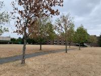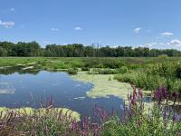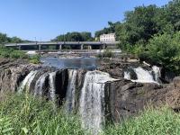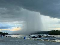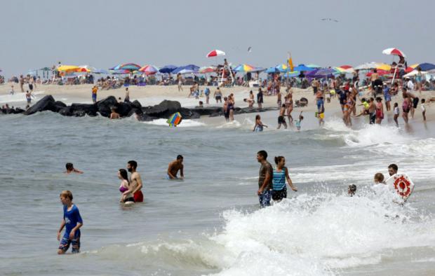
August featured an abundance of excellent beach weather thanks to above-average temperatures and below-average precipitation (photo by Amanda Marzullo/NJ.com).
August Overview
While above-average temperatures persisted from July into August, the precipitation regime did a 180° reversal between months. A 9th warmest July transitioned to a 2nd warmest August across the Garden State, based on records extending back to 1895. The 14th wettest July proved to be a hydrological blessing following the 20th driest June and preceding the 9th driest August. While August ended with most of New Jersey designated as “abnormally dry” and the northeast in “moderate drought” according to the US Drought Monitor, and north Jersey remained under a NJ Department of Environmental Protection “drought watch,” water supplies would have been in far worse shape come late summer had July been dry.
The 2nd ranked temperature of 77.0° only fell behind 2005 (Table 1). This is 3.6° above the 1981–2010 mean. Nine of the 15 warmest Augusts of the past 122 years have occurred since 2002, a pattern similar to that of July temperatures and, as discussed below, summers (June–August) as a whole.
| Rank | Year | Aug. Avg. Temp. |
|---|---|---|
| 1 | 2005 | 77.4° |
| 2 | 2016 | 77.0° |
| 3 | 1955 | 76.2° |
| 3 | 2002 | 76.2° |
| 5 | 1900 | 76.0° |
| 6 | 2001 | 75.8° |
| 7 | 2009 | 75.6° |
| 8 | 1988 | 75.5° |
| 9 | 1980 | 75.4° |
| 9 | 2003 | 75.4° |
| 9 | 2010 | 75.4° |
| 12 | 1937 | 75.1° |
| 12 | 2012 | 75.1° |
| 14 | 1938 | 75.0° |
| 14 | 2006 | 75.0° |
Table 1. The 15 warmest Augusts across New Jersey since 1895.
August rainfall totaled 2.05”, which is 2.16” below normal (Table 2). This is the driest August since 1995, and followed another dry August last year, which ranked 14th. The bulk of the month had little rain, as some of the 2.05” fell during the daytime and evening of July 31st, which, given the morning observation times of most of the National Weather Service Cooperative Stations that go into the generation of the average, is counted as falling on August 1. Some of the heavier rain persisted into the morning of the 1st.
| Rank | Year | Aug. Avg. Precip. |
|---|---|---|
| 1 | 1964 | 0.90" |
| 2 | 1916 | 1.28" |
| 3 | 1896 | 1.75" |
| 4 | 1918 | 1.77" |
| 5 | 1995 | 1.92" |
| 6 | 1972 | 2.00" |
| 7 | 1925 | 2.01" |
| 8 | 1943 | 2.02" |
| 9 | 2016 | 2.05" |
| 10 | 1980 | 2.09" |
| 11 | 1917 | 2.11" |
| 12 | 2005 | 2.13" |
| 13 | 1957 | 2.17" |
| 14 | 2015 | 2.20" |
| 15 | 1984 | 2.32" |
Table 2. The 15 driest Augusts across New Jersey since 1895.
Temperature
August began with some relief from the hot days of July. Seven of the first nine days saw minimum temperatures falling into the 50°s at one or more of the 60 NJ Weather and Climate Network locations. Basking Ridge (Somerset County) had a low of 59° on the 2nd, and fell to 54° on the 3rd, when 15 other stations were between 57°–59°. Basking Ridge reached 51° on the 4th and Pequest (Warren) 52° on the 4th, with 27 stations between 54°–59°. The 5th saw Berkeley Township (Ocean) and Basking Ridge at 54° and 22 stations between 55°–59°. Pequest fell to 55° and Basking Ridge 57° on the 7th, followed by 55° and 56°, respectively, on the 8th, and 55° and 54° on the 9th. By now, frequent readers of these reports may have noticed the absence of a mention of the Walpack (Sussex) station that often has some of the chillier NJ lows. This station was damaged earlier in the summer and conditions at the site have yet to permit repairs.
Eight of the last ten days of the month had lows in the 50°s, and, on one day, 40°s. A refreshing air mass sent lows down to 51° at Pequest and Basking Ridge on the 22nd. The coolest morning of the month followed on the 23rd, with Pequest at 46°, Basking Ridge 47°, four stations at 48° or 49°, and 37 stations between 50°–55°. Harvey Cedars (Ocean) was mildest at 65°. Basking Ridge was 51° on the 24th, with Pequest and Oswego Lake (Burlington) 52°. Oswego Lake was 55° on the 25th, Pequest 57° on the 27th, Basking Ridge and Pequest each 55° on the 28th, Pequest 59° on the 29th, and Pequest 53° and Basking Ridge 54° on the 30th.
The daily maximum temperature topped out at 90° or higher somewhere in NJ on 19 August afternoons. Adding insult to injury were high humidity levels during a mid-month heat wave. The first 90° day arrived on the 6th, with four stations up to 91° and 18 at 90°. Three stations reached 90° on the 7th. South Harrison (Gloucester) and one of the newest NJWxNet stations in West Deptford (Gloucester) got to 93° on the 10th. Hawthorne (Passaic) had a 96° maximum and six stations reached 95° on the 11th. This was the first in a string of exceedingly humid days that contributed to unusually warm nighttime minimums. For instance, Fortescue (Cumberland) only fell to a low of 81° and both Lyndhurst (Bergen) and Bivalve (Cumberland) 80° on the 11th. Five stations achieved maximums of 97° on the 12th, with 51 between 90°–96°. Fortescue and Bivalve did not fall below 81° for lows, with 35 stations between 75°–80° on the 12th.
The 13th was the most uncomfortable day of the summer, and on par with some of the worst on record across New Jersey. Maximum temperatures topped out at 99° in Haworth (Bergen), Toms River (Ocean), and West Deptford, with 53 other NJWxNet stations between 90° and 98°. Harvey Cedars was least hot at 84°. Fortescue never got below 83° for a low and 15 stations had lows of 80°–82°. With dew point temperatures nearing 80° in many locations, the mid afternoon heat index was in the 110°–115° range, with a few locations briefly higher. It was somewhat fortunate that this was a Saturday, much like the hottest day this past July (23rd), as energy demands were reduced and fewer individuals were toiling outside than would have been the case during the workweek.
The heat continued on, with a NWS Cooperative station in Harrison (Hudson) reaching 100° on the 14th for NJ’s only century mark reading of this summer. Four NJWxNet stations sweltered at 98° on the 14th, with 51 others between 90°–97°. Piney Hollow (Gloucester) got to 95° and ten other sites to 94° on the 15th. Piney Hollow, Sicklerville (Camden), and Upper Deerfield (Cumberland) were 94° on the 16th, with this mark reached at Atlantic City Marina (Atlantic) on the 17th. Cherry Hill (Camden), Hamilton (Mercer), and Woodbine (Cape May) topped out at 91° on the 19th, four stations reached 92° on the 20th, and Pequest and Hawthorne saw 90° on the 21st.
The 90°s returned for the last six days of the month, starting with 96° at West Creek (Ocean) and 95° at three other stations on the 26th. Nine stations got to 92° on the 27th and Hamilton (Mercer) reached this mark on the 28th. Hamilton’s late-month run of hot days continued on the 29th at 95°, with six stations reaching 94°. Hamilton made it to 91° and six stations 90° on the 30th. Hamilton, along with a new NJWxNet station in Moorestown (Burlington), were 93° on the 31st, when 21 sites rose to 90°–92°.
Precipitation and storms
While August statewide rainfall was less than half of normal, there were a few locations that came in on the positive side. This included the region in and near the northern Highlands, where Bloomingdale (Passaic) totaled 7.82”, Wayne (Passaic) 7.03”, Ringwood (Passaic) 6.33”, and two stations in Oakland (Bergen) 6.27” and 5.95”. Elsewhere, 6.09” accumulated in Lebanon (Hunterdon) and Andover (Sussex) saw 6.01”. It is worth a look at totals without the first day of the month included, thus eliminating the bulk of the rain that fell on July 31st. In this case, the last 30 days of the month saw maximum totals of 5.63” in Andover, 4.48” at Bloomingdale, 4.29” in Hampton (Hunterdon), and 4.16” at Califon (Hunterdon). These totals are included to demonstrate how most of the month and much of the state was quite dry throughout August.
On the lowest end of the precipitation list was Galloway (Atlantic), with only 0.62” for August. Other south and central locations with meager totals included Robbinsville (Mercer) at 0.67”, Moorestown 0.79”, Old Bridge (Middlesex) and Hammonton (Atlantic) each with 0.80”, and Pitman (Gloucester) 0.81”. Removing any rain reported on the 1st found the three driest stations over the last 30 days of the month to be Eatontown (Monmouth) with 0.44”, Galloway 0.57”, and Old Bridge 0.58”.
The event that began on July 31st and ended during the morning of the 1st brought Flemington (Hunterdon) 3.72”, Berkeley Township 3.65”, and Wayne 3.58”. These heavy totals were within portions of Hunterdon, northern Passaic, northwest Bergen, and Ocean counties that had totals exceeding an inch. Less fell elsewhere, with nothing in the southwest.
A squall line moved from north to south Jersey late in the afternoon and into the evening of the 6th. Hardyston (Sussex) received 0.99”, Toms River 0.96”, Bloomingdale 0.87”, and Andover 0.85”. A few lines of showers crossed northern and central portions of the state from late on the 9th through midday on the 10th. Warren, northern Hunterdon, and western Morris counties received the most, with 1.79” in Hampton and 0.74” at Califon.
The 11th through 13th found afternoon and evening storms impacting scattered portions of the state. The 11th event saw 34 of the 202 CoCoRaHS reporting stations receive at least an inch of rain. Topping the list was Glen Gardner (Hunterdon) with 2.34”, Montague (Sussex) with 2.21”, Andover 2.13”, and Wantage (Sussex) 2.12”. Little or no rain fell in the south. Storms on the 12th brought 1.06” to Upper Freehold (Monmouth), 0.88” to Pennington (Mercer), and 0.72” at Burlington (Burlington). There were reports of trees and power lines brought down by localized strong winds in Hunterdon and Bergen counties. Warren County saw similar wind damage from storms late on the 13th. The northern tier saw the most rain, with Andover catching 1.01”, Bloomingdale 0.75”, and reports of 0.70” and 0.71” from Oakland. Again, no rain fell in the south.
The evening of the 16th into the early morning of the 17th found storms dumping 1.00” at North Arlington (Bergen) and 0.81” at both Helmetta (Middlesex) and Chatham (Morris). Most central and northern locations received a few tenths of an inch of rain. Some tree and wire damage was reported in Sussex County. The 17th into early 18th saw a shift of rain to the south. Upper Township (Cape May) caught 0.86” and Woodbine 0.80” as a small area close to the intersection of Cape May, Atlantic, and Cumberland counties was soaked. Late in the evening of the 18th, heavy rain fell from Gloucester and Salem counties into western Atlantic County. Franklin (Gloucester) received 1.65”, Buena Vista (Atlantic) 1.10”, and Woodstown (Salem) 0.93”.
The afternoon and evening of the 20th brought 1.00” to Bloomingdale, a favorite target of storms this month, and 0.78” to both Edison (Middlesex) and Madison (Morris). Those same hours on the 21st found soakings of mainly 0.75”–1.25” along the northern and southern tiers of the state, with little falling in between. Wayne received 1.72”, Denville (Morris) 1.36”, Dennis Township (Cape May) 1.35”, and Upper Deerfield 1.31”. Winds toppled trees in Cape May County. Following a dry week, the 1.00” fell in Upper Township and 0.66” in Woodbine on the 30th, with showers covering a region similar to that of the 17th–18th event.
The lowest atmospheric pressure of the month was observed on the 6th, with many barometers across NJ registering between 29.65”–29.70”. Highest pressure occurred on the 23rd, running about 30.35”–30.40”.
Winds gusted to 40 mph or greater at scattered NJWxNet stations across NJ on five days. Wantage got to 42 mph on the 11th, Charlotteburg (Passaic) reached 42 mph on the 13th, Fortescue and Charlotteburg each peaked at 45 mph on the 14th, and High Point Monument (Sussex) and Fortescue made it to 40 mph on the 17th. Overall, this was not a windy month.
Summer Overview
Statewide, the summer (June–August) average temperature was 74.9°. This is 2.1° above the 1981–2010 mean and 2.9° above the 1895–2015 mean. The summer was the 4th warmest since 1895, joining many other recent summers ranking high (Table 3). Nine of the 15 warmest summers of the past 122 years have occurred since 1999. The number of days with stations with maximums of 90° or higher is running somewhat higher than average. Given that some stations had 90° readings in May and many are likely to experience them in September, a full accounting will appear in the September report.
| Rank | Year | Summer Avg. Temp. |
|---|---|---|
| 1 | 2010 | 76.2° |
| 2 | 2005 | 75.6° |
| 3 | 2011 | 75.2° |
| 4 | 2016 | 74.9° |
| 5 | 1949 | 74.6° |
| 6 | 1999 | 74.5° |
| 6 | 2012 | 74.5° |
| 8 | 2002 | 74.4° |
| 9 | 2006 | 74.3° |
| 10 | 1955 | 74.1° |
| 11 | 2008 | 74.0° |
| 12 | 1900 | 73.9° |
| 13 | 1943 | 73.8° |
| 13 | 1973 | 73.8° |
| 13 | 1988 | 73.8° |
Table 3. The 15 warmest summers (June–August) across New Jersey since 1895.
As discussed earlier, NJ was indeed fortunate to receive some ample rainfall in July, as June and August were not nearly as cooperative. The 11.55” statewide average rainfall for the summer is 1.20” below the 1981–2010 mean (1.42” lower than the 1895–2015 mean) and ranks as the 47th driest. Year-to-date precipitation has averaged 28.87” across NJ, which is 2.51” below average or 92% of average.


