"It's been a wet one." That's what many New Jersey residents would say so far about the first part of June. There has been little time to dry out in between back to back to back rainstorms.
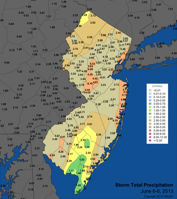
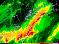
Earlier this month, only a few days after the official start of the Hurricane Season, Tropical Storm Andrea formed in the Gulf of Mexico and headed northeast bringing heavy rain and gusty winds to parts of Florida and the coasts of North Carolina and Virginia. The remnants of Andrea eventually tracked off our shores and brought a period of very heavy rain to much of the state. Andrea's downpours gave much of the northern Jersey shore around 4.50" to just over 5.00" of rain. Most of the Turnpike corridor saw precipitation range from 3.50" to a little over 4.00". There was less precipitation to the southeast and the northwest with those areas averaging around 2.00"-3.00".
Prior to Andrea, disturbances on the 2nd and 3rd brought some localized heavy rain. Over the two day span some areas, especially in the central and shore corridor of the state, saw as much as 1.00"-2.00". More disturbances after Andrea would continue to inundate residents with more heavy downpours on June 10 and June 13, the latter of which was attributed to strong thunderstorms in the southern part of the state. And finally, thunderstorms and heavy rain showers during the early part of this week (June 16-18) gave some areas another 1.00"-3.00", with the most rainfall along the coastal and southern central regions of the state.
Since the beginning of month, many stations in the state have recorded anywhere between almost 6.00" and as much as over 10.00" of rain. Sea Girt (NJWxNet) recorded 10.44" of rain. A CoCoRaHS observer in South Brunswick (Middlesex) recorded 10.15" for the period, while other areas in the central part of the state including South Brunswick, Toms River, Woodbridge, and Point Pleasant all have received over 8.00" of rain for the month.
There were slightly lower totals away from this corridor, but overall the state is averaging 8.27". This has already placed June 2013 as the 3rd wettest June on record, behind only 1972 (8.41") and 2003 (8.61"). Furthermore, four of the top ten wettest June months have occurred since the year 2000. Preliminary reports show that the Long Branch-Oakhurst National Weather Service Coop station has measured 10.50" of rain so far for June 2013, which already ranks as the wettest June in the station's 95 year history! Other stations smashing June rainfall records include Seabrook Farms with 10.37" and Atlantic City Airport with 7.19". June 2013 is also the wettest June of the Atlantic City Marina's 137 year station history with 8.57".
Will the second half of June give us more precipitation and shatter records across the state? Be sure to check out the June ONJSC monthly narrative coming in early July!


