What a Weak La Niña Event Might Have in Store for New Jersey this Winter

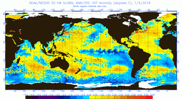
As some of you may remember, last winter there was a weak La Niña event in the tropical Pacific that followed a strong El Niño in 2015. As most past La Niñas have suggested, due to remote influences on circulation across North America, the winter 2016/17 snowfall in New Jersey was not abundant. Here we are again in a weak La Niña situation as the heart of the 2017/18 winter approaches. Thus far, snowfall is above average, but clearly it is too early to say if this season will end up with a surplus or deficit of the white stuff.
What exactly is a La Niña? Like an El Niño, a La Niña is associated with anomalous atmospheric trade winds and ocean circulation in the tropical Pacific. While an El Niño involves a weakening (or even reversal) of westerly (east to west moving) trade winds along the equator and resultant warming of waters in the eastern equatorial Pacific, a La Niña event essentially involves an enhancement of the more common ocean and atmosphere circulation regimes.

