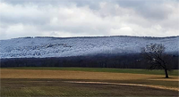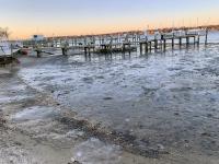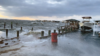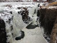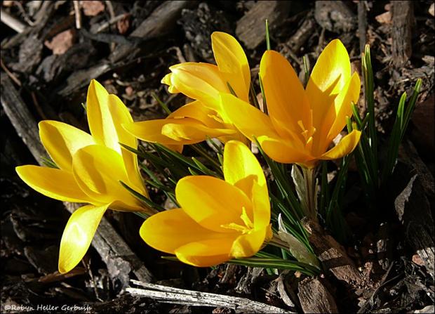
Crocuses made an early appearance during an unseasonably warm February (photo by Robyn Gerbush).
February Overview
On many an afternoon this past February, one had to be reminded that, according to the calendar, we were in the midst of a winter month. While there was a modest snowstorm for central and northern areas on the 9th, there were 11 days, including the day prior to the storm, when temperatures equaled or exceeded 60° at one or more New Jersey locations. The average statewide monthly temperature of 40.1° made February 2017 NJ’s mildest since records commenced in 1895 (Table 1). The average was 6.6° above the 1981–2010 mean and 1.0° above the previous record in 1998. In fact, the 2017 average was only 0.7° lower than the mean for March, and would rank as the 54th mildest (69th coolest) March on record.
| Rank | Year | Feb. Avg. Temp. |
|---|---|---|
| 1 | 2017 | 40.1° |
| 2 | 1998 | 39.1° |
| 3 | 2012 | 38.9° |
| 4 | 2002 | 38.4° |
| 5 | 1990 | 38.3° |
| 6 | 1997 | 38.1° |
| 7 | 1954 | 37.7° |
| 7 | 1976 | 37.7° |
| 9 | 1984 | 37.6° |
| 10 | 1991 | 37.3° |
Table 1. The 10 warmest Februaries across New Jersey since 1895.
February precipitation (rain and melted snowfall) averaged 1.70”. This was 1.10” below the 30-year mean and ranks as the 11th driest on record (Table 2). Only the storm on the 9th delivered more than an inch of rain or melted snow to some observing stations around the state.
| Rank | Year | Feb. Avg. Precip. |
|---|---|---|
| 1 | 2009 | 0.66" |
| 2 | 2002 | 0.75" |
| 3 | 1901 | 0.96" |
| 4 | 1980 | 0.99" |
| 5 | 1968 | 1.05" |
| 6 | 1895 | 1.24" |
| 7 | 1987 | 1.33" |
| 7 | 2012 | 1.33" |
| 9 | 1991 | 1.35" |
| 10 | 1978 | 1.40" |
| 11 | 2017 | 1.70" |
| 12 | 2006 | 1.76" |
| 13 | 1954 | 1.77" |
| 14 | 1947 | 1.83" |
| 15 | 1917 | 1.91" |
Table 2. The 15 driest Februaries across NJ since 1895.
Statewide, snowfall averaged 4.7", which is 3.4" below average. The northern third received 9.9", which is only 0.2" below average, the central region saw 6.1” (2.9” below average), while the southern third caught just 1.1", which is 5.5" below average. Season-to-date snowfall (from first flake to the end of February) is 12.9" statewide (8.1" below the average through February), and can be broken down to 21.4" in the north (-6.1"), 13.8” in central areas (-9.5"), and 7.8” in the south (-8.7"). Leading the way thus far is the High Point Ranger Station (Sussex County) with 45.8”.
Temperature
The February warmth was the result of a recurrent flow of southerly air into the state. This advected flux was locally boosted by generally clear skies and often snow-free ground. With the polar jet stream often far to the north, it was awfully difficult to introduce cold air into the eastern US, or sustain it when on occasion it visited. It is also likely that as a result of human-induced greenhouse warming a mild month became the warmest on record. It has become apparent that day-to-day weather is being subtly influenced by this human factor, which has led to an overall milder base or foundation that exceeds that normally found in years past. That does not mean that every specific day, month, or year is warmer than the last one, however, odds have improved for more often reaching record or near-record warmth than in the past.
The 7th was the first of the 60° days, with the Greenwich (Cumberland) and Mullica (Atlantic) NJ Weather Network stations reaching 65° and 15 other stations (out of 66) between 60°–64°. Meanwhile, the far north didn’t share the warmth, with a maximum of only 32° at both High Point (Sussex) and Wantage (Sussex). The 8th saw the first of seven February days maxing out at 70° or higher. Cape May Courthouse (Cape May) and Woodbine (Cape May) got to 71°, and Egg Harbor Township (Atlantic) and Greenwich were 70°, with 53 stations between 60°–69°. High Point Monument (Sussex) was coolest at 48°. Egg Harbor Township was the sole location at 60° on the 11th.
Warmth returned on the 18th and dominated the remainder of the month. On the 18th, Egg Harbor Township and West Creek (Ocean) hit 70°, with 45 locations between 65°–69°. The adjacent cool Delaware Bay water kept Bivalve (Cumberland) and Fortescue (Cumberland) at only 53°. The 19th was warmer, with Woodbine at 72° and 18 stations either 70° or 71°. Elevation kept High Point Monument coolest at 56°. Cape May Courthouse and Woodbine got to 61° on the 20th.
A remarkable run of February “heat” began arriving on the 22nd, with Oswego Lake (Burlington) up to 64° and Red Lion (Burlington) and Berkeley Township (Ocean) at 63°. The 23rd brought a 76° maximum to Sicklerville (Camden), along with 75° in Columbus (Burlington), Red Lion, and West Deptford (Gloucester). 35 locations were between 70°–74° and 22 from 60°–69°. Harvey Cedars (Ocean) was coolest at 56°.
The 24th was one of the three warmest February days on record across the Garden State, back to the late 19th century. Hamilton (Mercer) soared to 78° and New Brunswick (Middlesex), Sicklerville, and Walpack (Sussex) all reached 77°. This was a record February high for New Brunswick, where observations date back to 1893. Some 47 other NJWxNet stations were between 70°–76° and ten ranged from 60°–69°. Harvey Cedars (Ocean) was only 54°. The previous two rivals for warmth occurred on February 25, 1930, when Pleasantville (Atlantic) hit 80° and Belleplain State Forest (Cape May), Indian Mills (Burlington), and Moorestown (Burlington) reached 79°. Tuckerton (Ocean) and Pemberton (Burlington) got to 78° on that 1930 afternoon, while 78° was also reached at Lakehurst (Ocean) and Long Branch (Monmouth) on February 24, 1985.
Conditions hardly cooled on the 25th, with Sicklerville up to 76°, four locations at 75°, and 30 between 70°–74°. West Cape May (Cape May) was coolest at 54°. February ended with a 70° maximum at Sicklerville on the 28th, with three other stations at 69°. New Brunswick reached 74°, thus reaching the 70° mark for as many as three consecutive February days for the first time on record.
Despite the warmth, cold air appeared from time to time in February. As most often the case in NJ, it was coldest in the northwest corner of the state, either at higher elevations or in valleys into which cold air drains on calm, clear nights. Also, it was up north where snow cover was most persistent during the first half of the month and helped chill the air. There were 14 February nights where one or more NJWxNet stations dropped below 20°. This began with a 17° low at Walpack on the 2nd. The 3rd found this location down to 10°, with High Point and High Point Monument following at 14°. Walpack fell to 8° on the 4th and the Monument to 11°. Pequest (Warren) and Walpack were 17° on the 5th. Fresh snow cover helped lower temperatures to 8° at Walpack and 9° at High Point Monument on the 9th, with 28 other stations between 10° and 19°. The 10th was the coldest day of the month, with Walpack down to 6°, the Monument again at 9°, and 33 locations between 10° and 19°. The Monument was 17° and High Point 19° on the 11th, Walpack and the Monument 19° on the 14th, Walpack 19° on the 15th, and the Monument 19° on the 16th. Pequest and the Monument were 16° and 17°, respectively, on the 17th. The 18th saw a minimum of 17° at Walpack before the afternoon high at this location jumped to 62°. That same day, Berkeley Township rose from 20° to 69°. Walpack was 16° and Pequest 19° on the 21st, and Berkeley Township 16° and Walpack 17° on the 27th.
Precipitation and Storms
With only four events over the course of the month depositing at least a half-inch or more of rain or melted snowfall somewhere in the state, it stands to reason that virtually every location received less-than-normal precipitation. Among the wettest sites were Hardyston Township (Sussex) with a hardly impressive 3.05”, Andover Township (Sussex) 2.91”, West Milford (Passaic) 2.86”, Palisades Park (Bergen) 2.83”, and North Arlington (Bergen) 2.77”. While the northern tier of counties was wettest, the southern reaches were driest, led by just 0.74” at Wildwood Crest (Cape May). Also, Middle Township (Cape May) only saw 0.78” and 0.79” (two NJ CoCoRaHS stations), Upper Deerfield (Cumberland) 0.86”, Pittsgrove (Salem) 0.93”, and Little Egg Harbor (Ocean) 0.99”. The dry weather contributed to a 350-acre brush fire on the 19th in Manchester Township (Ocean). No injuries or damaged structures were reported.
Two Wantage stations took top snowfall honors in February with 14.7” and 14.1” measured. They were followed by 13.7” at the High Point Ranger Station, 13.1” in Vernon Township (Sussex), 12.8” at Jefferson Township (Morris), 11.7” in Hardyston Township, and 11.6” in Tenafly (Bergen). No snow to less than an inch fell during the month in Cape May, Cumberland, and Salem counties.
A rain event, some of it of the freezing variety, occurred during the morning of the 7th. Hunterdon County saw the heaviest precipitation, with 0.59” in Clinton, Lebanon 0.55”, and Holland Township 0.54”. The northern half of the state had greater than 0.20”, while totals tapered to zero in far southern areas.
The most impactful event of the month was a storm from the pre-dawn to mid-day hours of the 9th. It commenced as rain and sleet in the north before quickly going to snow. This was just 12 hours after temperatures were in the 60°s. The turnover to snow moved into central sections by daybreak, but struggled to get much further south. While not as big a storm as predicted in the 24 hours leading up to it, snowfall was still substantial enough and the morning rush hour timing just right to justify the closing of most schools and some businesses in central and northern areas. Statewide rain and melted snowfall was mainly between 0.50”-1.00”, with Palisades Park reaching 1.25”, Long Branch 1.20”, Franklin Township (Somerset) 1.20”, and Ocean Township (Monmouth) 1.10”. On the low end, Pine Beach (Ocean) and Middle Township saw only 0.39” and Woodstown (Salem) 0.45”. Thunder was heard in Cape May, Atlantic, and Ocean counties and there was minor coastal flooding as winds gusted to 66 mph at High Point Monument, 50 mph at Fortescue, and 49 mph in Seaside Heights (Ocean). Twenty other NJWxNet locations gusted from 40 mph–48 mph.
Snowfall on the 9th exceeded 6.0” at some locations in 13 of NJ’s 21 counties (Table 3). Top totals included 13.5” in Highland Lakes (Sussex), 11.3” in West Milford (also an 8.8” observation there), and elsewhere in Sussex County, 11.0” in Vernon Township, 10.3” and 9.9” at stations in Wantage, and 10.0” at Lafayette and Lake Mohawk. Overall, 8.0”–10.0” or more fell north of Interstate 80, 6.0”–8.0” between 80 and Interstate 78, 4.0”–6.0” from 78 to Interstate 195, 1.0”–4.0” from 195 to the Atlantic City Expressway, and under an inch south of the Expressway (snow map available here).
| County | Location | Snowfall |
|---|---|---|
| Bergen | North Arlington | 9.5” |
| Essex | Newark Airport | 7.8” |
| Hudson | Harrison | 6.5” |
| Hunterdon | Clinton | 9.1” |
| Mercer | West Windsor Twp. | 6.0” |
| Middlesex | Woodbridge Twp. | 6.8” |
| Monmouth | Freehold | 6.6” |
| Morris | Jefferson Twp. | 9.8” |
| Passaic | West Milford | 11.3” |
| Somerset | Bedminster Twp. | 7.3” |
| Sussex | Highland Lakes | 13.5” |
| Union | Linden | 7.6” |
| Warren | Blairstown and Allamuchy | 8.8” |
Table 3. Greatest snowfall in the 13 NJ counties where totals on February 9th equaled or exceeded 6.0”.
A modest event from the pre-dawn hours to evening of the 12th brought light snow to northern, mainly higher elevation areas, light rain and freezing rain to northern and central locations, and rain to the south. The north saw the most precipitation, with 0.89” of rain, freezing rain, and melted snowfall at Hardyston, 0.80” at West Milford, and 0.78” in Bloomingdale (Passaic). Totals were generally greater than 0.50” in the northern third of the state, tapering to minimums of 0.10” at Middle Township and 0.12” in Wildwood Crest. Eight counties had stations reporting measurable snow, but in only four of them did local totals exceed an inch. Top counts included 3.3” in Montague (Sussex), 3.1” and 2.1” at two Wantage stations, and 2.1” in Vernon Township and Highland Lakes.
A spring-like squall line swept through the state during the late afternoon and early evening of the 25th, bringing an end to the record mild conditions. Winds gusted to 61 mph at High Point Monument, 55 mph at Fortescue, and from 40 mph–47 mph at six other NJWxNet locations. Stronger winds appeared to have occurred locally, bringing down trees in the northwest and damaging or destroying several buildings at Space Farms Zoo in Beemerville (Sussex). Pea-size hail was reported in portions of Sussex, Warren, Hunterdon, and Bergen counties. Given the fast moving nature of the line, rainfall totals were not excessive, generally 0.25”–0.75” in the northern half of the state and 0.10”–0.40” in the south. Andover Township caught the most with 0.90”, followed by Bernards Township (Somerset) with 0.84”, Holland Township (Hunterdon) 0.81”, and Phillipsburg (Warren) 0.78”. Wildwood Crest only saw 0.08” and Stafford Township (Ocean) 0.10”, as the storms lost some punch as they approached the cooler ocean atmosphere.
The lowest atmospheric pressure in February was in the 29.30”–29.40” range on the 15th. The highest was from 30.40”–30.50” on both the 4th and 27th. Aside from the aforementioned strong winds on the 9th and 25th, winds gusted to 40 mph or higher on eight other February days. The 4th saw Columbus gust to 41 mph. High Point Monument reached 42 mph and Fortescue 40 mph on the 10th. Pennsauken (Camden) and Upper Deerfield gusted to 57 mph and 44 mph, respectively, on the 12th. The 13th joined the 9th and 25th as an exceedingly windy day, with Seaside Heights reaching 59 mph, Pennsauken 57 mph, six stations between 50 mph–56 mph, and 25 NJWxNet sites from 40 mph–48 mph. Pennsauken topped out at 42 mph, Woodbine and Fortescue 41 mph, and Sea Girt (Monmouth) and Seaside Heights 40 mph on the 15th. High Point Monument hit 53 mph and Fortescue 40 mph on the 16th, and the Monument 48 mph on the 17th and 51 mph on the 26th.
Winter 2016-2017 Overview
December 2016–February 2017 averaged 37.5° across New Jersey. This is 4.4° above the 1981–2010 average and ranks as the 6th mildest winter of the past 123 years (Table 4). Five of the top ten mild winter seasons have occurred in this century, with two others in 1997-1998 and 1998-1999.
| Rank | Year | Winter Avg. Temp. |
|---|---|---|
| 1 | 2001-2002 | 38.8° |
| 2 | 2015-2016 | 38.5° |
| 3 | 2011-2012 | 38.3° |
| 4 | 1997-1998 | 38.0° |
| 5 | 1931-1932 | 37.9° |
| 6 | 2016-2017 | 37.5° |
| 7 | 1998-1999 | 36.2° |
| 8 | 1990-1991 | 36.1° |
| 9 | 1948-1949 | 36.0° |
| 10 | 2012-2013 | 35.8° |
Table 4. Top 10 warmest NJ winters (December–February) since 1895-1896.
Winter precipitation averaged 8.78” across NJ. This is 1.27” below normal and ranks as the 32nd driest on record. The wettest locations included Lacey Township (Ocean) with 11.95”, Chatham (Morris) 11.55”, Berkeley Township 11.35”, Howell (Monmouth) 11.20”, and Point Pleasant Beach (Ocean) 11.09”. On the dry side, Winslow Township (Camden) received only 6.90”, followed by Upper Deerfield at 7.00”, Woodstown 7.09”, Middle Township 7.16”, and Wildwood Crest 7.22”.
A drought warning issued by the NJ Department of Environmental Protection remained in place throughout the winter for Ocean, Monmouth, and Mercer counties northward, and a drought watch in Burlington, Camden, Gloucester, and Salem counties. As winter progressed, the US Drought Monitor reduced drought conditions to D1 (moderate drought) in much of northern NJ, though a patch of D2 (severe drought) remains. Most of southern NJ stayed or fell into the D0 (abnormally dry) category, while the southwest fell to D1 toward the end of February. These rankings all suggest that insufficient precipitation has fallen across NJ during the winter to eliminate drought concerns as spring begins.


