Summer

Roasting: August 2022 Recap and Summer Overview

September 7, 2022 - 8:17pm -- Dave Robinson

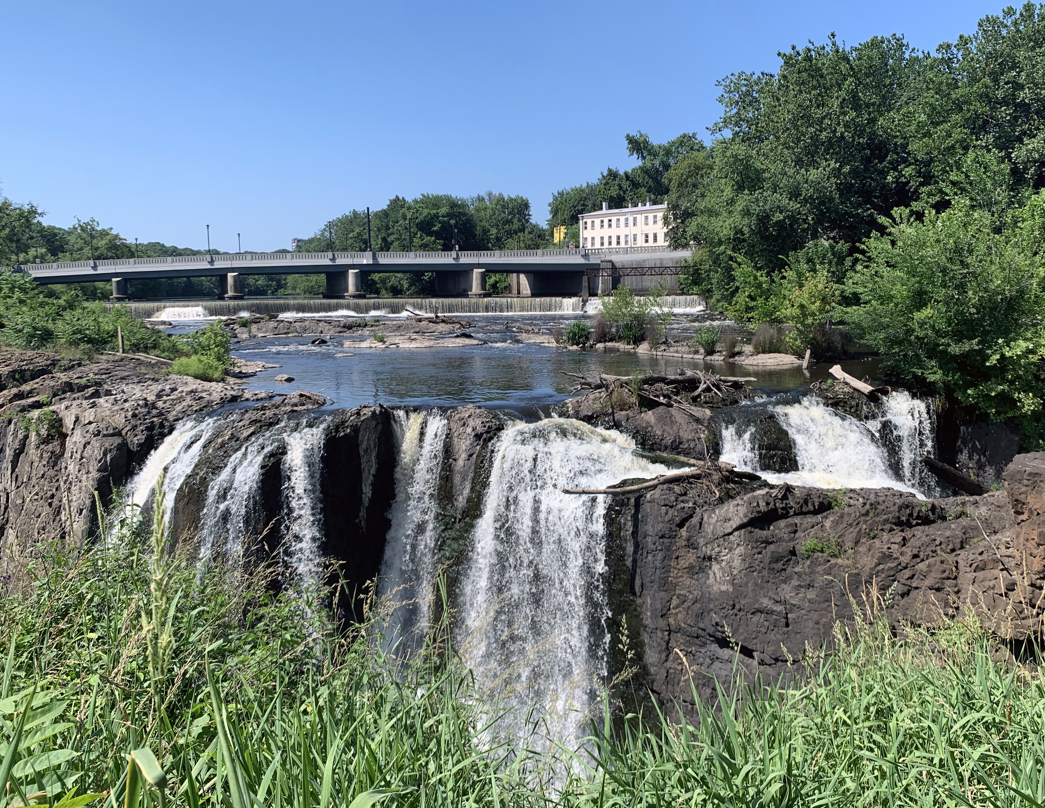
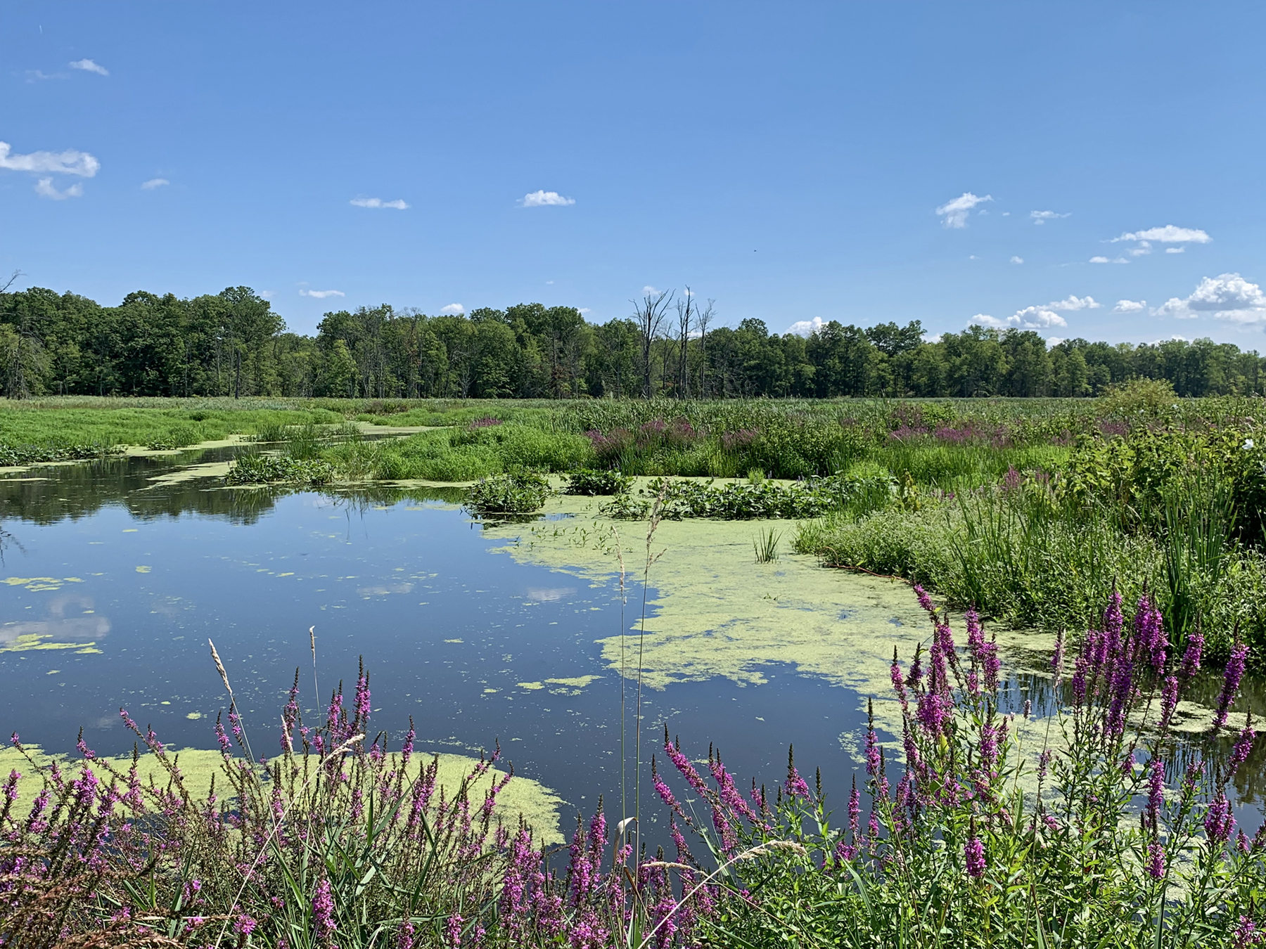
The Great Swamp National Wildlife Refuge (Morris County) on August 24th. While August 22nd rain proved beneficial, the water level is normally higher. Photo taken by D. Robinson.

Much like this past July, August was a hotter and drier month than normal. Despite a June with rather close-to-normal numbers, the two most recent months brought the summer temperature and precipitation to top-10 levels for hot and dry conditions. More on summer ’22 later in this report, but first to discuss is a record hot and quite dry August.

The August average temperature of 77.4° was 3.8° above the 1991–2020 normal, ranking as the hottest on record. Eight of the ten warmest Augusts since 1895 have occurred since 2001. The average maximum of 88.5° was 4.7° above normal, the hottest on record, while the average minimum of 66.2° was 2.9° above normal, tied for 5th warmest. North Jersey averaged 75.7° (+3.8°, warmest on record), the south 78.4° (+3.8°, warmest on record), and the coast 77.9° (+3.2°, 3rd warmest).

Statewide, August precipitation averaged 2.61”, which is 1.96” below normal, ranking as the 22nd driest. The north came in at 2.31” (-2.25”, 18th driest), south 2.82” (-1.75”, 29th driest), and coast 2.54” (-2.06”, 25th driest). As the map shows, virtually the entire state had a monthly total below the statewide 4.57” normal. Exceptions were found in isolated west central and central coastal areas where several storms quickly deposited hefty totals. Less than half the normal monthly rainfall fell in a good portion of the north and in scattered areas of the south and north coast.

Once Again Hot, and This Time Around, Dry: July 2022 Recap

August 6, 2022 - 11:14am -- Dave Robinson

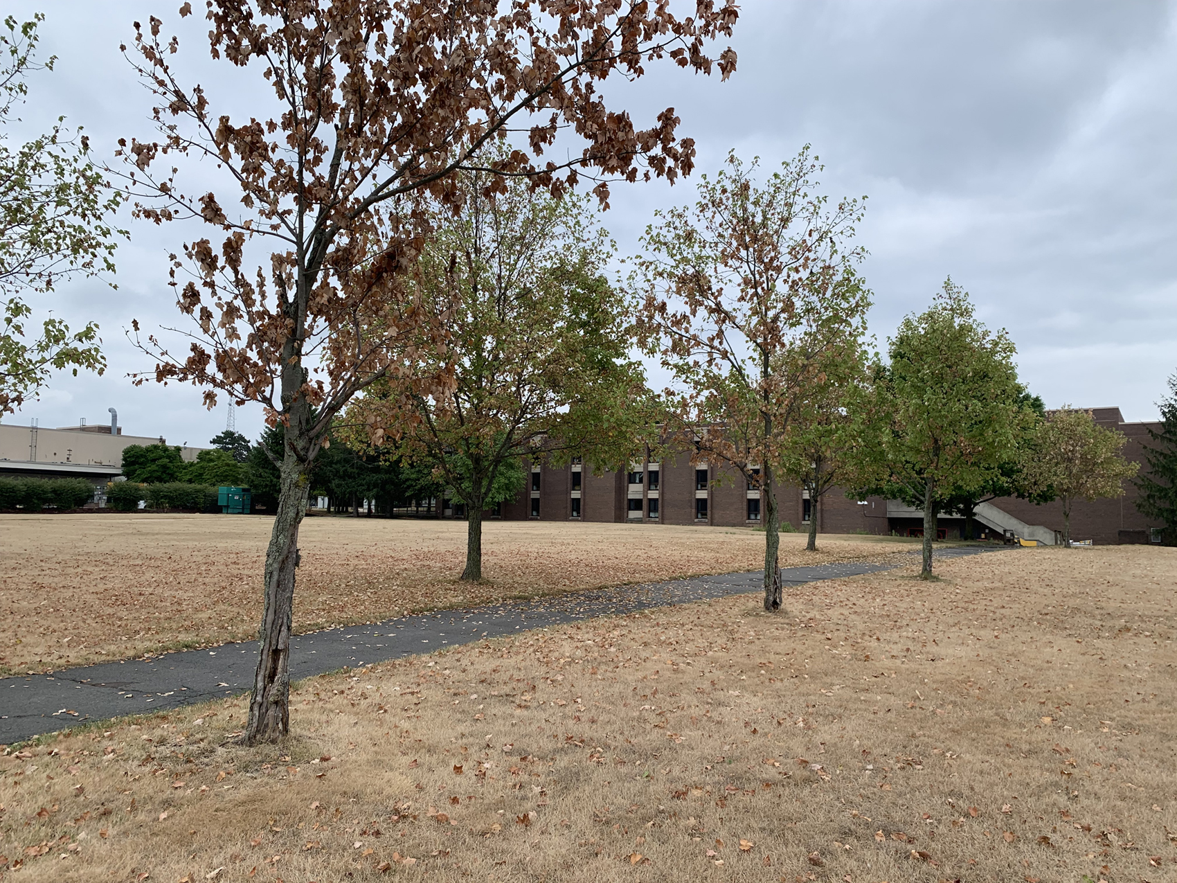
Trees and grass impacted by excessively dry conditions on Livingston Campus at Rutgers University in Piscataway (Middlesex County). Photo taken by D. Robinson on August 1st.

When it comes to recent hot Julys in New Jersey, the beat goes on. This year the heat was joined by quite limited precipitation, something not often seen in recent years. The statewide average temperature of 78.1° was 2.7° above the 1991–2020 normal, ranking 6th warmest since records commenced in 1895. Eight of the ten warmest Julys have occurred since 2010, leaving only 1955 and 1999 as top-ten outliers. The statewide average maximum was 88.6° (+2.9°, 6th warmest) and the minimum 67.5° (+2.4°, 4th warmest). Northern counties averaged 75.9° (+2.2°, 9th warmest), southern counties 79.5° (+3.0°, 3rd warmest), and coastal areas 78.8° (+2.6°, tied as 4th warmest).

Statewide July precipitation averaged 2.19”, which is 2.52” below normal, ranking as the 13th driest on record. Of the top 15, only two have occurred this century. The north averaged 2.03” (-2.69”, 14th driest), south 2.30” (-2.44”, 14th driest), and coast 2.16” (-2.22”, 17th driest). The central portion of the state was driest, with less than 2.00” accumulating, and under an inch in the driest areas. Closer-to-normal totals were found in the northwest, northeast, and southwest. At month’s end, portions of central NJ were classified as being in moderate drought (D1) on the weekly U.S. Drought Monitor map. This denotes conditions not seen more than once every five to ten years. Surrounding central and northern areas were considered abnormally dry (D0), as was the southeast corner of the state. This all coincides quite well with the most pronounced precipitation deficits of the past month.

Nondescript: June 2022 Recap

July 7, 2022 - 3:24pm -- Dave Robinson

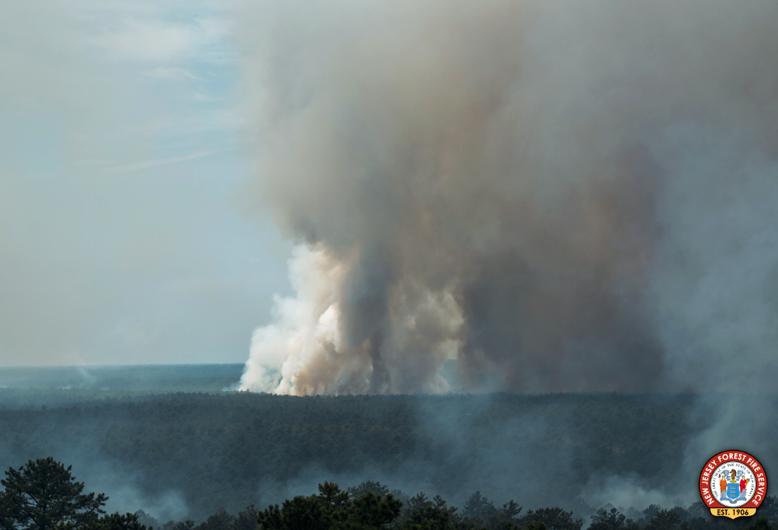
Smoke billows from a large wildfire in the Wharton State Forest around June 20th. Photo from the New Jersey Forest Fire Service.

As reported multiple times during the first half of 2022, the day-to-day weather and overall climate of the Garden State have varied frequently, exhibiting lots of variability and never “locking” into a given pattern for an extended period of several weeks or longer. Such was the case this June, making it difficult to define any conditions that dominated. June was somewhat drier than average, but eight events brought over an inch of rain somewhere within the state. It was also dry enough at one point for a wildfire to scorch over 13,000 acres of the Pine Barrens. Low temperatures fell into the upper 30°s and low 40°s at multiple locations on the 20th, yet three days earlier, the majority of the state saw highs in the low to middle 90°s. “Non-descript” seems the best way to sum things up.

Statewide, rainfall averaged 3.44”. This is 0.86” below the 1991–2020 normal and ranks as the 61st driest of the 128 Junes since 1895. The north received 3.59” (-1.02”, 61st driest), the south 3.39” (-0.75”, 61st driest), and coast 2.90” (-0.95”, 54th driest). As the map shows, the far south was driest, continuing a pattern seen in recent months. The June 30th U.S. Drought Monitor map has the bulk of the southern area seen on the Figure 1 map receiving less than 4.00” for the month classified as “Abnormally Dry” (D0). This rating is also a function of both low streamflow and ground water levels. Further north, pockets of above-average rainfall surrounded a below-average central region that has yet to have prolonged enough water deficits to qualify for D0 status.

Sticky: August 2021 and Summer 2021 Recaps

September 10, 2021 - 6:30pm -- Dave Robinson

Flash flooding and residential evacuations in Helmetta on August 22

Whether the thermometer was reading high or low this August or whether rain was falling or not, one factor that most always had to be considered was the high level of humidity. The “Dog Days” of summer indeed. Of course, there was much else to consider this month, including contributions of rain from two tropical storms, one of which brought the largest crests on some rivers since May 1, 2014, 11 days where one or more locations received at least 2.00” of rain, and 16 days where the high temperature reached 90° or higher somewhere in the state.

Adding up all the rainfall, the statewide monthly average was 6.87”. This is 2.30” above the 1991–2020 normal and ranks as the 15th wettest August since 1895. The northern climate division led the way with 7.89” (+3.33”, 11th wettest), followed by the coastal area with 6.65” (+2.05”, 21st wettest), and the southern division at 6.21” (+1.64”, 27th wettest).

The statewide average temperature of 75.9° is 2.3° degrees above normal and ranks 4th warmest. Seven of the top 10 and 13 of the warmest 20 have occurred this century. The warmth was most strongly a function of elevated nighttime temperatures, which, for NJ, averaged 66.9°. This is 3.6° above normal and ranks 2nd warmest. The maximum temperature averaged 84.9°, some 1.1° above normal and ranks 18th warmest.

Everything but the Kitchen Sink: July 2021 Recap

August 5, 2021 - 7:55pm -- Dave Robinson

Tornado damage

Wow, what a month. July 2021 provided a never-ending cascade of weather events, including a tropical storm, a record-tying number of tornadoes, large hail, flash floods, hot days, chilly nights, smoke-filled skies, and on the last day of the month, perhaps the nicest day of the summer. The statewide average precipitation of 7.59” was 2.88” above the 1991–2020 normal and ranked 8th wettest of all Julys back to 1895. It was the wettest July since 1975 and second wettest in almost 50 years. The northern portion of the state averaged 8.16” which was 3.44” above normal. The south averaged 7.36” which was 2.62” above normal.

The average temperature of 75.8° was 0.4° above the 1991–2020 normal, but 1.9° above the 1895–2021 average. This ranked as the 24th warmest July since 1895. 13 of the 25 warmest Julys in the past 127 years have occurred since 2002. The nine July tornadoes is the most in a month since official records began in 1950. Tropical Storm Elsa was the earliest fifth storm of any season on record in the Atlantic basin. Read on for details on this potpourri of weather happenings.

Hit or Miss: June 2021 Recap

July 8, 2021 - 7:32pm -- Dave Robinson

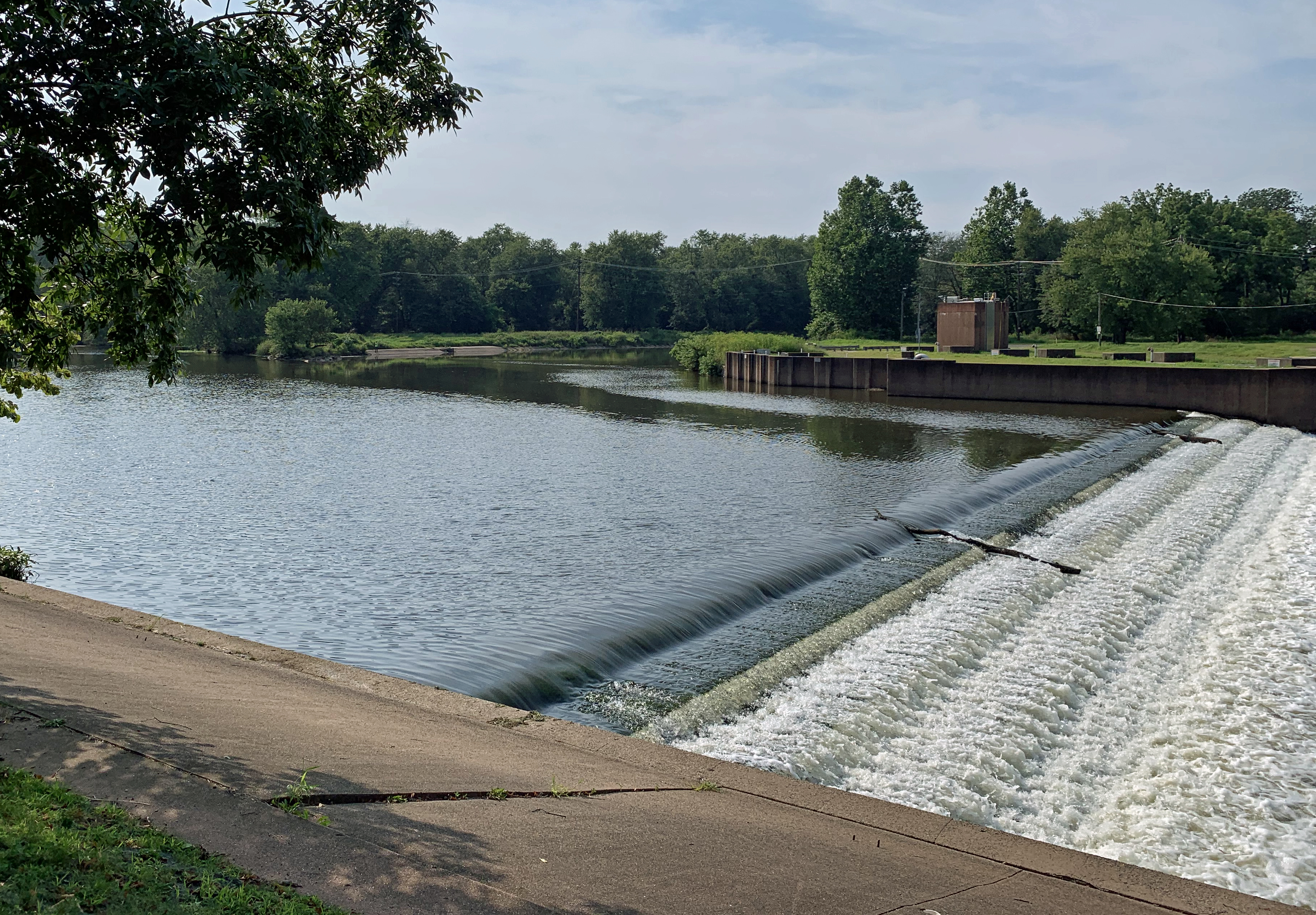
A weir immediately downstream of the confluence of the Raritan and Millstone rivers in Somerset County on June 16th, as taken from the towpath of the Delaware-Raritan Canal

June was a hit or miss month when it came to rainfall, even within counties. Of course, this is not all that uncommon during the warm season, where much of the rainfall arrives courtesy of localized showers and thunderstorms. There were also ups and downs of the thermometer during the month, including some chilly mornings. Overall, the balance was weighted towards the warm side of the ledger, resulting in a top 10 ranking for June temperature.

The statewide average temperature of 71.9° was 1.6° above the 1991–2020 normal (3.0° greater than the 1895–2021 average). This ties the month with 2011 as the 8th warmest since records commenced in 1895. Seven of the 16 warmest Junes of the past 127 years have occurred in just the past 17 years. The average high of 82.7° was 1.7° above normal and ties as the 11th warmest, while the average low of 61.0° was 1.4° above normal and ranks 8th warmest.

The Beat Goes On: August 2020 & Summer Recaps

September 7, 2020 - 9:50pm -- Dave Robinson

Sunset photo

August joined the chorus of much warmer-than-normal months experienced throughout most of 2020 to date across the Garden State. Six of the eight months have ranked among the top 10 warmest for the 126 years beginning in 1895. Only April and May are outliers and, in fact, each of them had below-average temperatures. With a mean of 75.5°, August tied with 2001 and 1955 as the 6th warmest. This is 2.5° above the 1981–2010 mean. Eleven of the warmest 17 Augusts have occurred since 2001. The mean maximum of 84.8° tied for 19th warmest at 1.5° above normal, while the mean minimum of 66.1° was 3.4° above normal and ranked 4th warmest.

Statewide precipitation averaged 6.04”. This is 1.94” above normal and ranks as the 26th wettest August on record. Above-average totals occurred in northern (6.02”), southern (6.10”), and coastal (5.50”) climate divisions. The southern division (Mercer-Middlesex-Monmouth counties and south, except a narrow coastal division) saw a range from the driest area in Monmouth and parts of Mercer counties and a very wet area in Salem and Gloucester counties.

Green Warmth: August and Summer 2018 Recaps

September 5, 2018 - 8:18pm -- Dave Robinson

Flash flood photo

The summer of 2018 concluded on a warm, wet note across the majority of what was a persistently green Garden State throughout the season. The warmth dated back to late June, with frequent humid conditions and abundant showers from mid-July onward. There will be more on the entire summer at the end of this report. First a look at August, with a statewide average temperature of 76.8° coming in 3.8° above the 1981–2010 average. This was the second warmest August since 1895, falling just behind 2016 by 0.1°. Nine of the 13 warmest Augusts during that 124-year interval have occurred since 2001.

Statewide, August precipitation averaged 5.63”. This was 1.53” above the 1981–2010 average and ranked as the 32nd wettest since 1895. It was the wettest August since the record wettest month in 2011. As is often seen in the summer, the majority of the precipitation fell in scattered showers and thunderstorms. This resulted in a wide range of monthly totals around the state, with some serious flash flooding occurring in several locations when moisture-ladened storms parked themselves over an area for multiple hours. Where storms missed time and time again, rainfall totals were below average. The northern NJ climate division (Hunterdon, Somerset, and Union counties northward) saw their 10th wettest August on record, with an average of 8.28” falling. This is 4.17” above average. Since 1990, only August 2011 was wetter in this division.

Summer Personified: July 2018 Recap

August 3, 2018 - 11:45pm -- Dave Robinson

Flash flood photo

July 2018 had a classic variety of summer weather. There was: 1) an ongoing heatwave to begin the month; 2) dry conditions for the most part in the first half of the month; 3) some warm, exceedingly humid conditions with widespread, at times heavy, showers the second half of the month (courtesy of the subtropics); and 4) some “top 10” sunny dry days following several cold front passages (thank you Canada).

The average statewide July temperature was 76.4°. This is 1.8° above the 1981–2010 average and ranks as the 13th warmest July in 124 years of records (2.6° above the full period of record average). Eleven of the 18 warmest Julys since 1895 have occurred in the past 20 years (since 1999). The average daily maximum temperature across the state was 87.2°, which is 2.2° above average and ranks as the 15th warmest on record. The 65.6° average minimum was 1.4° above the 1981–2010 average and comes in as the 17th warmest.

Statewide, August precipitation averaged 5.63”. This was 1.53” above the 1981–2010 average and ranked as the 32nd wettest since 1895. It was the wettest August since the record wettest month in 2011. As is often seen in the summer, the majority of the precipitation fell in scattered showers and thunderstorms. This resulted in a wide range of monthly totals around the state, with some serious flash flooding occurring in several locations when moisture ladened storms parked themselves over an area for multiple hours. Where storms missed time and time again, rainfall totals were below average. The northern NJ climate division (Hunterdon, Somerset, and Union counties northward) saw their 10th wettest August on record, with an average of 8.28” falling. This is 4.17” above average. Since 1990, only August 2011 was wetter in this division.

Rather Typical: June 2018 Recap

July 5, 2018 - 4:08pm -- Dave Robinson

Sandy Hook from plane

After an ample share of ups and downs throughout the past spring, the weather in June became rather typical for the start of summer. It was drier than average in the north and wetter than usual in the south, with the temperature close to the long-term mean. Fortunately, New Jersey entered the heart of summer with reservoirs full. However, with the onset of an apparent extended period of heat late in the month, it is certainly prudent to conserve water wisely.

The June average statewide temperature of 69.8° equaled the 1981–2010 mean, but is 1.0° above the 1895–present average. This tied with 1906 and 1967 as the 42nd mildest June on record. Precipitation averaged 3.43” across NJ, which is 0.58” below the 1981–2010 mean. This ranks as the 57th driest June, tied with 2011.

Pages

Subscribe to RSS - Summer