Record Rainfall

Spring Ahead: March 2020 Recap
April 7, 2020 - 11:40am -- Dave Robinson

March 2020 was the 6th mildest in New Jersey dating back to 1895. Combined with mild rankings of 9th in January and 4th in February, 2020 has started off as the 2nd mildest on record at 5.8° above the 1981–2010 average. The 40.8° average only falls behind 2012’s 41.4°. Six of the ten mildest January–March intervals in the past 126 years have occurred since 2002.

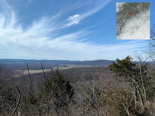
March averaged 46.3° across NJ, which is 5.5° above average. The average maximum of 56.2° (+5.4°) ranked 7th mildest and the minimum of 36.4° (+5.6°) 2nd mildest. Anomalies were +5.8° in both the southern (47.9°) and coastal (47.7°) divisions, ranking 6th and 4th mildest, respectively, and +5.0° in the north (43.7°), ranking 9th mildest. As a result of the premature warmth, vegetation green up across the state was at least two weeks earlier than normal.

Winter Arrives Early, Record Wet Fall: November 2018 and Fall 2018 Recaps

December 5, 2018 - 5:11pm -- Dave Robinson

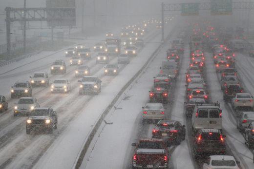
Snow-covered highway

November weather packed quite a punch, putting an exclamation point on what will go into the book as the wettest Fall (September–November) on record (since 1895). With seven storms that each deposited an inch or more of rain (or melted snow) at numerous locations, this was the second wettest November. The statewide average of 8.77” was 5.16” above the 1981–2010 average. The record will remain 9.01” in 1972.

One of the largest early-season snowstorms on record delivered significant impacts to all but southeastern NJ on the 15th. This event alone resulted one of the snowiest Novembers on record. Statewide, the monthly snowfall was 4.1”, which is 3.3” above average and ranks as the 6th snowiest since 1895 and the snowiest since 1989. With 7.4” in the north (Sussex, Passaic, Bergen, Warren, Morris, Essex, and Hudson counties), it was the snowiest November since 1938 and 3rd most on record. Central NJ (Hunterdon, Somerset, Union, Middlesex, Mercer, and Monmouth counties) received 4.8” (+3.9”), the 5th snowiest on record and most since 2012. The south (Burlington, Ocean, Camden, Gloucester, Atlantic, Salem, Cumberland, and Cape May counties) averaged 2.0” (+1.4”), the 10th snowiest and most since 2012.

Mid-Atlantic Deluge

August 13, 2014 - 5:40pm -- Dave Robinson

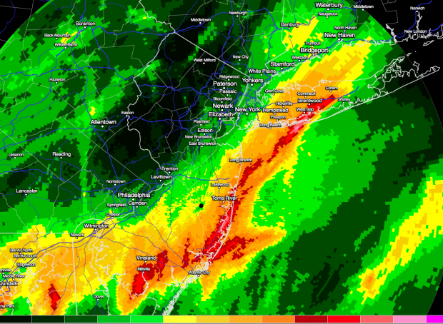
Rainfall estimate map

Extremely heavy rain drenched portions of the Mid-Atlantic during the daytime hours on August 12 until after sunrise on the 13th. Starting off in the Washington-Baltimore area and moving up into central Long Island, a narrow ribbon of rainfall exceeding 5”, and over 10” in a few locales, resulted in flash flooding that resulted in water rescues and many damaged roads and vehicles. Excessively heavy rains, occasionally accompanied by lightning, traveled up a frontal boundary that was associated with an unusually strong August low-pressure system situated over the Great Lakes. The atmospheric impulses riding up this front joined forces with abundant atmospheric moisture (in the top 1% for the region) to bring multiple inches per hour rainfall rates…for multiple hours.

The heaviest rain was situated within less than a 10-mile wide path. Within 20 miles on either side, totals fell off to a mere inch or two, or even less. Such is the nature of these events, where despite the abundant atmospheric moisture, there is a finite amount of water available. The dynamics concentrated the atmospheric lifting, thus the condensation of the majority of the moisture and resultant rainfall, while adjacent areas balanced out the lifted air with subsiding air that greatly limited rainfall totals.

Flooding rains persist

June 19, 2013 - 12:00am -- Dan Manzo

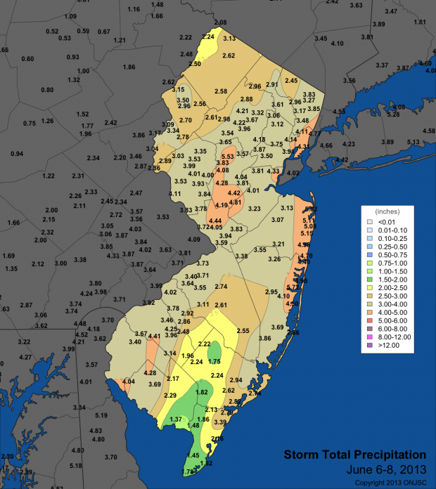
Tropical Storm Andrea rain totals

"It's been a wet one." That's what many New Jersey residents would say so far about the first part of June. There has been little time to dry out in between back to back to back rainstorms.

Earlier this month, only a few days after the official start of the Hurricane Season, Tropical Storm Andrea formed in the Gulf of Mexico and headed northeast bringing heavy rain and gusty winds to parts of Florida and the coasts of North Carolina and Virginia. The remnants of Andrea eventually tracked off our shores and brought a period of very heavy rain to much of the state. Andrea's downpours gave much of the northern Jersey shore around 4.50" to just over 5.00" of rain. Most of the Turnpike corridor saw precipitation range from 3.50" to a little over 4.00". There was less precipitation to the southeast and the northwest with those areas averaging around 2.00"-3.00".

Subscribe to RSS - Record Rainfall