November Overview
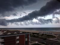
The first statewide nor'easter of the season on the 26th-27th provided much needed rainfall and kept the month from becoming one of the driest on record. Storm specifics are found below, confirming that this event accounted for the bulk of the statewide monthly average of 2.83" and at least temporarily staved off worsening drought conditions. This was 0.81" below the 1981-2010 normal and ranked as the 52nd driest of the past 119 years. Temperatures seesawed a fair bit but overall, colder than average conditions prevailed for the second consecutive November. The statewide average of 43.0° was 2.6° below normal and tied with 1906, 1919, 1940 and 1986 as the 36th coolest on record. Rather frequent frontal passages resulted in winds gusting to 40 mph or greater on twelve November days.
Temperature
Six November afternoons had one or more stations within the 54 station NJ Weather and Climate Network reach at least 65°. The 1st was the month's warmest day, with Hawthorne (Passaic County) and Mansfield (Burlington) topping out at 72°. Some 31 other stations reached 70° or 71°, with a balanced thermal environment across NJ finding High Point Monument (Sussex) and Seaside Heights (Ocean) the coolest locations at 64°. Seven stations reached 71° on the 2nd, perhaps the last 70° day of 2013. Cherry Hill (Camden) got to 69° on the 6th, and the Monmouth County communities of Oceanport and Howell reached 65° on the 7th. On the 10th Sicklerville (Camden) was 65° and Cherry Hill, Piney Hollow (Gloucester), and Clayton (Gloucester) were 69° on the 17th.
Minimum temperatures on ten November days fell to 15° or colder at one or more stations. On nine of these days Walpack (Sussex) was among the cold locations. In fact, this valley situated station was the sole one at 15° on the 4th, 9th, and 12th. It was 11° on the 15th, when the next coldest station was Pequest (Warren) at 20°. Walpack was 13° on the 20th and 12° on the 21st, when Pequest was 15° and Harvey Cedars (Ocean) had a mild 45° minimum.
The 24th saw High Point Monument (Sussex) at 12° and Berkeley Township (Ocean) and High Point (Sussex, nearly 400 feet in elevation below the 1750' Monument station) both at 13°. The coldest day of the month was the 25th, with Walpack at 7°, Pequest 9°, and 32 stations between 10° and 19°. West Cape May (Cape May) was "warmest" at 27°. The last two days of the month found Walpack down to 7° on the 29th, with Walpack at a monthly state minimum of 6° on the 30th and Pequest at 10°.
The first statewide freeze of the season occurred on the 13th when West Cape May and Atlantic City Marina (Atlantic) finally made it down to the freezing point. Harvey Cedars had first achieved that mark a day earlier. This made for a state longest 222 day growing season at the Marina, compared to the shortest of 119 days at Walpack.
Precipitation and storms
Peak rainfall totals for November included 4.54" in Little Falls (Passaic), 4.28" at Cedar Grove (Essex), 4.27" in Summit (Union), and 4.26" at Chatham (Morris). The vast majority of the NJ stations received between 2.50"-3.99". The least rain fell in Toms River (Ocean) with 1.99", followed by Lacey Township (Ocean) 2.10", Tabernacle (Burlington) 2.25", and Buena Vista (Atlantic) 2.28".
Several small snow events accumulated to monthly totals of 2.8" at High Point Ranger Station (Sussex), 1.8" in Wantage (Sussex), 0.7" in Jefferson Township (Morris), and 0.5" at several stations in Hunterdon, Morris, and Warren counties.
Of the five November events that deposited more than 0.40" of rain on at least one NJ location, only the 26th-27th storm saw totals exceed an inch. The first event included a quick hitting squall line that raced across the state on the morning of the 1st. Blairstown (Warren) received 0.65", Oxford (Warren) 0.61", and Summit (Union) 0.60". Most of NJ received one to several tenths of an inch, with gusty winds throughout, peaking at 52 mph in Wantage (Sussex) and 45 mph at Woodstown (Salem). Damage from downed trees and power outages were reported in a number of counties. The 7th brought Cape May County more than 0.20", while elsewhere totals were near 0.10". Sea Isle City (Cape May) caught 0.49" and Cape May Courthouse 0.37".
The second bout of snow flurries of the season (the first was on October 24th) fell in the north on the 8th. A dusting in the northwest hills and flurries elsewhere in NJ occurred on the 12th. The 16th brought early morning rain exceeding 0.10" to the far south, with less falling elsewhere. Cape May communities receiving the most included Cape May Courthouse 0.45", Sea Isle City 0.44", and Upper Township and Dennis Township both with 0.40". A pre-dawn squall line crossed NJ on the 18th, depositing 0.55" in Hope (Warren), 0.53" at Hackettstown (Warren), and 0.50" in Hardyston (Sussex). Most of the northwest and Cape May County caught 0.20"-0.30", with less over the Raritan basin, the southwest, and the central coast. Winds gusted to 52 mph at High Point Monument and 51 mph at Charlotteburg (Passaic). Three other locations gusted from 40-44 mph.
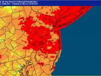
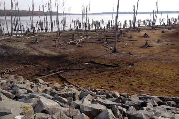
By the fourth week of November, most of the state had yet to accumulate an inch of rain, with only a few locations having received as much as 1.50". Given the dry conditions that had persisted across NJ, especially the northern half, since early September, the ONJSC recommended that the weekly US Drought Monitor designate the northern quarter of the state as D1 (moderate drought, with a return period every 5 to 10 years) and Burlington and Ocean counties northward to the D1 area as D0 (abnormally dry, with a return period every 3 to 5 years). Evidence of the dry conditions included northern reservoirs below normal seasonal capacity, well below-average stream flows and low ground water levels. Surface moisture was also quite low, contributing to the spread of a 230-acre brush fire in Cheesequake State Park (Monmouth) that began on the windy 24th and was not fully extinguished until the rains of the 26th-27th.
While 90-day deficits remain substantial, the pre-Thanksgiving storm, at least temporarily, put the brakes on encroaching drought conditions. For example, a Franklin Township (Somerset) station received just 2.98" from September 4 - November 25 (83 days) before collecting 2.82" from the storm. With conditions having been so dry, the heavy rain failed to bring streams over their banks and even kept most basement sump pumps quiet. Heavy rain, some northwest freezing rain, and strong winds contributed to holiday travel woes, though fortunately the worst conditions occurred during the overnight hours of Tuesday the 26th into Wednesday the 27th. Amongst over 250 storm reports from NJ CoCoRaHS observers and automated NJWxNet stations, Little Falls (Passaic) received the most rainfall, with 3.81". Verona Township (Essex) was close behind with 3.71", followed by Cedar Grove (Essex County) with 3.60" and Florham Park (Morris) 3.57". Over two-dozen locations received at least 3.00" and close to 100 were between 2.00"-2.99". The heaviest rain fell in a swath from Mercer and Hunterdon counties northeast to Bergen and Passaic counties, with somewhat less to the northwest and along the coast. Still, the lowest totals exceeded an inch, with the smallest total of 1.24" at Sea Isle City (Cape May), with Wildwood Crest (1.31") and Upper Township (1.47") in Cape May County coming in as the next "driest" locations.
In addition to the rain, which as previously mentioned froze on contact with some surfaces in the northwest early on, there was a bit of snow at the beginning of the event, totaling no more than a few tenths of an inch at higher elevations. Snow also fell at the tail end of the storm, though only accumulating at elevations above 750-1000 feet. This included 1.3" at the High Point Ranger Station (Sussex; 1500' elevation), 0.8" at Wantage (Sussex), and 0.5" and 0.2", respectively, in the Hunterdon County townships of Bethlehem and Holland.
Temperatures throughout most of NJ soared into the 50°s and low 60°s as the storm passed over NJ, with four stations making it to 64° in the pre-dawn hours of the 27th. In the northwest, High Point Monument (Sussex) only reached 47°, while cold air remained trapped in some valleys, thus Walpack (Sussex) never made it above 40° and Hope (Warren) above 42°.
The barometer fell to 29.30"-29.40" as the storm passed over NJ, and this contributed to winds gusting over 30 mph in exposed locations. This included maximums of 57 mph at High Point Monument and 55 mph at Wantage. Eight stations gusted into the low 40 mph range and 20 between 30-39 mph on the 27th, with Atlantic City Marina (Atlantic) and Wantage up to 44 mph and 40 mph, respectively, on the 28th.
On the heels of the storm, the strongest high-pressure system of the season arrived, bringing barometers up to the impressive 30.70"-30.80" range on the 29th-30th.
Aside from the winds gusting above 40 mph on the aforementioned 1st, 18th, 27th, and 28th, eight other November days had stations exceed that mark. High Point Monument got to 42 mph and Wantage 41 mph on the 7th, and High Point to 41 mph on the 8th. The 10th was a windy day, with High Point Monument to 44 mph, four stations from 40-42 mph, and 24 of 50 NJWxNet stations reporting winds in the 30-39 mph range. Clayton (Gloucester) reached 44 mph on the 12th and 42 mph on the 13th, with High Point Monument to 41 mph and 46 mph, respectively, on these days. The Monument station reached 49 mph on the 19th and 48 mph on the 23rd, with Wantage at 42 mph and 47 mph, respectively, on those days. The 25th was the windiest day statewide during November, with High Point Monument gusting to 58 mph, eleven stations between 40-49 mph, and 24 between 30-39 mph.
Fall summary
The major story of the fall was the dry conditions that prevailed over much of NJ. Statewide precipitation from September through November totaled 7.44". This is 4.20" below average and ranks as the 19th driest since 1895. Further information on the dry conditions and the temporary reprieve provided by the late November nor'easter was provided above.
Temperatures varied quite a bit during the season, with September and November averaging below normal and October above. Combined, the 54.9° average was 0.6° below normal and ranks as the 63rd coolest (or 57th warmest).
A storm that impacted the southern portion of NJ from October 9th-12th was arguably associated with the remnants for Tropical Storm Karen. Otherwise there were no tropical storm impacts on the region during the fall. The Atlantic hurricane season finished with twelve named storms, only two of which became minimal (category 1) hurricanes. This compares with a 30-year average of twelve named storms, seven of which reach hurricane status, with three of these major (category 3 or higher) storms. The remnants of Tropical Storm Andrea soaked NJ in June, providing the only other storm-related precipitation for New Jersey during the 2013 hurricane season.


