Coastal Flooding

Turn! Turn! Turn!: September 2023 Recap

October 9, 2023 - 2:32pm -- Dave Robinson

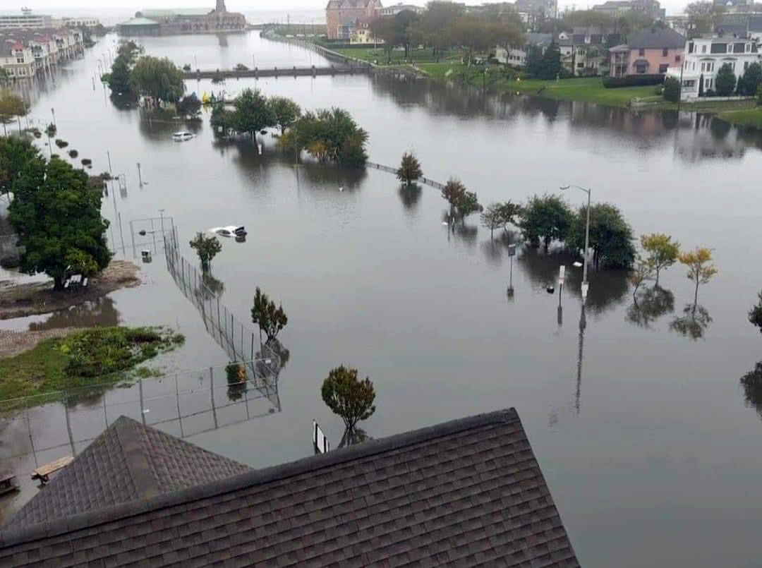
Flooding of Wesley Lake on the border of Asbury Park and Ocean Grove (Monmouth County) on September 29th. Submerged cars are located on aptly named Lake Avenue. (Photo courtesy of S. Isk).

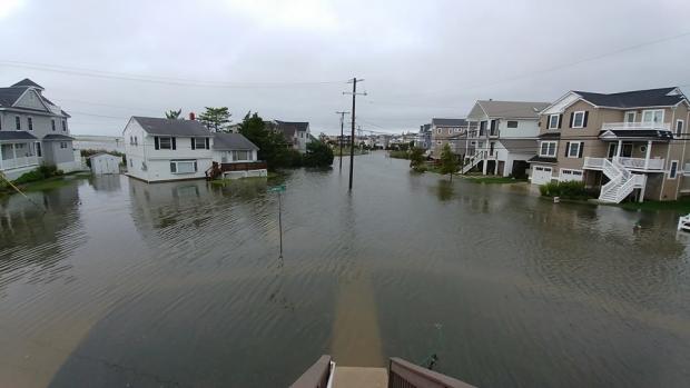
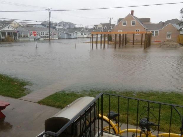
Fall and spring months are considered to be seasonal transition ones. At times, the change of season takes place rather slowly. Then there are months like this past September when the turn is quite abrupt. September 2023 began with the hottest day and week of 2023. Several rainy periods, some with severe storms, ensued as temperatures began to decline and Hurricane Lee, while remaining far offshore, brought rough surf and some clouds to NJ. Soon after came chilly conditions with the remnants of Tropical Storm Ophelia twice bringing heavy rain into portions of the state and over a week of minor to occasional moderate coastal flooding at times of high tide.

Statewide, the average temperature of 68.1° was 1.2° above the 1991–2020 normal. This ranked as the 16th warmest September since records commenced in 1895. The average high temperature was 77.4°, which 0.2° above normal and ranks 35th warmest. The average low temperature of 58.8° was 2.2° above normal, ranking 8th warmest. The northern climate division averaged 65.8° above (+0.9°, 21st warmest), southern +69.5° (+1.4°, 14th warmest), and coastal 69.9° above (+1.2°, 14th warmest).

September rainfall was excessive, with the southwest and northwest the driest regions of the state yet averaging above the statewide 30-year normal. The wettest area was along the northern coast with rainfall as much as 3 to 4 times above the climatological mean. Statewide, September precipitation averaged 7.55”, which is 3.39” above normal and ranks as the 9th wettest. The northern division averaged 7.73” (+3.27”, 11th wettest), southern 7.38” (+3.39”, 11th wettest), and coastal 8.01” (+4.12”, 3rd wettest).

Seeking Identities:December 2022 and Annual 2022 Recaps

January 6, 2023 - 9:53pm -- Dave Robinson

Strong winds push waves and spray onshore after a cold frontal passage on December 23rd in Seaside Heights (photo credit: Daniel Nee/Lavallette-Seaside Shorebeat).

As has so often been the situation in 2022, December’s weather never settled into any persistent pattern. Unless, of course, a pattern of frequent variations constitutes persistence! In any case, it seems appropriate to co-label this combined monthly and annual report as intervals in search of identities!

Looking first at December, the statewide average temperature of 35.5° is 1.1° below the 1991–2020 normal. This ranks as the 44th mildest December dating back to 1895. The statewide average maximum temperature of 44.9° is 0.1° below normal and ranked 31st mildest. The average minimum was 26.1°, which is 2.1° below normal and ranks 54th mildest. North Jersey averaged 33.3° (-0.8°, 36th mildest), south Jersey 36.8° (-1.3°, 49th mildest), and the Jersey coast 37.7° (-1.4°, 50th mildest).

Statewide precipitation averaged 4.76”, which is 0.49” above normal and ranks 35th wettest. North Jersey averaged 4.93” (+0.68”, 32nd wettest), south Jersey 4.68” (+0.40”, 37th wettest), and the Jersey coast 4.49” (+0.13”, 43rd wettest). The wettest locations were in the northeast and along the northern coast, while the northwest and much of the south were on the drier side.

Once Again, Summer is Slow to Depart: September 2018 Recap

October 7, 2018 - 8:18pm -- Dave Robinson

Coastal flood photo

For the fourth consecutive year, summer weather stubbornly hung on well into September across the Garden State. The statewide average temperature of 70.4° was 4.6° above the 1981–2010 mean, and ranks as the third warmest since records commenced in 1895. September 2017, now ranking 11th, sat in the top 10 for just one year before being bumped out by 2018. This September was the fifth consecutive month of above-average temperatures. The past 12 months have seen the 2nd warmest October, 4th warmest May, 1st warmest August (tied with 2016 based on updated figures), and now the 3rd warmest September. The June through September period this year averaged 73.3° (+2.5°), making it the 4th warmest on record. The top 10 such intervals have all occurred since 2005. The August–September average of 73.7° (+4.3°) was the warmest on record, followed by 2005, 2016, 2015, and 2010.

Perhaps what was most interesting about temperatures this past month was the disparity between average maximum and minimum temperature anomalies. The average maximum of 77.7° was 1.4° above average and ranked 27th warmest. However, the average minimum of 63.2° was 7.9° above average and is a whopping 2.2° milder than the previous highest September average minimum. This came about due to the excessive cloud cover and humidity throughout most of the month, which kept the days from getting too warm and, come nighttime, “trapped” much of the heat gained during the day within the lower atmosphere. Thus, unlike the past three warm Septembers (as well as 2013 and 2014), each of which had below-average precipitation, this year was anything but dry. There were frequent rainy episodes, which at times produced localized deluges and resultant flash flooding. The statewide average rainfall of 7.60” is 3.55” above the 1981–2010 average, and is tied with 1960 as the sixth wettest September since 1895. The wettest September on record remains 1999, which averaged 9.50 inches, in no small part due to Tropical Storm Floyd’s rains. Aside from 1999, you have to go back to 1975 to find a September with more rain than this year.

Plenty Dry with Backwards Warmth: September 2017 Summary

October 5, 2017 - 4:40pm -- Dave Robinson

Waves photo

While remarkable deadly and destructive hurricanes pummeled portions of the Caribbean and southern states, September weather conditions in the Garden State were generally quiet. The most notable exceptions were the dangerous rip currents at the Jersey shore associated with the latter stages of Hurricanes Irma and Jose, which resulted in several drowning deaths and numerous water rescues. Minor to some moderate back-bay flooding and beach erosion accompanied the tumultuous surf, particularly between the 18th–21st. Otherwise, little more than some clouds and light rain reached NJ from these storms, while earlier some remnant energy and moisture from Hurricane Harvey brought one of the month’s few notable rain episodes. Dry conditions prevailed through much of the September, especially the second half. As a result, statewide precipitation averaged just 2.23”. This is 1.82” below the 1981–2010 average and was the 28th driest September since 1895.

While the first half of the month had an average temperature of about a degree below normal, September finished on a warm note. Some locations experienced three consecutive days with maximums of 90° or higher from the 23rd–25th. This backwards turn to warmth while the calendar suggested there should be a decline in temperature resulted in the month averaging 2.6° above the long-term mark. The 68.4° average made this the 10th warmest September on record. The last three Septembers and six since 2005 all fall into the top 10.

A Dreary Month, and Shades of Years Past: December and 2014 Annual Summary

January 5, 2015 - 9:58pm -- Dave Robinson

Coastal Flooding from Dec 9 Nor'easter

Clouds prevailed in this darkest month of the year, making for some rather persistent dreary conditions. Until the last week of the month there were only two days (the 4th and 7th) where the sun outperformed the clouds across NJ. At least the year ended on a bright note, with lots of sun during five of the last six days. With the clouds came a fair amount of precipitation, and given milder-than-normal conditions, the vast majority was in the form of rain. Statewide precipitation averaged 4.79". This is 0.88" above the 1981–2010 mean and ranks as the 27th wettest December since 1895. The mean temperature of 38.9° was 3.3° above average and ranked as the 15th warmest on record. Snowfall averaged 0.6", some 3.5" below average and ranked as the 19th least snowy December. A strong nor'easter brought strong winds, multiple inches of rain, minor to moderate coastal flooding, and beach erosion on the 9th.

Subscribe to RSS - Coastal Flooding