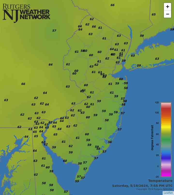
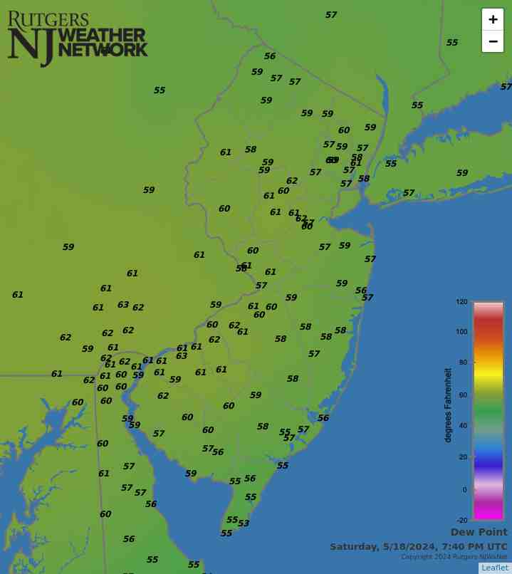
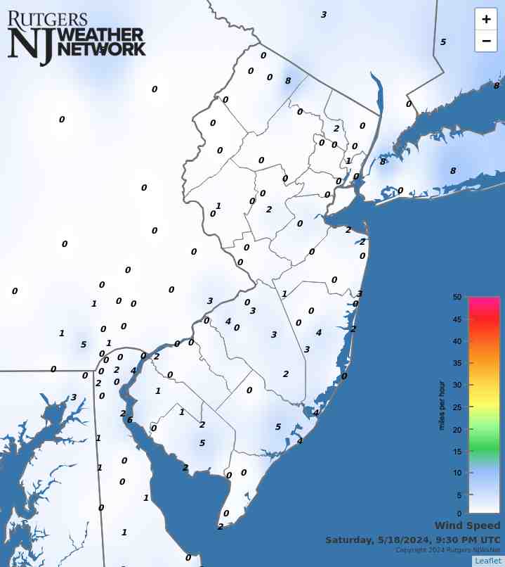
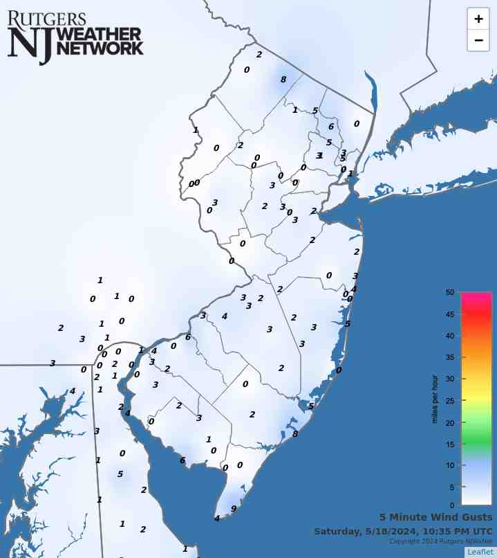
Latest Temperatures

Current Dew Point

Latest Wind Speeds

Wind Gusts

Top Story

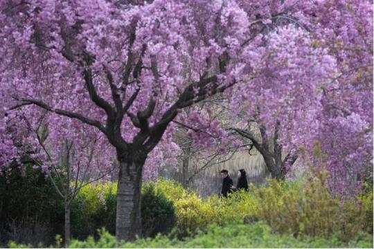
Cherry Blossom trees in full bloom at Branch Brook Park in Newark (Essex County) on April 10th. Photo by Tariq Zehawi/NorthJersey.com.

You would never have guessed it by looking at most days, with some wet, some dry, some warm, some cold, but put it all together and a rather normal April temperature- and precipitation-wise emerged from quite a variety of days and weeks. This is often the case during a transitional month (mid-fall or mid-spring), but this month took it to a bit of an extreme. Toss in a partial solar eclipse and an earthquake and it was quite the month for all who enjoy observing our fascinating world and solar system.

April precipitation averaged 4.14” across New Jersey. This is 0.44” above the 1991–2020 normal and ranks as the 42nd wettest of records dating back to 1895. Generally, the north received more rain than the south. The north climate division averaged 4.59” (+0.69”, 40th wettest), south division 3.89” (+0.31”, 48th wettest), and coastal division 3.65” (+0.10”, 61st wettest).

The year-to-date precipitation (rain and melted frozen precipitation) is 19.86”. This is 5.61” above normal and ranks as the 5th wettest January–April period on record. The top total is 22.98” in 1983 and the second through four wettest occurred in 1979, 1958, and 1953. The past 12 months have seen a state average 56.98” of precipitation, which is the 6th wettest of all such May–April periods dating back to 1895.

Latest Extremes

City, State Temp
Logan Twp., NJ 62
Sussex, NJ 62
Lyndhurst, NJ 62
North Haledon, NJ 61
West Deptford, NJ 61
City, State Temp
Hackettstown, NJ 56
West Cape May, NJ 56
Harvey Cedars, NJ 56
Chester Borough, NJ 56
Little Egg Harbor Twp., NJ 56
most current information as of May 18 11:20 PM

Latest Conditions & Forecast

New Brunswick, NJ

Rutgers University Meteorology Program

60°F

Wind

0 mph from the NNW

Wind Gust

1 mph from the N

Slight Chance Showers and Patchy Fog
57 °F
Patchy Fog then Partly Sunny
70 °F
Partly Cloudy then Patchy Fog
54 °F
Patchy Fog then Mostly Sunny
74 °F
Mostly Clear
53 °F
Sunny
82 °F
Mostly Clear
56 °F
Sunny
85 °F
Partly Cloudy
62 °F
Partly Sunny then Chance T-storms
84 °F
Chance T-storms
60 °F
Mostly Sunny
80 °F
Chance Showers
57 °F
Partly Sunny then Chance Showers
74 °F

Tonight

A slight chance of showers before midnight. Patchy fog after 3am. Otherwise, mostly cloudy, with a low around 57. Calm wind. Chance of precipitation is 20%.

Sunday

Patchy fog before 8am. Otherwise, partly sunny, with a high near 70. Northeast wind around 5 mph.

Sunday Night

Patchy fog after 2am. Otherwise, partly cloudy, with a low around 54. East wind around 5 mph becoming calm in the evening.

Monday

Patchy fog before 8am. Otherwise, mostly sunny, with a high near 74. Northeast wind around 5 mph.

Monday Night

Mostly clear, with a low around 53. Southeast wind around 5 mph becoming southwest after midnight.

Tuesday

Sunny, with a high near 82.

Tuesday Night

Mostly clear, with a low around 56.

Wednesday

Sunny, with a high near 85.

Wednesday Night

Partly cloudy, with a low around 62.

Thursday

A chance of showers and thunderstorms after 2pm. Partly sunny, with a high near 84. Chance of precipitation is 30%.

Thursday Night

A chance of showers and thunderstorms. Mostly cloudy, with a low around 60. Chance of precipitation is 30%.

Friday

Mostly sunny, with a high near 80.

Friday Night

A chance of showers. Mostly cloudy, with a low around 57. Chance of precipitation is 30%.

Saturday

A chance of showers. Partly sunny, with a high near 74. Chance of precipitation is 30%.

Search by zipcode or city/state for the latest conditions, forecasts, graphs, maps and more nearest to you.

More News

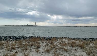
Looking south from Island Beach State Park toward Long Beach Island and the Barnegat Lighthouse on March 20th (photo by Dave Robinson).

So much for March flipping from lion to lamb or vice versa. March 2024 was often a lion throughout, with frequent roaring winds and multiple rain events producing a near-record monthly precipitation total and occasional flooding. The first half of the month ran at a record-warm pace, the monthly average later to be tempered by a second half that was cooler than the first. Still, the month emerged as the 9th mildest on record. Befitting the overall mild conditions, snowfall was scarce to non-existent. Winds gusted to 35 mph or higher at one or more Rutgers NJ Weather Network (NJWxNet)...

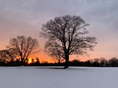
Sunset at Colonial Park in Franklin Township (Somerset County) on February 15th (photo by Dave Robinson).

Perhaps the title of this report is a bit overstated when it comes to February weather conditions, but not by all that much. However, like much of the coterminous United States, it applies rather appropriately to the December 2023–February 2024 winter. New Jersey’s winter conditions follow at the end of this report, with February discussed first. February 2024 was on the dry side. In fact, the statewide average precipitation (rain and melted snow) of 1.55” was 1.31” below the 1991–2020 normal and ranks as the 12th driest since records began in 1895. The northern climate division averaged...

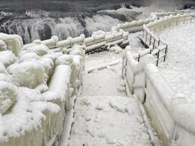
An ice-encased walkway and railings generated from spray from Great Falls (background) in Paterson (Passaic County) during the cold January outbreak (photo courtesy of Liz Reilly).

The first month of 2024 provided a potpourri of weather happenings, including excessive rainfall and flooding, multiple snowfalls, frequent strong winds, frigid days, occasional warmth, and culminating with persistent dismal (aka damp, cloudy) conditions. Something for anyone or perhaps not favored conditions for most people. Totaling up the multiple precipitation episodes, this month emerged as the 6th wettest January on record dating back to 1895. It was the wettest January in 25 years and follows this past December, which was the wettest on record. The statewide 6.39” of rain and melted...

More News

Dry Conditions Persist: December 2021 Recap; Another Warm One: Annual 2021 Recap

January 8, 2022 - 1:28pm -- Dave Robinson

Fallstreak photo

Following a cooler-than-normal November, it was back to the mild side in December, the ninth such month in 2021. However, much like November, the last month of 2021 was a top 10 dry one. An annual recap follows the December report where more will be said regarding annual temperature and precipitation.

Statewide precipitation in December was 1.29”. This is 2.98” below the 1991–2020 normal and ranks as the 6th driest since records commenced in 1895. It was the driest December since 1989, which happened to be the coldest December on record. The west-central area received the most precipitation, exceeding 1.80” in some locations, but this was still well below normal. The far south was driest, most places receiving less than an inch. The northern division averaged 1.46”, which is 2.79” below normal and ranked 10th driest. The southern division came in with 1.20”, which is 3.08” below normal and ranks 5th driest. The coastal division with 1.09” was 3.27” below normal and ranked 4th driest.

ONJSC's Top 10 NJ Weather and Climate Events of 2021

January 3, 2022 - 7:18pm -- Dave Robinson

A flooded TD Bank Ballpark in Bridgewater (Somerset County) on September 2nd following the staggering rainfall caused by the remnants of Ida. Photo by Thomas P. Costello and Tariq Zehawi/USA Today Network.

For the 13th consecutive year, we in the state climate office have evaluated the myriad daily, monthly, and annual observations gathered across New Jersey during the course of the year to choose what we feel were the most significant and impactful 10 weather and climate events of 2021. More about each event can be found in the monthly narratives and the special Post-tropical Cyclone Ida report posted on our website. You might be tempted to rearrange the rankings, particularly as some of the events on the list may have affected you more than others ranked higher. Or perhaps you best recall one that didn't make the list. That's the enjoyment and frustration of lists! Unless stated otherwise, statewide values are based on an average of several dozen stations. The period of record for monthly, seasonal, and annual departures is 1991–2020; while for extremes and rankings it is from 1895–present. Observations are mainly drawn from National Weather Service Cooperative Observing Program stations, Rutgers NJ Weather Network stations, and NJ Community Collaborative Rain, Hail, and Snow Network locations.

It’s Been A While: November 2021; A Common Theme: Fall 2021 Recap

December 7, 2021 - 4:32pm -- Dave Robinson

The season’s first measurable snow at High Point on November 15th. Photo courtesy of N. Stefano.

November was the first month since May 2020 with both averages of precipitation and temperature below 1991–2020 normals. The last drier-than-normal month was this past June while the last cooler-than-normal month was this past May. However, it’s been a while, 19 months, since the two anomalies teamed up. And dry it was, with the statewide average of 1.06” running 2.29” below normal. This ranks as the 7th driest November since records commenced in 1895. Only two other Novembers since 1936 fall in the top 10.

The statewide average November temperature of 43.9° was 1.2° below the 1991–2020 normal and ranked as the 73rd coolest of the past 127 years. This was 17.2° cooler than the mild average of this past October. The normal difference between the months is 10.2°. The average maximum was 54.5° (-0.2°, 84th coolest) and the average minimum was 33.2° (-2.3°, 47th coolest). The north averaged 41.9° (-1.2°, 74th coolest), the south 44.9° (-1.4°, 68th coolest), and the coast 46.0° (-1.3°, 70th coolest). The first Rutgers NJWxNet or NWS Cooperative station to reach the freezing point this season was Pequest (Warren County), late on the 2nd. This was the latest first freeze in NJ since at least 1900 (based on Coop records). The last location to reach freezing was West Cape May (Cape May) on the 28th, on the late side but not unusually so.

A Slow Crawl into Fall: October 2021 Recap

November 8, 2021 - 5:43pm -- Dave Robinson

Colorful foliage surrounding Lake Hopatcong (Sussex County) on October 31st, bringing a tranquil close to a turbulent end of October. Photo courtesy of Kelly Wallis.

October was the second mildest on record in the Garden State since records commenced in 1895. This follows on the heels of the 11th warmest September, leaving most residents wondering when cool weather would arrive and leaves would turn and fall. For the first time since at least 1900, not a single weather observing station in New Jersey recorded a freezing low temperature on any day in either September or, as is climatologically most common, October. All of this resulted in a leaf season that was delayed by one to two weeks.

The statewide average October temperature of 61.1° was 5.7° above the 1991–2020 normal, a mark only surpassed in 2007. The average daily maximum of 70.1° (+4.3°) ranked 5th mildest (tied with 1920), and the average minimum of 52.0° (+7.1°) tied with 2007 as the mildest. These temperatures are close to what Norfolk, Virginia, normally experiences in October. In fact, despite the mean temperature normally declining 11.5° from September to October, this year’s mean was warmer than four previous Septembers since 1895 and the minimum was milder than 14 earlier Septembers. The state’s three climate divisions all ranked second mildest, with the north at 59.0° (+5.7°), south 62.3° (+5.8°), and coastal 63.2° (+5.6°).

Unprecedented: September 2021 Recap

October 11, 2021 - 4:38pm -- Dave Robinson

A flooded TD Bank Ballpark in Bridgewater (Somerset County) on September 2nd following the staggering rainfall caused by the remnants of Ida. Photo by Thomas P. Costello and Tariq Zehawi/USA Today Network.

Post-tropical storm Ida. The title of this month’s report speaks to this momentous weather extreme that will forever be the defining event of this month and likely the entire year. The storm delivered the most powerful tornado to strike the Garden State since 1990, demolishing multiple homes in Gloucester County. Rainfall exceeding 3.00” per hour led to the most widespread flash flood event on record for the state, resulting in the tragic deaths of 30 individuals in central and northeastern locales. A separate report on Ida has been prepared and may be accessed in the "News" menu.

There were 29 other days of weather this month that fortunately were not as dramatic as Ida on the 1st. All told, monthly precipitation averaged 6.20” across NJ. This was 2.04” above the 1991–2020 normal and ranks as the 15th wettest September since 1895. The north, where the bulk of Ida’s rain fell, averaged 8.92”, which was 4.46” above normal and ranks 7th wettest. The south averaged 4.61”, which was 0.62” above normal and ties as the 31st wettest. Along the coast, only 3.81” fell, some 0.08” below normal and ranking 44th wettest.

Ida Remnants Strike New Jersey

October 6, 2021 - 2:59pm -- Dave Robinson

Photo of flood debris from business establishments on Main Street in Manville on September 7 (photo credit: M. Holzer).

Post tropical storm Ida moved across the Garden State during the afternoon of September 1st into the early hours of the 2nd. It brought with it torrential rainfall, leading to flash and river flooding that took the lives of approximately 30 individuals and the rescue of countless more from raging waters. Additionally, it brought three tornadoes to southwestern and central areas, including the first EF-3 twister to strike New Jersey in 31 years. There were only minor injuries and no deaths from the tornadoes.

Ida developed in the Caribbean, being named a tropical storm on August 26th. From there, it moved northwestward, attaining hurricane status on the 27th as it passed over extreme western Cuba and moved into the Gulf of Mexico. It maintained a steady course as it strengthened into a major category 4 hurricane, making landfall in Louisiana on the 29th with sustained one-minute wind speeds as high as 150 mph. Once inland, winds diminished rather quickly but rainfall associated with the tempest remained heavy as the storm began to curve toward the northeast. This track remained quite steady as the storm weakened to a tropical depression on the 30th and became an extratropical low-pressure system as it approached the central Appalachians. On September 1st, Ida’s remnants merged with an advancing cold front as the system entered the Mid-Atlantic and crossed New Jersey before moving into southeast New England on the 2nd.

Sticky: August 2021 and Summer 2021 Recaps

September 10, 2021 - 6:30pm -- Dave Robinson

Flash flooding and residential evacuations in Helmetta on August 22

Whether the thermometer was reading high or low this August or whether rain was falling or not, one factor that most always had to be considered was the high level of humidity. The “Dog Days” of summer indeed. Of course, there was much else to consider this month, including contributions of rain from two tropical storms, one of which brought the largest crests on some rivers since May 1, 2014, 11 days where one or more locations received at least 2.00” of rain, and 16 days where the high temperature reached 90° or higher somewhere in the state.

Adding up all the rainfall, the statewide monthly average was 6.87”. This is 2.30” above the 1991–2020 normal and ranks as the 15th wettest August since 1895. The northern climate division led the way with 7.89” (+3.33”, 11th wettest), followed by the coastal area with 6.65” (+2.05”, 21st wettest), and the southern division at 6.21” (+1.64”, 27th wettest).

The statewide average temperature of 75.9° is 2.3° degrees above normal and ranks 4th warmest. Seven of the top 10 and 13 of the warmest 20 have occurred this century. The warmth was most strongly a function of elevated nighttime temperatures, which, for NJ, averaged 66.9°. This is 3.6° above normal and ranks 2nd warmest. The maximum temperature averaged 84.9°, some 1.1° above normal and ranks 18th warmest.

Everything but the Kitchen Sink: July 2021 Recap

August 5, 2021 - 7:55pm -- Dave Robinson

Tornado damage

Wow, what a month. July 2021 provided a never-ending cascade of weather events, including a tropical storm, a record-tying number of tornadoes, large hail, flash floods, hot days, chilly nights, smoke-filled skies, and on the last day of the month, perhaps the nicest day of the summer. The statewide average precipitation of 7.59” was 2.88” above the 1991–2020 normal and ranked 8th wettest of all Julys back to 1895. It was the wettest July since 1975 and second wettest in almost 50 years. The northern portion of the state averaged 8.16” which was 3.44” above normal. The south averaged 7.36” which was 2.62” above normal.

The average temperature of 75.8° was 0.4° above the 1991–2020 normal, but 1.9° above the 1895–2021 average. This ranked as the 24th warmest July since 1895. 13 of the 25 warmest Julys in the past 127 years have occurred since 2002. The nine July tornadoes is the most in a month since official records began in 1950. Tropical Storm Elsa was the earliest fifth storm of any season on record in the Atlantic basin. Read on for details on this potpourri of weather happenings.

Hit or Miss: June 2021 Recap

July 8, 2021 - 7:32pm -- Dave Robinson

A weir immediately downstream of the confluence of the Raritan and Millstone rivers in Somerset County on June 16th, as taken from the towpath of the Delaware-Raritan Canal

June was a hit or miss month when it came to rainfall, even within counties. Of course, this is not all that uncommon during the warm season, where much of the rainfall arrives courtesy of localized showers and thunderstorms. There were also ups and downs of the thermometer during the month, including some chilly mornings. Overall, the balance was weighted towards the warm side of the ledger, resulting in a top 10 ranking for June temperature.

The statewide average temperature of 71.9° was 1.6° above the 1991–2020 normal (3.0° greater than the 1895–2021 average). This ties the month with 2011 as the 8th warmest since records commenced in 1895. Seven of the 16 warmest Junes of the past 127 years have occurred in just the past 17 years. The average high of 82.7° was 1.7° above normal and ties as the 11th warmest, while the average low of 61.0° was 1.4° above normal and ranks 8th warmest.

Decision-Making Dilemma: May & Spring 2021 Recaps

June 6, 2021 - 4:03pm -- Dave Robinson

A waterspout over Barnegat Bay on May 8th near Seaside Heights

Weather often varies from week-to-week and even day-to-day during the spring transition season. Such was certainly the case in spring 2021, as will be recapped later in this report. However, when it came to such “weather indecision,” May 2021 took the cake. Starting off somewhat damp with seasonable temperatures, a prolonged period of exceedingly dry weather ensued, first accompanied by cooler-than-normal temperatures and frosty mornings, and later by summer-like heat. As several wildfires broke out and soil moisture vanished, concerns of early-summer drought arose. Then along came one of the coolest Memorial Day weekends on record, accompanied by more than an average May’s worth of rain in some locations. This led to frequent decision making amongst farmers, gardeners, water resource managers, utility companies and customers, and day trippers. All were left wondering what might come next! Cicadas perhaps?

With the thermometer up and down throughout May, the statewide average temperature of 61.0° was just 0.2° below the new 1991–2020 normal. This ranked as the 47th mildest May since 1895. The average maximum of 73.0° was 0.7° above normal, while the 49.0° average minimum was 1.2° below normal. This is illustrative of a month that had many clear days and cool nights with low humidity. Despite dry conditions for most of the month, monthly precipitation came in close to normal, averaging 3.95” across NJ. This is 0.20” above normal, ranking 48th wettest of the past 127 years. Far south and west central areas were driest, while the central coast and northeast saw the most rain. Unlike last May, no snow was observed.

Pages

Subscribe to Front page feed