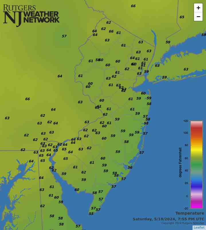
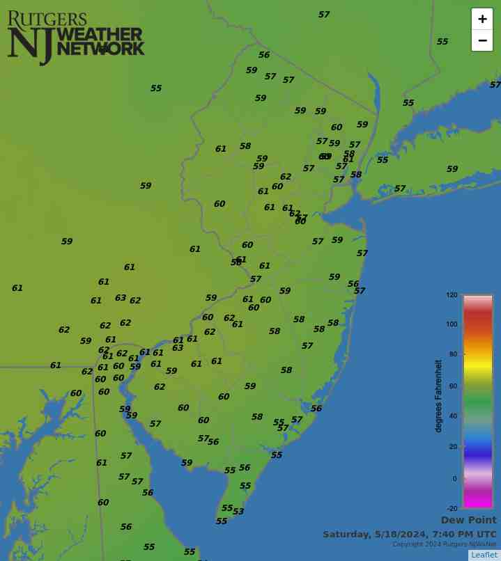
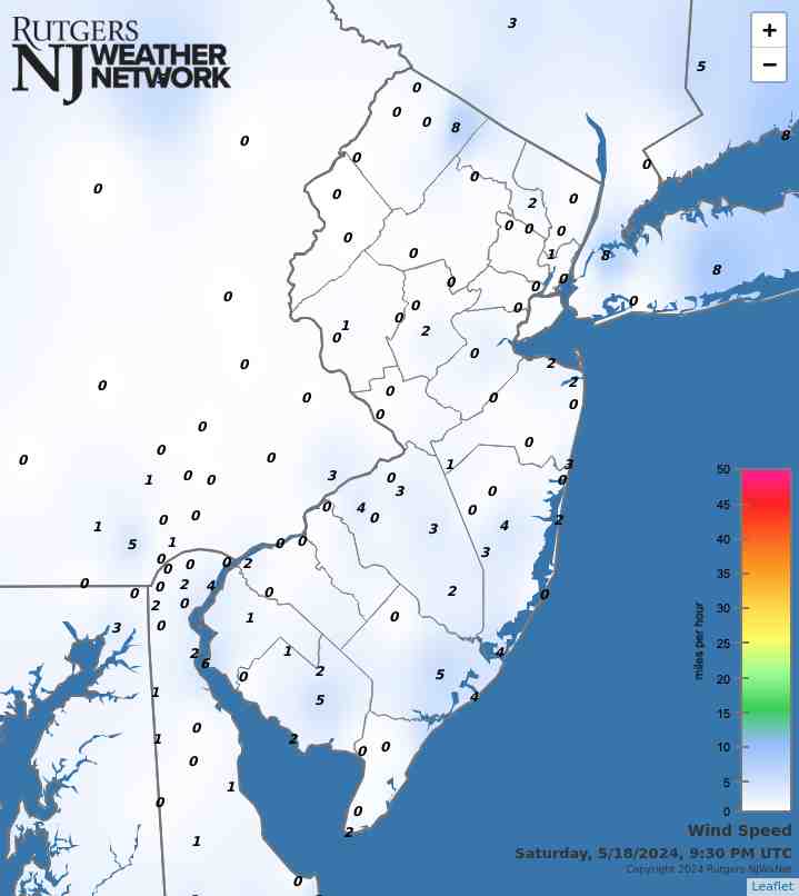
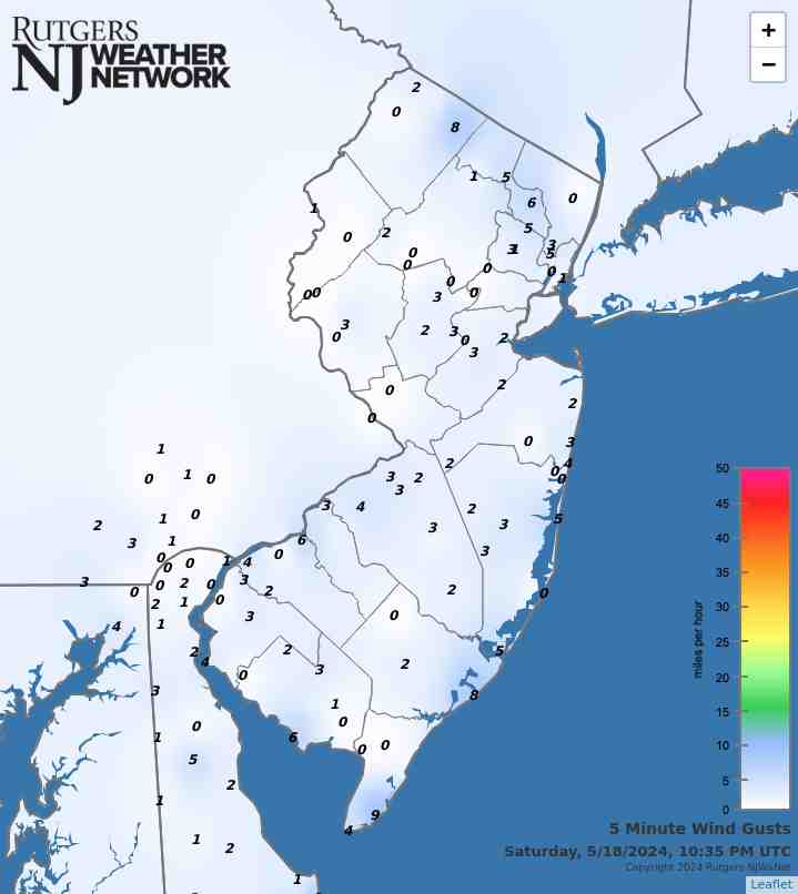
Latest Temperatures

Current Dew Point

Latest Wind Speeds

Wind Gusts

Top Story

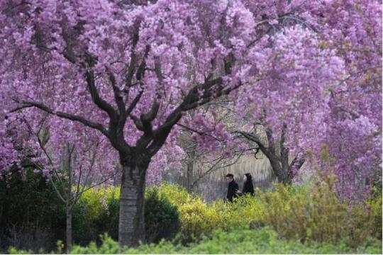
Cherry Blossom trees in full bloom at Branch Brook Park in Newark (Essex County) on April 10th. Photo by Tariq Zehawi/NorthJersey.com.

You would never have guessed it by looking at most days, with some wet, some dry, some warm, some cold, but put it all together and a rather normal April temperature- and precipitation-wise emerged from quite a variety of days and weeks. This is often the case during a transitional month (mid-fall or mid-spring), but this month took it to a bit of an extreme. Toss in a partial solar eclipse and an earthquake and it was quite the month for all who enjoy observing our fascinating world and solar system.

April precipitation averaged 4.14” across New Jersey. This is 0.44” above the 1991–2020 normal and ranks as the 42nd wettest of records dating back to 1895. Generally, the north received more rain than the south. The north climate division averaged 4.59” (+0.69”, 40th wettest), south division 3.89” (+0.31”, 48th wettest), and coastal division 3.65” (+0.10”, 61st wettest).

The year-to-date precipitation (rain and melted frozen precipitation) is 19.86”. This is 5.61” above normal and ranks as the 5th wettest January–April period on record. The top total is 22.98” in 1983 and the second through four wettest occurred in 1979, 1958, and 1953. The past 12 months have seen a state average 56.98” of precipitation, which is the 6th wettest of all such May–April periods dating back to 1895.

Latest Extremes

City, State Temp
Caldwell, NJ 63
Sussex, NJ 63
Logan Twp., NJ 63
North Haledon, NJ 62
West Deptford, NJ 62
City, State Temp
West Cape May, NJ 55
Little Egg Harbor Twp., NJ 56
Hackettstown, NJ 56
Dennis Twp., NJ 57
Harvey Cedars, NJ 57
most current information as of May 18 10:00 PM

Latest Conditions & Forecast

New Brunswick, NJ

Rutgers University Meteorology Program

60°F

Wind

1 mph from the NNE

Wind Gust

2 mph from the E

Chance Showers then Patchy Fog
57 °F
Patchy Fog then Partly Sunny
70 °F
Partly Cloudy then Patchy Fog
54 °F
Patchy Fog then Mostly Sunny
74 °F
Mostly Clear
53 °F
Sunny
82 °F
Mostly Clear
56 °F
Sunny
85 °F
Partly Cloudy
62 °F
Partly Sunny then Chance T-storms
84 °F
Chance T-storms
60 °F
Mostly Sunny
80 °F
Chance Showers
57 °F
Partly Sunny then Chance Showers
74 °F

Tonight

A chance of showers, mainly before 11pm. Patchy fog after 3am. Otherwise, mostly cloudy, with a low around 57. Calm wind. Chance of precipitation is 40%. New precipitation amounts of less than a tenth of an inch possible.

Sunday

Patchy fog before 8am. Otherwise, partly sunny, with a high near 70. Northeast wind around 5 mph.

Sunday Night

Patchy fog after 2am. Otherwise, partly cloudy, with a low around 54. East wind around 5 mph becoming calm in the evening.

Monday

Patchy fog before 8am. Otherwise, mostly sunny, with a high near 74. Northeast wind around 5 mph.

Monday Night

Mostly clear, with a low around 53. Southeast wind around 5 mph becoming southwest after midnight.

Tuesday

Sunny, with a high near 82.

Tuesday Night

Mostly clear, with a low around 56.

Wednesday

Sunny, with a high near 85.

Wednesday Night

Partly cloudy, with a low around 62.

Thursday

A chance of showers and thunderstorms after 2pm. Partly sunny, with a high near 84. Chance of precipitation is 30%.

Thursday Night

A chance of showers and thunderstorms. Mostly cloudy, with a low around 60. Chance of precipitation is 30%.

Friday

Mostly sunny, with a high near 80.

Friday Night

A chance of showers. Mostly cloudy, with a low around 57. Chance of precipitation is 30%.

Saturday

A chance of showers. Partly sunny, with a high near 74. Chance of precipitation is 30%.

Search by zipcode or city/state for the latest conditions, forecasts, graphs, maps and more nearest to you.

More News

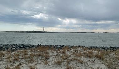
Looking south from Island Beach State Park toward Long Beach Island and the Barnegat Lighthouse on March 20th (photo by Dave Robinson).

So much for March flipping from lion to lamb or vice versa. March 2024 was often a lion throughout, with frequent roaring winds and multiple rain events producing a near-record monthly precipitation total and occasional flooding. The first half of the month ran at a record-warm pace, the monthly average later to be tempered by a second half that was cooler than the first. Still, the month emerged as the 9th mildest on record. Befitting the overall mild conditions, snowfall was scarce to non-existent. Winds gusted to 35 mph or higher at one or more Rutgers NJ Weather Network (NJWxNet)...

Sunset at Colonial Park in Franklin Township (Somerset County) on February 15th (photo by Dave Robinson).

Perhaps the title of this report is a bit overstated when it comes to February weather conditions, but not by all that much. However, like much of the coterminous United States, it applies rather appropriately to the December 2023–February 2024 winter. New Jersey’s winter conditions follow at the end of this report, with February discussed first. February 2024 was on the dry side. In fact, the statewide average precipitation (rain and melted snow) of 1.55” was 1.31” below the 1991–2020 normal and ranks as the 12th driest since records began in 1895. The northern climate division averaged...

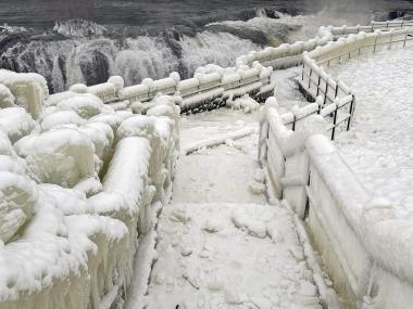
An ice-encased walkway and railings generated from spray from Great Falls (background) in Paterson (Passaic County) during the cold January outbreak (photo courtesy of Liz Reilly).

The first month of 2024 provided a potpourri of weather happenings, including excessive rainfall and flooding, multiple snowfalls, frequent strong winds, frigid days, occasional warmth, and culminating with persistent dismal (aka damp, cloudy) conditions. Something for anyone or perhaps not favored conditions for most people. Totaling up the multiple precipitation episodes, this month emerged as the 6th wettest January on record dating back to 1895. It was the wettest January in 25 years and follows this past December, which was the wettest on record. The statewide 6.39” of rain and melted...

More News

Union County towns see rare tornado

July 3, 2013 - 1:24pm -- Tom Karmel

Tornado Damage in Berkeley Heights

Mary Borsos walked toward her backdoor the morning of July 1 in Berkeley Heights (Union County) and noticed the rain falling in heavy sheets. “It didn't seem like anything unusual due to all the rain and thunderstorms we’ve had these past couple weeks.”

However, she quickly noticed the wind pick up, and took her three grandchildren a couple steps into the dining room away from windows. Within those couple steps, she heard trees begin to snap and branches pound the house. In what she described as “no more than two minutes”, Borsos’ yard was littered with downed trees, snapped power lines, and scattered outdoor furniture. Little did Borsos and many know, three towns encountered their first ever documented tornado.

Record Wet June and Mid-Year Recap

July 1, 2013 - 12:00am -- Dave Robinson

Raritan River flooding

Rain, rain and, more rain was the theme for New Jersey weather in June 2013. When all was said and done, statewide average precipitation totaled 9.57", a record for any June back to 1895 (Table 1). Temperatures were above average too. The average of 71.3° was 1.2° above the 1981-2010 mean and ranked as the 19th warmest June. These averages are derived from an evaluation of several dozen long-term National Weather Service Cooperative Observing (Coop) stations situated throughout the state.

More on thermal conditions later in this report, but first back to the precipitation. The 9.57" total was 5.55" above the 4.02" average. Tropical Storm Andrea brought the most abundant rain of the month, but there were 13 days during the month when an inch or more accumulated at one or more locations. A point of information is warranted here. While over an inch fell in some locations on the afternoon of the 30th, most Coop observers had already reported for the day, as had Community Collaborative Rain, Hail and Snow Network (CoCoRaHS) observers. Most take measurements close to 7 AM, with the historic rule being that the morning observation "ends" that particular calendar day. Thus any rain after that time on the last day of a month is reported on the 1st of the following month. While this practice can be debated, one can only compare June 2013 with previous Junes by following suit.

May 2013 Summary and Spring Recap

June 2, 2013 - 12:00am -- Dave Robinson

Seaside Heights boardwalk rebuild

If there is one thing that was consistent with New Jersey's weather in May, and for that matter throughout this past spring (March-May), it was the inconsistency. Of course this is rather typical of many a spring month, as our region sits in the battle zone between reluctantly retreating winter conditions and sporadically advancing summer weather. When all was said and done, May 2013 came in with a near average statewide temperature of 60.7°. This was 0.1° below the 1981-2010 average and ranks as the 53rd mildest May of the past 119 years (1895-present). Precipitation averaged 4.01", a minute 0.01" above average and was the 42nd wettest on record. It was not only day-to-day conditions that varied in May, there were also notable differences in temperature and precipitation from one location to another.

April 2013 Summary and 2012-2013 Snow Season Recap

May 4, 2013 - 12:00am -- Dave Robinson

April sea breeze map

While many wondered if spring would ever arrive across the Garden State, the average April temperature was actually close to the long-term mean. At 51.5°, the month was 0.3° above average, ranking as the 35th mildest April since statewide records were established in 1895. Using the central NJ city of New Brunswick as an example, 16 days were above average, 12 below, and two spot on average.

A Chilly Start to Spring: March 2013

April 7, 2013 - 12:00am -- Dave Robinson

While the core of the winter season (December-February) averaged quite a bit milder than usual across New Jersey (see winter summary in the February narrative), the broader cool season began with a November that was cooler than average with above-average snowfall and ended with a cooler and snowier than average March, making for what seemed to be a long winter. Looking more closely at March 2013, the statewide average of 38.3° was 2.8° below the 1981-2010 average and ranked as the 37th coolest since 1895. What a difference a year makes, as March 2012 was 11.5° warmer than this year! Precipitation (rain and melted snowfall) averaged 3.05", which is 1.18" below average and the 36th driest on record. Snowfall averaged 5.2", which is 1.0" above average.

Chilly conditions were rather consistent during March, with only six days where one or more observing stations in NJ reached a maximum of 60° or higher. There was an absence of excessive cold, with lows falling into the teens in some locations on 12 mornings, yet most of the state dropping no lower than the 20°s at any point. Beginning with the cold lows, the 3rd and 4th both dawned with the NJWxNet High Point and High Point Monument stations (Sussex County) at 18° and 19°, respectively. Walpack (Sussex) was coldest at 19° on the 9th. The 10th was one of the three coldest mornings statewide in March. Pequest (Warren), Berkeley Township (Ocean), and Walpack fell to 19°, with a total of 23 of the 55 stations in the NJWxNet at 25° or colder.

A Rather Average Month, A Mild Winter 2012/2013

March 15, 2013 - 3:59pm -- Dave Robinson

Snow cover photo

An amalgamation of cold and mild spells, a few moderate rain events, one significant snowstorm, and several local or minor snowfalls brought a rather average February in the weather department to New Jersey. Preliminary numbers indicate an average temperature of 32.5°. This is 1.3° below normal and 53rd warmest of the 119 Februaries since 1895. Precipitation averaged 3.28" (rain and melted snow/sleet), which is 0.42" above normal and 44th wettest. Snowfall averaged 6.8", which is 1.2" below normal and 53rd most snowy.

A Mild Start to the Year, Despite One Frigid Week: January 2013 Report

February 13, 2013 - 4:16pm -- Dave Robinson

Highway sign knocked over by the wind

By mid-winter standards, January 2013 was not an exceedingly memorable one in the New Jersey weather and climate annals. But like every month, there were certainly events worthy of mention. This included the state's coldest week since 2007 and a surge of warmth late in the month that was broken by a squall line with strong winds and heavy rain.

Statewide, the January temperature averaged 33.7°, which is 2.5° above average. This ranks as the 27th mildest January since 1895 (119 years). Of the past 24 months, only one (November 2012) has averaged below normal. Going back a bit further, since March 2010, 30 of the past 35 months have been above average, one month was exactly average, and four months were below average.

The first three weeks of the month were mostly on the mild side. On five of the first 20 days, one or more station topped out at 55° or higher.

Sandy Strikes: October 2012 Report

November 9, 2012 - 3:47pm -- Dave Robinson

Hurricane Sandy satellite image

Sandy, a category 1 hurricane as it approached the New Jersey coast during the daytime hours of the 29th and a post-tropical cyclone as it came ashore near Atlantic City (Atlantic County) that evening, dealt the state a punishing blow. It brought hurricane-force wind gusts to coastal and inland sections, close to a foot of rain in the far south, a state record low barometric pressure, and a record storm surge along the coast and in adjacent water bodies. Additional
information on Sandy can be found later in this report, and a more complete analysis will be provided on an upcoming website from the state climate office.

Statewide, the month averaged 57.1°, which is 2.3° above average. This ranks as the 20th warmest October since statewide records commenced in 1895. It marks the 21st consecutive month with temperatures equal to (June 2012) or warmer than (all other months since February 2011) average. The first ten months of this year have averaged 58.9°, or 3.1° above the 1981-2010 average. This keeps 2012 on pace to be the Garden State's warmest year on record (Table 1).

Pages

Subscribe to Front page feed