Top Ten

ONJSC's Top 10 NJ Weather and Climate Events of 2015

January 1, 2016 - 4:33pm -- Dave Robinson

Listed below is the Office of the NJ State Climatologist’s ranking of the top 10 weather and climate events of 2015. More about each event can be found in the monthly narratives posted on njclimate.org. You might be tempted to rearrange the rankings, particularly as some of the events down the list may have affected you more than others ranked higher. Or perhaps you best recall one that didn’t make the list. That’s the enjoyment (and frustration!) of lists. While there are a variety of events that made the list, the variable that more often than not took center scene in 2015 was the temperature. Be it warm or cold, the thermometer had stories to tell. Unless stated otherwise, observations are based on an average of several dozen stations. The period of record for monthly and annual departures is 1981–2010; while for extremes and rankings it is from 1895–present.

A Dreary Month, and Shades of Years Past: December and 2014 Annual Summary

January 5, 2015 - 9:58pm -- Dave Robinson

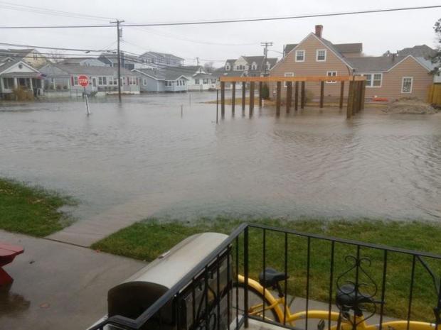
Coastal Flooding from Dec 9 Nor'easter

Clouds prevailed in this darkest month of the year, making for some rather persistent dreary conditions. Until the last week of the month there were only two days (the 4th and 7th) where the sun outperformed the clouds across NJ. At least the year ended on a bright note, with lots of sun during five of the last six days. With the clouds came a fair amount of precipitation, and given milder-than-normal conditions, the vast majority was in the form of rain. Statewide precipitation averaged 4.79". This is 0.88" above the 1981–2010 mean and ranks as the 27th wettest December since 1895. The mean temperature of 38.9° was 3.3° above average and ranked as the 15th warmest on record. Snowfall averaged 0.6", some 3.5" below average and ranked as the 19th least snowy December. A strong nor'easter brought strong winds, multiple inches of rain, minor to moderate coastal flooding, and beach erosion on the 9th.

ONJSC's Top 10 NJ Weather and Climate Events of 2014

January 4, 2015 - 12:00pm -- Dave Robinson

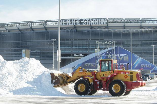
Snow removal at Metlife Stadium

Listed below is the Office of the NJ State Climatologist's ranking of the top 10 weather and climate events of 2014. More about each event can be found in the monthly narratives posted on njclimate.org. You might be tempted to rearrange the rankings, particularly as some of the events may have affected you more than others higher on the list. That's the enjoyment (and frustration!) of lists. This was the second consecutive year that was not too eventful for NJ weather and climate (goodness, we remain stunned by 2011 and 2012). Of course there is still plenty to talk about.

An Active Pattern: December and 2013 Annual Summary

January 1, 2014 - 12:00am -- Dave Robinson

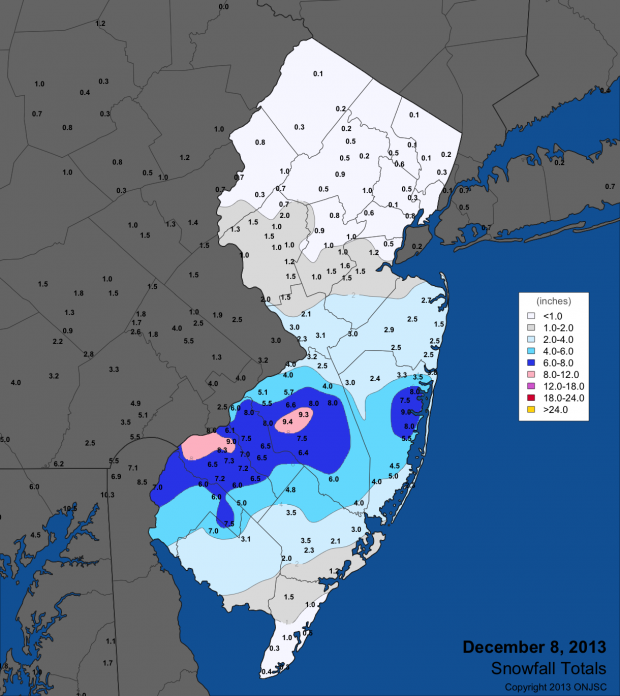
Snowfall totals map from December 8th

The final month of 2013 proved to be a rather volatile one in the weather department. A smorgasbord of conditions included biting cold, record warmth, four snow events, and several soaking rainstorms. The statewide average temperature of 36.2° was 0.6° above normal, making it the 46th mildest December dating back 119 years to 1895. Not only were there major day-to-day fluctuations in temperature, as on several occasions temperatures varied by more than 40° from north to south Jersey. Precipitation in the form of rain and melted snow averaged 4.91" across NJ. This is 1.00" above normal and is the 26th wettest on record. Snowfall averaged 9.2", which is 4.3" above normal and the 31st snowiest December.

Pages

Subscribe to RSS - Top Ten