NJWxNet

Exploring NJWxNet Solar Radiation Observations
March 20, 2020 - 11:52am -- Rohan Jain

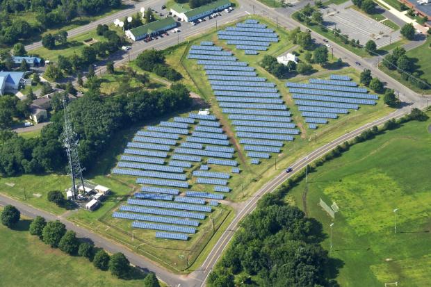
Solar panels photo

Serving a wealth of potential user needs, solar radiation is one of the many variables observed at stations within the Rutgers NJ Weather Network (NJWxNet). Dating back as far as 2004, the original solar network of a half dozen stations has grown to the current 46. The solar instruments record incoming radiative fluxes in the 0.36 to 1.12 micron range. A myriad of products stem from observations, initially gathered once each hour and, since mid-2012, every five minutes. These include radiation maximums, averages, minimums (W/m²), and totals (kJ/m²), at five minute, hourly, and daily time scales.

Solar data gathered at NJWxNet sites help promote an understanding of the relationship between solar radiation and terrestrial systems involving the heating of the surface and atmosphere, plant growth, human health, and energy generation. Atmospheric conditions influence the magnitude of irradiance reaching the surface, with variables such as cloud cover, humidity, and aerosols (minute natural and human-generated liquid or solid particles) influencing incoming radiation. Prior to the advent of the NJWxNet, solar radiation observations across the Garden State were few in number and most often not of a continuous long-term nature. This was the case elsewhere in the US prior to the recent establishment of mesonets, such as the NJWxNet, in many states.

Exploring NJWxNet Soil Temperature and Water Content Observations

August 13, 2019 - 4:46pm -- Rohan Jain

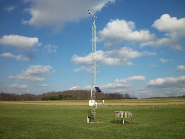
Photo of Pittstown NJWxNet station

Observations of soil temperature and water content are among the many variables gathered at stations within the Rutgers NJ Weather Network (NJWxNet). While observations at 5 and 10 centimeter (cm) depths for water content have been taken at about a dozen NJWxNet stations as far back as 2003, only since 2013 have soil temperature and water content observations been taken at 5 cm, 10 cm, 20 cm, and 50 cm at currently nine stations across New Jersey. The soil and atmospheric observations at these sites provide an understanding of soil–atmosphere interactions, such as how soil conditions respond to atmospheric forcings. Soil temperature and water content also influence atmospheric conditions; however, this is exceedingly difficult if not impossible to demonstrate at individual locations. Prior to the advent of the NJWxNet, soil temperature and water content observations were almost completely lacking across NJ. This was the rule across the United States and beyond until recently when mesonets, such as the NJWxNet, began providing vital data that will continue to lead to improved short- and long-term weather and climate forecasts.

The objective of this report is to introduce the soil data being gathered at NJWxNet stations and to demonstrate the potential value of these observations to agricultural, hydrological, meteorological, engineering, and other communities. For instance, for the agricultural community, the difference between a bountiful harvest and a subpar one is quite dependent on soil conditions, not solely on what is occuring in the atmosphere. Understanding present soil conditions and analyzing past trends of soil water content and temperature can help a farmer determine when to plant, what crops to plant and, once growth commences, when to irrigate.

Flooding rains persist

June 19, 2013 - 12:00am -- Dan Manzo

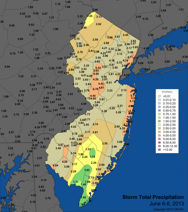
Tropical Storm Andrea rain totals

"It's been a wet one." That's what many New Jersey residents would say so far about the first part of June. There has been little time to dry out in between back to back to back rainstorms.

Earlier this month, only a few days after the official start of the Hurricane Season, Tropical Storm Andrea formed in the Gulf of Mexico and headed northeast bringing heavy rain and gusty winds to parts of Florida and the coasts of North Carolina and Virginia. The remnants of Andrea eventually tracked off our shores and brought a period of very heavy rain to much of the state. Andrea's downpours gave much of the northern Jersey shore around 4.50" to just over 5.00" of rain. Most of the Turnpike corridor saw precipitation range from 3.50" to a little over 4.00". There was less precipitation to the southeast and the northwest with those areas averaging around 2.00"-3.00".

A manageable heat wave to end May

June 4, 2013 - 12:00am -- Dan Manzo

Boardwalk photo

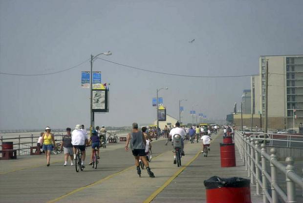
A week after the unofficial start of summer many areas saw temperatures soar, giving the Garden State its first heat wave of the season (a heat wave is defined as a hot period having at least three consecutive days of 90°+ temperatures). Temperatures steadily rose throughout the period from May 29 to May 31, with most areas away from the shoreline getting into the low to mid 90’s.

Just prior to the beginning of the heat wave on May 29, temperatures along the state’s Turnpike corridor rose into the upper 80’s. Our NJWxNet Woodstown station in Salem County recorded a high temperature of 88°, Cream Ridge in western Monmouth County recorded a maximum of 87°, and Haworth in Bergen County recorded a high of 86°. The story was not the same away from the urban corridor. Wantage (Sussex County) only made it to 80°, and Atlantic City Marina topped off at 71°.

Subscribe to RSS - NJWxNet